CFHC
|
| () |
| Sun Aug 04 2002 04:56 PM |

|
|
|
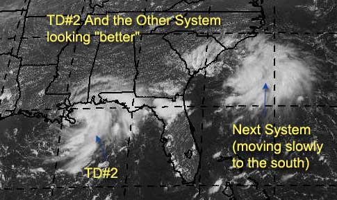
And the system off the carolinas might form quicker than expected also...
The storm in the Gulf is near land and will not have much time to strenghten, but it will cause a lot of rain and some gusty winds along the coast. It is expected to hook west, but as it looks fairly healthy everyone should watch it a bit.

Atlantic chances now...
code:

forget it) 0 1 2 3 4 5 6 7 8 9 10 (sure thing)

          [------------*---------]
Both could go either way at this point, we'll have to wait and see just a few more days.
NASA GHCC Interactive Satellite images at:
North Atlantic Visible (Daytime Only), Infrared, Water Vapor
Some forecast models:
NGM, AVN, MRF, ETA ECMWF
DoD Weather Models (NOGAPS, AVN, MRF)
AVN, ECMWF, GFDL, MM5, NOGAPS, UKMET
Other commentary at Mike Anderson's East Coast Triopical Weather Center, Accuweather's Joe Bastardi, Hurricane City, Gary Gray's Millennium Weather, Barometer Bob's Hurricane Hollow Even more on the links page.
- [mac]