CFHC
|
| () |
| Tue Aug 06 2002 08:21 PM |

|
|
|
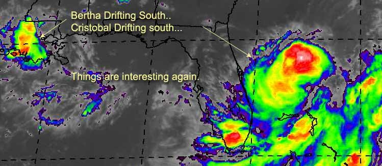
Tropical Storm Cristobal has formed from Tropical Depression Three. Currently moving southward. It is forecast to move away from land, and spin the fish mildly, but we'll watch it just in case. Steering winds aren't all that well defined right now.
As that moves outward another interesting possibility is that Berta might show up again. As it is currently moving south (very slowly) Although the chances of this happening are low, it's still worth a watch. Louisiana is getting buckets of rain. If it does move back over the gulf then I hope you folks in Texas haven't forgotten about Bertha. It could regain itself fairly fast. If it does, we'll be on it.
Graph for Bertha (again)
code:

forget it) 0 1 2 3 4 5 6 7 8 9 10 (sure thing)

          [-----*----------------]
We'll be watching.
NASA GHCC Interactive Satellite images at:
North Atlantic Visible (Daytime Only), Infrared, Water Vapor
Some forecast models:
NGM, AVN, MRF, ETA ECMWF
DoD Weather Models (NOGAPS, AVN, MRF)
AVN, ECMWF, GFDL, MM5, NOGAPS, UKMET
Other commentary at Mike Anderson's East Coast Triopical Weather Center, Accuweather's Joe Bastardi, Hurricane City, Gary Gray's Millennium Weather, Barometer Bob's Hurricane Hollow Even more on the links page.
- [john@flhurricane.com]