CFHC
|
| () |
| Mon Sep 16 2002 07:00 PM |

|
|
|
Update 11am EDT, 17 Sept 2002:
Tropical Depression # 10 is back! Advisories have restarted as of 11am EDT.
---
Original Post:
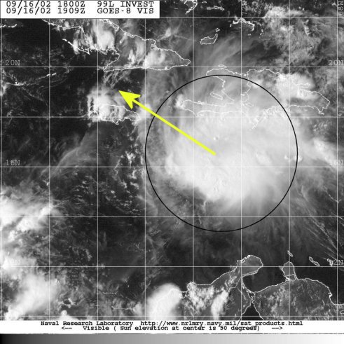
Tropical Depression 10 was downgraded to an open wave by the National Hurricane Center, and it is causing a lot of controversy. A recon aircraft was sent out today but could not find the LLCC (lower level circulation center). So this system officially still remains an open tropical wave. Although looking at visual satellite photos of the system it appears to have some sort of circulation, in any case this system is in a very favorable area for intensification and storm development and must be monitored. So we will be keeping a close eye on this one.
In the comments section (Forums) everyone is doing a great job in tracking this storm. Thank you and keep up the good work.
Caribbean Hurricane Page - includes reports from individuals scattered across the Caribbean islands
NRL Monterey Marine Meteorology Division Forecast Track of Active Systems (Good Forecast Track Graphic and Satellite Photos)
NASA GHCC Interactive Satellite images at:
North Atlantic Visible (Daytime Only), Infrared, Water Vapor
Some forecast models:
NGM, AVN, MRF, ETA ECMWF
DoD Weather Models (NOGAPS, AVN, MRF)
AVN, ECMWF, GFDL, MM5, NOGAPS, UKMET
Other commentary at Mike Anderson's East Coast Tropical Weather Center, Accuweather's Joe Bastardi, Hurricane City, Gary Gray's Millennium Weather, Barometer Bob's Hurricane Hollow, Snonut, Ed Dunham and Jason M in our Storm Forum Even more on the links page.
- [john@flhurricane.com]