MikeC
|
| (Admin) |
| Sat Jun 12 2004 12:15 PM |
|
|
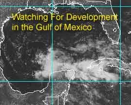
Nearly mid June, and it looks like we may have some potential for development. Over the last few days we've been watching the area in the northwest Caribbean, and thought that the wind shear was too much for any chance of development, not to mention the proximity to land.
The other factor is that it was an upper level low, and tropical systems need low level or surface lows to begin formation. And for an upper level low to spin up a lower level low it needs favorable winds higher up. It doesn't have them now, but it may soon.
So tomorrow we should have a better. Right now it's no sure bet, but we'll put up a scale:
Code:
forget it) 0 1 2 3 4 5 6 7 8 9 10 (sure thing)

          [-----*----------------]
(note the wrong scale was originally put up on the first article -- this here is what was intended)
It has a few obsticles it needs to overcome to make depression status.

NASA GHCC Interactive Satellite images at:
North Atlantic Visible (Daytime Only), Infrared, Water Vapor
Some forecast models:
NGM, AVN, MRF, ETA ECMWF
DoD Weather Models (NOGAPS, AVN, MRF)
AVN, ECMWF, GFDL, MM5, NOGAPS, UKMET
Multi-model plots from WREL
Other commentary at Mike Anderson's East Coast Tropical Weather Center, Robert Lightbown/Crown Weather Tropical Update Accuweather's Joe Bastardi (now subcriber only unfortunately), Cyclomax (Rich B.), Hurricane City , mpittweather , Tropical Weather Watchers.Com (JasonM) Gary Gray's Millennium Weather, Barometer Bob's Hurricane Hollow, Snonut,
Even more on the links page.