MikeC
|
| (Admin) |
| Fri Jul 15 2005 07:27 AM |
|
|
11PM Update (Friday)

After undergoing an eyewall replacement cycle this afternoon, resulting in a 20mb jump in pressure and 30mph reduction in winds, Emily has rapidly intensified once again. As of the 11pm advisory, winds had increased again to 135mph; since then, recon reports indicate the pressure has fallen to 954mb. This makes Emily a dangerous category 4 hurricane once again. Another eyewall replacement cycle is likely in its near future, probably sometime during the early morning hours tomorrow. Clark has more analysis and forecast reasoning in the met. blogs below.
Original Update
Overnight, Emily strengthened again, to a category four storm. It formed a relatively small eye (around 6 nautical miles) and deepened. Right now it appears to be going through an eyewall replacement cycle, which may allow it to deepen a little more after it is complete.
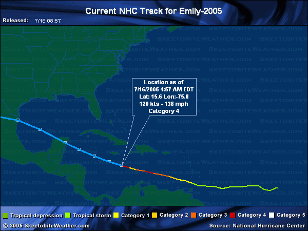


Hurricane warnings are up for the island of Jamaica, as the storm will pass very close to the island, most likely just to the southwest, but the cone of error potentially puts it crossing the island as well. Once again, folks in Jamaica must prepare for a major hurricane.
Beyond Jamaica it looks as if Emily may clip the Yucatan peninsula, cross into the bay of Campeche, and eventually landfall likely in Mexico just south of the Texas border. Because of the possible error with this storm, folks along the coast of Texas to much of the eastern coast of Mexico, and the Yucatan, including Cancun need to keep a very close watch on this storm.
It will be near or over the Yucatan Monday, and over the Bay of Campeche Monday night, and tuesday, and nearing the mainland coast of Mexico or Texas Wednesday. Florida is in the clear, as is most of the Gulf coast west until Texas. However, even then the more likely scenario is into Mexico. Watch it, of course, but the ridge above it is strong and will likely keep it on a more westerly track.
Forecast models aren't being all that consistant with the exact track that far out (into the landfall in Texas or second in Mexico) So folks from Houston/Galveston southward well into Mexico will need to watch this.
Event Related Links
StormCarib hurricane reports from observers in the Islands - Jamaican StormCarib Reports
Caribbean Island Weather Reports
Jamaican Meteorological Service
Color Sat of Gulf (Animated)
RAMSDIS high speed visible Floater of Storms
Emily
Visible/IR Floater of Emily with storm track Overlays
Aruba Radar
Animated Model Plot of Emily
Model Plot Graphic from the South Florida Water Management District of Emily
Emily Spaghetti Model from boatus
Weather Underground Model Plots for Emily
QuikScat Image of Emily
Dennis and emily plotted on a google map
Area east of Emily (99L)
Animated Model Plot of Area East of Emily 99L
Model Plot of Area East of Emily 99L (Graphic from the South Florida Water Management District)