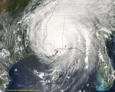
| Hurricane Fredrick 1979 |
| (Weather Guru) |
| Thu Jul 28 2005 12:40 AM |

|
|
|
Quote:
http://www.ourgallagherfamily.com/storm_image/92L/92L.html
look at that..dont you think thats a little to far north..and they have it intensifying in kts..what are peoples inputs on this
info apreciated
-Ryan
Ryan
Thats the XTRP model which to me is usless. It's just one thrown in there for good measure. The GFDL GFS UKMET NOGAPS are the models to look at. Maybe the ECMC and the FSU MM5