| Random Chaos |
| (Weather Analyst) |
| Wed Sep 01 2010 10:20 PM |

|
|
|
Beautiful IR storm presentation...now if only I were further from its track!
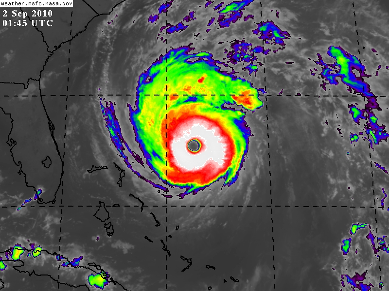
Quick note for people looking for IR images:
SSD is sometimes (not always) running 30 to 60 minutes behind MSFC for releasing IR images. This means for the most recent IR images, head over to MSFC. Their interface is harder to use and does not automatically update the images, so SSD is better for just running a monitoring animation. Not sure how other sites stack up in terms of release intervals.
SSD: http://www.ssd.noaa.gov/PS/TROP/float2.html
MSFC: http://weather.msfc.nasa.gov/GOES/goeseasthurrir.html