| cieldumort |
| (Moderator) |
| Sun Jul 20 2025 06:00 PM |

|
|
|
7AM CDT 23 July 2025 Update
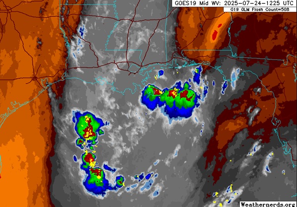
The weak trof which includes some remnant energy from old Invest 93L that looped back around is now in the north central Gulf. A recon mission has been tentatively scheduled to check it out today and so we could be tracking Invest 95L here in a bit.
This feature has a very low chance of development into a TC before moving inland over Texas and/or Louisiana later this week, but is worth monitoring given the very warm Gulf waters and the sensitivities to additional rain across sections of the south.
Ciel
8PM EDT 22 July 2025 Update
There is a new 10% area being tracked, this is part of the remnants of invest 93L that loop back over into the Atlantic, but it's unlikely to develop in the Gulf, but there's a slight chance if it gets its act together. (Other parts of 93L split and went into Texas too) If it gets another Invest it'll wind up with 95L.
Some of the models suggest parts of it may loop back once again into the Atlantic and Gulf next week as well.
Original Update
The final stretch of July has a few areas of interest worth monitoring, none of which are particularly concerning at this time, however.
In the Main Development Region east of the Caribbean, a tropical wave has a marginal environment to work in, but could eek it out. This wave has now been Invest tagged, 94L, and hyper-focused model runs have begun.
Later this week, on-and-off support exists for the development of something tropical either side of Florida, but thus far there's nothing to really hang ones hat on for tracking.
Elsewhere, the remnant swirl of 93L hasn't given up the ghost just yet, providing some much appreciated clouds and a few light showers across Texas.
Ciel
{{StormLinks|94|94|4|2025|94L|Invest 94L}}