MikeC
|
| (Admin) |
| Sat Aug 02 2025 02:00 PM |
|
|
2:30PM EDT 6 August 2025 Update
The area in the East Atlantic is now being tracked as invest 96L, the area off the southeast chances have dropped to 30%. Right now there is nothing too concerning for land areas out in the Atlantic.
11:00AM EDT 6 August 2025 Update
Dexter and his sibling, possibly soon to be Invest, appear set on a course offshore and hopefully also with the sibling, out to sea. It would not surprise to see the Invest TBD get a name and more or less follow Dexter's path.
Way out in the Tropical Atlantic, NHC has assigned 60% development odds to a wave that thus far has failed to impress. Steering currents are still in play, but most yet not all modeling suggests a recurve. This one is still worth keeping watch, in that if it does track more westerly conditions could be favorable for a US impact ~ still a long, long way out and no need to start packing bags.
A few other areas we are keeping tabs on, nothing urgent.
Ciel
2:00PM EDT 3 August 2025 Update
Invest 95L is on the cusp of becoming Dexter, but fortunately will likely track out to sea. However, behind it, NHC is now officially mentioning the potential development for a sibling/spawn of 95L. Modeling suggests that if a TC forms in the wake of 95L/Dexter, it would have a much better chance of heading back towards the east coast.
Ciel
12:30AM EDT 3 August 2025 Update
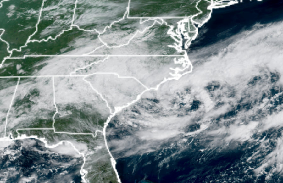
The area of low pressure that has developed along the frontal zone stretched SW-NE offshore of the east coast has been Invest tagged, 95L, and we have started a Lounge on this feature.
Invest 95L appears poised to make a very good run at becoming our next named storm and has a slight chance of heading towards land but will more probably head out to sea. Of potentially greater interest and concern, is that some model runs are suggesting 95L spins off or helps "spawn" another cyclone in its wake, one that could more easily be steered towards the eastern seaboard.
We will be doing deeper dives into this Invest and its potential spawn/sibling in the Lounge: 95L and Possible Spawn Forecast Lounge
Ciel
Original Update
Typical of August, activity, but not guaranteed, the Hurricane season starts to ramp up, with activity already off the North Carolina coast (visible on satellite and radar) with a 30% chance currently for development. If this system develops, it will likely remain weak and move away from the US mainland out to sea.
Beyond this, activity seems to ramp up on ensemble and other modeling in mid August, but too soon to say any particulars for it. But mid to late August (at least) may get busy. However nothing in particular is concerning at the moment, other than the general trends. We're mainly monitoring to see if these persist. One area, exiting Africa, has a 20% chance to develop, somewhere over a large region in the central Atlantic. If anything develops out there it is likely to turn out to sea well before the Caribbean.
Persistence in the modeling, and convection, and activity is the key.
Another area in the east Atlantic has a 20% chance to develop over the next 7 days.
{{StormLinks|4|4|4|2025|4|Tropical Storm Dexter}}
{{StormLinks|96|96|5|2025|96|Invest 96L}}
{{BermudaNews}}