| cieldumort |
| (Moderator) |
| Fri Aug 21 2026 10:57 PM |

|
 Four Atlantic Slight Chance Areas in Late August as Tropical Storm Moke Threatens Hawaii
|
11AM ET (3AM HT) 27 August, 2026 Update
One of the very robust waves to exit Africa over the past week has overcome what has seemed near impossible this season to become a tropical storm, Dolly, in the Tropical Atlantic. While presently way, way out at sea, Dolly is worth monitoring for the extended range, as it may try to take advantage of possibly more favorable conditions closer to the Bahamas and/or the Gulf (Dolly has its own LOUNGE for these extended-range considerations)
Ciel
9AM ET (3AM HT) 22 August, 2026 Update
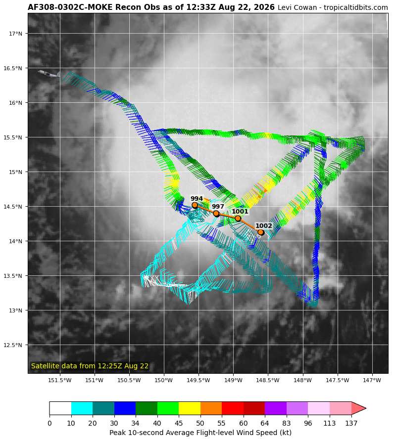
The final pass though from the third recon mission into Moke overnight found pressures had dropped within the cyclone to below 995mb, with winds possibly getting a little stronger. Almost all of the impactful weather from Moke is in its northern half because of shear. This also means that the heavy rain is being displaced to the north and will likely begin affecting the Hawaiian islands Saturday night and spread westward into early next week despite the storm center tracking well south of the islands. Winds across portions of the Big Island may reach tropical storm force, at least in gusts, but this will largely be due to a strong pressure gradient from interaction with the high pressure center to the north, and Tropical Storm Watches and Warnings are not expected. Additional flash flooding is a very real concern.
Ciel
Original Update
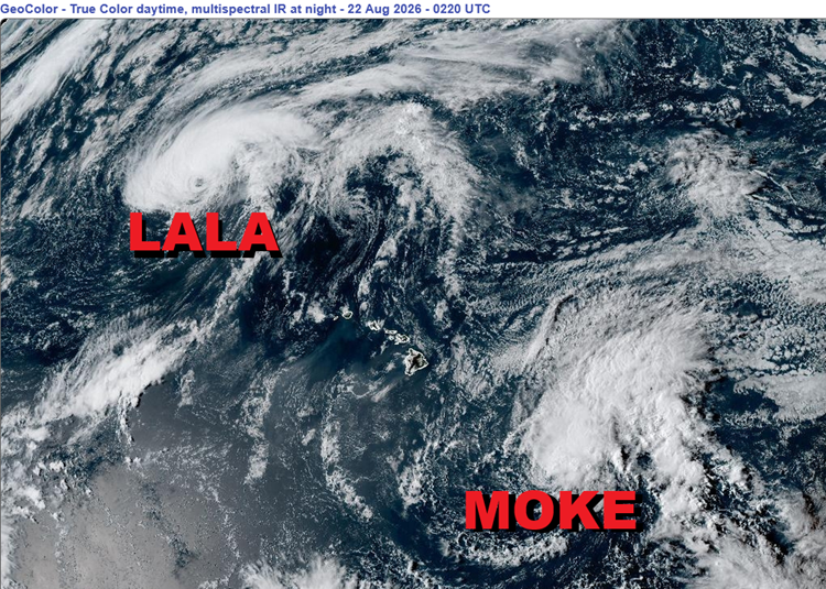
Three more Areas of Interest presently in the Atlantic have NHC odds of 20% or less for development, plus one that is yet to roll off Africa with also a 20% handle. Lots of lemons out there in the Atlantic basin during this record-setting El Niño.
First up is a wave, not yet mentioned in NHC's TWO, that has a slight model-suggested chance of becoming a short-lived TD or weak storm. This one is in the Main Development Region of the Tropical Atlantic, and is also the most tropical of the three currently in that basin. We are monitoring it in a Lounge, as it is a stout wave heading west, in the general direction of the Caribbean.
Second, a weak area of low pressure in the central subtropical Atlantic well east-southeast of Bermuda. This disturbance is expected to drift west-southwest over this weekend and then turn to the north next week, avoiding land.
Third, a non-tropical low in the far northeastern Atlantic, even beyond the Azores, has some tepid model support to acquire subtropical or tropical characteristics. It should ultimately bring wet and blustery weather to Spain and Portugal, though far less certain that it would have a name while doing so.
Next week, yet another stout wave rolling off Africa into the far eastern Atlantic is already NHC highlighted for a slight chance of development, at 20%.
Much closer to the United States is newly-named Tropical Storm Moke in the Central Pacific. This tropical cyclone has the potential to dump additional heavy rain on to the Big Island, still recovering from a direct hit from powerful Hurricane Lala just last weekend.
{{StormLinks|Dolly|Dolly|4|2026|Dolly|Dolly}}
{{HawaiiStorm}}