| cieldumort |
| (Moderator) |
| Thu Jun 26 2025 06:31 PM |

|
|
|
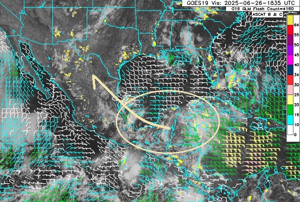
Base sat/scat/glm image above courtesy Weathernerds.org
A broad and weak area of low pressure and disorganized showers and a few thunderstorms stretching across the NW Caribbean to the western Gulf is serving as a reminder that we are still in the very early part of the season. This area of disturbed weather has maybe a 5% ensemble implied chance of becoming a very brief TC before pushing into eastern Mexico and likely being drawn northwestward from there.
To the south of this feature, Invest 95E can be seen in the eastern Pacific, which is forecast to become the sixth name storm in that basin within the next few days, way ahead of schedule over there, and yet another one likely to make landfall along the west coast of Mexico far earlier in a season than normal.
Combined or separately, the Gulf feature and 95E (Likely future Flossie) to its south, could significantly enhance monsoonal rains over parts of Texas and the desert southwest later this weekend into next week.