| cieldumort |
| (Moderator) |
| Wed Aug 21 2024 06:19 PM |

|
|
|

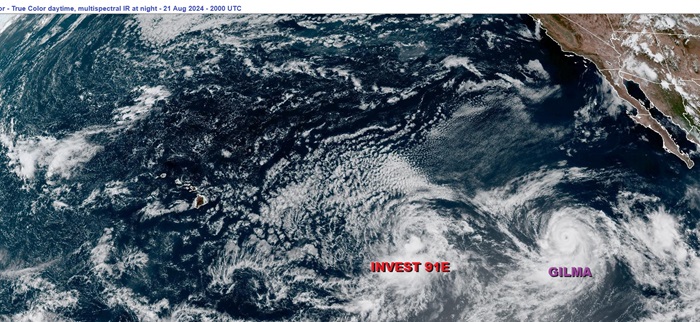
Left: Invest 91E. Right: Hurricane Gilma
A well-defined low pressure area east-southeast of the Hawaiian Islands is already on the cusp of becoming a tropical cyclone. Given that this system increasingly has environmental and model support for development with a track that takes it perilously close to the Hawaiian islands, we are starting a Lounge on this system at this time. This feature is Invest-tagged 91E, which is a merger of two areas of previously watched disturbances.
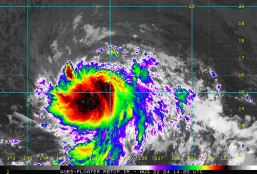
Invest 91E has become a full-fledged tropical cyclone, TD ONE in the Central Pacific, and the title has been updated accordingly.
2024-08-22-12z 15.4N 140.3W 30 KNOTS
Tropical Storm Hone as of the 1100 AM HST Thu Aug 22 2024 Advisory
Recon and radar are showing that Hone is now a hurricane. 8-25-24-0715z
-Ciel
| cieldumort |
| (Moderator) |
| Thu Aug 22 2024 10:56 AM |

|
|
|

Invest 91E has become a tropical cyclone, presently estimated possibly conservatively to be a TD, CP ONE, and advisories will begin in the Central Pacific. Watches and even Warnings could be going up for Hawaii this week.
| cieldumort |
| (Moderator) |
| Sat Aug 24 2024 04:05 PM |

|
|
|
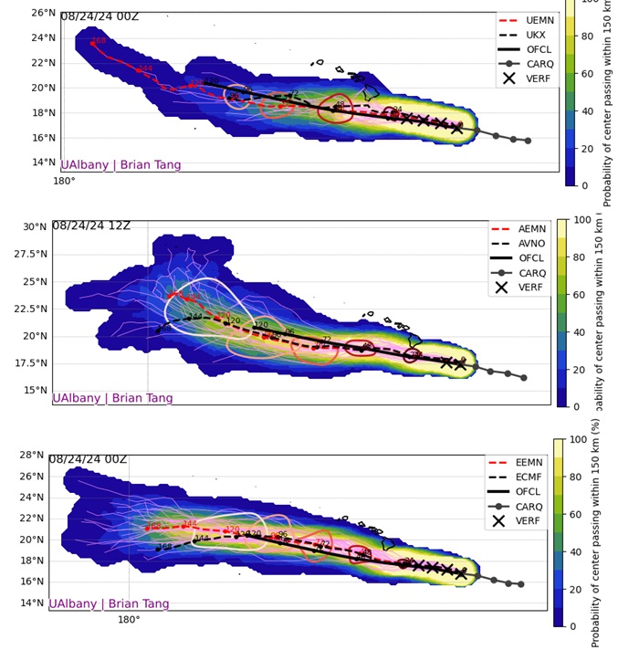
Hone has been tracking a hair north of forecast and intensifying a little more than forecast. Satellite and recon suggests that the cyclone may be making a run at hurricane prior to passing west of the Big Island. A track a little on the stronger side and closer to or even directly over the Big Island is supported by a few of the ensemble members. Something to keep an eye on, as a hurricane watch or even warning is not out of the realm of possibility.

Above:
UKMET Ensembles 8-24-24-0z
GFS Ensembles 8-24-24-12z
ECMWF Ensembles 8-24-24-0z
Credit: Brian Tang