MikeC
|
| (Admin) |
| Sat Jun 12 2004 04:15 PM |
|
|
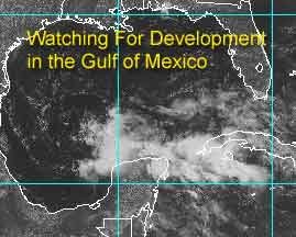
Nearly mid June, and it looks like we may have some potential for development. Over the last few days we've been watching the area in the northwest Caribbean, and thought that the wind shear was too much for any chance of development, not to mention the proximity to land.
The other factor is that it was an upper level low, and tropical systems need low level or surface lows to begin formation. And for an upper level low to spin up a lower level low it needs favorable winds higher up. It doesn't have them now, but it may soon.
So tomorrow we should have a better. Right now it's no sure bet, but we'll put up a scale:
Code:
forget it) 0 1 2 3 4 5 6 7 8 9 10 (sure thing)

          [-----*----------------]
(note the wrong scale was originally put up on the first article -- this here is what was intended)
It has a few obsticles it needs to overcome to make depression status.
NASA GHCC Interactive Satellite images at:
North Atlantic Visible (Daytime Only), Infrared, Water Vapor
Some forecast models:
NGM, AVN, MRF, ETA ECMWF
DoD Weather Models (NOGAPS, AVN, MRF)
AVN, ECMWF, GFDL, MM5, NOGAPS, UKMET
Multi-model plots from WREL
Other commentary at Mike Anderson's East Coast Tropical Weather Center, Robert Lightbown/Crown Weather Tropical Update Accuweather's Joe Bastardi (now subcriber only unfortunately), Cyclomax (Rich B.), Hurricane City , mpittweather , Tropical Weather Watchers.Com (JasonM) Gary Gray's Millennium Weather, Barometer Bob's Hurricane Hollow, Snonut,
Even more on the links page.
| James88 |
| (Weather Master) |
| Sat Jun 12 2004 04:40 PM |

|
|
|
This system definately needs to be watched. I wouldn't be surprised if it did develop, but then it would not suprise if it didn't amount to anything. Whatever the case, it certainly seems to be trying to organise itself, and this is the most favourable area for a storm to form in June. It is over sufficiently warm SSTs in air that is reasonably moist, although there is substantially drier air not far to the west. This must be one of those 'will it or won't it?' situations. Only time will tell...
| Unregistered User |
| (Unregistered) |
| Sat Jun 12 2004 04:47 PM |
|
|
LLC seems like its forming just north of the Yucatan. This should head north, or NNW, to be deflected that way by the frontal boundary coming down the eastern seaboard. Could be Louisiana bound! Cheers!!
| Justin in Miami |
| (Storm Tracker) |
| Sat Jun 12 2004 05:25 PM |
|
|
Well, possibly the first storm soon...hello everyone. I've been quietly reading everyone's posts and glad to be back for another year!
| Cycloneye |
| (Storm Tracker) |
| Sat Jun 12 2004 05:26 PM |
|
|
Regardless if it forms into a TD or a minimal tropical storm plenty of rain will go to the gulf coast next week.Let's see what happens when recon gets in there tommorow if they go as the plan of the day says at link below.
http://www.nhc.noaa.gov/text/MIAREPRPD.shtml?
| James88 |
| (Weather Master) |
| Sat Jun 12 2004 05:39 PM |
|
|
|
|
If the system continues to organise things could get very interesting in the next couple of days. Perhaps the next TWO will reveal something new, or maybe a special tropical disturbance statement will be issued sometime soon.
| HanKFranK |
| (User) |
| Sat Jun 12 2004 06:08 PM |

|
|
|
not terribly surprised about the invest. it looks a tad more promising today, and i've got a hunch on what the big obstacle it will be dealing with is. really already been foreseen by bastardi, with the assymetric system he was describing. there appears to be a weak surface trough associated with 93L on the western periphery of its convection, which may eventually become its low center if it continues to organize. the centroid looks to be around 22/93.. 120 miles or so northwest of merida on the yucatan. this system shouldn't organize quickly, first recon probably won't send back a vortex message tomorrow (assuming things progress). if bastardi's timing is on, there is a 72 hour window for an alex to develop; chances of that look to be where john c put em.. 40% or so. globals still aren't very enthusiastic with this system.
a side note: gale center should cut off in the northwest atlantic, somewhere north/northeast of bermuda, for early next week. though doubtful, there is an outside chance it will hybridize. the western pacific is active.. assuming an mjo wave is inbound, we may get a period of invests trhough the rest of the month, if nothing else.
HF 1807z12june
| Cycloneye |
| (Storm Tracker) |
| Sat Jun 12 2004 06:09 PM |
|
|
It has a small window to develop into a tropical system because a shortwave trough will come down to the gulf coast and then it will make things unfavorable with the shear increasing so timing is important for this disturbance to try to develop.
| Rob_M |
| (Weather Hobbyist) |
| Sat Jun 12 2004 06:20 PM |

|
|
|
Another upper low offshore the TX/MX coast is currently causing a strong area of convergence just west of it...but at the same time is enhancing divergence over our low. This will probably continue to aid convection, but that is all it will do...not a tropical situation at all. Keep in mind this has yet to transition into a warm-core...the interaction between that upper low to the west will not help. That low should scoot south to southeastward over the weekend, and THEN conditions will be a little more conducive for a surface low to develop and perhaps warm-core transition to occur. However...it will be almost immediately afterwards when a shortwave trough digs into the region and create a strong shearing environment. If we don't have a warm-core system by then, we won't have one at all...and given the current setup with the upper low to the west and the lack of surface low, I wouldn't hold my breath.
Bear watching? Definately...but IMO the chance of a classified tropical cyclone is still very slim...
|
Ed Dunham
|
| (Former Meteorologist & CFHC Forum Moderator (Ed Passed Away on May 14, 2017)) |
| Sat Jun 12 2004 06:59 PM |
|
|
I'm a little surprised that nobody (except Cycloneye) picked up on this. Go back and look at the recon plan of the day. If TPC decides to send out an aircraft tomorrow afternoon, they will send it to 27N 94W - if development should continue, the second aircraft is heading for 28N 90W twelve hours later. That should give you a hint at the initial thinking regarding 'track' at NHC. The system would be moving east of the ULL and could even outpace the shortwave. It may not develop, but those coordinates should give some insight as to where NHC thinks the 'weather' will be going. Of course those coordinates will change if the system continues to evolve, but it suggests that I should adjust my thinking a little eastward

Cheers,
ED
| Unregistered User |
| (Unregistered) |
| Sat Jun 12 2004 07:10 PM |
|
|
The chances of this developing are zero percent chance

| Cycloneye |
| (Storm Tracker) |
| Sat Jun 12 2004 07:19 PM |
|
|
ED really I didn't thought about that about where they will go to investigate and that will say what track the system will take and that is a good point that you bring.
| Rob_M |
| (Weather Hobbyist) |
| Sat Jun 12 2004 07:21 PM |
|
|
|
|
Great point, Ed. FWIW here are the latest 18Z tropical model plots...

| Unregistered User |
| (Unregistered) |
| Sat Jun 12 2004 07:22 PM |
|
|
Whats your meteorological reasoning for suggesting a 0% chance of development?
| Unregistered User |
| (Unregistered) |
| Sat Jun 12 2004 07:40 PM |
|
|
For one the Global models don't like this system for some reason. Second this whole system is being hold together by a upper low to the east once that is gone in the shear comes in then bye bye!

| LI Phil |
| (User) |
| Sat Jun 12 2004 08:33 PM |

|
|
|
If they have scheduled 2 recon flights, then there is obviously 0% chance for development. What kind of logic is that? Of course I'm rooting for it (which probably means it won't develop), but as James88 so frequently reminds us, we will have to wait and see. LOL
Cheers & Peace,
LI Phil
| HanKFranK |
| (User) |
| Sat Jun 12 2004 08:40 PM |
|
|
|
|
anon, that's off-base. globals keep the upper low/trough through the forecast period, so that factor isn't going away. remember that tropical cyclones often form in a shear environment. the shear isn't all that bad (isn't all that good either). i guess saying there is a zero percent chance, there's roughly a sixty percent chance you'll get your outcome. but that's not how probability statistics are meant to work (or else, all you'd ever see on the weather forecast is a zero or 100 percent chance of rain). i'm sure if the nhc thought there was a zero percent chance they wouldn't be sending recon. i guess you're trying to be funny.
rob and i are from different schools of thought about where this thing starts out on the 'tropical-ness' scale. if its in the tropics, over warm waters, convective and closed off it's a tropical cyclone in my book. but then i really don't know how this thing would look on a theta-e diagram. incipient systems even in the deep tropics sometimes start with a cold profile (not something i would hold against them if they have the other necessary features). the models show slightly higher heights overhead the convection (thunderstorm outflow?).. but i doubt that's a true indicator. i guess the other way of thinking is probably more correct, because its what the official sources tend to go by. i listened to joe b a little too much a few years back and tend to think classification standards are often too stringent, but then again five hundred million red chinese dont give a ****. neither does the nhc.
if it's revving up tomorrow and nhc dances around the issue half the board will be complaining about it, which happens every other day when we've got an active storm. it's the way of the world.
HF 2040z12june
| James88 |
| (Weather Master) |
| Sat Jun 12 2004 08:49 PM |
|
|
|
|
Some good philosphy there, HanKFranK
>>>> "as James88 so frequently reminds us, we will have to wait and see."
Waiting is not something I'm usually good at, but in this case I'm willing to make an exception. I've been caught out several times in the past with systems forming practically overnight. Now I just prefer to sit back and wait, rather than miss something. I will try to use the phrase less
Luckily, this doesn't seem to be one of those situations - this system may develop but it seems fairly unlikely.
| teal61 |
| (Weather Hobbyist) |
| Sat Jun 12 2004 08:57 PM |
|
|
on the west side of the deeper convection northwest of Merida.
Looking at a visible 15 image loop on the NASA GHCC site zoomed in you can pick this up fairly easily. The big question, is this in the low levels, mid levels, or just a vort that those thunderstorms to the east spit out ? Looks to be moving off the the wnw.
| Unregistered User |
| (Unregistered) |
| Sat Jun 12 2004 09:24 PM |
|
|
From the 5:30pm EDT TWO:
a large area of disturbed weather continues over the southeastern
Gulf of Mexico and northwestern Caribbean Sea. A weak and broad
low level circulation has formed today over the west-central Gulf
and additional slow development is possible over the next day or
two as the system moves slowly northward. If necessary...an Air
Force plane will investigate the area on Sunday.
Elsewhere tropical storm formation is not expected through Sunday.
| LI Phil |
| (User) |
| Sat Jun 12 2004 10:56 PM |
|
|
|
|
93L (possibly Alex) is, if nothing else, a huge rainmaker. Dumping anywhere between 5"-10" on Cancun and Cozymel. Interests in the Gulf should be carefully monitoring the progress of this storm. Even if it never materializes into Alex, it will probably soak many areas in the Gulf Monday/Tuesday. Hopefully it won't stall out, ala Allison.
WREL has model graphics that show "landfalls" anywere from the Mid Tejas coast to the mid-LA coast.
models
And from Hurricane Alley, here's the recon graphics:
93L Recon
C & P
LIP
| Cycloneye |
| (Storm Tracker) |
| Sat Jun 12 2004 11:29 PM |
|
|
Yes regardless of what this system turns out to be a big rain producer will go to many areas in the gulf coast and points east of a center is where the main action will be in terms of rain and if system intensifies then gusty winds.
| Storm Cooper |
| (User) |
| Sat Jun 12 2004 11:47 PM |
|
|
I think the global models have a better grasp on the direction than the tropicals do... this falls in w/ what Ed posted and he made a great point. Time will tell if this will make TD or a slim chance of more but our local mets and the WFO are getting ready for a good bit of rain for the panhandle.
| LI Phil |
| (User) |
| Sun Jun 13 2004 12:16 AM |
|
|
|
|
NHC not really committing one way or the other, but I will bet they do send in the recon tomorrow.
SPECIAL FEATURES...
1011 MB LOW HAS FORMED AS OF 2100 UTC IN THE W GULF OF MEXICO
NEAR 23.5N92.5W MOVING NW ABOUT 10 KT. THIS LOW APPEARS TO HAVE
ORIGINATED MOSTLY FROM A MID/UPPER LOW PRESSURE SYSTEM THAT HAS
BEEN WORKING ITS WAY DOWN INTO THE LOW LEVELS AND HAS NOW
REACHED THE SURFACE. THE LOW'S CIRCULATION IS BROAD WITH ANY
SIGNIFICANT CONVECTION SHUNTED TO THE E DUE TO SHEAR. IN
ADDITION THE DEEP-LAYERED LOW IS VERTICALLY-STACKED WITH LOTS OF
DRY AIR ALOFT... NOT AN IDEAL CANDIDATE FOR RAPID DEVELOPMENT.
HOWEVER A LARGE AREA OF DISTURBED WEATHER IS TO THE E OF THE LOW
UNDER A MORE FAVORABLE ENVIRONMENT AND THE WHOLE SOUTHERN GULF
HAS POTENTIAL FOR TROPICAL CYCLONE DEVELOPMENT. THE MOISTURE
FROM THIS SYSTEM IS HEADED TOWARD THE GULF COAST REGARDLESS OF
TROPICAL DEVELOPMENT AND HEAVY RAIN IS POSSIBLE ESPECIALLY AFTER
THE WEEKEND. WIDELY SCATTERED WEAK/MODERATE CONVECTION IS S OF
25N BETWEEN 84W-92W WITH SCATTERED STRONG CONVECTION OVER THE
YUCATAN PENINSULA AND W OF 83W N OF 19.5N IN THE CARIBBEAN SEA.
Looking much better this evening than earlier.
Cheers & Peace,
LI Phil

| Jamiewx |
| (Storm Tracker) |
| Sun Jun 13 2004 01:48 AM |

|
|
|
Well i have to say, i think i'm leaning more toward development now. It seems every needed ingredient is there, plenty warm SST's and light shear environment. Although the convection appears to be undergoing some shearing at this time, the tendency has been for it to decrease, and the forecast suggests a light shear environment for the next 48 hours, so that may give the system a chance to pull itself together. Only thing i did note, was the dry air showing up on the water vapor loop, anyone think this will play a part in development?
| Storm Cooper |
| (User) |
| Sun Jun 13 2004 02:10 AM |
|
|
You are on it about the dry air getting to it...... if it were to make it I think we would have a hunt & peck for a LLC. I think this will be a good dry run for all

| LI Phil |
| (User) |
| Sun Jun 13 2004 02:26 AM |
|
|
|
|
As long as you two are both online. Do either of you see development out of 93L?
LIP
| SirCane |
| (Storm Tracker) |
| Sun Jun 13 2004 03:02 AM |

|
|
|
This could get a bit interesting. Anyway, we sure could use the rain! It's been really lacking this year.
| Steve |
| (Senior Storm Chaser) |
| Sun Jun 13 2004 03:30 AM |

|
|
|
Looks like there will be a pretty significant rain event for some of us. I called early week that I though the main action would end up east of here. I still think that. But I'd bet lower Jefferson, St. Bernard and Lafourche will see some heavy totals. I'm just hoping to see a couple of squalls and a rainband or two and I'll be happy. I plan on picking up some ice and beer after I bring the kids to church tomorrow, so with any luck, I'll get to issue a couple of buzzed out reports from the front lines tomorrow night, Monday and maybe Tuesday.
Tough to say what New Orleans might see. We're potentially in the 5"+ range of possibility, but something just keeps tugging my mind east to Biloxi, Mobile and Pensacola. Bastardi, in his nightly update, is pretty convinced that it's coming in west of New Orleans. Maybe that's because he's going to be here Tuesday morning. Last time he was in town, we had a 1.5 hour 6" burst and he got to see some of the flooding first hand. He was all over that. You can imagine if he gets to ride out Alex or would-be Alex... He's convinced, named or not, there will be some torrential rains and tropical storm conditions NE of wherever the system goes in.
We'll see again tomorrow. I'm real interested in what happens in the daytime tomorrow with the pulsing of the system, and what kinds of storms it puts off.
The thing I like most about this system is it's been pretty pesky despite some of the negatives. I'll take another look at it later.
Steve
| javlin |
| (Weather Master) |
| Sun Jun 13 2004 05:51 AM |
|
|
Steve looks like part of the system is pushing W to me and some coverge is moving E of that.Like another core is forming might be way off base here a couple of Scotch and waters can do that you know.Looks like something is trying to happen more moisture starting to wrap up only way to tell it.It's starting to get that signature look.Have a look in the morning.I just read some of the earlier post I think it's happening.See ya guys in the morning.
| Kevin |
| (Weather Master) |
| Sun Jun 13 2004 06:04 AM |

|
|
|
Looks like the LLC is breaking away from the cloudiness and heading towards Mexico. This is sure to hurt the already low chances (imo) of development with this system. If you want development , you'll have to look to the possibility of a new center forming farther to the east. This isn't necessary probable, but it would be interesting.
BTW...love the new emoticons. nice work fellas

| James88 |
| (Weather Master) |
| Sun Jun 13 2004 07:09 AM |
|
|
|
|
A rather impressive 'blob' of convection has fired up just off the east coast of the Yucatan Peninsula this morning:-
Convection off the Yucatan
Does anyone think this could be something trying to reform, or is it just likely to be an unrelated flare up?
| Hurric |
| (Weather Guru) |
| Sun Jun 13 2004 11:33 AM |

|
|
|
James, That blob off ne side of Yucatan still there. Hopefully the visible Pics will give us a better indication of what is happening. I agree with your thoughts that a center may form much further east than the current one that seems to be rapidly moving off towards TEXMEX.
If anyone has a WORKING radar from that side of Yucatan please share it. Maybe the rainfree view from Cancun is to please the touristas, but it doesn't help much if your trying to see how the rain is moving around the area.
| LI Phil |
| (User) |
| Sun Jun 13 2004 01:32 PM |
|
|
|
|
Just checking in...here's what accuwx has to say about our "blob":
"This 1010 mb low is centered in the Gulf of Mexico near 23 N 93 W with a surface trough extending from 27N 91W through the low to 19N 93W. This area of low pressure has a slight chance of becoming a tropical cyclone. Most of the convection is east of the center of the low pressure area. Tropical moisture associated with this system is expected to reach the coastal areas of Louisiana, Mississippi, Alabama, and western portions of the panhandle of Florida by late Sunday night and early Monday morning."
Looks like all our gulf posters are in for some serious rain. Probably nothing more.
LI Phil :?:
| Unregistered User |
| (Unregistered) |
| Sun Jun 13 2004 01:41 PM |
|
|
looks like a new spin north of yuc on vis.
| Steve |
| (Senior Storm Chaser) |
| Sun Jun 13 2004 01:54 PM |
|
|
|
|
Early images of rain are showing up nicely on the Mobile Radar:
Mobile Radar
I could see some of the clouds overhead associated with the dry band across my area in the 12:15UTC GOES shots. Typical whispy cirrus clouds across the sky. It's a bowl of soup here today though - warm, muggy and fairly still.
Early thoughts on the convection - a lot of FL posters around the web last night got enamored with the spinning blob of convection that sat over Cancun area last night. But that kind of stuff is always early-season "fooler" convection. This time, instead of being MLC sheared blowoff convection, it was probably feeder type moisture at the base of a stretched out trof in the area. The LLC that popped out of the system last night is still somewhat discernable on visible zooms. It appears the bulk of the new convection is coming out of another spinning area somewhere around 92-23.5. Obviously a disorganized Gulf system is liable to have several spins & swirls. We've all seen that before. I'm sticking with heaviest rain east of me, though I am expecting to see some action here. As promised yesterday, I'll post whenever we see any rain.
In the segment that may interest only me and LoisCane, check around the globe for all the swirly features looking good on sat. I need to find the alt-link to the NRL since their main page is down through the usual channels. But there is a global burst in the Indian and Pacific Oceans. If you go to a hemispheric mosaic view, you see this pretty well.
Anyway, today's the day that many of us coastal denizens should start seeing some effects from our unnamed system. I, for one, can't wait.
Steve
| Shan |
| (Verified CFHC User) |
| Sun Jun 13 2004 02:52 PM |
|
|
Hi all-
I posted a few times last year but have been a lurker for quite awhile. I'm south of Mobile, in Bayou La Batre (near Dauphin Island). We have partly cloudy skies this morning and it's already quite hot and sticky out.
We had some really strong stoms to pass through yesterday. They were brief but did cool us down quite a bit. Although I in no way wish a deadly storm on anyone, some rain storms to cool us down would be great.

| Unregistered User |
| (Unregistered) |
| Sun Jun 13 2004 02:59 PM |
|
|
I still don't really see that this will become a tropical cyclone...time is not on its side, and it really has a ways to go...
(unofficial) IWIC Atlantic Basin Tropical Weather Discussion - 13 June 2004 - 10:45 AM EDT
The situation in the Gulf of Mexico has become rather chaotic over the past 12 hours or so. The broad low level circulation that developed yesterday has continued to scoot off to the west-northwest closer to the northern Mexican coastline, while all of the convection has remained further east in the central Gulf of Mexico. Early visible imagery hints that this low level circulation is also becoming elognated. In order for this circulation to develop, convection will have to shift or rebuild over it. Given the recent convection trends, and the upper level low-driven dry air in the vicinity of the exposed circulation, redevelopment of convection appears highly unlikely. This low level circulation expected continue to move uneventfully to the west-northwest and dissipate with time.
This leaves us with the poorly organized mass of convection in the central Gulf of Mexico. In essence, the shape of the convection is an arc, with slow cyclonic motion noted. Convection is being inhibited to the south of the flow due to dry air being undercutted from the upper level low in the Bay of Campeche. There is no evidence whatsoever of another low level circulation within this large mass. Satellite imagery animation over the past 12 hours shows that the "arc" may be trying to bend inward on the left flank, which could lead to more of a distorted comma shape later today. The global models, including the GFS, CMC, NOGAPS, and UKMET, all develop a new, though still broad, low level circulation within this convection over the next day or so as they lose the current one off to the west. This does not seem all that unreasonable given the recent convection configuration trends already mentioned. The process will not occur right away, as the convection still has to organize into a more concentrated shape, and the low level circulation to the west has to dissipate or weaken significantly so that a new one can take over.
As a result, time is thus clearly something this disturbance needs, but does not have. A shortwave trough is still going to dig down into the northern Gulf of Mexico within the next day or so. As this occurs, upper level southerly shear will rapidly increase in the vicinity of the disturbance. Based on the average of progged times of when the shear will come into play by the global models, this system has only about 24 hours to organize, develop a new low level circulation, and become a classified tropical cyclone. Afterwards, southerly shear will blow most of the convection north and east of any low level circulation that might be present. If the system is a classified tropical cyclone when that occurs, no doubt it will not strengthen any further, and if anything will just weaken back into a disorganized disturbance.
Trackwise, the main area of convection will continue to move slowly to the northwest along the southeastern prehiphery of the subtropical ridge. After 24 hours or so, the convection, possibly with a new low level circulation, will then be steered more quickly to the north as the shortwave trough moves through. The system is expected to come ashore somewhere from Louisiana to to the western Florida Panhandle late Monday night, though the area of showers and thunderstorms will cover a large area and be displaced more to the east. So Mississippi, Alabama, Georgia, and the Florida Panhandle may end up getting the most weather from this disturbance. The main threat will be heavy rainfall. There does not appear to be time for this to organize into a tropical cyclone before it feels the impact from shear, and we expect a weak hybrid at the very most. All in all, tropical development still appears very unlikely.
Elsewhere, all is quiet.
But if this were to develop...I know it'd make LI Phil happy.
| Rob_M |
| (Weather Hobbyist) |
| Sun Jun 13 2004 02:59 PM |
|
|
|
|
(sorry, that was me, obviously)
| James88 |
| (Weather Master) |
| Sun Jun 13 2004 03:39 PM |
|
|
|
|
It looks like this system was just a false alarm - but it still has a slim chance to become a short-lived tropical depression (according to the TWO). Still, if it doesn't develop it is providing a good 'warm up' for the season ahead!

| LI Phil |
| (User) |
| Sun Jun 13 2004 05:21 PM |
|
|
|
|
>>> But if this were to develop...I know it'd make LI Phil happy
Rob, ROFLMAO (If you don't know what that acronym is, PM me and I'll tell you.
)Hey, if it doesn't develop, I won't be crushed. But it sure has kept the boards lively this early in the season, huh?
Cheers & Peace,
LI Phil
| Rob_M |
| (Weather Hobbyist) |
| Sun Jun 13 2004 05:37 PM |
|
|
|
|
Sure has...and regardless if it develops or not...somebody along the northern Gulf coast is in for nasty weather in the coming days.
Btw yes I am aware of that acronym.
But come on, I know you're just DYING for this to develop. hehehe...J/K.
| LI Phil |
| (User) |
| Sun Jun 13 2004 05:47 PM |
|
|
|
|
Rob,
Yes, and I expect to have "front line" reports from Steve (and Cat V Rick from his boat) on the weather.
Seriously, though. What's up with the models? Seems to me that only the AVN has a handle on this. Haven't checked your site yet, but here's what WREL is showing:
wrel
Is the "storm" really that far west? On Satellite, looks to be just due south of New Orleans, not Houston. Perhaps you can shed some light on the matter.
Thanks,
LI Phil
| SirCane |
| (Storm Tracker) |
| Sun Jun 13 2004 05:53 PM |
|
|
|
|
Looks like we're in for a lot of rain up here on the North Gulf Coast. Look at this sattelite loop! Looks like organization is taking place. Seems like the LLC is taking shape and pulling the convection around it. We may have a Tropical Storm before landfall. See if you see what I'm seeing!
http://www.ssd.noaa.gov/PS/TROP/DATA/RT/gmex-vis-loop.html
| Unregistered User |
| (Unregistered) |
| Sun Jun 13 2004 06:10 PM |
|
|
When is the plane scheduled to arrive?
I do agree with the LLC beginning to pull some storms into it. I have no idea what this "system" is going to do but I do know that it is providing a bunch of excitement for all of us.
SoonerShawn ( a.k.a. ShawnS)
| James88 |
| (Weather Master) |
| Sun Jun 13 2004 06:12 PM |
|
|
|
|
I see what you mean. This is very interesting! Maybe the system is finally pulling itself together. I wouldn't be at all surprised if a Special Tropical Disturbance Statement was issued sometime today.
Phil - You should watch this closely! You've got around 33 hours left for your prediction to become a reality.
| LI Phil |
| (User) |
| Sun Jun 13 2004 06:19 PM |
|
|
|
|
Sooner,
DE PLANE is already in there. We're just waiting for the recon reports. Should have that info in less than an hour. It probably won't tell us what we don't already know, but more info is always welcome.
alex...alex...alex...c'mon, everybody now...alex...alex...alex
Sorry. Couldn't resist
LI Phil
| Cycloneye |
| (Storm Tracker) |
| Sun Jun 13 2004 06:34 PM |
|
|
Any reports from recon? I see it organizing this afternoon but recon will have the ultimate word on what is going on.
| Rob_M |
| (Weather Hobbyist) |
| Sun Jun 13 2004 06:40 PM |
|
|
|
|
Phil, the dominant LLC is still further west...exposed of any convection and basically has no chance of developing. What the recon is doing though is seeing if there's a new LLC where most of the convection is. Even if they don't find one, we probably will see a new LLC further east over the next day or 2 given how the global models pick up on intense low level vorticity as the convection moves northward.
It's so disorganized. If the recon doesn't find an LLC strong enough to be called a TD later today, I doubt it ever will. Strong shear ahead of the shortwave already moving into the Gulf...
http://cimss.ssec.wisc.edu/tropic/real-time/atlantic/winds/wg8sht.html
| Unregistered User |
| (Unregistered) |
| Sun Jun 13 2004 06:41 PM |
|
|
Is it just me or does our LLC seem to be trying to really ball up into a tiny system of its own and leaving all the other moisture behind? I was looking at a vis. close up and it sure looks like there is banding coming from the center going SW in direction. Has anyone else noticed this?
ShawnS
SoonerShawn
and whatever else I've been called!
| Jamiewx |
| (Storm Tracker) |
| Sun Jun 13 2004 06:45 PM |
|
|
|
|
Not sure if anyone else has had trouble accessing NRL, but there is another link that seems to be working
Alternate NRL Link
| Unregistered User |
| (Unregistered) |
| Sun Jun 13 2004 06:49 PM |
|
|
this thing is starting to take off. vis shows it starting to rap up .
| LI Phil |
| (User) |
| Sun Jun 13 2004 06:57 PM |
|
|
|
|
Didn't get too much out of the latest update, but I made a slight misstatement a few posts ago. Recon left from Keesler AFB at 1:00 (I think that's CDT), so they're not in there yet. It's an eight hour flight, but we should have some info in a couple of hours or so. They're flying into the westernmost blob (27N 94W) first, and the next flight will be to the north and east of that at 28/90.
On all the visables, this thing is really starting to fire up. Getting the classic "comma" shape of a deep low pressure system.
JK, saw you were online, what's your take on this? Will we have Alex tomorrow?
LI Phil
| James88 |
| (Weather Master) |
| Sun Jun 13 2004 07:04 PM |
|
|
|
|
Check out this visible loop - there definately seems to be a circulation apparent in the convection.
Gulf Disturbance
| Storm Cooper |
| (User) |
| Sun Jun 13 2004 07:05 PM |
|
|
It is looking better...T1.0/1.0 now
| Unregistered User |
| (Unregistered) |
| Sun Jun 13 2004 07:05 PM |
|
|
If it is an eight hour flight and they didn't leave until 1:00 central, that won't put them there until 9:00 this evening. I'm pretty good at math,huh!!! How would we have info in a couple of hours?
ShawnS
| Unregistered User |
| (Unregistered) |
| Sun Jun 13 2004 07:08 PM |
|
|
"A weak Tropical Cyclone ay be developing about 400 miles south of Louisiana" from TLH AFD.
| Unregistered User |
| (Unregistered) |
| Sun Jun 13 2004 07:08 PM |
|
|
Can't see it being an 8 hour flight, it takes 8 to fly to orlando from london and thats coming down the east coast of US. Must be less than 8hrs.
| Steve |
| (Senior Storm Chaser) |
| Sun Jun 13 2004 07:16 PM |
|
|
|
|
YAY! /specialed
The 2004 season has officially started for me. I get excited when the countdown to June 1st is on. But the season never really starts for me until I see that first tropical raindrop. It happened about a half hour ago. I just finished cutting the grass and that first, sweet drop of 2004 tropical goodness landed on my head. It wasn't anything much. A NWward moving line had aligned a little to my north and west, but small, warm raindrops fell from dark grey clouds for about 10 minutes. It's thundering a bit now with tstorms to my north, west and south. So it's on. (Oh yeah, I drank some of it falling out the sky /ritual).
I like the look of the system this afternoon. It's been pesky all week. I gave it 50/50 and I'm still sticking with that. I've got the apparently-forming new center at about 24.12N, 93.06W and heading generally northwest still. There is another swirl around 25/85 that seems to be moving North at about the same pace.
----------------------------------------------------
Anyway, this frosty delicious Abita Amber was cracked open in honor of the real [tm] kickoff to the 2004 season. Whether anything develops or not, the tropical rains are here. Cheers
As for recon, they've been reporting back their positions. Chad over at s2k is posting as the raw data becomes available.
Steve
|
Ed Dunham
|
| (Former Meteorologist & CFHC Forum Moderator (Ed Passed Away on May 14, 2017)) |
| Sun Jun 13 2004 07:21 PM |
|
|
Actually the recon has been there for quite awhile. At 1835Z the aircraft reported a wind of 27010 at 23.1N 93.0W. At 18Z I had the developing circulation at 23.8N 92.9W, so the recon report was from a location about 40+ miles south of the center of activity. Here is the report:
URNT11 KNHC 131835
97779 18354 11231 93000 03800 27010 24//8 /0011 49905
RMK AF963 01AAA INVEST OB 08
Cheers,
ED
| Unregistered User |
| (Unregistered) |
| Sun Jun 13 2004 07:22 PM |
|
|
On " Lou's Weather" he has just changed his color code to "purple" which means "Tropical Cyclone Formation Likely"
ShawnS
| LI Phil |
| (User) |
| Sun Jun 13 2004 07:31 PM |
|
|
|
|
>>> Oh yeah, I drank some of it falling out the sky /ritual
Steve, LOL! Actually more like LMFAO. We weather fans are strange birds, no? Up north here, I always try to taste the season's first snowflake. And I'm glad you cracked open that tasty frosty beverage (mmmmm.it is early, but I could use a cold one 'bout now).
In all seriousness, I really do believe we will have Alex on our hands. And as long as it's just a big rainmaker and no one gets hurt, well then all the better. Wish I could be down there for the start of the season, but I'm vicariously enjoying it up here all the same (so, too, are Rich B. & James88 across the pond, I'd imagine).
What were the Dvorak #s? 1.0/1.0? Can't get too excited YET. If they get to 2.0/2.5 anytime soon, well then I'm popping that frosty cold one!
Enjoying the show and the banter,
LI Phil
| James88 |
| (Weather Master) |
| Sun Jun 13 2004 07:55 PM |
|
|
|
|
Definately finding this very interesting across the pond - the way things are going, we may have a classified system on our hands very soon. I sometimes think that the anticipation of a system forming is better than when it actually occurs, but then each have their advantages. Still on the lookout for a STDS.
| Unregistered User |
| (Unregistered) |
| Sun Jun 13 2004 07:56 PM |
|
|
I just watched the so-called tropical update on TWC and they said the plane is not investigating the swirl we have all been watching but the "mess" well to the east. Is this true?
ShawnS
| LI Phil |
| (User) |
| Sun Jun 13 2004 08:05 PM |
|
|
|
|
Shawn,
The first flight is going to the western blob, the second flight is going to the eastern swirl. I saw the Trop UD too, and it was pretty lame. Seidel is great on location, but fairly lame in the studio. God I miss John Hope. Forbes isn't much better. At least Jon Nese is decent during the weekdays.
Haven't heard if TWC is sending anyone down south to report. Guess we'll find out tonight if JC isn't doing studio shots.
Man, it must be the "season" but this little event is really firing me up.
Cheers & Peace,
LI Phil
(From the Moderator: Not everyone that watches TWC understands the weather like we do. Stay focused.)
| Unregistered User |
| (Unregistered) |
| Sun Jun 13 2004 08:09 PM |
|
|
Is it normally bad news when the plane has been out there for a couple of hours and hasn't sent back any info? Does that mean they are having a really tough time trying to find what they are looking for?
| DroopGB31 |
| (Weather Guru) |
| Sun Jun 13 2004 08:14 PM |
|
|
If you ask me, it looks like the dry air is getting the best of the main swirl everyone is talking about in the western gulf. Look at the lastest visible sat. loop and it looks like the area of convection is dying on the west side like it hit a brick wall. Anybody see this? I could also be wrong but look at the movement of the main swirl, which way is it starting to move? It isnt moving NW anymore. Also Dr. Lyons is focusing on the area in the Central Gulf...Could these 2 areas merge? or am I just totally out of it today LOL Well, these are my observation, just wondering if any of ya'll see it.
| James88 |
| (Weather Master) |
| Sun Jun 13 2004 08:15 PM |
|
|
|
|
If they're having difficulty finding what they are looking for, it doen't mean it isn't t there. Remember, with Claudette last year the Hurricane Hunters spent a long time tryng to find the circulation, and then they found one on the way out!
| LI Phil |
| (User) |
| Sun Jun 13 2004 08:20 PM |
|
|
|
|
>>> From the Moderator: Not everyone that watches TWC understands the weather like we do. Stay focused
I had a feeling you were going to edit that out. My bad.
must....stay....focused....
As you are wont to say, "the topic is tropic". BTW, any idea when we'll get some relevant data from recon?
LI Phil
|
Ed Dunham
|
| (Former Meteorologist & CFHC Forum Moderator (Ed Passed Away on May 14, 2017)) |
| Sun Jun 13 2004 08:20 PM |
|
|
You are correct. Dry air intrusion is eroding the western side of the system. At 20Z I had the weak center at 24.0N 92.4W - movement to the northeast.
Regarding RECON, here is the latest:
URNT11 KNHC 132003
97779 20034 11240 93300 02500 99005 24//8 /0010 49905
RMK AF963 01AAA INVEST OB 15
West of the center - light and variable winds.
Now this one is interesting:
URNT11 KNHC 132015
97779 20154 11240 92600 03500 24012 24//8 /0010 41720
RMK AF963 01AAA INVEST OB 16
Cheers,
ED
| LI Phil |
| (User) |
| Sun Jun 13 2004 08:39 PM |
|
|
|
|
Ed,
If I'm reading the RECCO correctly, the winds are only at 5 kts? Is that correct?
Here's a link for anyone trying to understand the RECCO data:
RECCO data
Thanks,
LI Phil
(From the Moderator: That's correct. On the second report the wind was reported out of the southwest at 12 knots.)
|
Ed Dunham
|
| (Former Meteorologist & CFHC Forum Moderator (Ed Passed Away on May 14, 2017)) |
| Sun Jun 13 2004 08:52 PM |
|
|
Here's one that is less than a half-hour old and is very close to the circulation center - probably just southeast of it, with winds out of the south southwest at 17 knots.
URNT11 KNHC 132028
97779 20284 11240 91900 03500 21017 24//8 /0011 41420
RMK AF963 01AAA INVEST OB 17
Cheers,
ED
| Unregistered User |
| (Unregistered) |
| Sun Jun 13 2004 08:56 PM |
|
|
In your opinion,looking at the info that has been coming in, do you think they will call it a depression?
ShawnS
| LI Phil |
| (User) |
| Sun Jun 13 2004 08:59 PM |
|
|
|
|
000
URNT10 KNHC 130028
97779 00284 10297 88100 56300 99005 56721 /4589
RMK AF963 WXWXA TRAIN OB 05
LAST REPORT
Winds up to 21 knots in this report.
(don't get too excited about this one - its from a training flight yesterday evening - with 5 knot winds. ED)
| teal61 |
| (Weather Hobbyist) |
| Sun Jun 13 2004 09:04 PM |
|
|
99005 is the wind field and that means light and variable.
| LI Phil |
| (User) |
| Sun Jun 13 2004 09:08 PM |
|
|
|
|
"TRAIN OB 05"
Man, I gotta read these things thru. However, I did get that info from NHC. Do you have a link to the most updated Recon info?
|
Ed Dunham
|
| (Former Meteorologist & CFHC Forum Moderator (Ed Passed Away on May 14, 2017)) |
| Sun Jun 13 2004 09:10 PM |
|
|
Maybe you meant to post this one:
URNT11 KNHC 132040
97779 20404 11244 91500 03700 19019 23//8 /0011 41825
RMK AF963 01AAA INVEST OB 18
And here is the latest:
URNT11 KNHC 132048
97779 20484 11248 91500 02200 18018 23//9 /0010 41920
RMK AF963 01AAA INVEST OB 19
ED
| Unregistered User |
| (Unregistered) |
| Sun Jun 13 2004 09:11 PM |
|
|
Looks like this one was a "dud". Good practice,though.
ShawnS
| DroopGB31 |
| (Weather Guru) |
| Sun Jun 13 2004 09:11 PM |
|
|
I have a question, Is the reason the area of convection near the LLC is so elongated from S to N beacuse of shear? Im just wondering, Im also trying to learn. Thanks
| Jamiewx |
| (Storm Tracker) |
| Sun Jun 13 2004 09:23 PM |
|
|
|
|
latest TWO says that surface winds are less than 25mph and the system is too disorganized to be upgraded to a tropical depression at this time. But still suggesting the potential for development over the next 24 hours, and another plane will be out there tomorrow if needed.
| LI Phil |
| (User) |
| Sun Jun 13 2004 09:32 PM |
|
|
|
|
I wouldn't expect it to be upgraded to TD status until tomorrow pm at the earliest. Time is now beginning to run out. If it just gets a little nudge tomorrow, maybe NHC will give it TD status, but my thinking is that there won't be enough time to become Alex. As Maxwell Smart used to say, "I was THIS CLOSE"
BTW, posters may want to check out my favorite whipping boy, TWC. They're running a pretty awesome hurricane special as we speak.
LI Phil
| Unregistered User |
| (Unregistered) |
| Sun Jun 13 2004 09:56 PM |
|
|
http://www.ndbc.noaa.gov/station_page.phtml?station=42003
| DroopGB31 |
| (Weather Guru) |
| Sun Jun 13 2004 10:18 PM |
|
|
Im not sure but reading the data from that bouy I get the idea that there might be some sort of circulation down there a bit earlier?? Someone correct me if im wrong, Still trying to learn here
| LI Phil |
| (User) |
| Sun Jun 13 2004 10:23 PM |
|
|
|
|
OK really bad REM pseudo-reference in the post title there. If you look at the sat ir, looks to be losing some convection...but check out the flare up over Cuba. Not sure if this portends any potential development, but tomorrow should prove interesting to say the least.
ir
LI Phil
| Jamiewx |
| (Storm Tracker) |
| Sun Jun 13 2004 10:36 PM |
|
|
|
|
I think the flare ups over Cuba are more likely to be afternoon convection firing-up, much similar to what you see happening here over Florida. Looking at water vapor loop, it looks like that dry air is going to be messing with our invest if its not already.
| Unregistered User |
| (Unregistered) |
| Sun Jun 13 2004 10:37 PM |
|
|
Looks like the west side is starting to fill in again on our poor little system. Looks to be moving NNE to me.
ShawnS
| LI Phil |
| (User) |
| Sun Jun 13 2004 10:40 PM |
|
|
|
|
So, you don't think the Cuban blockade is due to this system, but rather to atmospheric conditions ala FLA? I'm not questioning you, rather, to me it seems as though this is a function of this system rather than a separate, isolated event. I could very easily be wrong though.
Any mets who see this post care to prove me wrong? It's happened about six times today, so one more wouldn't hurt.
Peace,
LI Phil
| teal61 |
| (Weather Hobbyist) |
| Sun Jun 13 2004 11:26 PM |
|
|
Sea breeze causes this, same thing happens quite frequently over Florida. It will happen almost every day, some days more active than others. The sea breeze is partly responsible for the thunderstorms in the Houston area this afternoon.
| LI Phil |
| (User) |
| Sun Jun 13 2004 11:31 PM |
|
|
|
|
Thanks for being civil, Teal61. I'd elaborate more but Ed will just edit me out. Just so I can be totally certain, the cuban t-storms have nothing to do with this system? Have a good night all, I've said more than enuf for today.
Peace & Cheers,
LI Phil

| SirCane |
| (Storm Tracker) |
| Mon Jun 14 2004 12:46 AM |
|
|
|
|
Looking at the latest loop, looks to me like there is a center wraping around. What do you all think? Pretty close to being a depression if you ask me.........
| Jamiewx |
| (Storm Tracker) |
| Mon Jun 14 2004 12:49 AM |
|
|
|
|
Perhaps the system may aid in bringing enhanced moisture up over cuba, causing a higher coverage of afternoon thunderstorms over that area. An east and west coast sea breeze collision has occured on the western side Florida this evening and has resulted in a burst of thunderstorm development over central and western parts of the peninsula, its raining here right now, lots of thunder too. Ed can probably explain the story of afternoon convection being down there in Melbourne.
| Cycloneye |
| (Storm Tracker) |
| Mon Jun 14 2004 12:56 AM |
|
|
http://www.goes.noaa.gov/HURRLOOPS/huirloop.html
While all eyes of course should be focused on the GOM system there is a tropical wave east of the lesser antilles that looking at sat pics it has a decent outflow going.I dont expect development from it but another round of rain going to the islands that haved been in surpluses of rainfall this year compared with past years.I will be watching it just in case it organizes but it is not likely at this time.
| Jamiewx |
| (Storm Tracker) |
| Mon Jun 14 2004 12:59 AM |
|
|
|
|
not sure its looking as healthy as it was earlier today convection wise. Latest IR loop shows convection decreasing significantly around the apparent center in the last few frames. Maybe this is the result of the dry air that showed up on the Water Vapor loop. The system has a limited window for development now, as shear will be on the increase in the gulf after about 36 hours.
| Unregistered User |
| (Unregistered) |
| Mon Jun 14 2004 01:40 AM |
|
|
I've been watching this also Luis. Nice amplification with this wave. As I stated earlier, wondering if UL conditions will be ok for further development. Its at the right place for this time of year to get into the eastern Caribbean. The GOM mess is enhancing T'storms over the Florida peninsula. More than your usual bout of seabreeze interaction, as those typically die off by 8pm. Gom still has a chance to tighten before running aground. Gives us two areas to watch. Cheers!!
| HanKFranK |
| (User) |
| Mon Jun 14 2004 02:05 AM |
|
|
|
|
phil, seemed like a good pop-culture pun reference for a minute, but then i thought of the emaciated look the disturbance has a picture of michael stipe came up and.. ech, now i don't like looking at it.
you may have ruined it for me, but i still owe you a beer if you get your june 14 system.
it's probably going to burst some overnight, slowly organize and such. one good several-hour burst would give us a tropical storm. once the overnight land breeze kicks up and the diurnal convection onland dies out, it should get more inflow and perhaps that will be enough to do it.
still going to keep it around 40% for making t.s., it has some going for it, but time and shear will probably not permit it being more than a very minimal system. we're all thinking rain...
one other thing of interest. ssts in the east atlantic subtropics and near europe are showing stronger positive anomalies.. think the implications of that may be a stronger azores high and more of a tendency for negative NAO, as we go into summer.
HF 0205z14june
| DustDuchess |
| (Weather Watcher) |
| Mon Jun 14 2004 02:11 AM |
|
|
Rain here has been lighter than usual in Polk, where I am. I guess the west coast caught most of it tonight. I am thinking we will wake up to find our "cuda been" - a "use to was". There were just too many things interfering with formation. Early in the year, and too many different wind directions. Hopefully the remains will not interfere in our afternoon rains because they are needed to make the heat tolerable.
| SirCane |
| (Storm Tracker) |
| Mon Jun 14 2004 02:48 AM |
|
|
|
|
Rain coming down here in Pensacola right now. We'll see how the system looks in the morning........
| Justin in Miami |
| (Storm Tracker) |
| Mon Jun 14 2004 03:24 AM |
|
|
Frank- negative NAO means what again? refresh my memory
| Steve |
| (Senior Storm Chaser) |
| Mon Jun 14 2004 04:58 AM |
|
|
|
|
Quote:
Frank- negative NAO means what again? refresh my memory
NAO is short for North Atlantic Oscillation and references a blocking pattern roughly between Greenland and the Maritimes. It can slow forward progression of systems and lead to amplification and other continental weather variations.
From the Met office in the U.K.
What is the North Atlantic Oscillation (NAO) ?
For many of the past 15 years, a recurring pressure pattern has resulted in milder than normal winter temperatures in in western Europe. After El Nino, this pattern is one of the most dominant modes of global climate variability - referred to as the North Atlantic Oscillation (NAO pronouned "en-ay-oh"). In a diary which he kept in Greenland during the years 1770-78, the missionary Hans Egede Saabye made the following observation: "In Greenland, all winters are severe, yet they are not alike. The Danes have noticed that when the winter in Denmark was severe, as we perceive it, the winter in Greenland in its manner was mild, and conversely." This temperature see-saw is now known to be a manifestation of the NAO. The high index winter/springs of 1989, 1990, and 1995, were caused by a net displacement of air from over the Arctic and Icelandic regions towards the subtropic belt near the Azores and the Iberian peninsula, and had strengthened westerlies over the North Atlantic ocean. Stronger westerlies bring more warm moist air over the European continent and gives rise to milder maritime winters. The low index winter/springs of 1917, 1936, 1963, and 1969 had weaker mean westerlies over the North Atlantic ocean with corresponding colder than normal European winters. The strengthened or weakened westerlies over the North Atlantic are also known to have major impacts on oceanic ecosystems and ultimately North Atlantic fish stocks.
After more than 100 years of scientific research, the fundamental mechanisms behind the variability of the North Atlantic Oscillation still remain intriguing mysteries. However, some things are however becoming clearer. For example, it appears that the link between the notorious bad boy of the tropical Pacific, El Nino, and his nordic cousin, the NAO, is relatively weak. It is also becoming clearer that some of the current day climate models are showing some encouraging ability to make probabilistic forecasts of the NAO a season ahead. What is not clear is why the NAO has become more positive over the last 30 years and there is some speculation that this may be a sign of human induced global warming. On the other hand, it could merely be natural climate variability. This question is currently being adressed by by analysing long simulations of the NAO using state-of-the-art climate models running on the world's fastest supercomputers. Because of its climatic importance, the NAO is currently generating intense scientific interest and this will undoubtably lead to further advances in our understanding of this intriguing phenomenon and hopefully our ability to forecast it.
------------------------------------------------
Local word in the city is 2-4", locally 6" over the next 48 hours as we sit between an upper level system that is expected to stall over east TX and the Gulf moisture. The rain is inching back toward the city. About 15 miles west of here in St. Charles Parish, they've already had 4-5" this afternoon and evening. So obviously the rain will be affecting LA, MS, AL, FL and GA as promised. Bastardi thinks it's going in at 92W late tomorrow night and should move into the Tennessee Valley by mid-week. He believes Tropical Storm "conditions" should occur east of the center out to 150 miles. In his zone forecast for the week, he dropped a note on Texas, "Zone 12. A very warm first part of the period over western areas turns cooler by the weekend. The tropical moisture that hangs in early leaves so it re-warms mid and late week, but over the weekend the front comes south and causes problems. The threat of trof splitting next week could set in motion more heavy thunderstorms from I-35 east the week of th 20th, including the next pulse of tropical development in the western gulf."
Steve
| ticka1 |
| (Weather Hobbyist) |
| Mon Jun 14 2004 11:11 AM |
|
|
Looks like the window of opportunity has run out for this system and it will just be a rainmaker for the GOM states this week. This is just the first of many systems for the 2004 Hurricane Season.
| Cycloneye |
| (Storm Tracker) |
| Mon Jun 14 2004 12:25 PM |
|
|
It tried hard and very close to develop into a tropical depression but upper features combined with the dry air didn't let this disturbance organize more.Now the search will go on for Alex where and when the first storm will form.This was a warmup for more active times later on in the season and for sure we will be tracking many systems so be patient as time will come for the atlantic basin to heat up.
| Old Sailor |
| (Storm Tracker) |
| Mon Jun 14 2004 01:22 PM |

|
|
|
It's still just the start of the season, but we sure did need the rain, last night in St. Pete beach we had about 4 inches of rain in 1 hour. Reminded me of the far east.
| DroopGB31 |
| (Weather Guru) |
| Mon Jun 14 2004 02:07 PM |
|
|
Just had a very nice squall go through here in Pensacola and Gulf Breeze. Very heavy tropical downpours and some gusty winds probably around 35 mph or so blowing the rain everywhere. Only lasted 5 or 10 mintues, so now just waiting for the next. Hope all of ya'll are getting your fair share of rain from this one. Cheers
| James88 |
| (Weather Master) |
| Mon Jun 14 2004 02:30 PM |
|
|
|
|
Is it just me, or does the tropical wave east of the Windward Islands look like it is trying to become organised?
Does anyone have any thoughts on this?
| javlin |
| (Weather Master) |
| Mon Jun 14 2004 02:35 PM |
|
|
The ULL over TX will keep it from developing for right now.The ULL is moving at a good clip right now to little to late I think.It was a good dry run now we wait for the rest of the rain.
| LI Phil |
| (User) |
| Mon Jun 14 2004 02:41 PM |
|
|
|
|
They've cancelled Recon, so I'm throwing in the towel. Sure gave us all something to watch, and many of you are now feeling the effects. To those who need the rain, you're getting it. To those who don't, well you're getting it too. Steve already covered JB so no need to repeat.
Alex will not be born on 6/14/04, but a couple of you did pick some later June dates...good luck.
Everybody enjoy the weather, it's the only weather you've got-JB
Cheers & Peace,
LI Phil
| Cycloneye |
| (Storm Tracker) |
| Mon Jun 14 2004 02:54 PM |
|
|
Phil I have june 28th as my date for Alex to form so let's see what happens.It was a warmup as I said before for the real season later on.
| Unregistered User |
| (Unregistered) |
| Mon Jun 14 2004 03:15 PM |
|
|
Right now, it seems the only thing worth watching. I wouldnt expect any kind of development at this time of year unless it gets into the Caribbean. Of course, in the last few years, two short lived depressions have formed east of the Islands so who knows. Either way, it wont develope today, but its worth watching, as i may see a twist in the clouds
| Jamiewx |
| (Storm Tracker) |
| Mon Jun 14 2004 03:24 PM |
|
|
|
|
LI Phil
According to the lastest TWO the recon is still going in this afternoon, I think they just cancelled the morning run. Even the tropical wave that some of you have been watching is getting a mention and is getting better organized. No signs of tropical cyclone development though.
here are the specifics
I. ATLANTIC REQUIREMENTS
1. SUSPECT AREA IN GULF OF MEXICO
FLIGHT ONE
A. 14/1800Z-0000Z
B. AFXXX 0301A CYCLONE
C. 14/1600Z
D. 25N 93W
E. 14/1700Z-15/0100Z
F. SFC TO 10,000FT
FLIGHT TWO
A. 15/0600-1200Z
B. AFXXX 0401A CYCLONE
C. 15/0500Z
D. 28N 93W
E. 15/0500Z-1300Z
F. SFC TO 10,000FT
2. SUCCEEDING DAY OUTLOOK: CONTINUE 6HRLY FIXES IF SYSTEM
IS THREAT.
So today they leave at 12pm EDT and arrive there at 2pm EDT
| Unregistered User |
| (Unregistered) |
| Mon Jun 14 2004 03:36 PM |
|
|
This wave has been discussed in previous posts. lThis is a decent wave with a weak low associated with it, and some I noticed some turning in the cloud pattern yesterday, not as prevalent today, but worth watching since the area of cloudiness has expanded a bit this morning. There maybe some shear to contend with tomorrow. If it remains light as it enters the E. Caribbean it will have a shot. Cheers!!!
| Jamiewx |
| (Storm Tracker) |
| Mon Jun 14 2004 03:40 PM |
|
|
|
|
T-numbers have been dropped down as well from 1.0/1.0 to a Too Weak classification.
| GaryC |
| (Weather Guru) |
| Mon Jun 14 2004 05:15 PM |
|
|
I said that we would have the first storm form on June 26th or the day after cause I am getting married and going to the bahamma's. It would be my luck for that to happen.
| summercyclone |
| (Weather Hobbyist) |
| Mon Jun 14 2004 05:40 PM |

|
|
|
It's obviously frontal, but, looking less so as time goes by...
http://weather.msfc.nasa.gov/cgi-bin/post-goes
Raining pretty heavily here in the Big Bend.
sc

| Rabbit |
| (Weather Master) |
| Mon Jun 14 2004 05:45 PM |

|
|
|
http://www.ssd.noaa.gov/PS/TROP/DATA/RT/nwatl-ir4-loop.html
you beat me to it, but this means i'm not just imagining things seems to have a better chance than either of the other two systems
starting to look the way Karen did in 2001 a few days before forming and appears to have in the last few hours a bit of banding and the convection trying to wrap around to the south and thickening
also, the frontal feature to the northeast is thinning out a bit and appears to be trying to seperate from the low
dont really want to forecast anything at this point, but wouldnt be surprised, as we did have something last year in april and december in this same general region
sum up: it has potential, but only about 48 hours to develop before moving over much cooler water
| James88 |
| (Weather Master) |
| Mon Jun 14 2004 06:00 PM |
|
|
|
|
That would be bad luck! Hopefully though, a storm won't ruin the day. Looking east, it seems that convection associated with the tropical wave mentioned earlier is currently on the wane. Maybe it will pick up again later.
| Rabbit |
| (Weather Master) |
| Mon Jun 14 2004 06:22 PM |
|
|
|
|
i'd say now looking at satellite images that the gulf system's chances of development are that of it snowing at my house tomorrow
pretty much a done deal, and heres the reason:
http://www.ssd.noaa.gov/PS/TROP/DATA/RT/float-wv-loop.html
what could be described as an upper level hurricane is not to far to the west and producing extremely fast shear
| Tropics Guy |
| (Storm Tracker) |
| Mon Jun 14 2004 06:53 PM |

|
|
|
NW Atl.,If not alex, then looks like its on its way to being a hybrid or sub-tropical storm, really starting to wind up. Gulf system looks dead, almost looks like a frontal boundary.
TG
| LI Phil |
| (User) |
| Mon Jun 14 2004 06:55 PM |
|
|
|
|
Here's a quick snippet of JBs 2:00 update:
"The nastiest of the system will be on the eastern side, and there is very little weather to its west. The ship in the central gulf 160 miles south of the mouth of the Mississippi is having gusts to 31 kts and I expect some rough weather for several hours in the southeast Louisiana coastal waters this evening."
He didn't mention any sustained winds, but I would imagine they're not very strong. May have to check some bouy readings. It's been fun watching this one, a nice kick off to the season.
Just quickly checked some readings. Nothing above 15 knots (and that was gusts).
CHECK THAT...I found one with somewhat impressive #s
bouy reading
Cheers,
LI Phil
| Unregistered User |
| (Unregistered) |
| Mon Jun 14 2004 06:56 PM |
|
|
getting very close to tropical or subtropical storm
http://www.ssd.noaa.gov/PS/TROP/DATA/RT/NWATL/VIS/20.jpg
hopefully it will become classified, because it would be the farthest ever northeast of the antilles
| Rabbit |
| (Weather Master) |
| Mon Jun 14 2004 06:57 PM |
|
|
|
|
forgot to log in with that one
i notice the archives page is also back up
| James88 |
| (Weather Master) |
| Mon Jun 14 2004 07:05 PM |
|
|
|
|
If the system to the north continues to develop, we could have Alex or at least a tropical depression fairly soon. Also, note the wave to the east of the Windward Islands. The latest TWO says:-
WHILE THIS SYSTEM HAS BECOME A LITTLE BETTER
ORGANIZED...THERE ARE NO SIGNS OF TROPICAL CYCLONE DEVELOPMENT AT
THIS TIME.
Looks like they are not writing that one off. If they were they would probably say that development would be slow to occur or tropical cyclone formation is not likely. Looks like 2 areas to watch.
| Unregistered User |
| (Unregistered) |
| Mon Jun 14 2004 07:16 PM |
|
|
http://www.ssd.noaa.gov/PS/TROP/DATA/RT/gmex-wv-loop.html
The spinning water vapor leaving Texas entering the Gulf, is that a LLC?
| Unregistered User |
| (Unregistered) |
| Mon Jun 14 2004 07:26 PM |
|
|
Can anyone answer why they are sending a plane out to the gulf this afternoon? If they didn't find anything yesterday they sure as heck won't find anything today. It's a waste of time. The upper low sitting right around us here in Texas would kill anything trying to develop anyway.
ShawnS
| Rabbit |
| (Weather Master) |
| Mon Jun 14 2004 07:27 PM |
|
|
|
|
no, unfortunately. it is all in the upper levels. you will likely not ever (to the best of my knowledge) be able to see the LLC on water vapor, which just shows the upper level moisture. there is a low there, and it is producing tremendous shear over the disturbance
| LI Phil |
| (User) |
| Mon Jun 14 2004 07:28 PM |
|
|
|
|
See above wv link. What happens if it exits the coast and emerges into the GOM? Could any development occur or is this thing simply a rainmaker for now?
| Rabbit |
| (Weather Master) |
| Mon Jun 14 2004 07:34 PM |
|
|
|
|
its pretty strong, so it could either kill development, or seeing the intensity, spin up another surface low
i would have to go with the first one
| Steve |
| (Senior Storm Chaser) |
| Mon Jun 14 2004 07:40 PM |
|
|
|
|
The low is still firing up down in the Gulf, but it's chumpy. It appears the worst of the weather will be over lower Jefferson, Plaquemines and St. Bernard Parishes in LA and perhaps Hancock & Harrison Counties in Missisippi. Several areas around the metro (mostly just NE and WNW) have gotten upwards of 5-8" since they reset the storm total Sunday morning. While we all know Doppler Radar can overdo rainfall estimates, it is also known to underestimate rainfall estimates sometimes as well. I think a general 3-6" will be legit when all is said and done. There's a nice training band that appears to be moving due north and lining up due south of New Orleans. If that sucker held together, it would be a 4" boost EASILY. But tropical rains usually peter out once they get inland and away from the center of circulation as new showers/bands form over water. We'll see if that pans out, because that's all my last 4 Abitas have riding on for tonight.
Otherwise, skies are grey and it's a little breezy out. It's certainly comfortable here for a June day. I was hoping we'd get some flooding rains so I could upload a picture, but it didn't happen.
Of further note, Joe B did mention that there's a shot that the wave approaching the Lesser Antilles could become a gulf concern in 7-10 days. He said it probably won't develop in the next few days though. He's got his hurricane forecast ready and delivered it today to the natural gas symposium he's speaking at down here. The only hints he gave were that it will be a "very active landfalling year." He'll have the details on-line when he gets back to PA in a week or so, so if you're interested in their 30 day free trial, check it out. He did note that he needed "Rock You Like a Hurricane" for the delivery of his forecast.
Steve
| Tropics Guy |
| (Storm Tracker) |
| Mon Jun 14 2004 07:44 PM |
|
|
|
|
New Invest for the disturbance approaching the islands, 94L
http://tcweb.fnmoc.navy.mil/tc-bin/tc_home.cgi
TG
| Unregistered User |
| (Unregistered) |
| Mon Jun 14 2004 07:53 PM |
|
|
Lou's Weather Page
This is the newest one of these to come out. Can someone explain why it says that there is a possibility of something forming right on my back door if the plane is going to somewhere around 90 degrees west? I'm totally confused!!
ShawnS
| Cycloneye |
| (Storm Tracker) |
| Mon Jun 14 2004 08:05 PM |
|
|
http://twister.sbs.ohio-state.edu/text/tropical/atlantic/models/04061419
Here are the first model plots for this invest that has to survive the shear ahead.If it survives that area then it might have a chance later in the western caribbean.
| Rabbit |
| (Weather Master) |
| Mon Jun 14 2004 08:18 PM |
|
|
|
|
replacement finally decided on for lili in 2002--laura
2003
fabian replaced with fred
isabel replaced with ida
juan replaced with joaquin
| LI Phil |
| (User) |
| Mon Jun 14 2004 08:20 PM |
|
|
|
|
C-eye (or Rabbit or anyone)...
The shear zone seems to be strengthening. By the time this wave reaches the antillies, does anyone know if the shear is forecasted to be lessening at that time? As it looks now, I don't think it could survive...guess we'll know more in 48 hours or so.
Thanks,
LI Phil
| Unregistered User |
| (Unregistered) |
| Mon Jun 14 2004 08:24 PM |
|
|
I believe with the ridge building west, it will provide a decent environment for this to develop. Looking pretty good on the waning visible loops of today....a definite turning, didn't know they put up an invest. Think this has a shot at Alex. Cheers!!
| Rabbit |
| (Weather Master) |
| Mon Jun 14 2004 08:31 PM |
|
|
|
|
if it doesnt dissipate in the next 24 hours, it may make it to at most a depression, as the last two have
i doubt it will ever reach storm intensity
| Old Sailor |
| (Storm Tracker) |
| Mon Jun 14 2004 08:39 PM |
|
|
|
|
It's very early in the season, and if you add the wind shear, Looks at thebestt to be just a rain maker or be pulled up the mid Altantic .
| LI Phil |
| (User) |
| Mon Jun 14 2004 09:15 PM |
|
|
|
|
TWOAT
TROPICAL WEATHER OUTLOOK
NWS/TPC NATIONAL HURRICANE CENTER MIAMI FL
530 PM EDT MON JUN 14 2004
FOR THE NORTH ATLANTIC...CARIBBEAN SEA AND THE GULF OF MEXICO...
THE BROAD LOW PRESSURE AREA LOCATED OVER THE NORTH-CENTRAL GULF OF
MEXICO REMAINS POORLY ORGANIZED AS IT MOVES SLOWLY NORTHWARD.
HOWEVER THERE IS STILL A SLIGHT POTENTIAL FOR DEVELOPMENT DURING
THE NEXT 24 HOURS. A RECONNAISSANCE AIRCRAFT WILL INVESTIGATE
TOMORROW MORNING...IF REQUIRED. THIS SYSTEM IS ACCOMPANIED BY AN
AREA OF RAINFALL EXTENDING FROM LOUISIANA EASTWARD TO FLORIDA AND
GEORGIA.
A WESTWARD-MOVING TROPICAL WAVE LOCATED ABOUT 700 MILES
EAST-SOUTHEAST OF THE WINDWARD ISLANDS IS PRODUCING SHOWERS AND A
FEW THUNDERSTORMS. THERE ARE NO SIGNS OF TROPICAL CYCLONE
DEVELOPMENT.
ELSEWHERE...TROPICAL CYCLONE FORMATION IS NOT EXPECTED THROUGH
TUESDAY.
Looks like we won't be seeing Alex anytime soon...
| Unregistered User |
| (Unregistered) |
| Mon Jun 14 2004 09:23 PM |
|
|
i have found a total of 8 unclassified tropical or subtropical storms since 2000, when the hurricane center apparantly got lazy not only with their forecasts, but with classifications.
had they been doing their jobs, we'd likely be on bonnie now
(first in may, second current in ne atlantic)
| Old Sailor |
| (Storm Tracker) |
| Mon Jun 14 2004 09:25 PM |
|
|
|
|
Sometimes you win other times you lose, I sail in the Far East for 10 years, their a place you don't want to be in season.
| Rabbit |
| (Weather Master) |
| Mon Jun 14 2004 09:33 PM |
|
|
|
|
i am very puzzled as to why either is still on the nrl site. the nhc says the atlantic system is not developing, and the gulf system has apparantly dissipated completely
| Unregistered User |
| (Unregistered) |
| Mon Jun 14 2004 09:38 PM |
|
|
Well, the area east of the Lesser Antilles looks more organized now than this morning. The difference is you had Stewart doing the 11am TWO. He looks ahead at potential. The environment is improving as high pressure builds west. Anyhow, its something to watch. We have all summer to get upset with the NHC! Cheers.
| HanKFranK |
| (User) |
| Mon Jun 14 2004 10:07 PM |
|
|
|
|
93L is running out of time, and the environment hasn't improved. ready to say that it isn't going to develop. we've had more rain here in the last two weeks than the two months previous, and this system's distant effects should push that a bit higher. they threw up an invest 94L today east of the islands (second time this year); it's going to run into lots of shear in a couple of days, and is moving fairly quickly. haven't seen it on the models, but as some folks earlier have mentioned, its wave energy should have propagated as far as the gulf around the time the next trough split happens. that's way out.
interesting to watch, though undoubtedly non-tropical.. low is occluding northeast of bermuda. saw it on the models, noted it saturday.. thoughts on it same, chances so slim as to be negligible. there's a good lower troposphere vortmax in the convection to the south of it.. nothing on that though.
only real positive thing i have to say in the way of development is that the basin has that mjo/on look. sort of. there's an IR velocity potential loop somewhere (i think a cpc subpage), but it's slow and unreliable so i usually ignore it.
the level of activity we're seeing right now would probably spawn a storm or two, in august or september. in june it really does take a lot. by the way, watch that westpac typhoon. official has it deepening to near super-typhoon and heading for the south coast of japan.
HF 2208z14june
| Steve |
| (Senior Storm Chaser) |
| Mon Jun 14 2004 10:30 PM |
|
|
|
|
It's raining here. We're getting some nice green-yellow tropical downpours. Just west of Metairie had a recent 3-4" rain hour. They put up an Urban and Small Stream Flood Advisory for Jefferson and Eastern St. Charles Parish (the latter is roughly the SW corner of Lake Pontchartrain). It was dry downtown, but I guess 5 miles east or west of any location could make a big difference as it appears to have rained here most of the day (= puddles in the streets but no standing water outside of the usual places).
I think Old Swede, or was that Old Sailor - hit it on the head. You win some and you lose some. I'll take the loss for lack of development (gave it a 50/50) but a win for 2 straight tropical days and a generally good call on the effects of what we'd see. Double hats off to Joe B. who had between 90-92 from several days out. Beginning on Friday, the web forums (though not CFHC this time) had every possible reason why the tropical system was on its way to Florida. The lesson learned is that a MLC east of a sheared LLC isn't ordinarilly going to be a major event.
Steve
|
Ed Dunham
|
| (Former Meteorologist & CFHC Forum Moderator (Ed Passed Away on May 14, 2017)) |
| Tue Jun 15 2004 12:00 AM |
|
|
This Gulf system , like many Gulf systems, was both complex and poorly defined but I do believe that a LLCC closed off around 17Z and moved inland near Point Chevreuil (to Centerville - that should bring out an atlas or three), LA, at 21Z this afternoon. The system moved steadily almost due north (010 degrees) from 16Z to 22Z. I'd estimate that sustained winds were around 25 knots in a very small area near the center from 17Z to 22Z, with small banding and plenty of convection - thus a Tropical Depression. What made the situation complex was an additional two open circulation centers that were also easy to track for a few hours (unfortunately I left all of the coordinate info at work). Anyway, there was enough evidence for a short-lived TD this afternoon - but it will not be recorded as such. LI Phil actually came mighty close with his prediction.
Regarding the May event, I'd have to side with NHC on that one. There indeed was a low, but I'm pretty certain that it never closed off, i.e., it was open to the south.
Cheers,
ED
| LI Phil |
| (User) |
| Tue Jun 15 2004 12:09 AM |
|
|
|
|
>>> LI Phil actually came mighty close with his prediction.
So, I know I didn't "win". It's all in fun anyway. But a quick question. Is this going to be like the Price Is Right, where if no one actually gets the date right, is it the closest to the date, or is anyone who went "low" (remember those who would bid "one dollar" because they felt everyone was over?), i.e. if a system does get named before the next prediction, am I considered the victor? (I really don't care, but I'm just curious). Or is it closest to the actual date?
All day I tried to find a buoy with sustained winds of 35 or more and couldn't, but I would still think this baby had at least TD status. Not TS status, but TD status.
Anyway, thanks for the props. BTW, do you have an opinion about NHC basically dismissing NRL's invest call? I know there's a lot of shear out there, but shouldn't they at least think about a flight? Looked pretty healthy this afternoon.
Cheers,
LI Phil
| Old Sailor |
| (Storm Tracker) |
| Tue Jun 15 2004 12:30 AM |
|
|
|
|
Gee Ed, you must have made the NHC mad - their web site is down, Don't you know that they Gov Med. are always right?
| LI Phil |
| (User) |
| Tue Jun 15 2004 12:47 AM |
|
|
|
|
LOL Old Sailor. You must have been through a bunch of nasty ones in the pacific. In the appropriate forum (whatever one that is), I'd love for you to regale the board with some awesome stories...I'm sure you have a few.
LI Phil
|
Ed Dunham
|
| (Former Meteorologist & CFHC Forum Moderator (Ed Passed Away on May 14, 2017)) |
| Tue Jun 15 2004 01:18 AM |
|
|
I've met a handful of them over the years - and they really are a great bunch. Its not an easy job that they've got - the responsibility is significant - and they don't like to 'bust' a forecast any more than I do.
I think that we'd all agree that whether the storm today was a TD or not didn't really pose any life-threatening significance since the flood potential was well covered for the public. Probably worth keeping in mind for later in the season - nobody's perfect in this business
Cheers,
ED
| LI Phil |
| (User) |
| Tue Jun 15 2004 01:33 AM |
|
|
|
|
Ed,
FWIW, isn't something like what occured today what we all kinda wish for? Some real tropical action and no one gets hurt. Kinda like last September when Isabel was a Cat V...but far away from any harm. Granted, she did end up with some deaths, (mostly from morons who waded out into the dangerous rip currents, but deaths nonetheless), but still a marvel of nature at its finest. Just gives us a taste for what's to come.
All in all, I'd say a pretty good start to the 2004 season.
Enjoy the rest of the show, this tropical mess will probably end up my way with some serious rains later in the week. Ah, my first taste of tropical raindrops.
Cheers & Peace,
LI Phil
| Cycloneye |
| (Storm Tracker) |
| Tue Jun 15 2004 02:47 AM |
|
|
Finnally the NRL principal site is up again after a few days out.The backup site dosen't have all the information the prime one has.
http://www.nrlmry.navy.mil/tc_pages/tc_home.html
| DroopGB31 |
| (Weather Guru) |
| Tue Jun 15 2004 05:31 AM |
|
|
Anybody in the pensacola area, specifically Gulf Breeze just see that squall go through?? Wow, best storm of my life..I was watching the radar wondering if it would ever get here, I became impatient so I just started lookin out my window and it was just raining normally and just all of a sudden huge gust of wind rips through my backyard....My mom has a screened patio tent thing that has 8 stakes and 4 ropes holding it in the ground....Well the wind picked it up and carried it up into my tree's, also the plastic patio chairs and table all took off somewhere....And these werent just gust, the winds were sustained for almost 6 or 7 minutes. Probably around 45 mph but the occasional gusts had to be well over 60 mph. It was amazing......I am going to go out and investigate any further damage, and I hope some other people get to enjoy what I just did.
| Cycloneye |
| (Storm Tracker) |
| Tue Jun 15 2004 11:07 AM |
|
|
But I dont expect this significant wave for the middle of june to develop into a TD because an upper trough to it's west will not make the enviroment too favorable.Just in case it surprises us developing I will be watching it from San Juan but here in the eastern caribbean we can expect plenty of rain and some gusty winds from it.
| ticka1 |
| (Weather Hobbyist) |
| Tue Jun 15 2004 11:37 AM |
|
|
Here in SE Houston, TX we are getting wrap around moisture from the system that was in the GOM. Been thundering and lightning since 3 a.m. this morning. Even heard some hail. We have a 70% chance of rain today.
| LI Phil |
| (User) |
| Tue Jun 15 2004 02:43 PM |
|
|
|
|
Here's what the models are predicting for 94L. Seems to be a tad better organized this morning, but development is unlikely.
| Steve |
| (Senior Storm Chaser) |
| Tue Jun 15 2004 03:43 PM |
|
|
|
|
LOL. The tropical models are useless, even in the tropics. They'll continue to try to curve the 94l up a bit more west with each run. You can prognosticate their errors just by running a water vapor loop at 25-30 frames.
Of interesting note, the ULL over East Texas has actually tapped into Pacific moisture and is sending up some training bands.
Steve
| summercyclone |
| (Weather Hobbyist) |
| Tue Jun 15 2004 03:46 PM |
|
|
|
|
It was a little better organized yesterday afternoon and evening, it sheared out some this am, does seem to be coming back, still plenty of shear ahead. E carib is never a favored place for development...if it goes up into the Bahamas or into the W Carib, we will see.
It could develop east of the islands, but, I doubt it.
sc
| summercyclone |
| (Weather Hobbyist) |
| Tue Jun 15 2004 03:53 PM |
|
|
|
|
Thanks for the model posts, Phil!
sc
| James88 |
| (Weather Master) |
| Tue Jun 15 2004 04:10 PM |
|
|
|
|
It seems really unlikely that development will occur (at least while it is this far east). Anyway, since 1967 only three systems have formed in this part of the Atlantic this early in the season.
| LI Phil |
| (User) |
| Tue Jun 15 2004 08:58 PM |
|
|
|
|
I know that some will argue against it, but Joe B, Joe Lundberg (also from accuwx) and ED all seemed to believe 93L should have been TD1.
Are there any instances where this could be retroactively classified? One of our earlier posters (forgot whom) even reported TS strength winds sustained in his backyard (of course, I doubt the folks at NHC would accept this as proof).
Still, I'd be interested in knowing if this storm is "gone" forever or if someone will take a "look-see" at it down the road.
Thanks,
LI Phil
| Unregistered User |
| (Unregistered) |
| Tue Jun 15 2004 09:03 PM |
|
|
Kind a mixed message out of the 2pm TWD:
Quote:
TROPICAL WAVE ALONG 56W SOUTH OF 18N MOVING WEST NEAR 15 KT.
THIS WAVE CONTINUES TO BE WELL DEFINED IN SATELLITE WITH AN
IMPRESSIVE AREA OF NUMEROUS MODERATE/STRONG CONVECTION ALONG AND
TO THE EAST OF THE AXIS WITHIN 100 NM EITHER SIDE OF LINE 9N57W
16N49W. THE MID/UPPER LEVEL FLOW NEAR THE WAVE REMAINS DIFFLUENT
WITH A WEAK TROUGH TO THE WEST AND WELL DEFINED RIDGING TO THE
EAST. THIS FAVORABLE UPPER PATTERN IS EXPECTED TO MOVE WESTWARD
WITH THE WAVE OVER THE NEXT 24 HOURS ALLOWING
SHOWERS/THUNDERSTORMS TO SPREAD OVER THE WINDWARD/LEEWARD
ISLANDS LATER TONIGHT INTO WED. LOCALLY HEAVY RAIN AND SQUALLY
WEATHER CAN BE EXPECTED WITH THE WAVE PASSAGE.
| Rabbit |
| (Weather Master) |
| Tue Jun 15 2004 09:13 PM |
|
|
|
|
looked pretty strong on satellite on the 13th, but reported winds were only about 20mph
before and after that, there was no evidence of a closed low at the surface
| DroopGB31 |
| (Weather Guru) |
| Tue Jun 15 2004 09:36 PM |
|
|
It was me who expireneced the tropical storm force winds last night, but as you probably know it was within an intense squall line, so it doesnt really count because there wasnt any area around the gulf coast reporting sustained winds outside of any of the storms up to TS force. So the sustained winds I recieved was probably very isolated, Winds at the most yesterday were sustained at about 20 or so with higher gust. So maybe a TD but most likely not.....Hope this made sense Phil as you probably already knew most of this. Good Day
| LI Phil |
| (User) |
| Tue Jun 15 2004 09:43 PM |
|
|
|
|
Actually, thanks for qualifying it. I was trying to do it from memory from having read your post at 10:00 this morning and basically forgot what you said other that the wind strength. Yes, winds in a squall line can reach tremendous speeds. I see what you are saying about winds from the llc.
My point wasn't actually argue whether it was a TD or not, but rather to ask if NHC (or some other agency) ever go back in time to reclassify systems, or is it just for the big ones that they do that for.
Thanks for answering though,
Peace,
LI Phil
| HanKFranK |
| (User) |
| Tue Jun 15 2004 09:55 PM |
|
|
|
|
it's a different basin and all, but check out typhoon dianthu. the official guidance has it at 165kt tomorrow. i don't think i've ever seen that on a system that wasn't already at cat 5. bad news is that down the road, it has a chance at japan.
on our side 94L looks a good bit better than i'd expected. must mean it's demise under heavy shear is REAL close.
HF 2155z15june
| LI Phil |
| (User) |
| Tue Jun 15 2004 09:56 PM |
|
|
|
|
HF,
check the other basins forum. Rob & James have been all over it.
| James88 |
| (Weather Master) |
| Tue Jun 15 2004 09:57 PM |
|
|
|
|
I suppose they could reclassify systems posthumously. They don't only do that for the big ones - Andrew being upgraded to CAT 5 after 10 years is probably the most famous. Remember, last year, Erika was upgraded to a hurricane several months afterwards, and Claudette was admitted to have attained hurricane status in the Caribbean. I would think that reclassification would account for systems of tropical storm strength that did not get named in recent years, for example Tropical Storm #6 in 1988. Well, that's my opinion, anyway.
As you said, wind gusts in squalls can reach tremendous gusts - sometime in the last 24 hours, somewhere on the Great Plains (I forget where) recorded a gust of 113mph in a squall. I found that on Accuweather, so if anyone wants to try and find it that's where it is.
| Old Sailor |
| (Storm Tracker) |
| Wed Jun 16 2004 01:09 AM |
|
|
|
|
Phil, your beating a dead horse, we have thunderstorms in Florida that have caused lot more trouble, As for 94L if it does anything be a TD and run up east coast area.
| Tropics Guy |
| (Storm Tracker) |
| Wed Jun 16 2004 03:38 PM |
|
|
|
|
94L being blown apart by shear, looks like we won't see alex anytime soon there or elsewhere.
TG
| James88 |
| (Weather Master) |
| Wed Jun 16 2004 08:18 PM |
|
|
|
|
The TWO says that conditions are ''EXPECTED TO
REMAIN UNFAVORABLE FOR SIGNIFICANT DEVELOPMENT.''
Does this mean that it could perhaps develop into a tropical depression sometime down the road? A tropical depression doesn't really seem like significant development.
| Unregistered User |
| (Unregistered) |
| Wed Jun 16 2004 09:52 PM |
|
|
Well if you look at the visible pic, there is a surface circulation at 16N/59W, albeit weak, but persistent. Check out the loop. There is some convection popping around the weak circulation. Check the floater vis.
| Unregistered User |
| (Unregistered) |
| Thu Jun 17 2004 12:43 PM |
|
|
Well, the shear has gotten the best of that wave! Maybe a chance to refire later. Now there is a wave amplifying under the ridge in the central atlantic. We'll see. Any Joe B. paraphrasing this morning? Cheers!!
| LI Phil |
| (User) |
| Thu Jun 17 2004 02:19 PM |
|
|
|
|
As I think most of you know, JBs been on the road, so his missives are fairly short, when he does get to post. Basically he mentions there is a strongly negative SOI (which is responsible for the supertyphoon). There will be a trof split next week, and he feels the tropics will need to be watched (when DOESN'T he say that), even with the negative SOI. "The gulf is open for business" so any of those waves getting sheared still have to be monitored as they enter the west carib/GOM.
Peace,
LI Phil
| Unregistered User |
| (Unregistered) |
| Thu Jun 17 2004 04:13 PM |
|
|
thanks!
| James88 |
| (Weather Master) |
| Thu Jun 17 2004 05:00 PM |
|
|
|
|
I suppose that these waves really do need to be watched. They can develop fairly quickly when they reach a favourable environment. Speaking of favourable conditions, it seems that SSTs in the East Atlantic are beginning to warm. This means it will probably be only about 4 or 5 weeks before a storm will be able to form further east than the Gulf and the W. Caribbean.
Real Time POES Imagery - Atlantic/East Pacific SST Loop
| Cycloneye |
| (Storm Tracker) |
| Thu Jun 17 2004 05:16 PM |
|
|
It will be a matter of time when we will see the first tropical depression and storm but anyway june and july are normally slow months.In many past seasons the first storm has formed in early to mid august and those seasons haved turned out to be active ones.
| James88 |
| (Weather Master) |
| Thu Jun 17 2004 05:24 PM |
|
|
|
|
This definately seems like one of those years when we have nothing in June - although there is plenty of time to be proved wrong. It really was very unusual for us to have had 7 systems before the end of July last year.
| Rabbit |
| (Weather Master) |
| Thu Jun 17 2004 05:58 PM |
|
|
|
|
we have had active seasons with slow starts recently:
1998--we didnt have our first storm until July 28 and had a total of 14 storms
1999--we didnt have our second storm on August 19 and there were 12 that year
2000--the first storm was on August 4 and there were 14 storms
2001-there were two storms before mid-August and there were 15 storms, oddly enough 7 formed after September
2002-first storm July 15 and 12 that year
a slow start is somewhat boring, but is by no means a precursor of a quiet season
that said, and the fact that the Eastern Pacific has had no storms yet this month (quiet pacific normally=active atlantic), i am re-upping my forecast to 12/7/3
| James88 |
| (Weather Master) |
| Thu Jun 17 2004 08:16 PM |
|
|
|
|
Perhaps this will be one of those years where we have very little happen for a long time, and then all of a sudden the tropics will explode into life. For example, in 1998 there was little until Alex formed in late July, and then once Bonnie formed on Aug. 19, 10 systems formed within 35 days.
Similiarly, in 1999 there was very little since Arlene formed in June, but then from the 18th of August 2 major hurricanes, one CAT 2 and a tropical storm formed within 6 days.
I know that we have yet to see a named storm this year, but perhaps this could be a scenario for later in the season.
| Hurricane |
| (Registered User) |
| Thu Jun 17 2004 08:18 PM |
|
|
Hi
Where can I find archived maps from the atlantic basin (for example from last year) to learn about the steering mechanisms of past storms? Are there any websites which are good for learning how to read surface and upper level maps and their influence to tropical storm tracks?
cu...
Hurricane
| James88 |
| (Weather Master) |
| Thu Jun 17 2004 08:27 PM |
|
|
|
|
If you are looking for archived storm tracks, Unisys is quite good, as it has data going back until 1851 for the Atlantic basin. However, as Phil warned me, it can sometimes be a little inaccurate, but it is mainly OK. Wunderground is quite good, and the NHC have yearly storm tracks going back a few years. If you wanted to know about some of the mechanisms that directed these storms, the NHC has a detailed analysis of each storm going back a couple of decades at least. They also have archived advisories for the Atlantic and E. Pacific basin going back to 1998, and these would have forecast positions and the conditions these storms were facing. Hope this helps!
| Unregistered User |
| (Unregistered) |
| Thu Jun 17 2004 08:55 PM |
|
|
Late start in the season could mean a late finish. Wasn't it Dec. last year when there was the tropical storm that hit S. America?
As we have all noticed, there seems to be subtle changes in weather paterns happening as we speak.
| James88 |
| (Weather Master) |
| Thu Jun 17 2004 09:13 PM |
|
|
|
|
I thought that the Hurricane/Tropical Storm hit Brazil in March of this year - or have I missed one? Whatever the case, there does seem to have been some very unusual activity south of the Equator in recent months.
| LI Phil |
| (User) |
| Thu Jun 17 2004 09:21 PM |
|
|
|
|
Odette & Peter both formed in December of last year, and were North Atlantic storms. The SA hurricane formed off of Brazil in March of this year. Both were extremely rare occurences, as we rarely see TS formation that late in the Season, and the SA Hurricane was, if not the only, then one of maybe two or three SA hurricanes. It's probably the only known hurricane, but board members have found instances of some Trop Stroms having developed south of the equator.
| James88 |
| (Weather Master) |
| Thu Jun 17 2004 09:24 PM |
|
|
|
|
I suppose we can only be truly sure of these occurences since we've had global satellite coverage, otherwise you can only guess.
| HanKFranK |
| (User) |
| Thu Jun 17 2004 11:10 PM |
|
|
|
|
trend in recent years has been for a great deal of activity. some seasons are spread out, some have most systems occuring over a 30-40 day period. 1995 and 2001 each had a pair of active periods. what we have right now is enso neutral... shifting towards positive but only slightly so. mjo waves will most likely define the active periods this year, as has been the trend of recent years.
i think a lot of people put too much stock in how warm/cold the east atlantic is. a great deal of the systems that affect north america originate as waves down there, but not all of them develop at 30w. in fact many get quite a bit further west before doing so.. higher ssts out there usually means storms peak and recurve well out to sea. how active the upper westerlies in the deep tropics has more to do with systems developing out there than does ssts, hitting the threshold early often means nothing as the atmosphere can't support what the water temps can.
warmer ssts in the subtropics are the more likely source of increased early season activity.. the usual suspects this time of year into july are of extratropical origin, or waves energy that gets turned up into a mid-latitude system. and we've got plenty of above normal sst patches near 30n across the atlantic.
HF 2311z17june
| LI Phil |
| (User) |
| Fri Jun 18 2004 02:37 AM |
|
|
|
|
HF,
Great post, as always. I'm still trying to learn about all the dynamics that come into play with each new season (MJO, ENSO, SOI, XYZ, etc.). But the more we look at it, the more it seems it is truly random...not that there aren't good analogs, and I think the experts are getting much better at being able to predict them ahead of time...but it still seems that each season is one "to each it's own." Think about it. We've been WAY overdue for a major strike, but haven't seen one (I mean TRULY major) since Andrew and Hugo. Sure, we had Opal & Floyd, but they were waxing (or is that waning?) upon arrival. And those happened (Andy & Hugs) during a decrease in activity cycle. 2004 could be very "active" as far as named storms are considered, but have (thankfully), no US landfallers.
Just as I was wrong with my 6/14 call for Alex, I'll stick with my #'s and still call for a major US landfall, though I sure don't want one. Heck, we could only have four named storms but if one of those is a CAT IV, then I'd rather have 16 with no US landfalls.
Sorry about the babbling, just a slow time so I felt like imparting this diatribe.
Peace,
LI Phil
| javlin |
| (Weather Master) |
| Fri Jun 18 2004 03:15 AM |
|
|
It's really amazing when you look at these loops.I see mass in motion is the first thought that comes to mind.The molecular structure and bond.The air out there is considered a fluid and the molecular bond of water is great.You have forces in action moving these little particles of water into significant masses.If you were to totally remove one item from the global equation like an ULL or front the chain reaction is far reaching.When I hear HF and Steve talk about things in the Pacific and it's impact on us down the road this is the only way I can visulize it.Just an observationl
| James88 |
| (Weather Master) |
| Fri Jun 18 2004 08:01 AM |
|
|
|
|
A good observation! Has anyone noticed that if you watch the SSTs loop, the cold tongue in the E. Pacific appears to be extending west? Does this mean anything?
Also, the wave in the central Atlantic seems to be just a little better organised this morning. It seems quite vigourous. so it could be one to watch over the next few days as it makes it way west towards the Caribbean.
| Rabbit |
| (Weather Master) |
| Fri Jun 18 2004 03:37 PM |
|
|
|
|
http://www.ssd.noaa.gov/PS/TROP/DATA/RT/nwatl-ir4-loop.html
there is a definate subtropical storm in the northeast atlantic, and it fits all of the criteria, and it is still not classified
| James88 |
| (Weather Master) |
| Fri Jun 18 2004 03:48 PM |
|
|
|
|
There doesn't seem to be anything about it in the Tropical Weather Discussion, either.
| Unregistered User |
| (Unregistered) |
| Fri Jun 18 2004 04:45 PM |
|
|
Is there anything to the mass of storms in the southern Caribbean or is it just typical tropical storms for the day that will die off later tonight. Looks as if it is trying to move northward towards the Yucatan. Just curious. I guess hoping for a lttle action. Thanks.
| James88 |
| (Weather Master) |
| Fri Jun 18 2004 05:15 PM |
|
|
|
|
Looks like it is currently moving inland, so it will probably die off tonight, but maybe if it re-emerges over water it will regenerate. However, I wouldn't expect it to be long-lived.
| Rabbit |
| (Weather Master) |
| Fri Jun 18 2004 06:29 PM |
|
|
|
|
it only goes to 32 north unfortunately, and this system is at about 41, so it will likely not be mentioned if it does not develop
| James88 |
| (Weather Master) |
| Fri Jun 18 2004 06:35 PM |
|
|
|
|
Looks like it is just skirting the Azores and moving towards Europe. I wonder if we'll feel anything in the UK in a few days.
|
Ed Dunham
|
| (Former Meteorologist & CFHC Forum Moderator (Ed Passed Away on May 14, 2017)) |
| Fri Jun 18 2004 10:46 PM |
|
|
Sorry guys - this northern system is not tropical in origin - not even subtropical. It is a north Atlantic gale, complete with warm front, cold front and occluded front - with a wave on the cold front. Satellite imagery easily depicts the entire frontal system associated with this gale.
Cheers,
ED
| Unregistered User |
| (Unregistered) |
| Sat Jun 19 2004 12:27 AM |
|
|
What about the storms in the western Caribbean? I have noticed they have been in that area all day. Looks to be moving NW or NNW towads southern gulf. Any ideas.
| javlin |
| (Weather Master) |
| Sat Jun 19 2004 01:11 AM |
|
|
I would not expect a whole lot for the time being every thing seems stagnit.The ULL in the Bahamas has not moved at all today causing shear to the W into the GOM.This will hinder any development of the system in W Carib along with it's proximity to land.If I am not mistaken would it not take something coming over the CONUS to move this picture?
|
Ed Dunham
|
| (Former Meteorologist & CFHC Forum Moderator (Ed Passed Away on May 14, 2017)) |
| Sat Jun 19 2004 01:58 AM |
|
|
There seems to be a mid or upper level circulation near 14.5N 83.5W at 18/01Z - and just about stationary for the past few hours. That location is over land, but very close to the coast. Upper level shear in that area is forecast to decline in the 24 to 48 hour timeframe. The area is probably worth taking a peek at from time to time over the weekend.
Cheers,
ED
| Cycloneye |
| (Storm Tracker) |
| Sat Jun 19 2004 02:34 AM |
|
|
SW and western caribbean are hot spots early in the season as climatology says so I will be watching that area.
| Steve |
| (Senior Storm Chaser) |
| Sat Jun 19 2004 06:56 AM |
|
|
|
|
SOI has strongly reversed back to negative. We're liable to see another invest out there.
1-Jun-2004 1014.48 1010.45 19.20 13.64 -0.21
2-Jun-2004 1014.73 1012.15 9.00 14.47 -0.08
3-Jun-2004 1013.14 1012.75 -6.30 14.15 -0.18
4-Jun-2004 1013.51 1012.50 -1.90 13.48 -0.29
5-Jun-2004 1014.91 1012.15 10.30 13.45 -0.35
6-Jun-2004 1015.31 1012.60 9.90 13.75 -0.37
7-Jun-2004 1013.83 1013.75 -8.50 12.70 -0.53
8-Jun-2004 1012.83 1012.70 -8.10 11.25 -0.67
9-Jun-2004 1012.56 1012.15 -6.10 10.24 -0.75
10-Jun-2004 1013.20 1012.00 -0.60 10.23 -0.72
11-Jun-2004 1015.63 1013.45 6.20 10.33 -0.67
12-Jun-2004 1015.26 1013.85 0.80 10.04 -0.76
13-Jun-2004 1013.60 1014.60 -16.10 9.28 -1.10
14-Jun-2004 1013.90 1014.50 -13.20 8.30 -1.55
15-Jun-2004 1013.76 1015.00 -17.70 6.87 -2.05
16-Jun-2004 1013.59 1015.60 -23.20 5.42 -2.59
17-Jun-2004 1013.05 1016.30 -31.90 3.81 -3.25
18-Jun-2004 1011.96 1015.80 -36.00 2.16 -3.88
19-Jun-2004 1010.31 1015.10 -42.70 0.17 -4.53
Sometimes there is a couple of weeks lag time from when the SOI goes strongly negative to when a a pulse of warm water moves eastward from the SW pacific. Nothing from there is showing up on the SSTA's yet SSTA's
Warmest water relative to average in the Atlantic right now is WSW of Spain. There are some pockets of warm water along the Eastern Seaboard and in Big Bend area Florida. One would think that Western Europe has a shot at a curving Cape Verde this year if the water in the Eastern Atlantic remains as warm as it is now relative to averages.
The energy along the coast of Central America is interesting not for development potential but for the evidence of heat buildup. There's supposed to be a trof split around day #5 which will back into Mexico and knock back some of the heights on the SW Ridge which will be followed by the typhoon recurviture which should cut into it further. That tells me SW Atlantic Ridge wlil probably be strengthening. My hunch on any pattern change or pulse development after the trof split puts any real action west of here, and wherever it is, a tropical flow should at least set back up N/S or NW/SE. In any event, I'm going to be watching the Gulf and Caribbean for the next week or two.
Steve
| HanKFranK |
| (User) |
| Sat Jun 19 2004 05:07 PM |
|
|
|
|
steve, thanks for mentioning SOI. i hadn't thought about the long paddock in a while... everybody who wants a heads up on development potential should follow that index. mjo and soi have been the best week-to-week predictive tools i've been introduced to. if anybody has a link to sites that track other indexes (pna, nao/ao, etc), by all means give it up to the crowd. they're better at telling you where the storm will go, once it forms.
i have an observation that i lack the meteorological savvy to decisively interpret, but do think it will play into the seasonal pattern... ssta's in the bering sea are well above normal, and will most likely contribute to anomalous ridging in alaska. across the continent cold ssta's are dominant near newfoundland (anomalously warm to the south). then there's that big positive ssta patch near spain further east. this configuration will at least play into our summer season longwave pattern.. i envision mean trough positions near being deep in the plains states, a shallow one near 50w, then another in eastern europe. of course wavelengths are much shorter in the summer and this is probably not on the mark... but watching the longwave pattern respond to ssta's should be an educational experience this summer.
steve mentioned that a recurving hurricane might get sst support most of the way to europe if the waters keep heating the way they have out there. a system recurving that hard would have a tough time not undergoing extratropical transition on the way.. and honestly i don't want to hear all the global warming doom-criers shrieking about hurricanes hitting brazil and portugal in the same year. so i'm intrigued by the idea, but won't entertain it further than that.
since i'm near the topic of climate trends, arctic sea ice is receding faster and further than the short record of 'normal', though it does this every summer like clockwork as of late.
HF 1708z19june
| James88 |
| (Weather Master) |
| Sat Jun 19 2004 05:53 PM |
|
|
|
|
Great post HanKFranK. The idea of a system recurving towards western Europe is certainly an intriguing one. It will be interesting to see if that scenario plays out this year. The last time a system came near to Europe (tropical or extratropical) was in 1998, I think. Ivan, Jeanne and Karl all passed near the Azores and made their way through to Europe. It would be a strange coincidence if this happened again, as it could be one of the same names as last time.
| Steve |
| (Senior Storm Chaser) |
| Sat Jun 19 2004 05:56 PM |
|
|
|
|
I didn't mean to imply that the EU would get hit by a hurricane or tropical storm. But anything extratropical could easily be curving in from the south rather than from the west as usual. The SSTA's on the eastern side of the pond bear watching.
As for the SOI, should it happen to stay as far negative as it has the last few days over the next 2-3 weeks, we're going to have to start thinking along the lines of El Nino. I don't see it, but it can't discounted either. The Pacific is decidedly neutral, but when the SOI is at -42 in June, it can't be completely ignored. The SOI was very negative in April, reversed back to positive in May, and has reversed again the last week or so to sharply negative. For the climate buffs, here's a little note from Joe B about the the upcoming few days. He's out of town until Wed. and is beginning to hint that he might have to hedge his bet on a +NAO and neutral SOI for the year. He's giving a headsup (sorta) that the Western Gulf would be the next place to watch. It should be faiirly wet in the deep south in the meantime as moisture from dying fronts and the SW Atlantic Ridge.
While the current run of the models of the next 10-15 days is really right down the pipe for a pretty fair score for June, one can not assume anything in this business. I am concerned about the SOI tanking the way it is. Just because it has done this before and come back, does not mean it has to this time. I am still on the road, but return to town Wednesday and will be able to spend the time needed to decide if such things as my hurricane idea and summer forecast needs a closer look. But one thing is for sure, the resumption of bulldog tactics starts Wednesday.
Now that does not mean I am not looking now, but one always prefers home court advantage if one has to make a stand.
Zone 7,8,11,12. Trouble with T. The problem now is that the push from the west in the subtropics stops the trof splitting that occurs when ridges can pump over the subtropics behind any northern branch features. We see the drag of northern branch features that leave pieces behind, but now they are being influenced by whats drifting in from behind. In the meantime, the pulse down in the SOI is not able to dislodge the southwest atlantic ridge. So one sees the fight going on here.. partially recruved typhoon showing us a ridge fairly far west in the Pacific...support downstream for the mean trof, both by the late spring wetness and now blocking coming back across Greenland, the SOI breaking through from the west south of 30 north, and the ridge off the south atlantic coast supported by a myriad of ideas that have been looked at over the last couple of months, which if reviewed now, would simply be bloviating.
But why lump these guys together. Cause a heck of alot of rain may fall here the next 7-10 days. Think what is going on....fronts can get in there ( witness right now), deep tropical moisture from two sources, one the atlantic ridge, the other the mean trof which basically is an extension from northern Europe back through the lakes and then tailing southwest, and the dark horse for 12 and 8, the tropics.
Now the only player on the field, and it can be argued, this is the 3rd string water boy, is the wave over central America. The idea now is that as next week goes on, this works its way into the western gulf and that we have to watch for it trying to get a hybridish type look. Again, like the previous 2 systems, its a case trying to nail a pulse, which because of disruptions in the SOI may not be there now. But the early season has never been one to have the negative SOI cause a development problem and quite the contrary, may be a positive factor in that it can supply the spark that can get things started. Enough on that for now. Suffice it say, the next 10 days have big ticket wet written all over then here.
FWIW, Zone 12 is Texas, 8 is LA/MS/AL/AR/TN.
Have a good weekend.
Steve
| Hurricane |
| (Registered User) |
| Sat Jun 19 2004 10:21 PM |
|
|
Would it be possible for a tropical storm to hit the madeira islands?
| Cycloneye |
| (Storm Tracker) |
| Sun Jun 20 2004 12:28 AM |
|
|
Great discussion there Steve abut the soi and el nino etc but I am with you about not seeing any signs of el nino around the equatorial pacific at this time in june and being that way I see neutral conditions for ENSO thru the peak of the season.After that peak of the season has passed then we will have to watch those pacific waters to see if it begins to warm.I am with the 28th of june as my date for Alex to form but I can say that it doesn't seem that anything will form at that date and my guess is a lost cause.This 2004 season looks like a late season one meaning starting more late and finishing late in november but time will tell.
| Steve |
| (Senior Storm Chaser) |
| Sun Jun 20 2004 02:12 AM |
|
|
|
|
No problem cyc, something to talk about after catching a drinking buzz.
>>everybody who wants a heads up on development potential should follow that index
Agreed. 2 posts back when I first looked at it, I was wondernig if we'd be seeing an invest. Sure enough, 99W is up on the NRL site.
HF,
Every time I search for the PNA and the NAO (full model variances) I can only find the annual ones. I'll work on getting that information over the next couple of days and post them when I do.
Steve
| Steve |
| (Senior Storm Chaser) |
| Sun Jun 20 2004 02:16 AM |
|
|
|
|
Alright,
Here's a link to the from the last 4 months for the NAO
http://www.cpc.ncep.noaa.gov/products/precip/CWlink/pna/nao_index.html
SWEET! Here it is! Ensemble mean forecasts
Ensemble Mean NAO Forecast
Here's the MRF NAO Forecast
MRF NAO Forecast
Now to see if we can find the PNA.
Steve
| LoisCane |
| (Veteran Storm Chaser) |
| Sun Jun 20 2004 04:31 AM |

|
|
|
Seems the Hurricane Season isn't starting any time this week so you all have a green light to spend father's day with whoever you need to without wondering what the sats look like.
Nothing is happening anywhere that begs your attention in the tropical world.
SW Carib flares... off and on, nothing happening down there to write home about. A wave is again headed into the shear zone, lots of luck. Bahamas and Gulf look clear for sailing.
Nice upper low interacting with remnants of our old wave in the Turks that is fun to watch but dont see it turning into anything.
Hope your children, grandchildren, nieces and nehpews, the kid next door or your girlfriend's kids got you a nice beautiful book about hurricanes with lots of beautiful pictures. If not.. buy yourself one for because you all deserve it.
take care... be well.. til something happens
Bobbi
| DustDuchess |
| (Weather Watcher) |
| Sun Jun 20 2004 03:38 PM |
|
|
Happy Father's Day to all. May you live long enough to be a pain in the neck to your children!!!
Now how about that twist in the Bahamas. Upper level, lower level or just a figment of the Satellite's imagination?
| Rabbit |
| (Weather Master) |
| Sun Jun 20 2004 07:21 PM |
|
|
|
|
its in the upper levels, low level all easterly winds
btw, strong swirl over nicaragua, may have become depression if it had another 24 hours over water
| Unregistered User |
| (Unregistered) |
| Sun Jun 20 2004 07:46 PM |
|
|
one system on pacific TWO, and it has outflow boundaries, so it wont develop because there is no inflow.
the only other thing is the system I mentioned earlier, moving into the pacific.
if that does not develop, we may have a year with no pacific june storm, which could signal a very active atlantic season
also, water temps in the lower 60s upwelling off of south america with a tongue of cooler-than-surroubnding-water temps extending west; could signal a la nina
http://www.wunderground.com/MAR/sepacm.html
| James88 |
| (Weather Master) |
| Sun Jun 20 2004 08:19 PM |
|
|
|
|
A year with no June storm in the E. Pacific could have interesting consequences. The last time it happened was in 1969 when Tropical Storm Ava formed on 1st July. That year was a big one in the Atlantic basin - 18 tropical systems, 12 of which were hurricanes, 5 of which were major hurricanes (including Camille).
Of course there are other years - 1995, in which there were only 10 systems for the E. Pacific, but the Atlantic had 21. Also, there was 1996, where there were only 9 storms in the E. Pacific, but 9 hurricanes and 6 major ones in the Atlantic.
If there is no storm in June it could be a signal of a busier year. But remember, there are still ten days left in June, and a lot can happen in that time.
Still looks as though we'll be going without a storm in the Atlantic this June.
| HanKFranK |
| (User) |
| Mon Jun 21 2004 12:09 AM |
|
|
|
|
steve, i need to get my thinking straight. SOI telegraphed the mean bermuda ridge strength somewhat, if i remember correctly. also there was something about how it altered the sst trends in the equatorial pacific. wasn't it negative SOI meant westerly flow, positive SOI meant easterly flow? and didn't westerly mean trend to warming ENSO? gotta help me out here.. i understood it at one time..
i've been looking at old global sst anomaly charts, comparing them to what we've been seeing so far this year. two that look most familiar are 1990 and 2003, to this year. wouldn't i just pick a pair of active years...
actually with the neutral signal it's hard to have a definitive feel. if el nino is coming on, it's going to have to hurry to cap the season. right now it's all systems go for an active year. james' mention of the quiet eastpac is also something to consider. that's if it keeps up (ten days to go for a no-storm june).
every year it's something different.
HF 0009z21june
| JustMe |
| (Weather Guru) |
| Mon Jun 21 2004 02:32 AM |

|
|
|
No one needs another Camille.... That is a storm that I would never want to experience again ever...
I hope that we all learned a lot of lessons with that one.
If they say go.... GO
I will be watching the Pacific for the next 10 days for certain
Happy Fathers Day to all the DAD'S
| Unregistered User |
| (Unregistered) |
| Mon Jun 21 2004 01:16 PM |
|
|
First look at this link:
http://www.ssd.noaa.gov/PS/TROP/DATA/RT/watl-wv-loop.html
Than look at this one:
http://weather.noaa.gov/weather/current/TJBQ.html
Looks like the winds down San Juan have picked up 10MPH in the last hour.
Something coming together???
| Unregistered User |
| (Unregistered) |
| Mon Jun 21 2004 01:56 PM |
|
|
30.09 seems high
| Unregistered User |
| (Unregistered) |
| Mon Jun 21 2004 07:11 PM |
|
|
I enjoy reading the posts and would comment more, if I had the experience and knowledge to add anything credible to things. One thing I have noticed about the speculations....
the fact that NO one is mentioning global warming, and the impact it may be having on hurricane activity...or more importantly...hurricane intensity.
When I met my wife in 79...they talked about Camille....when Frederic hit....they drove through there a few days after....
toiilet seats in the middle of oak trees that were completely stripped of all leaves.....looked like an atom bomb hit...
we are due...for a 5....I think...smewhere along the emerald coast...from New Orleans to Panama City....one will hit...and THAT is inevitable.
Here's another topic....Hypercanes.....are they possible?....
| James88 |
| (Weather Master) |
| Mon Jun 21 2004 07:47 PM |
|
|
|
|
According to some scientists, it is quite unlikely that a hypercane would form, even in the most dire global warming situation. To create such a catastrophic storm, parts of the ocean would have to reach temperatures of at least 100 degrees. Only the impact of a large asteroid hitting the tropical ocean or a massive undersea volcano could generate such intense heating. It might have happened at least once in our past, though. A few scientists believe that hypercanes caused by these things could have contributed to massive global extinctions in the past.
So, a hypercane is theoretically possible, but it would need a huge trigger to produce the conditions needed to support one.
As for global warming, a number of scientists have dismissed links between tropical activity and the phenomenon, but in the decades to come, perhaps we will see some evidence of a link.
| LI Phil |
| (User) |
| Mon Jun 21 2004 08:51 PM |
|
|
|
|
Rick, LOL!
Bit early in the season for the CAT V discussion, no?
James, nice research. Here's how a hypercane is described: A hypercane is a hypothetical class of hurricane that would be formed by an asteroid impact. They are also a possible consequence of global warming.
"It would be a phenomenal storm: 20 miles high, with winds approaching 500 miles an hour.
Jupiter's Great Red Spot is labeled as a hypercane."
I'm not buying the global warming for a minute. An asteroid, maybe. But global warming? Causing a 500 MPH hurricane. Puh-lease.
LI Phil
| James88 |
| (Weather Master) |
| Mon Jun 21 2004 09:09 PM |
|
|
|
|
Apparently, a hypercane could also leave a colossal amount of debris and moisture in the atmosphere, which could disrupt the climate and eat away at the ozone layer. The hole we've already got is enough as it is! It's lucky that hypercanes are quite unlikely events, because Hypercane Bonnie or Hypercane Hermine would be a bit much!
I have to agree with you Phil about global warming. Surely it would take decades for the number of storms to become noticeably higher than normal.
| Unregistered User |
| (Unregistered) |
| Mon Jun 21 2004 11:42 PM |
|
|
never too early to talk about cat 5 canes....
there is no "evidence" to suggest that global warming is causing hurricanes to be more intense or more frequent, but if temperature is a main barometer for them...then how could anyone with reasonable intelligence surmise otherwise? Any only mildly exhaustive search on the internet concerning global warming and the greenhouse effects....and future climactic changes, will yield very alarming possibilities. Remember, no one in the political field can "allow" the facts of global warming to interefere with the economic and political uncertainties of this age. I say that because there is overwhelming evidence to suggest global warming is real...and "waiting" for scientific proof is like putting a frog in a pan of water and slowly cooking him to death. You can boil him alive, and he won't notice it until it is too late.....the same for global warming...happening slow enough...so that the catastrophic end result is almost assured...
positive, isn't it?
| HanKFranK |
| (User) |
| Tue Jun 22 2004 12:18 AM |
|
|
|
|
two things you should consider:
A) the earth is a closed system. in other words, if you push somewhere, some part of the system gives to compensate. for example, more CO2 means warmer temperatures mean more atmospheric moisture, more vegetation and cloud cover.. which result in knocking the temperature back down and reducing CO2. for another, bigger example, comet knocks a 100-mile wide hole in the crust.. earth compensates (has several times). there are multiple states the earth's climate can run in, called 'stability regimes'. the one we're in is slowly changing.. eventually it will reach a critical point and then skip into another regime. probably an ice age. this is theory, but it is the one that makes the most sense when looking at the geologic record. you hear a lot of scientists disagreeing about how much influence 'greenhouse gases' are having. anthropogenic (human-originating) effects on the atmosphere show a very small signature on the larger trend of warming. anyhow, the big 'switch' for northern hemisphere climate seems to be the gulf stream/north atlantic drift, which the geologic record suggests can slow to a crawl or alter course when/if too much glacial meltwater reduces its salinity, chokes it, and causes it to stop sinking in the arctic.. a natural kink in the system that develops over time and causes ice ages. so really global warming leads to global cooling.. which in turn leads to global warming. anyway, the point.. the earth won't get hot enough for a hypercane. built in standard safeguards, baby. that overwhelming and loosely tied bit said...
B)a hypercane would probably not be on your worry list if a large asteroid hit. lets take one like the 'dinosaur killer' hit just off the yucatan, 67 million bc. the initial hit would create a superheated pressure wave that would scour the land nearby... it would be like the world's entire nuclear arsenal (plus a couple more the chinese will build over the next few decades) was detonated in the same place. now for the hypercane.. atmosphere comes rushing back in, a huge convection current gets the coriolis effect working on it, and set the supercharged vortex spinning off.. over wasteland. you see, anywhere that has the leftover amount of heat to feed the beast has already been blown to hell. i'm sure you'd be getting all kinds of extreme weather all over the world, as the earth's atmosphere works frantically to dissipate all of that injected heat.. but all of that would be secondary.. bad but secondary. anywhere the 'hypercane' could exist would be gone... the shockwave would have killed and destroyed everything for hundreds of miles. i'm sure that volcanism would be rampant as the whole earth would have been jolted... and the encapsulating dust shroud would be bringing months of dusk and night for the world. but hey, those kinds of things only happen every few million years.. tens of millions for the big-uns.
and what's all this talk about deflecting asteroids? you wouldn't want to upset mother nature's way, would you?
we see the tip of the iceberg (ice age?). maybe we'll get to know a little more in our lifetimes.
this is off-topic.. some relevance (and nothing to track right now), but ed i won't blame you if it goes to inhabit.. uh.. what forum would this post belong in?
cheers, evvybody. watch the sky. and don't worry about hypercanes.
HF 0018z22june
| LI Phil |
| (User) |
| Tue Jun 22 2004 12:50 AM |
|
|
|
|
>>> lets take one like the 'dinosaur killer' hit just off the yucatan, 67 million bc
HF,
I don't mean to correct you, but I believe that was 68 million bc.
In all seriousness,
Movies like The Day After Tomorrow (killer special effects, hope Oscar remembers it), really do more to harm than help the tree-hugging global warming theorists. I don't want to say there is no such thing as global warming. Actually, I do believe it is happening, but not to the extent portrayed either in the movie or by the alarmists. And reducing CO's, aresol emissions, dirty air, etc. (remember, I live next door to NYC, so I know all to well about too much carbon monoxide releases, coal firing plants in PA, etc.), can only be good for mother earth. But the ice caps are NOT melting at levels which will cause armageddon in three weeks. Personally, I recycle everything and believe there is no good use for styrofoam (other than for packaging McDonald's burgers), but it's not going to cause 500 mph 'canes next week. HF made an excellent point that earth is a closed system, and every action will either directly, or indirectly, cause an equal and opposite REaction. Remember, hurricanes are actually nature's way of ventilating heat from the surface. She (or he) will never let it get to the point where a hypercane is necessary to do that. At least not in our, our children's, or our grandchildren's lifetimes.
Now, could a CAT V hit Rick in Mobile this year? Absolutely. Same chances as every year. However, is a 300' tsunami going to level lower Manhattan & the east coast. As James88 would probably opine,
"Not Bloody Likely".
Let's just keep focused on the tropics, and maybe we'll all get another Isabel Cat V to track later this year...which hopefully will spin the fish.
Truth be told, I love Rick's doom and gloom forecasts. Always gives the board excellent fodder, especially now, when we're unlikely to see anything for at least a week to 10 days worthy of interest.
Enjoy the evening,
Peace & Cheers,
LI Phil
| Steve |
| (Senior Storm Chaser) |
| Tue Jun 22 2004 02:07 AM |
|
|
|
|
I am a tree hugger (studied forestry in college), but I don't believe in global warming yet. I do believe that man can and will alter the climate, but effects are unknown over time. That's for another discussion.
>>steve, i need to get my thinking straight. SOI telegraphed the mean bermuda ridge strength somewhat, if i remember correctly. also there was something about how it altered the sst trends in the equatorial pacific. wasn't it negative SOI meant westerly flow, positive SOI meant easterly flow? and didn't westerly mean trend to warming ENSO? gotta help me out here.. i understood it at one time..
The SOI can point to several different global climactic issues. The ones you listed are valid as well as it can predict amplifcation in the eastern USA, it can portend development in the WPAC. It clues you in to El Nino/La Nina conditions. It shows pulses of heat heading east across the Pacific. It's one of those indexes that points to many different things depending on the season, values, other global conditions, etc.
Steve
| LI Phil |
| (User) |
| Tue Jun 22 2004 02:15 AM |
|
|
|
|
>>> I am a tree hugger (studied forestry in college), but I don't believe in global warming yet.
Steve,
I certainly didn't mean that in the perjorative sense. All kidding aside, I'm probably more of a tree-hugger than not.
Just wanted to highlight that there's no doomsday scenario right around the corner. Years from now, probably, could happen.
Back on topic, what's up with the strongly negative SOI? Joe B's been on top of it, but other than that, I'm not hearing/reading anything. This isn't going to tip 2004 into an El Nino, is it? Thought that was 3-4 months away.
Anyhoo, I just gotta ask...Is Rick gonna get his CAT V in Mobile Bay this summer/fall? (JK)
One last question, What about JB's teleconnections? I think he's a week off, but then again, I could be wrong. Next week in the gulf????
Thanks,
LI Phil
| Steve |
| (Senior Storm Chaser) |
| Tue Jun 22 2004 04:39 AM |
|
|
|
|
>>Back on topic, what's up with the strongly negative SOI?
My opinion is that it's got more to do with the Super Typhoon, 98W invest and whatever the new one is called (if it's not the same one). That's preliminary of course.
>>Joe B's been on top of it, but other than that, I'm not hearing/reading anything. This isn't going to tip 2004 into an El Nino, is it? Thought that was 3-4 months away.
Too early to tell. In an earlier post in this thread, Cycloneye and I agreed that we didn't think El Nino was imminent. Neither of us sees any warm pulses in the western ENSO zones, but we could expect to see some type of measurable reaction if it stays as strongly negative as it has been.
>>Anyhoo, I just gotta ask...Is Rick gonna get his CAT V in Mobile Bay this summer/fall? (JK)
I think he's in one of the hotspots. Rick has as good of a chance as anyone to see a bunch of action this year. Time will tell.
>>One last question, What about JB's teleconnections? I think he's a week off, but then again, I could be wrong. Next week in the gulf????
The pulse teleconnection doesn't work when the SOI is negative IMHO. He's trying to say it still might, but I have to disagree. I think the basin will be ripe, but I'd bet there's a close in EPAC or Mexican pulse up in tropical moisture. The only wrinkles in the lines on some of the models (and I think it was NOGAPS and maybe UKMET or CMC) were pretty close to the Texas Coast. So if something's coming up, it might be some monsoonal moisture from Mexico. I can't say one way or the other, but that would be my guess.
Steve
| tornado00 |
| (Weather Hobbyist) |
| Tue Jun 22 2004 12:14 PM |
|
|
It looks like that this wave that moved into the carribean over night might have something going for it. If it gets through those hostile central Carribean winds, it might have the chance to develope into something. Well just have to wait and see....
| summercyclone |
| (Weather Hobbyist) |
| Tue Jun 22 2004 01:24 PM |
|
|
|
|
I am not into the 'humans are causing this' imbroglio---the whole ecosytem is just that, a system. We ARE part of that. Both 'sides' of the argument miss this--we are NOT apart from it! In the sense of outcomes, per se, therefore, it doesn't matter what the cause is. It DOES matter if we can (or should--there is another angle entirely) do anything about it. Which is not limited to if it is 'just' man-made, you know what I mean? The ramifications of if we DO 'interfere' with the warming cycle (or any cycle) are illustrated with the arguments about hurricane modification. Many scientists have concluded we shouldn't modify them even if we could, the outcome of that might be worse than what we experience now---the heat budget will balance some way, just as HF says. What if the way was a flurry of 10s or 100s of F5+ tornadoes every Spring, instead of what we have now? Or, conversely, sorta, terrible blizzards (yes, they run on heat too)--or northeasters that were thousands of miles across and much worse.
Or--what if the heating is helping to HOLD OFF a new ice age, or ameliorate it?? We need to be very careful fooling with things we don't understand that are much bigger than we are.
And--following the hurricane modification 'model'---where we mitigate/move people out of harms way....the same could/will apply to GW/SLR (sea level rise) issues. It is much safer that way, until we really understand the sea-air-land interface and how it works and all the interrelated factors.
Off my soapbox now.
sc
| Unregistered User |
| (Unregistered) |
| Tue Jun 22 2004 01:29 PM |
|
|
Back to the tropics, uh hem, watching the wave crossing the windwards. ULL over Hispaniolo will be moving NW as a trough gis into the western Caribbean. The wave may get in more favorable conditions if the ULL fills, and the ridge builds into the SW Atlantic. Ed, I was registered as Steve H. last year, but I can't post under that name this year. Can I re-register as Steve H. or should I register under a new alias? Cheers!!
| rickonboat |
| (Weather Hobbyist) |
| Tue Jun 22 2004 02:15 PM |
|
|
The posts on global warming are all excellent, and I appreciate the input. I will however, offer this undeducated and totally unsubstantiated opinion.
Global warming is real, and will alter the climate earthwide....a few areas...such as Siberia, Russia...will welcome it...Islands in the South Pacific..that are losing land mass, will not...
It will become a major problem....and one we will experience more and more.....and soon realize is quite real.
The synopsis that the earth's ecosystem is a closed one is, of course correct. However, implications that balances and checks exist that make major changes unlikely is hopeful thinking.
in the last 20 years...I think 19 of them are the warmest temperatures recorded in history.
Big business, greed, and political mumbo jumbo will not save the earth and mankind from destroying the ecosystems. PERIOD.
Maybe a few cat 5's will wake em up...doubt it though.
Did anyone hear the rumor that the government tried to stop the "sensationalist" movie..."the day after"....granted, it was surreal...but the underlying message is real.
suprised so many of you are poo pooing the dire implications that global warming is giving us....
| LI Phil |
| (User) |
| Tue Jun 22 2004 02:30 PM |
|
|
|
|
Cat V Rick and all other posters, I'll bet Ed would give "global warming" it's own forum. Here's a link to the EPAs site on it. I'm sure we could all debate the topic ad infinitum.
Here's a brief snippet from the EPA:
"Complex systems, such as the climate system, can respond in non-linear ways and produce surprises. There is the possibility that a warmer world could lead to more frequent and intense storms, including hurricanes. Preliminary evidence suggests that, once hurricanes do form, they will be stronger if the oceans are warmer due to global warming. However, the jury is still out whether or not hurricanes and other storms will become more frequent.
More and more attention is being aimed at the possible link between El Niño events – the periodic warming of the equatorial Pacific Ocean – and global warming. Scientists are concerned that the accumulation of greenhouse gases could inject enough heat into Pacific waters such that El Niño events become more frequent and fierce. Here too, research has not advanced far enough to provide conclusive statements about how global warming will affect El Niño."
Rick, I didn't hear that the government was trying to supress the release of TDAT, though it wouldn't surprise me. If there has ever been a presidency that Hollywood opposed more than this one, you'd be hard pressed to find it. Actually, I would think they would have been supportive of TDAT, as it is so far-fetched and beyond the realm of possibility that it would make the global warming crowd look ridiculous.
Back on topic, Joe B hasn't yet posted and other than some convection in the gulf, all seems quiet.
A quick shout out to Steve -- thanks for answering all my ??s on the previous page. You really know your stuff!
And, SC, nice diatribe on the weather. Good reading!
Peace & Out for now
LI Phil
| javlin |
| (Weather Master) |
| Tue Jun 22 2004 03:21 PM |
|
|
Rick the time frame we have been keeping records is a blink of the eye to the Earth.The same scientist today were in the 60's and 70's calling for an Ice Age to come.The CFC's emititied by one Volcanic eruption(a good one)dumps more CFC"s in the atmosphere than man has done in his time on Earth.This not to say there are things we should not try to control in pollution and waste.The climate of Earth I would be best said goes through cycles and makes adjustments like HF commented on.
| rickonboat |
| (Weather Hobbyist) |
| Tue Jun 22 2004 03:28 PM |
|
|
"The CFC's emititied by one Volcanic eruption(a good one)dumps more CFC"s in the atmosphere than man has done in his time on Earth"
absolutely NOT true.....they have burned half the known oil reserves on earth into the biosphere, and to assume that one volcanic eruption is the equivalent is absurd. Too many posts with completely unsubstantiated "facts"....
not to be demeaning...but global warming is real guys....
| Unregistered User |
| (Unregistered) |
| Tue Jun 22 2004 03:35 PM |
|
|
I'm not John or Ed, but I think this would be better on another forum. Fortunately, the tropics are quiet. Cheers!!
| LI Phil |
| (User) |
| Tue Jun 22 2004 03:37 PM |
|
|
|
|
I don't think anyone who has responded has said that global warming isn't real. It's just that it's not occurring on a grand scale (yet). And it won't happen overnight, ala TDAT. Go read the EPA's website (which I posted above). Even the government acknowledges global warming.
Regarding the eruption of a volcano, I'd have to do some research on that, but it wouldn't surprise me that a monster eruption could have a much greater affect on planet earth than anything humans have been pumping into the air for the past 200 years.
Again, remember, until the industrial revolution, humans had little, if any, effect on global conditions. We now understand the ramifications of this and are taking (albeit baby) steps to rectify the problem we have created. But the environment has an amazing ability to adjust to climate change. Should we be concerned about global warming? Absolutely. Should we take steps to mitigate or even reverse it? Absolutely. Should we be worried about 500 MPH hurricanes hitting Moblie? NO! Not today, not tomorrow, not next season, not in 2045.
Yes, Rick, global warming exists, it's here and we know it. But it's not gonna kill us all in the next week.
PEACE!
LI Phil
| James88 |
| (Weather Master) |
| Tue Jun 22 2004 03:41 PM |
|
|
|
|
I will agree that the world is on a warming trend, but I also agree that it goes in cycles. At the moment we just seem to be in a particularly fast upward trend. Here are some facts:-
-Since the beginning of the 20th century, the mean surface temperature of the earth has increased by about 1.1º F (0.6°Celsius).
-Over the last 40 years, which is the period with most reliable data, the temperature increased by about 0.5 º F (0.2-0.3°Celsius).
-Warming in the 20th century is greater than at any time during the past 400-600 years.
-Seven of the ten warmest years in the 20th century occurred in the 1990s. 1998, with global temperatures spiking due to one of the strongest El Niños on record, was the hottest year since reliable instrumental temperature measurements began.
Notice that most of these observations have been observed within the last 150 years. To get a good idea of the forces at work, we would need to be looking at a time scale of thousands of years. The evidence we have of the past has shown that temperature can rise and fall quite quickly, and has done for millions of years.
Global warming is definately real, but for the time-being, the sort of catastrophic weather that appeared in TDAT will not be becoming commonplace.
| Old Sailor |
| (Storm Tracker) |
| Tue Jun 22 2004 05:55 PM |
|
|
|
|
Steve, there is to much wind shear going on, be hard for anything to get going under these wind shear conditions.
| Unregistered User |
| (Unregistered) |
| Tue Jun 22 2004 07:08 PM |
|
|
Ya, looks like my thinking of a storm forming in June is out the window. Huge ridge building in the Atlantic will strengthen during the next week (check out globals) which is pushing deep tropical moisture into the SE states. But also the troughs and ULL over Hispaniola making it quite unfavorable in the western Atlantic/Caribbean for tropical development. May have to find another hobby to cover me for the next month
Let's see what next week brings. Cheers!!
| javlin |
| (Weather Master) |
| Tue Jun 22 2004 07:33 PM |
|
|
Only eight more days left in June could be interesting with the data that James88 supplied earlier.Active season possibily later.I do not particularly look forward to no CAT3 or above but the energy it supplies to the metropolis is unique .One can cut the tension in the air with a knife.That is why you stayed prepared.The weather here along the coast today is really tropical today.It has rained twice today already both times brief with intense thunder and some lighting.It stopped maybe 15 minutes ago and sounds like another volley starting.Time to sign off again.
| summercyclone |
| (Weather Hobbyist) |
| Tue Jun 22 2004 07:52 PM |
|
|
|
|
Got a swirl going there, has been developing all day, convection not well organized and can't tell if it is on the surface or elsewhere..... but, it is trying....or maybe not??
http://wwwghcc.msfc.nasa.gov/cgi-bin/post-goes
sc
| James88 |
| (Weather Master) |
| Tue Jun 22 2004 08:55 PM |
|
|
|
|
Following on from the earlier posts regarding E. Pacific activity vs. Atlantic activity - the NOAA released their experimental outlook for the E. Pacific a few days ago:-
There is a 45% probability of a below normal tropical eastern North Pacific hurricane season during 2004, a 45% probability of near-normal season, and only a 10% probability of an above-normal season
The 2004 tropical eastern North Pacific outlook calls for 13-15 tropical storms (average is 15 to 16), with 6-8 becoming hurricanes (average is 9), and 2-4 becoming major hurricanes (average is 4 to 5). This predicted activity is based on an expected continuation of ENSO-neutral conditions through August, combined with the overall reduced hurricane activity observed since 1995.
This could be the signal for an active Atlantic season, and when you consider that the E. Pacific has so far only had one named storm (compared to the 2-3 that have normally occured by now) it makes you wonder whether there will be a strong link this year.
| LI Phil |
| (User) |
| Tue Jun 22 2004 09:16 PM |
|
|
|
|
This was posted this afternoon on accuwx:
We continue to see a relatively quiet weather pattern across the tropics. We are tracking four tropical waves. They are located along 24 west, 58 west, 71 west and 84 west. The waves are generally south of 18 north and are moving westward at about 15 kts or about 6 degrees longitude per day. The wave along 71 continues to be the more impressive wave. However, there has been no change in the overall structure of the wave over the past several hours. This wave will be roughly from eastern Jamaica southward to eastern Panama by tomorrow afternoon. Some global computer models take this wave into the southwest Gulf of Mexico Friday night and Saturday. This could lead to an increase in clouds, showers and thunderstorms over south and perhaps eastern Texas this weekend.
There is no mention anywhere of development, but I suppose it bears watching.
Cheers,
LI Phil
| HanKFranK |
| (User) |
| Tue Jun 22 2004 11:39 PM |
|
|
|
|
expect that would be the last chance for anything in the atlantic in june. can't find much in the way of model support for it. an mcc drifting off the texas coast, a max on whatever part of the wave gets there, or both acting together would probably be needed. mjo should flip negative (that's a plus for development) soon here.. anything is possibly, nothing is likely. no invest on it (yet) but there's a decent disturbance south of mexico in the epac.. moving a bit quickly.. whether it develops or not, could signal that things in the atlantic will improve.
the topic ran its course, but i was surprised by how many folks here have cared to look in to global warming and form an opinion--something substantive in the relative void (that's carefree people living unawares) between the green fringe (plus willingly sycophantic media outlets) and commercial lobbies (plus big business' silver-tongued p.r. people). well, i shouldn't be that surprised by the enthusiasm.. this is a weather forum.
a'ite steve h., i promise not to go too far off topic again.. today. scouts' honor.
HF 2339z22june
| LI Phil |
| (User) |
| Tue Jun 22 2004 11:54 PM |
|
|
|
|
>>> i was surprised by how many folks here have cared to look in to global warming and form an opinion--something substantive in the relative void (that's carefree people living unawares) between the green fringe (plus willingly sycophantic media outlets) and commercial lobbies (plus big business' silver-tongued p.r. people). well, i shouldn't be that surprised by the enthusiasm
HF, brilliant post as always. LOL. I "tried" to get the topic moved, but it seems this is the only forum where people consistently respond. And since it's slow, maybe Ed'll leave the posts here. You're right about the passion. I think we all acknowledge there is such a thing as global warming, but not to the extent of the tree-hugging hollywood crew portray it, and it is much more serious than the Limbaugh/Cheney/Bush folks would like us to believe. I for one do not believe that we'll be seeing any hypercanes in any of our lifetimes, and as HF so brilliantly pointed out on page 9, if it ever got to the point where we COULD have a hypercane, that would probably be the last of our worries.
OK, no more on GW (global warming not "Dubya"). I will reiterate that I bet it would make a good separate forum piece so Ed, if you think of starting something new...and want to start with the GW posts, go for it.
As "the topic is tropic", I don't think we're going to see much action for a couple of weeks, even with the accuwx info. A late start to the season doesn't mean a slow season, as several posters have pointed out. OK, that's it for now.
Steve H., echoing HF, no more on GW for today.
Peace & Cheers,
LI Phil
| Unregistered User |
| (Unregistered) |
| Wed Jun 23 2004 03:11 AM |
|
|
Oh, Its slow now and I don't really care. I was just concerned that it might turn into a slug fest. Its a hot topic of debate (no pun intended). To me its a cyclic thing, but who knows. The ball is rolling now, so if it is armageddon in disguise, what's done is done. Some things just are what they are, and if the culprits are fossil fuels and such, it will boil down to the almighty dollar/dinar. No control over that. But back to the tropics, maybe the GOM will provide something soon. It may be slow for a bit though, but I don't think we'll have to wait for the third week in August this year. Cheers!!
| javlin |
| (Weather Master) |
| Wed Jun 23 2004 03:53 AM |
|
|
You know I would almost say an ULL but it looks different.Nothing to be concerned about but an answer would be nice and HF mcc heard it last year.I seem to remember it had something to do with weather complex over land.Enlighten me please.Thanks.
| James88 |
| (Weather Master) |
| Wed Jun 23 2004 01:45 PM |
|
|
|
|
The activity in the GOM seems to be dying off a bit. Meanwhile, there has been an increase in convection with a tropical wave in the Caribbean, but it is showing very few signs of organisation, so don't expect too much.
On another note, there is a tropical wave in the E. Pacific that is being monitored for signs of possible development. Perhaps this means that June will have a storm out there. Still, very quiet on the Atlantic side.
| Unregistered User |
| (Unregistered) |
| Wed Jun 23 2004 02:17 PM |
|
|
I think that were going to wait until next month for something develop. The upper level winds in the Carribean aren't letting anything get its act together. The GOM is favorable, but there's nothing there. I'm betting the second or third week of June for the first storm.
| tornado00 |
| (Weather Hobbyist) |
| Wed Jun 23 2004 02:20 PM |
|
|
FYI, the message above this was me, not nobody. lol
| LI Phil |
| (User) |
| Wed Jun 23 2004 02:31 PM |
|
|
|
|
JB is back and tomorrow he'll be updating his hurricane forecast, both in writing and on video. woo-hoo!
Here's a snippet of what he said today:
"The guts of the tropical wave over Central America has worked its way into the Pacific, but a tongue extends northward into the Gulf. In the meantime, the front has gotten so far south into Texas that the normal cranking south to southeast flow as been interrupted. The point is the western Gulf will have to be watched over the next several days until some semblance of normalcy returns. What is most important now is the abnormally pumped up amount of water around with a front in there and a low-level south-southeast connection feeding in will lead to enough rain in some places near the Texas Gulf coast that would make a tropical storm jealous. Whether it can feed back in the coastal waters and start some kind of hybrid development is right now a secondary point compared to the threat of rainfall in the area this front is in, where amounts may reach 10-15 inches by Saturday for some."
He also went off on a rant about the SOI being so strongly negative, hinting that we could "technically" be in an El Nino situation. Tomorrow he will elaborate more but "Suppose an El Nino evolves and "holds down" the season as was portrayed in some circles. But this time, the two category 4 hurricanes within three days of land on the forecast do hold together and hit. Would an El Nino have held down the season? I say this because the current 90-day SOI is -5, and technically that means we are in an El Nino situation in the Tahiti-Darwin area."
The tropics may be quiet but JB's sure heating up.
Peace & Cheers,
LI Phil
| James88 |
| (Weather Master) |
| Wed Jun 23 2004 02:32 PM |
|
|
|
|
July certainly seems to be the most reasonable time for the first storm to form, because as you said, conditions aren't really favourable for development now. Maybe if something makes it into the Gulf we could have Alex, but there doesn't look like much chance of this happening anytime soon.
Just looking at the Hurricane Alley website, and they expect two storms to form in July. One in the Gulf, and one in the Atlantic of the East Coast. They also expect it to be an active CV year - they forecast 6 to form in the open Atlantic. It will be interesting to see if this plays out.
Hurricane Alley 2004 Forecast
| Unregistered User |
| (Unregistered) |
| Wed Jun 23 2004 03:48 PM |
|
|
I know when there is an El Nino there are strong winds but I don't think that is an issue, so what is causing it. Maybe Hank can explain or someone else. Thank you.
| Unregistered User |
| (Unregistered) |
| Wed Jun 23 2004 04:45 PM |
|
|
Mainly because it is June and we have a trough moving into the western Caribbean and a TUTT low hanging out near the eastern tip of Cuba/Caicos, with a building ridge in the Atlantic funneling deep tropical moisture into the SE states. There is a nice circulation at about 30W today, but its so damn dry out in the Atlantic due to the ridging and consequently subsidence. But wildcat, nothing unusual. The tropics will heat up in the next 4 - 6 weeks; maybe sooner. Cheers!!
| Unregistered User |
| (Unregistered) |
| Wed Jun 23 2004 06:17 PM |
|
|
JB might be ranting El Nino but not this site:http://www.bom.gov.au/climate/enso/index.shtml
| Steve |
| (Senior Storm Chaser) |
| Wed Jun 23 2004 06:47 PM |
|
|
|
|
He's not ranting about El Nino, he's just back in the saddle. The SOI does produce a warming pulse and burst of westerlies over time, often enhancing a southern stream. What Joe is saying is that it needs to be taken into account if it continues as negative as it has been this month. I agree with that. After a strongly negative April, strongly positive May, we're now in a negative June (more negative recently than over the entire month). I attribute it to the typhoon burst over the last several days (and another one or two likely to form by the weekend). Also, they've had some "arctic" (antarctic) air in Austraila. Remember, it's winter over there right now.
As discussed last week, I see neutral conditions for the forseeable future. But El Nino conditions in some of the western zones obviously can't be ruled out if a) the SOI remains in the -30 range and b) warmer SSTA's start showing up in the next week or so near Austraila. I think it's less than 10% that all the ENSO regions in the Pacific go warmer by September or October, but it wouldn't be a stretch (say 40-50%) if some of the zones did.
We'll have to wait and see. In the meantime, the indexes from 6/1 through today have been:
19.2
9.0
-6.3
-1.9
10.3
9.9
-8.5
-8.1
-6.1
-0.6
6.2
0.8
-16.1
-13.2
-17.7
-23.2
-31.9
-36.0
-42.7
-44.4
-39.6
-28.0
-28.4
Steve
| LI Phil |
| (User) |
| Wed Jun 23 2004 07:15 PM |
|
|
|
|
>>> He also went off on a rant about the SOI being so strongly negative, hinting that we could "technically" be in an El Nino situation.
That was my earlier post...said he was ranting about the SOI, not El Nino. Guess your comment wasn't directed at me, Steve
, but rather the anon poster. Tropics sure are quiet.
Steve, with the recent west-pac typhoon (and there's another one forming), do you see any teleconnections for us, say 2 weeks from now? The gulf is ripe for development, of course, but do you see any activity in the west carrib as a result of this?
Thanks,
LI Phil
| Steve |
| (Senior Storm Chaser) |
| Wed Jun 23 2004 08:37 PM |
|
|
|
|
Not really. Last week I pointed out that anything to watch would be Gulf or WC, but I don't see either as a particular hotspot. The western Gulf is possible if there's anything that gets spinning down there before the front washes out, but that's about it. The wave that brought all the showers to Hispan(i)ola, is splitting. A piece of energy is heading off NNW, while the axis continues west. The piece heading up is following in the wake of an ULL around 77W which is also headed NW. In the Gulf, there is an ULL centered around 86/26 which will probably prevent anything from happening east of 90 in the near term.
I'd say chances right now for anything the rest of the month are pretty slim and none. But with the SE/S flow interrupted on the Texas Coast (as per your Joe B recap), it's not impossible that something could brew up along the TX Gulf Coast. I doubt it, but the moisture is available.
Steve
| LI Phil |
| (User) |
| Wed Jun 23 2004 08:43 PM |
|
|
|
|
Steve,
Thanks. That's pretty much what I thought.
So, are you or I going to post JB's updated hurricane forecast tomorrow am?
Cheers,
LI Phil
| Unregistered User |
| (Unregistered) |
| Wed Jun 23 2004 08:56 PM |
|
|
Thank you for your answer concerning the winds. But, that leads me to another question. How is a TUTT different from an upper low. Is there a difference or is one a fancy name.
And, how does an upper low affect circulation forming at the surface?
| Steve |
| (Senior Storm Chaser) |
| Wed Jun 23 2004 09:12 PM |
|
|
|
|
I'm not posting it. All that stuff is proprietary (and they'll put an extra disclaimer on that). If you put some of it in your own words, you'd probably be okay.
As for the question about Tutt lows, they are different from the more concentric ULL's that move around the basin. The TUTT lows are broad swaths shaped kind of like a script capital "V" and are usually strongest (relative to effects on the Tropical Season) in EL Nino Years. I don't have time to find you the best explanation and modeling, but if you go to Google, search for TUTT or Trupical Upper Tropospheric Trough. Here's the results from the Google Search. Browse them as you will:
Google Search for Tropical upper...
| LI Phil |
| (User) |
| Wed Jun 23 2004 09:17 PM |
|
|
|
|
I wasn't going to post the entire article...last thing I want to do is get kicked off of accuwx. Rather, I was going to either post small snippets or "summarize" his thoughts. Actually, what might be even better, and less risky, will be to watch the video and then post away. He teased us a bit this morning, so it will be real interesting to see what he says tomorrow.
At least we'll have something to talk about during this dead time.
Cheers,
LI Phil
| Unregistered User |
| (Unregistered) |
| Wed Jun 23 2004 09:25 PM |
|
|
A TUTT lo is an Tropical Upper Tropospheric Trough that is at 250 - 500 mb. How that differs from an ULL I frankly don't remember right now. Whether its higher or lower in elevation, or if it is positioned between two high pressure area and somewhat anchored may be the key. Someone on this board should have a quick answer. The short of it is that they seem to be very reluctant to move anywhere fast and can act as a buzzsaw to tropical disturbances/Storms. Interesting to note today that the TUTT low currently in the Caribbean is split into two areas; one in the Bahamas and one in the eastern GOM. The one in the Bahamas is expected to move north as the trough coming into the SE moves in. That may leave an opportunity for the wave near Haiti/DR to develop as it gets in the western caribbean. Long shot, but possible. Anyhow, now that I haven't answered your question at all, I'll leave to the experts here. Cheers!!
| LI Phil |
| (User) |
| Wed Jun 23 2004 09:35 PM |
|
|
|
|
TUTT explained, from NOAA:
A "TUTT" is a Tropical Upper Tropospheric Trough. A TUTT low is a TUTT that has completely cut-off. TUTT lows are more commonly known in the Western Hemisphere as an "upper cold low". TUTTs are different than mid-latitude troughs in that they are maintained by subsidence warming near the tropopause which balances radiational cooling. TUTTs are important for tropical cyclone forecasting as they can force large amounts of harmful vertical wind shear over tropical disturbances and tropical cyclones. There are also suggestions that TUTTs can assist tropical cyclone genesis and intensification by providing additional forced ascent near the storm center and/or by allowing for an efficient outflow channel in the upper troposphere.
Hope that helps...
| Unregistered User |
| (Unregistered) |
| Thu Jun 24 2004 02:00 AM |
|
|
Thank you. So a TUTT can split into a V pattern if I understand it and it can split into two areas such as the gulf and the bahamas? I see the phrase used frequently however I'm never sure how they really differ. I'll read through the links you sent and hope to understand it better.
An exaplanation of how the winds work on different levels might be helpful at sometime around here.
The atmosphere is like a 3 ring circus with something going on at all levels.
Thank you to both the Stevens and everyone else who answered the question. Google, why didn't I think of that. Thanks.
| James88 |
| (Weather Master) |
| Thu Jun 24 2004 02:54 PM |
|
|
|
|
Looks like we're in the middle of a quiet patch. There is very little to speak of in the tropics - there's some convection in the Gulf associated with an upper level trough and several waves throughout the basin, but none of them with any significant thunderstorm activity or convection. There is also some waning thunderstorm activity in the Bay of Campeche.
Still, we are nearly through to July, so perhaps Alex will form in the next 2-3 weeks (or possibly more).
Things seem to be heating up in the E. Pacific - there are two invests, each of which has the potential to become a tropical depression in the next couple of days. Blas and Celia could be there in a few days. Maybe these disturbances are a precursor to some Atlantic activity in the near future.
| Steve |
| (Senior Storm Chaser) |
| Thu Jun 24 2004 03:30 PM |
|
|
|
|
Bastardi issued his eagerly awaited landfall intensity forecast today. I read the text but I haven't had time to view the videos yet. His synopsis is fairly interesting this year as many members of this board, if he verifies, are going to see at least tropical storm conditions and possibly more. You're getting a super condensed version here. If you want it all, you can go sign up for the 30 day free trial at Accuweather. The way the landfall intensity scale works is that numbers are assigned based on pressure at landfall with 50% of the NHC's call weighted in to diffuse any bias or agenda.
1 = 1000-1010mb (T.D.)
2 = 990-1000mb (T.S.)
4 = 975-990mb (Cat 1)
8 = 960-975mb (Cat 2)
16 = 940-960mb (Cat 3)
32 = 920-940mb (Cat 4)
64 = < 920mb (Cat 5)
He had originally hinted that his landfall # (based on the pressure of a storm at landfall) was set to be somewhat above normal (normal = 36.7 points). But it looks like he ramped it up even higher than last year and values overall landfall intensity for the US and Canada at quite a bit more than double the average.
Joe's highest threat area this year is Cape San Blas southward to Key Largo on the Gulf Coast side of Florida. The implications are for the equivalent of a major hurricane hit, though he can't say that it's going to be an aggregate of more than one storm or simply a Cat 3. The second highest potential (Cat 2 aggregate) is for the Texas Gulf Coast. 3rd highest is the coasts of NC & SC with > Cat 2 aggregate potential. 4th highest threat is the Mouth of the Mississippi River to Cape San Blas.
It should be noted that no area from Brownsville to the Canadian Maritimes is listed below normal for the year though Joe sees Louisiana and SE Florida only as normal. That means every other zone should see effects (and that doesn't mean a direct landfall because the effects from a landfall outside of a zone can still affect that zone) from the tropics at greater than normal.
Anyway, if you want the meat of the forecast, go ahead and sign up for their 30 day free trial. You can always cancel it after your 30 days are up, but you get the benefit of the forecast as well as 4 weeks worth of streaming videos and columns. You can't go wrong with that.
Enjoy.
Steve
| James88 |
| (Weather Master) |
| Thu Jun 24 2004 04:04 PM |
|
|
|
|
Great post Steve. After looking at all the data and forecasts, the general consensus does seem to call for a major landfall in the Gulf this season. When you consider that the last major landfall in the US was Bret in 1999, it certainly seems as though a hit is overdue. While I do not wish it to happen, the data is hard to argue with.
| Unregistered User |
| (Unregistered) |
| Thu Jun 24 2004 04:28 PM |
|
|
I bet people ask you all the time if you are really joe bastardi.
I think it would make sense logically to sign up for the free service towards the end of August and into the September period as everyone says its going to be a late starting year.
I don't understand the math but either way a lot of work was put into it.
Thanks for posting because I haven't signed up for mr bastardi's site yet.
| Steve |
| (Senior Storm Chaser) |
| Thu Jun 24 2004 04:33 PM |
|
|
|
|
Heh. Not me. I've been watching these things since I was a kid. Joe is just a guru out there who you can learn a ton of unconventional information from. I know I have. HankFrank, probably the best poster on this site, would tell you the same thing. I couldn't go into any more detail because I don't want to break my terms of service with Accuweather. Also, I don't want to sell out Joe. But he's got me to the point where I might be posting something I'm looking at the night before he comes out with something similar in his column. It's kind of the old idea that you can lead a horse to water... Me and my loud mouth/keyboard, I'm willing to take a drink.
Steve
| LI Phil |
| (User) |
| Thu Jun 24 2004 04:42 PM |
|
|
|
|
I really can't add much to what Steve posted concerning Joe B. Great recap, you hit one out of the park. All I can add is that JB's "analog" years are 1960, 1985 and 1992. Those should put the fear of god into anyone from Texas to Maine. 1960 gave us Donna & Ethel (Donna whalloped Florida, then went on to slam NC and LI, while Ethel slammed into Mississippi). 1985 (a year I'll never forget) gave us Elena (LA/MS), Gloria (LI) and Kate (Fla. Panhandle). And of course 1992 produced Andrew (S. Fla & LA).
Joe's pretty convinced the US will see a CAT III or higher hit, and the area most at risk, as Steve stated above, is for the big bend south to the keys.
Statistically, we're overdue for a major strike. Everybody stay prepared and if they tell you to leave, GO!
Peace,
LI Phil
| Kevin |
| (Weather Master) |
| Thu Jun 24 2004 05:36 PM |
|
|
|
|
Checking in...things are still quiet...
Yes, I have Accuwx Pro service as well. I read the forecast this morning, and honestly my jaw just about dropped when I saw his intensity ratings and highest landfall risk areas. Looks my area could be in for some action this season if the western Florida ideas in JB's forecast verify
!
Top three highest threat areas are Florida WC, NC Coast, and Texas, as Steve said. And the interesting thing is, SE Florida has a very average chance of getting hit this year. Heck, even Jason, Rob and I didn't see anything about SE Florida chances that really stood out for this season. That's not saying it can't happen though.
The most compelling evidence (imo) that he cited came with the impending negative PDO. Basically, US landfalling activity skyrocketed from the 40's to the 60's when the PDO was negative. This oscillation has been trending towards negative since December, and it is believed amongst some meteorologists that the negative phase of this oscillation will cause more severe landfalling hurricane activity in the next 20 years.
Hey, with all of the activity we've been having since 1995, eventually we are going to have to see a string of seasons where the landfalls are just as incredible as the activity levels. It's bound to happen eventually. Could that sort of thing happen this season?
| Rob_M |
| (Weather Hobbyist) |
| Thu Jun 24 2004 05:57 PM |
|
|
|
|
Just read and listened to JB's forecast...can't argue with him on much, for the most part his landfall predictions are similar to what Jason, Kevin, and I forecasted in our seasonal a month ago. Our highest risk US region is from MS to the Big Bend (likely 1 major)...then others such as TX, west FL, and NC all at lesser risks (weaker NS hits)...and then regions such as LA and east FL where we don't expect anything period. I can't say that I really agree with JB's high probability of a west FL major, but the western side of FL in general...more likely the Panhandle...at a greater risk I CAN agree with.
It'll be interesting to see what happens. Regardless of precise landfall points, there's very little doubt we'll be on our toes a lot this season.
| Steve |
| (Senior Storm Chaser) |
| Thu Jun 24 2004 06:33 PM |
|
|
|
|
Great posts Rob & Kevin. It's always good to see you guys on the web.
I pretty much agree with Rob. I think the MS/AL line across to Cedar Key is most likely to see an IH. In my guesscast, I had 2 named storm hits with the potential for a strong to intense hurricane between Mobile Bay and Panama City Beach. This was based on the 1995 analog and corresponding double whammy that Pensacola got. I had the West Coast of FL south of Cedar Key with the potential for 1 hit (a tropical storm or weak Cat 1). I also agree with everyone downplaying Louisiana. While we'll definitely see some effects this year (I've got 1-2 weak hits between Lafayette and Pascagoula), I doubt we're going to be the ones creamed.
Anyway, we're only 79 days until September 11th which, if memory serves me correctly, is not only the date of the attacks on the WTC, it's also the historical peak of the season.
Steve
| Unregistered User |
| (Unregistered) |
| Thu Jun 24 2004 06:39 PM |
|
|
Actually, Its SE Florida that's had the most hits from intense hurricanes, and I believe they are at the highest risk this season. The west coast has had their share, but with expected ridging to hold strong in the SW Atlantic, West Palm south through hurricane alley seem to be the likely spots IMO. These west bound storms also continue west, and will threaten Texas and Louisiana. To say SE Florida doesn't have a higher than average threat is ludicrous.
Later in the season I see the west coast threat.
| LI Phil |
| (User) |
| Thu Jun 24 2004 08:10 PM |
|
|
|
|
Kevin & Rob, great posts. Steve H. made I think an excellent point about SE Fla. In JBs "analog" years, 1960 & 1992 each had SE Fla taking CAT IV hits. (or CAT V for Andrew). Donna did the recurve thingy and landfalled in NC and LI, and Andrew chugged west. As JB pointed out, every area on the East Coast and Gulf is at increased risk this year, just some more than others.
My area seems to be ranked next to last in terms of risk (fortunately), but Donna and Gloria from Joe's analogs hit LI very hard. So who's to say?
I also note in Rob, Jason & Kevin's forecast, the Virginia to NY and NY to Maine regions are not expected to see any landfalls, although they do allude to a near-miss for Cape Cod (which by definition would probably also be a near miss for LI, unless the storm was not in the process of recurving at the time).
Looks like we're looking at a whole-lotta-nuttin' for the next week-10 days, so the timing of JBs forecast was actually rather good.
Peace & Cheers,
LI Phil
| Unregistered User |
| (Unregistered) |
| Fri Jun 25 2004 01:32 AM |
|
|
"It's kind of the old idea that you can lead a horse to water... Me and my loud mouth/keyboard, I'm willing to take a drink."
So, you aren't Joe and you aren't Mr. Ed either. Nice to know someone is drinking water round here.
Thanks for being you.
| Rob_M |
| (Weather Hobbyist) |
| Fri Jun 25 2004 02:03 AM |
|
|
|
|
Jason M wrote this discussion... FEW indications we may have to start watching the Mean Development Region more closely in the upcoming weeks...
(unofficial) IWIC Atlantic Tropical Weather Discussion - 24 June 2004 - 8:20 PM EDT
Shower and thunderstorm activity in the northwest Gulf of Mexico is associated with tropical moisture being drawn northward into a land boundary over the southeast by the Atlantic ridge. Tropical development will not occur. The remainder of the Atlantic Basin is still very quiet. Upper level lows enhancing strong westerly shear is controlling much of the weather in the Caribbean in western Atlantic.
As stated yesterday evening, the potential for a named storm forming during the last few days of June look very slim at this point. Our seasonal hurricane forecast released on May 25 called for no June storms, so this is a good way to start the season. Now we begin to look forward into the month of July. We're forecasting 1-2 tropical storms to form next month. None of which are expected to reach hurricane status. The primary area we're going to focus on is the Mean Development Region (the area between the Lesser Antilles and the coast of Africa). The runner-up region is the western Atlantic. The 384H GFS forecasts often change numerous times, but these runs are somewhat useful for getting the general idea of what we might expect over the next couple weeks. The GFS does indicate that a series of waves will exit Africa, with the last one shown on the run being the strongest, 1010MB. Now if this were August, it probably wouldn't be anything special. However, the North Atlantic Oscillation is expected to return to neutral during that timeframe after going positive during the first week of July. The likelyhood of tropical development is slightly greater when the NAO is negative as the subtropical ridge weakens a bit. In addition, the western edge of the negative phase of the MJO will likely still be over the central/eastern Atlantic by that timeframe. But remember, we're looking as far out as July 10th, so we have a lot of time to go over model runs and TC parameters before we suggest that anything has even a 50/50 shot at development. But being that the MDR will be a place to watch next month we wanted to at least mention it.
-end-
| Unregistered User |
| (Unregistered) |
| Fri Jun 25 2004 03:03 AM |
|
|
Doesn't one feature tend to leave the door open to the next feature? So, I'm asking normally after a TUTT, then What? What usually fills in the air then?
Thanks Mr. Mann on the post, its very complicated and I'm trying to understand it in simpler words. Will take me a while.
| James88 |
| (Weather Master) |
| Fri Jun 25 2004 07:19 AM |
|
|
|
|
If all these predictions do pan out, it looks like Alex will be forming back where he did in 1998. Deja vu.
| Rob_M |
| (Weather Hobbyist) |
| Fri Jun 25 2004 02:31 PM |
|
|
|
|
The TUTT is almost always present throughout the season. It's usually at its strongest during late spring-early summer (right now), but fades by the peak. It'll likely still be there even around the peak, just in a much weakened form and too weak to really have a negative influence on development/intensification. During periods when the TUTT is not present at all, it'd be replaced by its opposite...an upper level ridge. Now the strength of the TUTT does vary in different seasons. For example, in 2000 it remained strong through Aug and Sep...which is one of the main reasons why we saw so many named storms fizzle out around the islands that year (Chris, Debby, Ernesto, Joyce). In most cases, you'll see a stronger TUTT in years with easterly QBO and El Nino...though 2000 actually had weak La Nina so it can be argued that the strong TUTT that year was highly unusual. On the subject of this season, we have WEST QBO and NO El Nino (if we do somehow see any weak El Nino form, it'll be after the peak of the season). So I doubt the TUTT will be much problem for storms in the peak this year.
| James88 |
| (Weather Master) |
| Fri Jun 25 2004 09:51 PM |
|
|
|
|
Looks like a fairly impressive wave has just rolled off the coast of Africa. Several weeks ago, we were talking about the unusually strong waves emerging for the time of year. Since then there have been very few of that strength. I guess conditions are still unfavourable that far east, but if it survives to the other side of the Atlantic, maybe it will become a candidate for Alex. Does anyone think it could do this?
| LI Phil |
| (User) |
| Sat Jun 26 2004 12:27 AM |
|
|
|
|
James88
That sure is a decent looking wave...and you're correct...first one we've seen in a couple of weeks...but...nothing is going to come from it.
If this were August, we'd definitely need to watch, but this wave is going to amount to zilch. Too bad, 'cause I'd like something to watch.
Since it's so dead around here, I've had a chance to read/watch Joe B several times...you should definitely consider subscribing to accuwx pro. At least for the free month trial. I'm not only going to keep it for the hurx season, but all year, as I live in an area that can get some serious winter wx (blizzards, nor'easters, etc.). Might not be worth it for our gulf/FLA posters, but for my neck of the woods...oh yeah. It's hard to believe that less than two years ago Joe B. was FREE, but, then again, that's life.
Anyhoo, back on topic. This looks to be like the real quiet time...probably just as well, as any storms that form during this time of year don't really amount to too much (excluding Audrey & Allison).
All the precursors to an "active" season seem to be nicely in place, looks like the SOI is rebounding, Joe was making positive comments on the MJO in his "longranger" and the soon to be two typhoons in the wPac all presage an active season ahead.
I'll still be watching that African wave, but wouldn't place any stake in it developing. Since it's slow right now, check out the cold tongue off of SA and the warm SSTs in the Atl... plus the really warm SSTs in the westpac. Methinks we're going to have a LOT to track this season, just not for a month or so.
Peace & Cheers,
LI Phil
| Tropics Guy |
| (Storm Tracker) |
| Sat Jun 26 2004 12:36 AM |
|
|
|
|
Seems like the strongest wave coming off the African coast in awhile, models aren't picking up on it, apparently conditions are still not ripe for development in that area.
TG
| HanKFranK |
| (User) |
| Sat Jun 26 2004 03:10 AM |
|
|
|
|
i'd be hard pressed to come up with as good an analysis of upcoming trends in the tropics. as a counterpoint, i'll play devil's advocate for some other things that i think may come to pass (not with true conviction, but with a speculative interest) during the first 2-3 weeks of july.
soi may (can't say will) go positive again, or at least neutral into early july. add to that nao flipping to positive (trough splitting near the east coast with a good strong atlantic ridge, cutoffs underneath).. and then throw in the fact that an mjo wave should be around in early july.. and whee, i'm thinking development in the subtropics. have this feeling that we'll finally see alex on a decaying front or some other type of mid latitude cutoff (25-30N has primed ssts all the way to near the azores). keep seeing vestiges of the TUTT advertised on the globals, as it goes through its warbling, discontinuous cycle of development and metamorphosis during the early summer... thus don't think anything significant can happen in the deep tropics (unless it's hours or minutes away from land ahoy in central america).. fairly reasonable that alex and perhaps bonnie will be mid-latitude july quickies. ya know, like the ones during summer 2002, or 1997. if we get mdr systems, they'll probably be the types we saw last year.. depressions that open back up in a day or two. doesn't look like a claudette could make it right now, or anytime soon.
as soi goes back the other way (assuming it really does), have to wait/see how the nino zone ssts respond over the next month. if we don't see a good shot of warming, count el nino out... and if el nino is out to pasture, then we get to see if all the gloomy core season predictions come true, and the big-uns come too close for comfort come august/september. 1960, 1985, 1992.. is bastardi trying to set himself up for a forecast letdown? anybody who knows hurricane history knows those years.. one with multiple notable and less notable hits, the other two having one tremendous haymaker hit on florida, and a secondary or two.
so is this year going to be another year of ultra-threatening but ultimately moderate opals, georges, floyds, lilis, isabels? can we dodge another couple of bullets, ya think?
better question for.. oh, august.
HF 0311z26june
| James88 |
| (Weather Master) |
| Sat Jun 26 2004 02:59 PM |
|
|
|
|
Another great post HanKFranK. Sounds like we'll have to keep a close eye on the subtropics in the next few weeks.
At the moment, there are 5 waves in the Atlantic, none of which have much potential. However, the wave just moving past the Antilles may be something to watch in a couple of days. Some computer models are forecasting that it will move towards South Florida around Thursday. Apparently it could enhance shower and thunderstorm activity in the area. I'm not saying that any tropical development would result, but it is something to watch.
There looks to be some heavy rain moving from south of LI up through the Canadian maritimes. Also, there is a non-tropical disturbance in the GOM producing heavy showers and thunderstorms. Very little around this neck of the woods, but the W. Pacific is still very active, with Mindulle and Tingting meandering along. Perhaps this could be the precursor to some early July activity here.
| LI Phil |
| (User) |
| Sat Jun 26 2004 10:40 PM |
|
|
|
|
Tropics are as quiet as these boards...
John or Mike, have you heard from ED recently? Haven't seen him patrolling the boards at all this week. I know Bettye had a minor operation on the 24th, and he said he'd have limited access to the boards, but he's been non-existent. I'm a tad concerned. He didn't return a PM or a direct e-mail as of Tuesday.
Anybody out there know anything????
LI Phil
| Unregistered User |
| (Unregistered) |
| Sun Jun 27 2004 07:15 PM |
|
|
It looks to me that the wave in the eastern caribbean is trying to form some sort of circulation at this hour. What do you all think?
ShawnS
| Unregistered User |
| (Unregistered) |
| Sun Jun 27 2004 07:52 PM |
|
|
Yeah, it is pretty slow on this board but that will change in time. That wave you're speaking of really has no circulation it's the upper low to its northwest that is pushing the convection northward. Plenty of time for circulations though. Everyone be prepared and safe this year.
| Unregistered User |
| (Unregistered) |
| Mon Jun 28 2004 05:03 AM |
|
|
I relaxed and enjoyed the weekend with my family. I watered my garden, because it obviously isn't going to rain. And, I figure the hurricane season won't get going until sometime in July.
I hope Phil finds Ed and all is okay.
This is a nice board and I enjoy reading it.
| DroopGB31 |
| (Weather Guru) |
| Mon Jun 28 2004 05:54 AM |
|
|
Does anyone think its time to get worried now that the SOI has been negative for almost 3 weeks? I havent kept up with any post lately but I browsed through and somewhere it sadi Joe. B said the SOI was rebounding but I just took a look at it and its at -46. Does anyone think this is a start to a different pattern..El Nino? or do ya'll still see a nuetral ENSO for the hurricane season? Cheers
| Unregistered User |
| (Unregistered) |
| Mon Jun 28 2004 11:55 AM |
|
|
https://www.fnmoc.navy.mil/products/OTIS/US058VMET-GIFwxg.OTIS.glbl_sstanomaly.gif
Looking at the latest SST's I would say no. Maybe the SOI is influenced by two Typhoons but I don't know enough about SOI to explain it.
| Unregistered User |
| (Unregistered) |
| Mon Jun 28 2004 11:58 AM |
|
|
If what you are implying is that an El Nino could be forming, then how long does it usually take for an El Nino to take over. I remember the one in 1997 happened faster than most but that was considered a rarity I thought.
| James88 |
| (Weather Master) |
| Mon Jun 28 2004 01:50 PM |
|
|
|
|
The 1997 El Nino certainly developed very fast. Higher than normal SST anomalies first became apparent in mid-February. The event then peaked around October, and maintained itself throughout the remainder of 1997.
In 2002, the NOAA first reported warming in the Pacific in early January. It went on to announce the official return of El Nino in July of that year. It peaked around early winter.
Going back a few years, the 1982-83 El Nino event began in May 1982, with slight ocean warming off the coast of Peru. It reached a high in December 1982, but inexplicably rose to new strengths in April 1983.
It seems that the stronger the event, the faster it develops.
1982-83 - 11 months from first signs to peak
1997-98 - 9 months from first signs to peak
2002 - 11 months from first signs to peak.
It seems that if El Nino is currently in the developing stages, it would hold it's greatest influence very late this year into 2005. At least that's my opinion. Here's a link to data about warm and cold episodes by season:-
Cold and warm episodes by season
| Rob_M |
| (Weather Hobbyist) |
| Mon Jun 28 2004 01:53 PM |
|
|
|
|
What we're seeing with the SOI is just fluctuational. As JB has even pointed out himself, it's been swinging up and down the past several months. One likely reason for the negative SOI the past week or so is the negative MJO that has been over the Australian/WPAC region. Not only has that enhanced WPAC typhoon activity, but also lowering of pressures over Australia...SOI. Once the positive MJO takes over (which should be rather soon), we'll probably see it swing back to positive again.
On another note, even IF the SOI were to stay negative for a long time...any El Nino that tries to come on will have a hard time. Significant El Nino development in late summer/fall is uncommon, and actually has NEVER occurred in the past 50-60 years or so when the QBO is westerly. The time period to look for El Nino formation is March-May...so AT MOST we'll have a warm-bias ENSO (not really true El Nino) towards the end of the year...too late to have any impact on the hurricane season.
| summercyclone |
| (Weather Hobbyist) |
| Mon Jun 28 2004 03:19 PM |
|
|
|
|
Will be most unusual, first time I ever remember that happening. Someone might want to take a look at what the ATL season was like in years in the past when there were no June storms in East PAC.
Also...interesting little blob south of Haiti, at the base of the wave....hmmmm.
sc
| James88 |
| (Weather Master) |
| Mon Jun 28 2004 03:55 PM |
|
|
|
|
Those years with no E. Pacific storm in June seem to be years in which a significant storm makes landfall. Obviously, the last time when no June storm occured, Camille devastated the Mississippi coast.
Here is a summary of years with no June storms:-
1969 - Camille CAT 5 Mississippi coast
1964 - Cleo CAT 4 Caribbean
- Dora CAT 3 Florida
- Hilda CAT 4 Louisiana
- Isbell CAT 3 Florida
1957 - Audrey CAT 4 Louisiana/Texas
These are the most recent years in which no storm has formed in the E. Pacific during June. The hurricanes listed above are shown by their peak intensity, although some did make landfall at this status. Looks like 2004 could be a big year in the Atlantic basin. Let's hope no-one gets hurt.
| Unregistered User |
| (Unregistered) |
| Mon Jun 28 2004 04:00 PM |
|
|
Right now, the only thing in the entire Atlantic with any chance whatsoever of becomining interesting is the little system south of Haiti. If it moves into the western Caribbean, I would give it a small chance of development. However, right now it just looks like a blob, with no turning in the clouds, so i wouldnt give it much of a shot anytime soon.
| James88 |
| (Weather Master) |
| Mon Jun 28 2004 04:30 PM |
|
|
|
|
It is in an area with moist air and warm SSTs. I suppose that one inhibiting factor could be the interaction with the mountainous terrain of Haiti. Even so, there seems to be persistent convection further south over water.
| javlin |
| (Weather Master) |
| Mon Jun 28 2004 05:11 PM |
|
|
Poximity to land is one factor for sure shear looks light though.Only shear seems to be to the NE from the ULL.Not much movement right now interesting feature though.
| Cycloneye |
| (Storm Tracker) |
| Mon Jun 28 2004 05:17 PM |
|
|
Yes the board is very slow and I am one of the members who was absent for a while but in my case it was computer problems what forced me to not be here for more than a week.But expect the board to be more active as the season becomes more active in weeks ahead.
| Steve |
| (Senior Storm Chaser) |
| Mon Jun 28 2004 05:51 PM |
|
|
|
|
According to Joe B, the fall to -46 in the SOI has to do with a front that blasted through Tahiti with wind gusts to 60mph and falling pressures. He said it was akin to a front reaching the Central Caribbean or Gulf of Tehuntapec. (Remember, it's winter in the southern hemisphere right now). Since last week, he has been anticipating a rise to positive teritory probably sometime late this week.
The main thing Joe's been harping on lately though is the Westpac and hints of a strong landfalling year again in the Atlantic. Some of you may recall the very far west tracks last year and far-west recurvatures. (It's funny how the the "Far East" can be the far west too.)
I don't see anything on the horizon. Today's Tropical Update showed the monsoon starting up in India again which should correlate to more waves exiting Africa and a return to neutral or postiive SOI.
Steve
| Unregistered User |
| (Unregistered) |
| Mon Jun 28 2004 05:59 PM |
|
|
Been monitoring the boards a bit here but really not much to say or add. Slow start to what should be a busy season I think. Though, who knows for sure. Just wanted to say this was an interesting comment, thanks for pointing it out so I can look at some sats. The African Wave Train has been ominously quiet the last couple weeks...this should seed that side of the theater a bit in the next few weeks.
Good observation Steve
Bobbi/lois
| Unregistered User |
| (Unregistered) |
| Mon Jun 28 2004 06:04 PM |
|
|
Thanks Steve for clearing that up for me. I wasnt aware of a strong cold-front going through Tahiti. I just thought it seemed odd with how far negative it plunged in one day. I think from -4 to -46. I understand now, thanks
| Rabbit |
| (Weather Master) |
| Mon Jun 28 2004 06:27 PM |
|
|
|
|
i am increasing my forecast in the atlantic because the Eastern Pacific has gone the first June since 1969 without a storm (the reason I am saying this so early is because it is the 28th, and nothing looks like it will form in the next three days)
in 1969, the Atlantic saw 18 storms
my new forecast:
15/8/3
| James88 |
| (Weather Master) |
| Mon Jun 28 2004 06:41 PM |
|
|
|
|
It doesn't look as though the E. Pacific will be seeing a huge amount of activity for a while. In fact, it is expected to experience a below average season.
| Steve |
| (Senior Storm Chaser) |
| Mon Jun 28 2004 08:59 PM |
|
|
|
|
Bobbi,
No problem. That's why I turn to the experts like Rob/Jason and Joe B in the quiet times. You never know what you can learn, plus it allows me to be lazy. Seriously, what does a cold front blasting up northward through Tahiti look like anyway? Who knows.
Here's the link to a couple of India IR's that you can use in the future to gauge monsoonal rainfall:
Intellicast's India IR
GMS5 Sat
Indien (sic) Ocean
All these sats come from a cool site in Germany:
Cool Site in Germany.
Steve
| summercyclone |
| (Weather Hobbyist) |
| Mon Jun 28 2004 09:33 PM |
|
|
|
|
I thought a little further down the line on this and wondered not only what happened in the ATL when there were no EastPac storms in June (thanks for the info), but, also, what happened when there was a storm in May and no storms in June? Now, that could be an analog!!
I hope someone with the time and resources will let us know, thanks!!
sc
| James88 |
| (Weather Master) |
| Mon Jun 28 2004 09:33 PM |
|
|
|
|
The wave in the Caribbean seems to have flared up recently and has increased in size. Right now it is centred near Haiti, but the mountainous terrain will rule out any development now. I'm surprised it has not been mentioned in the TWO. Does anyone think that this wave has the potential to develop?
| summercyclone |
| (Weather Hobbyist) |
| Mon Jun 28 2004 09:36 PM |
|
|
|
|
There is a bit of a swirl S of Haiti, but it could be a topographically induced vortex.
North of Haiti, it does look like some development. In any case, looks like this wave might make S Fl and may be vigorous....maybe in the Gulf???
sc
| James88 |
| (Weather Master) |
| Mon Jun 28 2004 09:45 PM |
|
|
|
|
I mentioned in a post yesterday that Accuweather were hinting that the wave could move up towards Florida and enhance thunderstorm activity in the area. Regardless of whether this happens or not, the wave certainly gives us something to watch. Alex has to form sooner or later!
By the way, the data for the E. Pacific I can find only goes back to 1949, and since then there has never been a storm in May followed by a storm-free June. Looks like this is quite an unusual year!
| Unregistered User |
| (Unregistered) |
| Tue Jun 29 2004 01:36 AM |
|
|
Really is dead as dead can be out there (excluding the WPAC of course...that's another story).
However, still a little bit interested in the long-run. Looking at the most recent GFS runs from today...it's still showing signs of a transition after July 10. What's most noticeable is that it develops a 1010MB low near 10ºN/40ºW on Day 13 and maintains it for the next 3-4 days. Doesn't strengthen it much but when we're looking this far out that's not as important as just having a persistent low in the first place. Though I imagine it would have a fairly favorable environment for the time being as the model also shows an anticyclone aloft that moves in tandem with the low...which would help counter any westerly shear that may be present. Track-wise, the GFS takes it on a general WNW course and places it near 25ºN/60ºW on Day 16.
Now I do want to stress that it's not as much as the low itself to pay attention to...but the overall pattern. Yes, the GFS is latching onto one particular wave...but it's so far out that it might as well be a different wave that develops. The point we're trying to make is...we're seeing signs that conditions in the Atlantic will change in the middle third of the upcoming month. The slow moving negative MJO currently over the WPAC should make it to the Atlantic by that time...which alone will help ripen the basin up. This and the fact that the GFS has consistently been indicating something is enough to raise an eyebrow.
It'd be foolish to actually forecast development this early in time...but it IS something to watch.
| Rob_M |
| (Weather Hobbyist) |
| Tue Jun 29 2004 01:37 AM |
|
|
|
|
Really is dead as dead can be out there (excluding the WPAC of course...that's another story).
However, still a little bit interested in the long-run. Looking at the most recent GFS runs from today...it's still showing signs of a transition after July 10. What's most noticeable is that it develops a 1010MB low near 10ºN/40ºW on Day 13 and maintains it for the next 3-4 days. Doesn't strengthen it much but when we're looking this far out that's not as important as just having a persistent low in the first place. Though I imagine it would have a fairly favorable environment for the time being as the model also shows an anticyclone aloft that moves in tandem with the low...which would help counter any westerly shear that may be present. Track-wise, the GFS takes it on a general WNW course and places it near 25ºN/60ºW on Day 16.
Now I do want to stress that it's not as much as the low itself to pay attention to...but the overall pattern. Yes, the GFS is latching onto one particular wave...but it's so far out that it might as well be a different wave that develops. The point we're trying to make is...we're seeing signs that conditions in the Atlantic will change in the middle third of the upcoming month. The slow moving negative MJO currently over the WPAC should make it to the Atlantic by that time...which alone will help ripen the basin up. This and the fact that the GFS has consistently been indicating something is enough to raise an eyebrow.
It'd be foolish to actually forecast development this early in time...but it IS something to watch.
| Cycloneye |
| (Storm Tracker) |
| Tue Jun 29 2004 02:32 AM |
|
|
Let's see what happens with that as we enter july which favors systems to form just east of the lesser antilles.
| Unregistered User |
| (Unregistered) |
| Tue Jun 29 2004 11:18 AM |
|
|
I was looking at the loops this morning and it occurs to me that something might be trying to form in the Pacific. Is that possible.
Also, why is this topic called Watching the Gulf? Are we still expecting development there sometime soon. Has Joe Bastardi mentioned something about that being the first place a storm would develop?
| JustMe |
| (Weather Guru) |
| Tue Jun 29 2004 11:49 AM |
|
|
|
|
TOday is my guestamation for the first something in the new season. Guess I was off as there doesn't seem to be anything close unless Haiti happens to move. (LOL) WIll keep my eyes open and keep watching the water, sky etc.
Hope you all are having a great day.
| James88 |
| (Weather Master) |
| Tue Jun 29 2004 11:51 AM |
|
|
|
|
It certainly seems possible that something could develop. The TWO says that there is the potential for slow development over the next few days. It would have to pull itself together pretty quickly to form within the month of June, though.
BTW, wasn't it a year ago today that Bill, the 3rd tropical system of 2003 formed?
| LI Phil |
| (User) |
| Tue Jun 29 2004 04:08 PM |
|
|
|
|
With the SOI still so strongly negative (though all signs are pointing to a return to neutral very soon), it's inhibiting EPac development. JB doesn't see any development with that wave. Additionally, the "blob" over Hispaniola won't develop, but it is going to send even more tropical moisture (than usual) into Florida. Looks like the whole Gulf coast, from Texas through Florida, is going to see A LOT of rain this week. Some areas could see as much as 5-10".
Mindulle in the WestPac is going to put a world of hurt on Taiwan, as the forecast calls for it to pass between the Mainland and Taiwan, then recurving northeast towards Japan. Gusts up to 145 Knots as it approaches from the South East! Yikes.
Mindulle
Hurricane Alley forecasts gusts to 160 Knots! Holy Mackarel
Hurricane Alley's Forecast
Anybody see any teleconnections from the WestPac?
| Rob_M |
| (Weather Hobbyist) |
| Tue Jun 29 2004 06:02 PM |
|
|
|
|
I'm not that excited by the EPAC disturbance. It has a ways to go before developing...the environment is only marginally favorable...and global models don't do much with it. Very slight chance we'll see a weak TC from it, but nothing significant.
Actually, I'm a little more intrigued by a low pressure progged to develop south of the Gulf of Tehuantepec later this week. The GFS, NOGAPS, and UKMET all show tropical development by Day 5 and take it on a general WNW track parallel to the Mexican coastline through the end of the forecast period. Indeed we've seen the models in agreement on EPAC development more than once already this season...so it could easily turn out to be nothing. But taking into account we're already approaching July, and a strong negative MJO (which has spawned several typhoons in the WPAC this month) will be scooting into the EPAC region soon...I do think this upcoming system will have a better chance than the teaser lows we've seen so far this EPAC season. Model trends/consistency is the key...it's only been a few runs that the models above have shown anything, and I would like to have ECMWF jump aboard as well before I actually call for anything from it. Just something to watch for now in this quiet time for both the Atlantic and EPAC.
| James88 |
| (Weather Master) |
| Tue Jun 29 2004 08:22 PM |
|
|
|
|
Maybe this means that Blas will arrive on the scene sometime soon. I have to admit, the system there now looks a bit ragged when compared to its appearance earlier today. Meanwhile, the quiet time continues on the Atlantic side. Obviously very little to speak of in the tropics, but it looks as though Texas is experiencing some bad thunderstorms.
| James88 |
| (Weather Master) |
| Wed Jun 30 2004 07:22 AM |
|
|
|
|
What was considered to be a safe bet yesterday does not look so safe now. The tropical disturbance in the E. Pacific has become much better organised, and conditions appear favourable for a tropical depression to form in the next day or so. Looks like we may get a June storm out there after all.
| Unregistered User |
| (Unregistered) |
| Wed Jun 30 2004 01:29 PM |
|
|
really though, if it formed today or tomorrow, it is still pretty much the same thing. 99% of June went stormless in the EPAC.
| Unregistered User |
| (Unregistered) |
| Wed Jun 30 2004 01:34 PM |
|
|
Storm before end of June.???..ummm, it is the end of June! , and even if it made depression today, I don't think that would 'count'...it is not going to be a storm today unless something really dramatic happens.....and even so, I agree with the poster about 99% of the month being over anyway,,,
Mr. A
| Unregistered User |
| (Unregistered) |
| Wed Jun 30 2004 01:34 PM |
|
|
Storm before end of JUne...ummm, it is the end of June, and even if it made depression today, I don't think that would 'count'...it is not going to be a storm today unless something really dramatic happens.....and even so, I agree with the poster about 99% of the month being over anyway,,,
Mr. A
| James88 |
| (Weather Master) |
| Wed Jun 30 2004 02:00 PM |
|
|
|
|
I suppose so. It does look less organised now than it did earlier. So passes the first June for 45 years with no E. Pacific storm. Maybe things will warm up in July - in fact, the strong wave just moving into the Pacific may have some potential. Watching out for the potential system Rob M mentioned yesterday.
Nothing to speak of in the Atlantic, just a few waves and troughs. Still, as the rhyme goes, 'July, stand by'.
| Unregistered User |
| (Unregistered) |
| Wed Jun 30 2004 02:30 PM |
|
|
http://jwocky.gsfc.nasa.gov/aerosols/today_aero.html
| Unregistered User |
| (Unregistered) |
| Wed Jun 30 2004 08:40 PM |
|
|
Wave at 10N/50W looks interesting. Check out vis loops. Still a bit of shear there right now though.
| Cycloneye |
| (Storm Tracker) |
| Wed Jun 30 2004 11:57 PM |
|
|
http://www.ssd.noaa.gov/PS/TROP/DATA/RT/float-vis-loop.html
Looks like a TD to me as I type this as it has a great circulation and deep convection near the center.It well turn into a TD later tonight or tommorow morning but dry air and shear to it's west may not let it develop further.
| Cycloneye |
| (Storm Tracker) |
| Thu Jul 01 2004 12:04 PM |
|
|
Well we are now in the second month of the 2004 season and so far nada has formed but the question now is what will july bring in terms of tropical developments.Anyway this month tends to be slow although more areas are to be watched than in june such as the Bahamas area and east of the lesser antilles where we have to start to look that way but time will tell if july will have storms to track or it will be without anything to form.I say at least 2 storms will form in july but it is only a guess on my part.
| LoisCane |
| (Veteran Storm Chaser) |
| Thu Jul 01 2004 12:37 PM |
|
|
|
|
And then what if there is nothing to track in July? What will we do? What will be?
Hot blue mornings, dusty streets, clouds climbing but not collapsing down in tropical rains...just blowing away being sucked up by the high
and we wait and wait and wait in the heat of summer
what then steve and cyclone and phil???
hmmmn?
oh well...
Que sera, sera
Whatever will be, will be
The future's not ours to see
Que sera, sera
What will be, will be
| James88 |
| (Weather Master) |
| Thu Jul 01 2004 12:44 PM |
|
|
|
|
Check out the large area of convection off the Carolinas - looks fairly impressive. I'm not saying it will develop, but it's quite noticeable.
| Unregistered User |
| (Unregistered) |
| Thu Jul 01 2004 05:40 PM |
|
|
a historical note: the atlantic has never in the satellite era gone all of June and JUly in the same year without a depression
| LI Phil |
| (User) |
| Thu Jul 01 2004 06:27 PM |
|
|
|
|
FWIW. Accuwx has issued their 2004 forecast for landfalls on the Atlantic or Gulf coasts:
Tropical Storm: 1
Hurricane: 4 (!)
Major Hurricane 1-2 (!!!!!)
Wow -- 6-7 landfalls with possibly TWO Majors.
I don't know how much weight JB got to put into that forecast, but that's a pretty scary 'cast.
How long before NHC designates 98E a TD? Looks like it's already one...
E-PAC IR Loop
This one will probably become Blas.
Cheers & Peace,
LI Phil
| Cycloneye |
| (Storm Tracker) |
| Thu Jul 01 2004 06:41 PM |
|
|
Wow that is scary stuff from them but time will tell if they will be right or not but the most important thing to do is to be prepared for the worse but hope for the best.
Phil agree that 98E is a TD and they might go ahead later today or tonight to classifie it but the question is will it become Blas as dry air is to it's west.
| LI Phil |
| (User) |
| Thu Jul 01 2004 06:44 PM |
|
|
|
|
Luis:
If that "td" is to become Blas, it'd better hurry...not only dry air but cool ssts ahead. Sure looks like it could be a very weak TS, even now.
Cheers,
LI Phil
| James88 |
| (Weather Master) |
| Thu Jul 01 2004 06:57 PM |
|
|
|
|
2 major landfalls would make this a very significant year - especially since 1964 was the last time it happened. Does anyone remember what Accuwx landfall predictions were last year?
The disturbance in the E. Pacific sure does look like it could be a tropical depression already. The TWO says that significant development is not expected because of cooler waters nearby. Still, as Phil said it will probably become Blas.
| Unregistered User |
| (Unregistered) |
| Thu Jul 01 2004 07:50 PM |
|
|
My momma always told me "Never say never" or was that my Uncle Joe
| Steve |
| (Senior Storm Chaser) |
| Thu Jul 01 2004 09:01 PM |
|
|
|
|
>>a historical note: the atlantic has never in the satellite era gone all of June and JUly in the same year without a...
I think July is a tough month for Atlantic storms to form in general. You don't get the June or October hybrid type development and the wind flows are decidedly different. You can get lows that work their way to the surface, but that's another process. July (to me) is the transitional month. Water is heating, summer patterns are evolving, etc. I do believe that the system that hit Haiti in May (?) was clearly a tropical depression if not a tropical storm. As noted by Joe B. on his Long Ranger today, many of the objective EU met services have classified it as such (he throws that out there in case there are any "verification" issues with the NHC. I'm not calling him paranoid in this case because I agree with him).
As for the question about the accuweather forecast from last year, I don't have a clue. I don't usually go to their free site since I pay for AccuPro. Joe was pretty good last year in his initial landfall analysis then botched it when he overplayed Florida in his August update.
Bobbi,
It ain't like that down here. If it hasn't rained 40 out of the last 50 days I don't know what it's done. This is the most insane May/June period that I can remember here in SE LA. I know you guys haven't had much to look at in Dade County, but it's a different story in Orleans and Jefferson Parishes. We're getting daily color from the radar sites so that helps to pass the time. Nonetheless, I'd expect we'll be tracking some waves this month if nothing else. What's been interesting so far is the E/W elongation of wave convection. I don't know what that means for the future, but I believe it shows a narrow path (with a southerly biased high thus far) for convection to travel across the Ocean.
Steve
| LI Phil |
| (User) |
| Thu Jul 01 2004 09:29 PM |
|
|
|
|
>>> Que sera, sera
Bobbi, LOL. Were you watching a video of "The Man Who Knew Too Much" when you made that post?
Regarding accuwx 2003 landfall forecast, I'm not sure they actually did one. Since I got pro, I haven't been back to the free site...I actually got the '04 info from the "HiRes Graphics" section of pro. So I checked the free site, and sure enough, it's on there too.
Steve, your neck of the woods has sure gotten it's fair share of rain the past month...pretty amazing amounts from Texas to Alabama, and all of it without a tropical storm. And mark down August 13...first preseason game...the J-E-T-S are a comin' to town. Unless, of course, Cat V Hurricane Gaston is heading up the Mississip Delta, preventing the plane from landing. Is the Superdome considered a hurricane shelter? (I'm being serious).
Still haven't heard from ED.
| James88 |
| (Weather Master) |
| Thu Jul 01 2004 09:48 PM |
|
|
|
|
I was just wondering whether this year's landfall forecast was calling for a significantly higher chance of a major hurricane landfall than in recent years. Maybe Accuwx didn't issue a forecast last year. Thanks for looking, anyway.
| Unregistered User |
| (Unregistered) |
| Thu Jul 01 2004 11:19 PM |
|
|
That info you gave has to do with landfalling storms, is that correct? Interesting.. have to think on it more.
"Tropical Storm: 1
Hurricane: 4 (!)
Major Hurricane 1-2 (!!!!!)
Wow -- 6-7 landfalls with possibly TWO Majors.
Wondered why he lowered the forecast and then reread it said landfalling, just checking.
Next... glad you are getting rain Steve...really... must be real colorful and pretty down there. Here it's dry.. dry and dryer. Have to turn on a hose and stand underneath it to get anything that resembles rainfall.
As for the Man Who Knew Too Much..well I'll tell ya..
It's like this..somewhere there is a man who knows too much and I'd like to talk to that man so I could clear up a few things I don't get or understand that others do.. so I could move on with my life.. but Doris Day isn't going to help. Sings a nice song though. Wish life was as easy as those stupid movies, but it's not. It's more like stupider stranger funnier movies.
As for the tropics.. que sera sera.
As for Steve's comment (was it steve or james?) about long thin line of convection.. well that will change with some good waves/systems that have lows intact. So far in the last month or so the waves with strong lows intact are on vacation. A wave out in front of the islands now is the closest I have seen to looking like it has any low or connection going on and that's meager at best.
Let's see what happens to the ITCZ when the real waves roll off, okay?
have a nice day.. nite...
Is it just me or is everyone in a mood lately? Everyone seems preoccupied or not happy about what they are occupied with and I'm missing a sense of humor here.. mean here online, a sense of joy de vive, a love for it all. Feel like everyone is grasping, the game is way out of control and the home team has fallen way behind and we are sort of just waiting for the minutes to tick off the clock.
re: football.. could use it now almost more than a Cane, getting closer..
my mind is getting fuzzy, ending this.. not sure why I'm posting because I said I wouldn't until I had something to say.
Bad habit?
nite
| Unregistered User |
| (Unregistered) |
| Thu Jul 01 2004 11:47 PM |
|
|
Somebody needs to change the subject. I'm sick of seeing something could form in the Gulf. It's boring enough in the tropics. How about "What's on the Horizon" as a new topic.
| Old Sailor |
| (Storm Tracker) |
| Fri Jul 02 2004 12:39 AM |
|
|
|
|
Accuwx and JB's track record over the last few years haven't been very good, but they are in the business getting Customers and people love to hear that things may go bad.
Maybe that's why they are on the Business New Channels, just like the stock market guys are never wrong.
| Jamiewx |
| (Storm Tracker) |
| Fri Jul 02 2004 12:55 AM |
|
|
|
|
I think Ed, Mike C and John C are the only ones with the ability to create a new forum. And i haven't seen any of them around in quite some time. We will have to wait for them to get back before any changes to the site can occur. LI Phil was saying earlier he still had not heard from Ed, so its been a couple of weeks.
| HanKFranK |
| (User) |
| Fri Jul 02 2004 01:01 AM |
|
|
|
|
they're calling for a landmark year. if we don't get one, they blew it.. simple as that. personally gotta go with the conservative side here.. don't see that many landfalls this year (though i do expect a couple to be noteworthy, and perhaps a couple just humdum). a real coup for accuwx if we get walloped a few times, though.
the only really spooky thing is how hard this year is to analog. enso is in limbo, and a lot of the analogs i've seen from various forecast sources don't ring very true (1990 and 2003 are mine, though i can see glaring inconsistencies).
one thing i have a decent mind on.. don't think this year's active spell starts last two weeks of august a la 1998/99. by late this month or early august we should have popped a few off. i'll be really surprised if we get to august without having had a couple.
HF 0101z02july
| LI Phil |
| (User) |
| Fri Jul 02 2004 02:17 AM |
|
|
|
|
First off, as James88 said, only Ed, John or Mike can change the thread. Secondly, Ed's been more than noticeably absent for more than 2 weeks. That should give the entire board pause.
Second, I'm sure the multiple posters would gladly change the subject, but it seems that the only forum anyone posts in is the Main One. There are other boards, and a few posters attempt to start new topics, only to be basically ignored. Which is fine, and everyone's prerogative.
Third, since ED is absent, no one's posts are getting edited, and I think we're all (myself as the biggest infractor...is that a word?) getting carried away. Yes, the Saints vs. Jets don't belong on the front boards, but at least they can stay up for a time.
Again, this gets me back to my main concern, which is that we have not heard from Ed for a long time.
As ED would say, "the topic is tropic", I'm happy to post only about our immediate basin concerns, which are basically nil.
Thanks, HF for a decent post, as always.
However, until such time as ED does return to keep us all in line, the posts shall flow.
Back on topic, bet we have Alex by 7/15. Anyone want to take a stab at that?
PEACE MI AMIGOS,
Phil
| Unregistered User |
| (Unregistered) |
| Fri Jul 02 2004 02:42 AM |
|
|
I’m still around, I have not heard from Ed. I hope he is ok. As far as posting a new thread I will work on that one.. Looking for something to post about! Mike is busy getting ready to make a major change to the site.
Have a great holiday weekend and be safe!
- John
| LI Phil |
| (User) |
| Fri Jul 02 2004 02:47 AM |
|
|
|
|
Looking forward to the changes...maybe some more "emoticons" or whatever they're called.
Please let us know (or at least me) about ED's status. That's far more important than whether or nor Blas develops within the next 72 hours (BTW>will it?)
I for one don't think the basin will be quiet for too much longer, maybe a week or two, and then (doing best "Emeril" impression) "BAM".
John & Mike, keep up the GREAT SITE, and as Joe B would say, "Enjoy the weather, it's the only weather you've got."
Peace,
LI Phil
| LoisCane |
| (Veteran Storm Chaser) |
| Fri Jul 02 2004 04:00 AM |
|
|
|
|
off topic..who is emerill
on topic.. is that an E storm?
| tom5r |
| (Weather Watcher) |
| Fri Jul 02 2004 06:34 AM |
|
|
LOIS,
Emeril, (I believe its spelled with one L) is a world reknowned chef, who has restaurants in NY and other major cities but who's home front is in Disney World. You can catch his cooking show any morning on channel 3.
| Unregistered User |
| (Unregistered) |
| Fri Jul 02 2004 02:01 PM |
|
|
oh ok.. i only watch the weather channel
thanks tho
ps, im a good cook
| Steve |
| (Senior Storm Chaser) |
| Fri Jul 02 2004 02:10 PM |
|
|
|
|
Emeril Lagasse is a Boston area native who calls New Orleans and New York City home. He trained at Commander's Palace as so many great chefs have. He runs 3 restaurants here in town - Emerils, NOLA and Delmonico's steakhouse. He's world renownd for his program on the food network "Emeril Live". If you didn't know (and I'm guessing you were just playing), every recipe from every show is on Foodnetwork.com. My wife has gotten a few of his recipes and tried them at home. All were superior. His chicken marsala is incredible as is his gumbo. Just last night we made pecan-crusted trout meneure (lemon, butter, worchestershire, bay leaves, cream sauce) with some fresh trout filets I had just caught. It was outstanding.
>>Accuwx and JB's track record over the last few years haven't been very good
Old Swede? Heh. Joe's record on his landfall intensity forecasts have been UNCANNY. He has correctly identified true areas of greatest threats the last few years. Last year's bullseyes on Texas and NC were excellent. This year's West Florida, LA-MS line across the panhandle, Texas and coastal Carolinas all are in for >/= Cat 1 effects. As he always says, let the tree bear its fruit. I disputed his 2002 forecast when it was obvious that Louisiana was to be the target area, and indeed we were. But he was fantastic with Lili and Isidore days prior to the NHC, TWC, and most internet posters who all (as usual) found a way for the storm to be heading to their area. And plus, if he sucked, the last thing I'd be doing is pissing away $14.95 a month for access. Having said that, I'm not a major fan of Accuweather outside of Bastardi.
Now I'm willing to listen to your take on exactly where you think they botched things.
---------------------------------------------
As for the tropics today:
SSTA's are still running slightly above average in most of the Atlantic Basin. The cool "La Ninaesque" tongue off the Western South American Coast is still entrenched. Some of the warm water, presumably from the recent strongly negative SOI is showing up around the equator from -150 to +150 giving the Pacific a "neutral" feel except around the SE Asian coast.
SOI has stayed around neutral for the 3rd straight day (4.50, 3.50, -0.20).
As for the other indexes, Artic Oscilation is running slightly negative, with the ensemble forecasts predicting neutral for the next few days. PNA is neutral and forecast toward the positive. NAO is positive and forecast toward neutral. If anyone doesn't have the index page at NCEP bookmarked, here it is:
NCEP "Index" Page
Steve
| James88 |
| (Weather Master) |
| Fri Jul 02 2004 03:50 PM |
|
|
|
|
The disturbance in the E. Pacific has finally been upgraded to Tropical Depression Two-E. It is not expected to reach tropical storm status.
Meanwhile, some fairly impressive (disorganised) convection continues to roll off the East Coast.
How much longer, I wonder?
| Unregistered User |
| (Unregistered) |
| Fri Jul 02 2004 05:14 PM |
|
|
Old saying.. still works.
Now that you mention it ..does sound kind of familar but I don't watch the food network and I was reading a weather board so it wasn't very familiar a name to me. And, I'm a really good cook but there are a lot of things I would rather be doing than pasting pecans to a piece of fish. Mind you.. I'd love to eat it and love to have creamy sauces and would love to find a husband down the road who enjoys cooking. I think men that cook well are so interesting...usually shows something about their nature if they have an appreciation of fine food.
I loved cooking shows when I was very little.. small.. stayed home a lot sick watching one cooking show after another, maybe that's why I am a good cook. Rarely follow recipes and adapt them a lot. But there are things I would rather do then cook together.
If I had been on a food chat I probably would have made the connection. Round here I wasn't sure if he was a linebacker for Tampa Bay or a NASCAR driver..sorry.
Fresh fish is good, very good.
As for that disorganized mess off the coast its not tropical and would have to hang there a long time to become tropical.
As for Joey boy.. will see what we will see. Love his gusto, suppose with all that bodybuilding he does I believe with his wife he's not much into creamy sauces and probably slurps those energy drinks while spacing out over models.
Its nice to be friends with your spouse, my ex and I were good friends.. we still are.. I want more than a friend and a co-hobbiest as a husband. We all have our priorities.
Just mentioning it because I am single, I am looking.. haven't found the right one, hope to.. was thinking of taking out an ad on a hurricane site somewhere.. You think that would work? Think the online dating is so.. empty. Suppose if you want someone exactly like you with the same hobbies, interests, height and origin its good.. But I think being connected to someone on a deep, deep, DEEP gut level attachment is about energy and respect and other things I won't mention here.
We are just all so different, all parts of the cosmos, the crazy quilt of people online talking between bodybuilding and frying fish.
take care guys, happy 4th of July.. I'll be back after the holiday hopefully relaxed and not more exhausted. Never know when traveling. Either way.. no storms on the horizon to track. Maybe when back..we will have something to play with..
Until then.. happy fishing, happy cooking and happy lifting those bar bells.
Bobbi
| Unregistered User |
| (Unregistered) |
| Fri Jul 02 2004 05:21 PM |
|
|
Since Ed's not here and we aren't so rigid on topics. I mean HELLO THE TWO BROTHERS OUT THERE..there is nothing in the Gulf, doubt Ed would mind if you admitted that and made a new room. Be creative, am sure you can come up with a topic. If I was Ed and had to take time off I'd probably feel badly somewhere that everything was left hanging and would be happy someone took an interest to help out.
So..since we aren't on topic... Marlon Brando died today. Very heavy for those of us who love the theatre. Great actor, strange man. Who would think someone like Brando would be known for his work playing Tennesee Wiliams roles. See the hard part is finding the perfect actor. Can't see Newman screaming Stella in the rain. He could have but.. wouldn't have been the same now would it? Or Burt playing Brick? He could have but it wouldn't have been the creation of the role we remember.
People are never irreplacable.. not the great ones like Brando.
Oh..he was half french btw.. bet he knew how to cook.
He'll be missed. We should name a cane after him Brando
| James88 |
| (Weather Master) |
| Fri Jul 02 2004 06:17 PM |
|
|
|
|
Looks like a fairly strong wave has just emerged off the coast of Africa. Maybe if it survives its journey across the Atlantic it will give us something to watch in a few days time. Note that there are quite a few guesses for the first named storm in the next couple of weeks. We are in July, and the conditions are slowly beginning to become favourable for development outside the GOM and the W. Caribbean, so can it be that much longer?
| summercyclone |
| (Weather Hobbyist) |
| Fri Jul 02 2004 06:23 PM |
|
|
|
|
Don't worry--we will have depressions ---if we don't, it'll mean an August and September (and October) that are totally frantic with storms...
sc
| summercyclone |
| (Weather Hobbyist) |
| Fri Jul 02 2004 06:30 PM |
|
|
|
|
It shouldn't have been upgraded, based on the types of ATL systems NHC has refused to upgrade in the past!
sc
| James88 |
| (Weather Master) |
| Fri Jul 02 2004 06:30 PM |
|
|
|
|
Just like 1998 - Alex formed on 27th July. It took off after that:-
-August had 4 storms form
-September had 6
-October and November had 3
Maybe we'll be looking at something like that again this year. Same names.
| Unregistered User |
| (Unregistered) |
| Fri Jul 02 2004 06:51 PM |
|
|
Yes, the dome is a shelter, believe it or not.
A
| Unregistered User |
| (Unregistered) |
| Fri Jul 02 2004 07:01 PM |
|
|
Looks like you and I were thinking of the same storm. How bout that.
| summercyclone |
| (Weather Hobbyist) |
| Fri Jul 02 2004 07:01 PM |
|
|
|
|
Agree with HF all down the line, except this year I think 'conservative' is out....it'll be a rocking and rolling year---or a dud, no two ways about it.
I believe it'll be Rockin and Rollin.
sc
| Cycloneye |
| (Storm Tracker) |
| Fri Jul 02 2004 07:18 PM |
|
|
Agree it is at least something to watch even if it does not go ahead and develop.The Atlantic Basin will have more favorable conditions once the MJO factor kicks in in the comming weeks as link below shows with those green lines expanding eastward.The effects from this MJO factor will be there after 2 weeks as it is a slow proccess.
http://www.cpc.ncep.noaa.gov/products/global_precip/gif/am_ir_monthly_1.gif
| James88 |
| (Weather Master) |
| Fri Jul 02 2004 07:28 PM |
|
|
|
|
Thanks for the link. Looks like these more favourable conditions are already spreading into the western GOM and W. Caribbean.
| summercyclone |
| (Weather Hobbyist) |
| Fri Jul 02 2004 07:47 PM |
|
|
|
|
Hate to sound like a broken record but looks like a circulation forming right on the coast near, hmm, Myrtle Beach. Not sure what if anything will happen, but, as I have pointed out, many years the season starts in that vicinity.
sc
| LI Phil |
| (User) |
| Fri Jul 02 2004 07:49 PM |
|
|
|
|
Late last night, John C. granted me "Moderator" status. A few of you have already noticed this. The posts have been getting pretty out of hand with Ed absent.
While I am as guilty as anyone of producing "off topic" posts, I now am charged with the responsibility of cleaning them up.
I just want to give fair warning to everyone. Until such time as Ed reappears, I will have to try to keep the board in line.
Hereafter, if I do believe there is a need to edit or remove a post, I will not delete it...it will be moved to another forum. Also, I will be giving more leeway than Ed did, so unless your post is attacking, offensive or derogatory, as long as it's "on topic" it will be untouched.
Feels like I've gone from class clown to teachers pet. Feel free to PM me if you feel anything is out of line and I'll deal with it.
Thank you all in advance for your understanding of the situation.
LI Phil
| Unregistered User |
| (Unregistered) |
| Fri Jul 02 2004 09:07 PM |
|
|
http://www.intellicast.com/Local/USLocal...mp;prodnav=none
Link to the Myrtle Beach's radar.
| James88 |
| (Weather Master) |
| Fri Jul 02 2004 09:36 PM |
|
|
|
|
Has anyone noticed that SSTs in the E. Caribbean seem to be falling (albeit slowly)? Could this have any implications for tropical development in the near future - or for that matter the season? I know that the E. Carib is a hostile environment for storm formation, but I'm just interested.
| HanKFranK |
| (User) |
| Fri Jul 02 2004 10:42 PM |
|
|
|
|
congrats, phil. on the other hand something has ed out of the loop, which probably isn't good.. hope the man is doing alright.
that little system in the eastpac finally got a classification, though it undoubtedly will never get any stronger. only of interest since it may be signaling that the very sluggish mjo wave is finally getting some influence in our hemisphere. summercyclone pointed out the little mcc poking around off the carolina coast.. expect it to collapse and definitely go out to sea. think it ballsy to hedge bets on a heavy season.. but i've come to not expect such and probably won't ever predict one unless the signs are unmistakable (or a heavy one comes along and makes me less of a skeptic).
for now globals aren't picking up on much. showing a bit more of an active wave train later in the period, but i wouldn't put any stock into that (later in july maybe). may be a disturbance in the nw caribbean later next week, low confidence. lots of TUTT activity.. a pattern not conducive to low-latitude development.. and not a lot of blocking or cutting-off from the main flow in the mid-latitudes.. between those factors there isn't much room for stuff to happen. oh, and there's troughing persisting near the east coast.. the sort of thing that turns an active season into a mild one if it persists into fall. not that i have any real thoughts on whether that will happen.
HF 2242z02july
| LI Phil |
| (User) |
| Fri Jul 02 2004 11:09 PM |
|
|
|
|
>>> congrats, phil. on the other hand something has ed out of the loop, which probably isn't good.. hope the man is doing alright
HF and everyone else:
That's exactly why I'm "doing" this. I suppose it is a great honor to be so highly (???) thought of to be given this responsibility. I was just extremely concerned about Ed. Hadn't heard a peep out of him for 2 weeks, so I PMed John. He hasn't heard either, at least to my knowledge. Anyhow, one thing led to another and John granted me "moderator" powers. So now I'm going from someone whose posts were frequently EDited to being the one to keep you guys in line.
Since my 6/15 first storm guess didn't pan out...I'll say we have Alex by 7/15. No meterological reasoning there (well, maybe a little), but it seems that all the precursors are just about coming into line...SOI returning to neutral, MJO coming around, cold tongue off of SA, teleconnections, seasonal tendencies, etc. I'm not certain if I can offer up a new forum, but if you guys want "Keeping An Eye on the Gulf" (or whatever this forum is entitled) changed, let Mike know. I think one of the reasons John/Mike have kept the present forum is that there's really nothing out there right now to make a new forum over. Things should start to pick up soon (I hope).
(doing my best ED impersonation) Cheers,
LI Phil
| Unregistered User |
| (Unregistered) |
| Sun Jul 04 2004 06:03 PM |
|
|
I think it's slowly starting to heat up in the tropics. The MJO is phasing into the tropical Atlantic very soon, the SOI seems to be staying slightly positive and the SST's are heating up. Just a matter of time. Probably the first storm will be in the Gulf from a wave mixing with a stalled front. This seems like the year where somewhere there will be a major hit. Hope I'm wrong though. After Andrew I wish nothing of the kind but the way the summer pattern is setting up someone along the east coast is going to get slammed. So be prepared this year. It only takes one.
| Unregistered User |
| (Unregistered) |
| Sun Jul 11 2004 04:14 PM |
|
|
On the upper Pacific Coast we have had the strangest weather, and I talk with many people all over the States and many of them are confused by the odd weather patterns as well.