Ed Dunham
|
|
(Former Meteorologist & CFHC Forum Moderator (Ed Passed Away on May 14, 2017))
|
|
Tue Jul 15 2008 04:55 AM
|
|
|
|
|
|
|
|
 CV Waves
|
|
Westerly windshear, which had been on the decline in the northern Caribbean Sea, is on the increase again. A large and strong upper level low well to the east northeast of Bertha is dropping to the south and compressing the Atlantic ridge. The shear zone roughly extends from 14N to 20N and from 80W eastward to 45W. In addition, uncommonly strong easterly shear is developing over west Africa and extends just off the coast. Tropical Waves of Cape Verde origin are going to have a rough time of it for awhile.
ED
|
|
|
|
Re: CV Waves
|
|
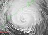
I was not sure where to put this question. But I was watching wv east loop and noticed this spin. It certainly does not look like Bertha or 94L, except for the motion that looks to be starting to push on Bertha's east/ne side.
|
|
|
|
Re: CV Waves
|
|
That's an upper level low.
|
|
ftlaudbob
|
|
(Storm Chaser)
|
|
Sat Jul 19 2008 07:51 PM
|
|
|
|
|

|
|
|
Re: CV Waves
|
|

Look all the way to the right,that is one heck of a wave about to come off.
|
|
Ed Dunham
|
|
(Former Meteorologist & CFHC Forum Moderator (Ed Passed Away on May 14, 2017))
|
|
Sat Jul 19 2008 08:30 PM
|
|
|
|
|
|
|
|
|
Re: CV Waves
|
|
Yes it certainly is - I've been tracking it across Africa for a couple of days. The shear zone that I mentioned earlier in the week has abated. I'm about to post a new Met Blog where I'll mention this system.
ED
|
|
Mike
|
|
(Weather Watcher)
|
|
Sun Jul 20 2008 11:59 PM
|
|
|
|
|
|
|
|
|
Re: CV Waves
|
|
I am surprised that the NHC has given a medium potential to a system that is STILL over Africa for another day or two. I missed the flagged area on the NHC home page. These waves have a tendancy to fall apart when the hit open water. I am wondering what they see over Africa. MET 9 shows a system. Wind shear over the East Atlantic must be low.
|
|
Ed Dunham
|
|
(Former Meteorologist & CFHC Forum Moderator (Ed Passed Away on May 14, 2017))
|
|
Mon Jul 21 2008 12:45 AM
|
|
|
|
|
|
|
|
|
Re: CV Waves
|
|
It is a bit surprising given that there is easterly wind shear (on the decline) and marginal SSTs of 25 to 26C, but its also true that those conditions didn't stop Bertha when it came off the coast in roughly the same area (SSTs were about the same). This particular wave has maintained a tropical low center for about the past four days - its roughly located near 13N 13W at 21/00Z. The wave will exit the coast on Monday (not Tuesday) and has a chance to become a depression on Tuesday (per the UKMET, which is what I'm sure NHC was looking at). In general though, you are correct that many of them do fall apart when they first exit the west African coast. The MET develops it as a tropical cyclone at 15.7N which seems a bit too far to the north given its current location.
ED
|
|
saluki
|
|
(Weather Hobbyist)
|
|
Mon Jul 21 2008 03:29 AM
|
|
|
|
|
|
|
|
|
Re: CV Waves
|
|
I can't EVER remember the NHC making such a comment about a wave that hasn't yet exited Africa (granted, I don't see every tropical update). Does anyone else?
|
|
craigm
|
|
(Storm Tracker)
|
|
Mon Jul 21 2008 03:13 PM
|
|
|
|
|

|
|
|
Re: CV Waves
|
|
GFS shows a lot happening in the next couple weeks comming off Africa
http://www.nco.ncep.noaa.gov/pmb/nwprod/analysis/carib/gfs/18/index_pcp_m_loop.shtml
|
|
LDH892
|
|
(Meteorologist)
|
|
Tue Jul 22 2008 12:09 AM
|
|
|
|
|
|
|
|
Re: CV Waves
|
|
Quote:
GFS shows a lot happening in the next couple weeks coming off Africa
http://www.nco.ncep.noaa.gov/pmb/nwprod/analysis/carib/gfs/18/index_pcp_m_loop.shtml
If that model is half right, we'll have plenty to talk about!
|
|
DMFischer
|
|
(Weather Hobbyist)
|
|
Tue Aug 05 2008 12:26 PM
|
|
|
|
|

|
|
|
Re: CV Waves
|
|
I have been watching the waves as they come off Africa, applying what knowledge I have learned from lurking around here every season since Charlie. This morning I noticed this strong wave just moving into water and what looking like bread crumbs of convection leading out to the islands. Now I am just trying out some knowledge I think I finally understand. ( I am an artist, this requires the other side of the brain thinking that I don't do as well with!  ) It looks like there is dry air that would be sheer? that will mess with it as it moves into cooler water, but its south. Does that mean the water is a bit warmer here? This just seemed like a strong one. Does the "bread crumbs" of ?convection feed a wave like this, or help steer its course? ) It looks like there is dry air that would be sheer? that will mess with it as it moves into cooler water, but its south. Does that mean the water is a bit warmer here? This just seemed like a strong one. Does the "bread crumbs" of ?convection feed a wave like this, or help steer its course?
/www.ssd.noaa.gov/goes/east/tatl/wv-l.jpg
Replaced Sat Pic with link due to size
|
|
|
 Re: CV Waves
|
|
That is the Intertropical Convergence Zone, or ITCZ, that you are seeing.
See here for an explanation:
http://en.wikipedia.org/wiki/Intertropical_Convergence_Zone
|
|
weathernet
|
|
(Storm Tracker)
|
|
Wed Aug 06 2008 03:26 AM
|
|
|
|
|
|
|
|
|
Re: CV Waves
|
|
DM~ As someone had already posted, the area of "breadcrumbs" you described, is the ITCZ ( some refer to it as the ITZ ); either way, is the zone which generally exists several degrees on either side of the equator. It is this zone or area that disturbances and tropical waves move westward ( N. Hemisphere ). Often times significant waves move off the African coast, only to eventually dissapear in this general area. On other occassion, what may appear as cloud free, might suddenly appear areas of convection. In some years this zone lies closer to the equator, and in others, lieing closer to 10N. Though not a distinctive measure of any organized or iminent development, the very fact that we may now, or perhaps in the future have an increase in convective activity in this zone, does portend to a greater degree of surface convergence ( winds approaching form the equator - from the south, and surface winds entering the picture from some other direction. Given fairly low pressures, along with some decent convergence, and walaaa! You have blobs of cumulonimbus popping. A good continuous blow up of these storms suggests rising air, combined with some mid level or low level vorticity from a tropical wave, and suddenly you have the firing mechanism to potentially initiate an increased cycle of inflow and the possible start of some cyclonic rotation.
At this point, the upper air may act as a cap, resisting this rising column of air, or if conditions are right, act as a vaccuum helping to expel the rising warm air as it cools, which in turn helps to pull this rising air even quicker.
There certainly does seem to be some sort of pulsating process that occurs where this ITCZ activity will seem to wane, and perhaps surge for a week or two.
|
|
DMFischer
|
|
(Weather Hobbyist)
|
|
Wed Aug 06 2008 05:18 AM
|
|
|
|
|
|
|
|
|
Re: CV Waves
|
|
I have read several things since this morning and am fascinated at the sight. Might sound silly, but its like a visible equator, where I have always had to imagine it.. This wave that is just now coming off is a really healthy one and I think its going to be very interesting to see what happens to it. At least I will find it interesting with the knowledge I gained from everyones answers. Thank you. 
|
