MikeC
Admin
Reged:
Posts: 4829
Loc: Orlando, FL
|
|
Since models are heading out to June, there's a bit of signal toward the west Gulf, however, majority of the signal is in the Eastern Pacific, so it's more likely that the East Pacific near the south of Mexico would have development than the Atlantic. Something sloppy off the coast of Carolina is also possible, but development is unlikely either way.

|
CFHC

Reged:
Posts: 201
Loc: East Central Florida
|
|
There has been some talk of something forming in the Atlantic near June 1st, but I just don't see it. However something is fairly possible around the in the East Pacific. It could be rainy near Florida the first week of June, but I don't believe anything will develop there.

Edited by MikeC (Wed May 20 2026 09:42 PM)
|
MikeC
Admin
Reged:
Posts: 4829
Loc: Orlando, FL
|
|
Euro and hinting at a wet weekend next week, especially south Florida. Tropical Development still unlikely, but could briefly in the Atlantic as it moves out to sea. Caribbean jet is strong this year, so development is likely to be down in general.
 De De


|
scottsvb
Weather Master
Reged:
Posts: 1185
Loc: fl
|
|
GFS Always has feedback errors after 84 hours out in the tropics by wanting to form early season Tropical Storms out of T-Storm clusters it blows up in May-Early June.
I would stick with Euro for 90% of June until we get into later July
|
CFHC
Reged:
Posts: 201
Loc: East Central Florida
|
|
Still nothing really new going into the first week or so of the hurricane season. Generally wet pattern in Fl/SE, but nothing likely to organize into a tropical system.
|
cieldumort
Moderator

Reged:
Posts: 2671
Loc: Austin, Tx
|
|
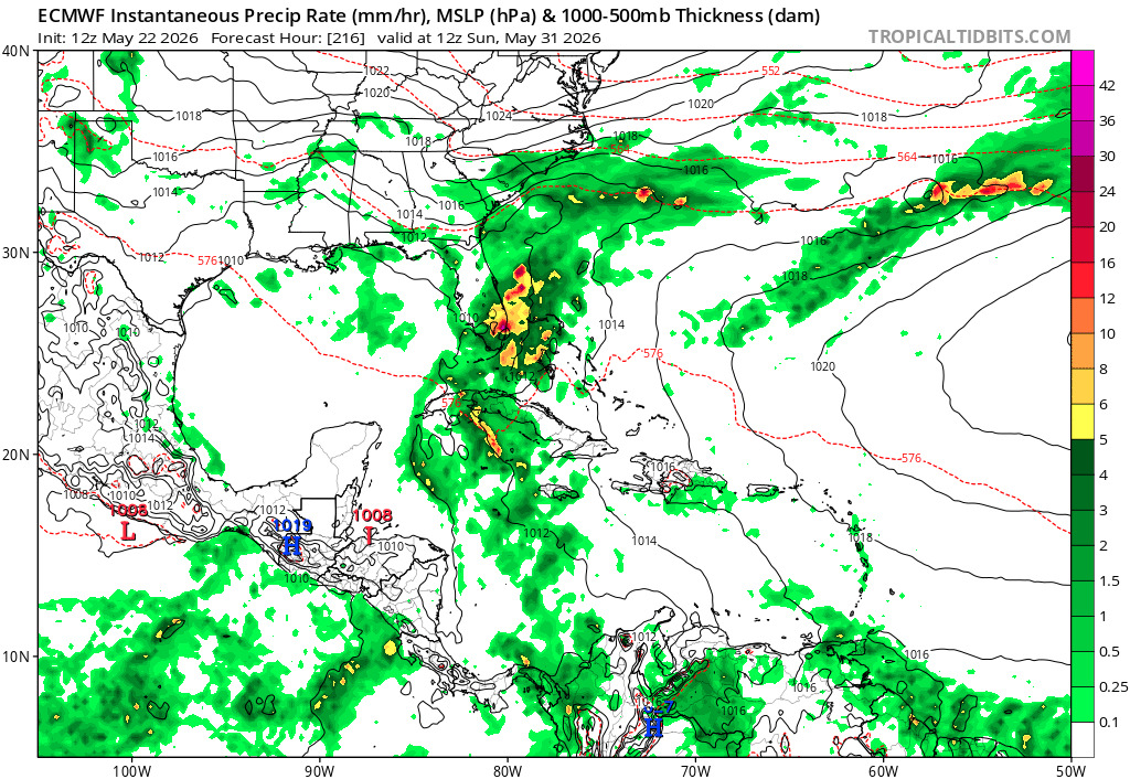
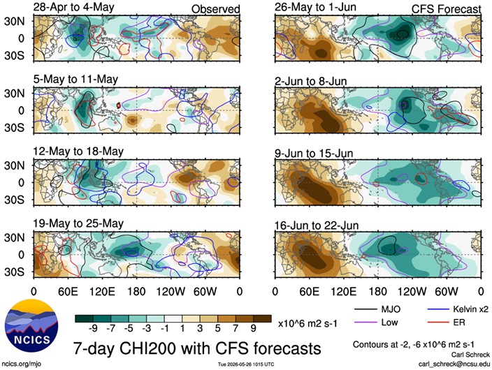
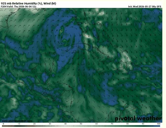
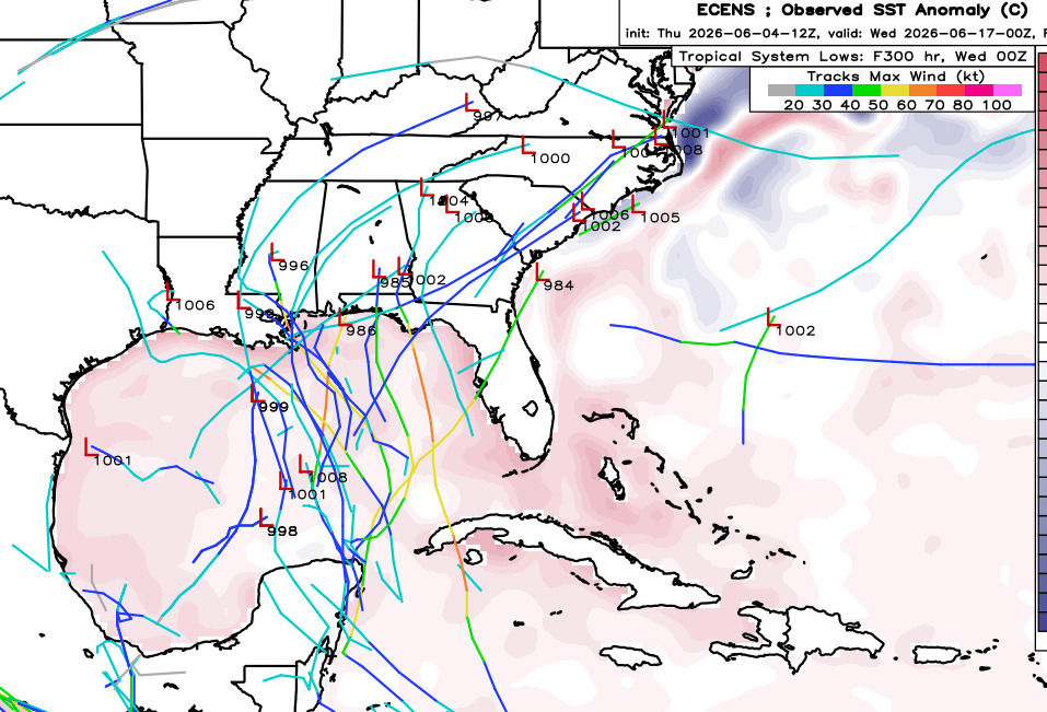
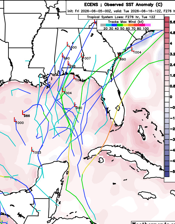
Starting to see more of a model convergence, including the highly-skilled AI models, on an increasing chance for development later next week, around Th/Fr June 4/5 +/-, in the Gulf. Nothing concrete yet, just a stronger signal for potential development. Among operational runs, the , as per usual, is all alone in going gangbusters. There are a few ensemble members of other models that are very bullish, but for now at least, these also remain outliers.
For the early part of the upcoming hurricane season, there should not be much, if any, influence from the forecast developing El Niño. Also, waters in the Caribbean and Gulf are sufficiently warm and an enhanced region of favorable 200hPa velocity potential anomalies, possibly coupled with an pulse, could be in place around this time.
Below: Negative anomalies (Shaded in green/blue) indicate upper-level divergence and rising air.
|
cieldumort
Moderator
Reged:
Posts: 2671
Loc: Austin, Tx
|
|
|
MikeC
Admin
Reged:
Posts: 4829
Loc: Orlando, FL
|
|
Lounge time:
One thing to watch this year is the old Canadian (Also known as the Gem or Model) received some pretty significant updates this week, including some AI related interpolation or nudging to help it along. So it's worth monitoring to see how it does.
The overnight (oz) runs are a bit crazy, inc

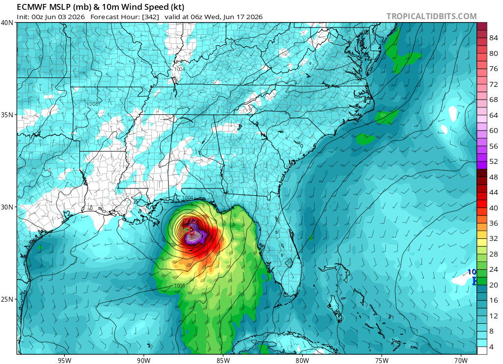
Example, here a hurricane making landfall near Venice/Sarasota County a week from friday on the 0z run.
Countered by nothing on the euro.but some rain

The new Canadian mention, just shows rain near Louisiana from it

6z run of the is still going, but is slower around the same period (still in the gulf)


Usually the fake storm behavior in the winds up either dissipating or pushing the storm out further and further in time.
AI models do not pick up anything from this.
Bottom line, still very unlikely anything develops, but the rain and energy is there for a window for something to possibly try to get going (and probably fail to get going) sometime later next week.
The pattern of higher chance of rain in Florida will be starting this weekend.
|
MikeC
Admin
Reged:
Posts: 4829
Loc: Orlando, FL
|
|
Overnight has backed off on the Atlantic side and the ensembles (ai includes) aren't very enthuisastic about it, however East Pacific still has more activity, so for tropical development look there.
|
MikeC
Admin
Reged:
Posts: 4829
Loc: Orlando, FL
|
|
0z euro is showing an east pacific crossover storm in 2 weeks. Notable since the euro typically doesn't do this, something to monitor trends for at least.
This one starts in the east pacific here:
Still unlikely, but notable it's not the .
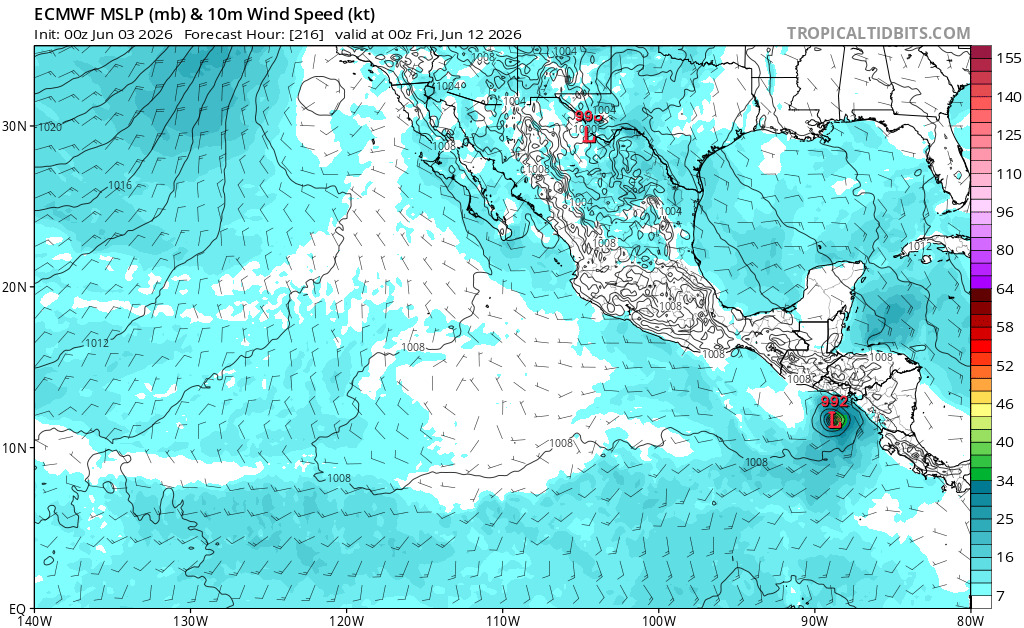
The east pacific has Amanda now, probably a second one over the weekend, doing things, but Euro wants a Pacific to Atlantic crossover around a week and a half, which is probably the only real shot for development in the Atlantic, and even that's unlikely as all get out.
|
MikeC
Admin
Reged:
Posts: 4829
Loc: Orlando, FL
|
|
12z euro also showing crossover, but spends more time over land so thus weaker. Still probably the place to watch next week, although still unlikely anything develops.
E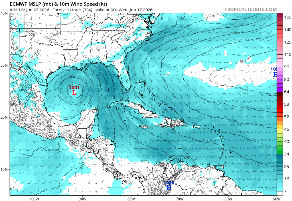
|
MikeC
Admin
Reged:
Posts: 4829
Loc: Orlando, FL
|
|
Overnight model runs still showing more energy passing over from the east pacific, but chances are still very low anything happens basically because much of the Gulf (particularly the eastern side) is likely high on windshear. While there's a small chance next week, development is still very unlikely.
Note this is using some the new site features to be able to paste images and then draw lines/arrows and inject text over them. ^
|
cieldumort
Moderator
Reged:
Posts: 2671
Loc: Austin, Tx
|
|
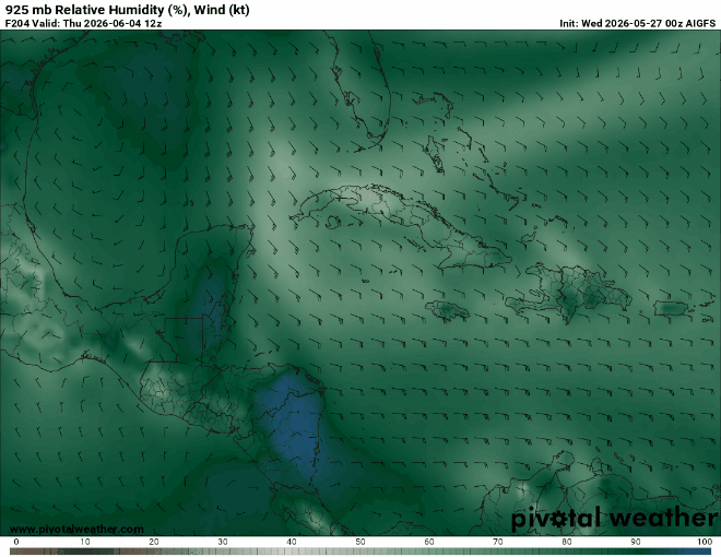
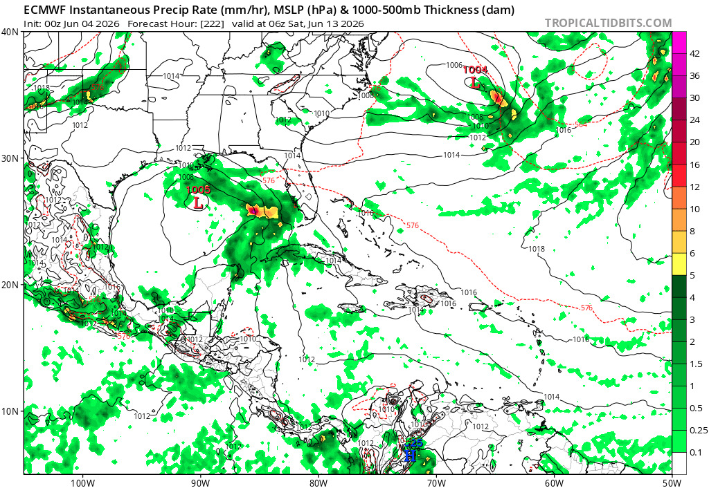
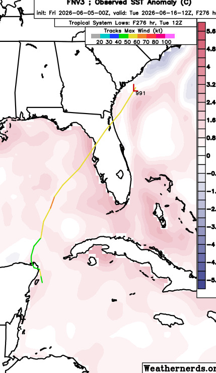
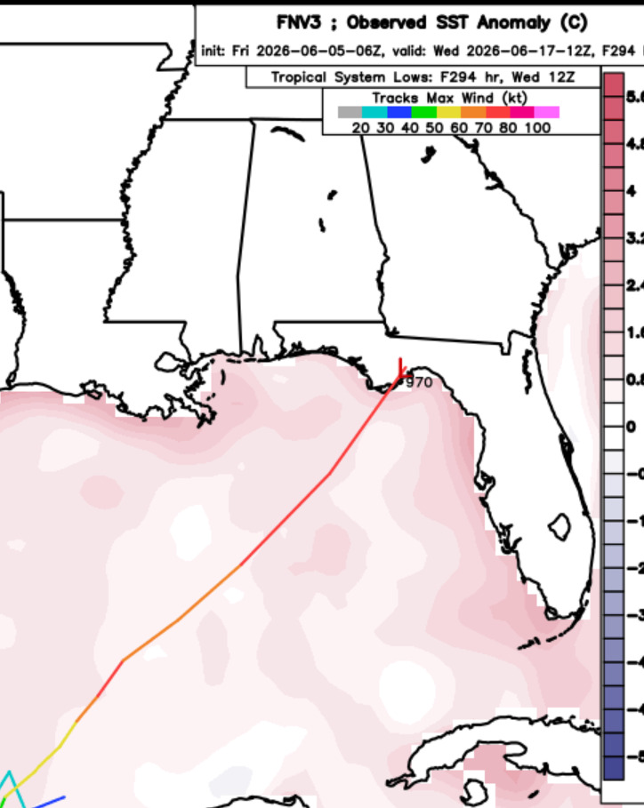
I've become very suspicious of any even medium-range forecasts. There are a number of reasons for this that I won't go into here, but long and short of it, generally speaking, the has become one of the last models I look to for anything more than a very broad-brush of future conditions. That said, last week's 5/27/0z run out to today arguably performed better than its competitors. While a closed circulation still looks to be a good bit more elevated than at the 925mb level predicted, it wasn't a totally outlandish modeled outcome, and as mentioned, seemed to outperform the EURO, EURO AI, AI and CANADIAN runs from the same time.
Below: 5/27/0z for 6/4/12z
Below: Actual 6/4/18z
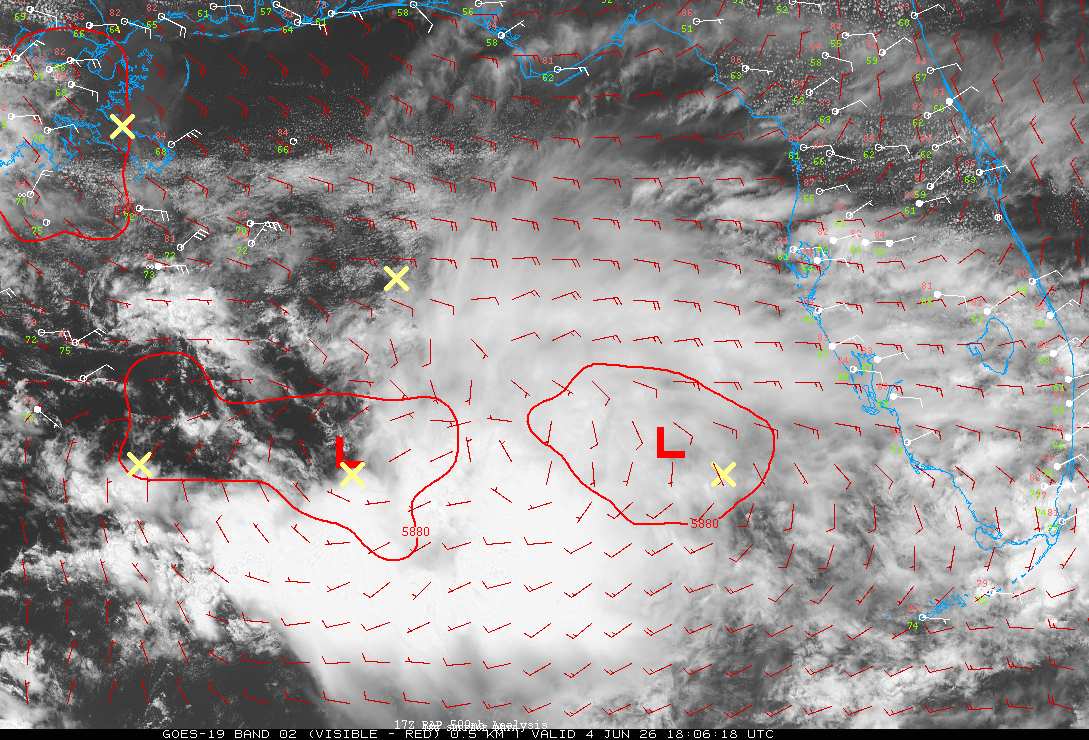
Something I'll be keeping in mind as the current season continues.
|
MikeC
Admin
Reged:
Posts: 4829
Loc: Orlando, FL
|
|
18z ensembles a little more picking up on it, but still need to see if this continues or not, conditions aren't great in the Gulf so everything would have to align just right to get there.
|
MikeC
Admin
Reged:
Posts: 4829
Loc: Orlando, FL
|
|
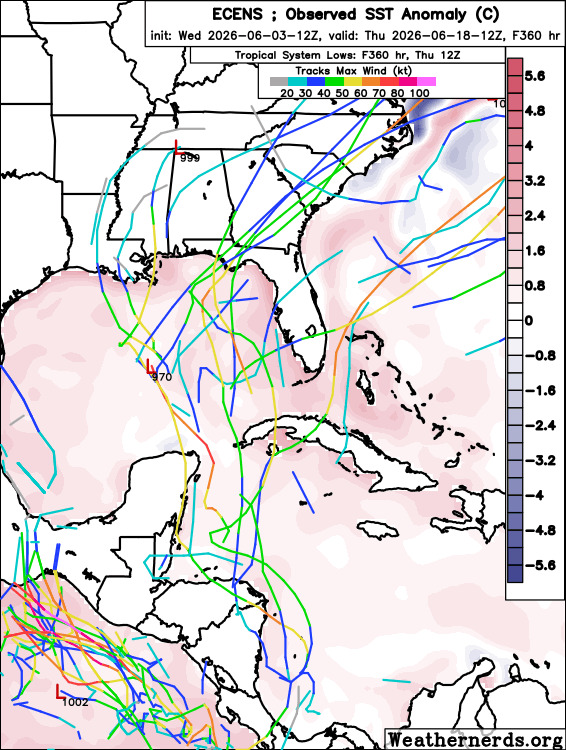
Deep mind dropped a lot of the ensemble members, except for one. Euro has a lot more, although mostly weak. Follows the pattern of may be something trying to form then, but unlikely to, or most likely stays weak. Nothing concerning, and development still seems like a long shot.
6Z Google Deep mind ensembles
Based on the ensemble maybe something weakish in the gulf in a week and a half, splitting the difference it winds up somewhere in the Panhandle.
Edited by CFHC (Fri Jun 05 2026 10:18 AM)
|
CFHC
Reged:
Posts: 201
Loc: East Central Florida
|
|
12z Euro has backed off a bit, although takes the energy into the west gulf and into Texas.
One of 12Z Google Deep Mind ensembles shows it over florida and then close to Wilmington, NC
Euro ensembles are further east of the operational.
All mostly very weak with 1/2 exceptions. Continues the idea that there may be something to watch late next week, even if weak. Still not a great chance for development.
|
MikeC
Admin
Reged:
Posts: 4829
Loc: Orlando, FL
|
|
Most of the models have backed off since Friday, still basic outside chance of something weak forming in the Gulf, but still very unlikely. Doubt the even puts a yellow area up or it.
|
CFHC
Reged:
Posts: 201
Loc: East Central Florida
|
|
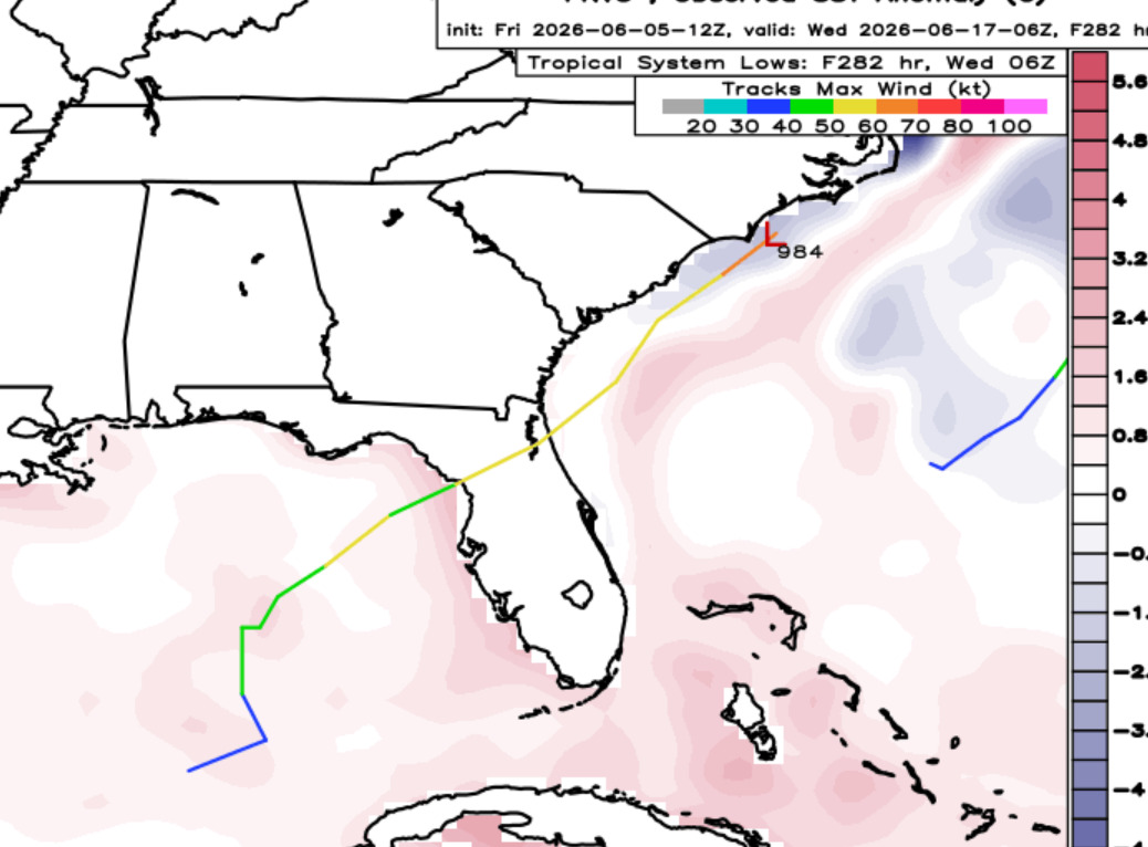
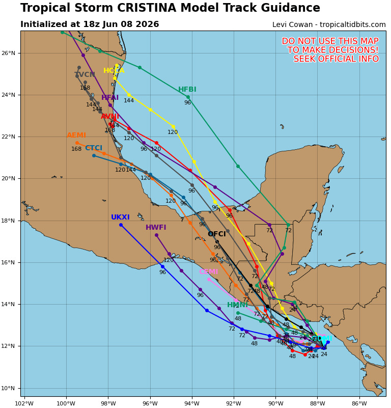
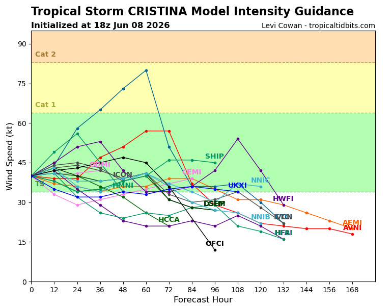
East Pacific Tropical Storm Cristina may cross over briefly into the Bay of Campeche, but probably not regain strength, it'll wind up being into Mexico. Potential for flooding rainfall is about it.
|
cieldumort
Moderator
Reged:
Posts: 2671
Loc: Austin, Tx
|
|
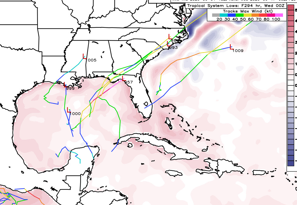
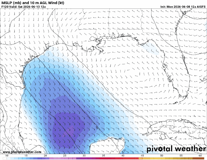
Operational runs of our traditional models, along with their AI versions, are starting to focus on the potential for the Central American Gyre to spill out a vort lobe ~ brand- new and/or the remnants of East Pac Boris and/or Chrstina ~ into the Bay of Campeche, later in the current week, and suggest that the lobe could become better defined while in the western Gulf.
This is a very favored mechanism and location for tropical cyclone genesis early in a season, but even so, the setup often results in nothing more than a stretched out area of closed low pressure that at best gets classified as a T.D. Regardless of development, it could potentially bring additional heavy rains to portions of Texas that are already experiencing some isolated to scattered flooding and are susceptible. Additionally, longer-range runs of ensembles ~ sometimes inc a couple of the excellent Google DeepMind ensembles ~ do hint at the possibility of the forecast disturbance lingering or drifting back out over the northwestern Gulf and acting as a focus for TC genesis up there heading into next week.
My take this far in advance is that it is probably fair to say that the western Gulf has a 15% chance of TC development over the next 5-10 days. At this time, this is both too low and/or too far into the future for to introduce a yellow zone. However, the western Gulf remains an area to keep eyes on.
|
cieldumort
Moderator
Reged:
Posts: 2671
Loc: Austin, Tx
|
|
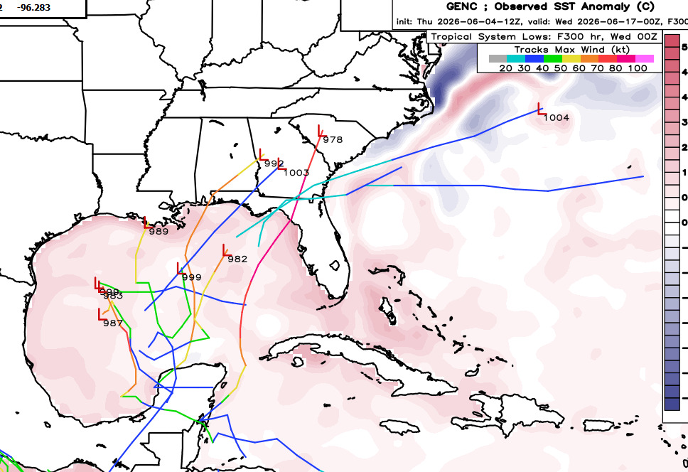
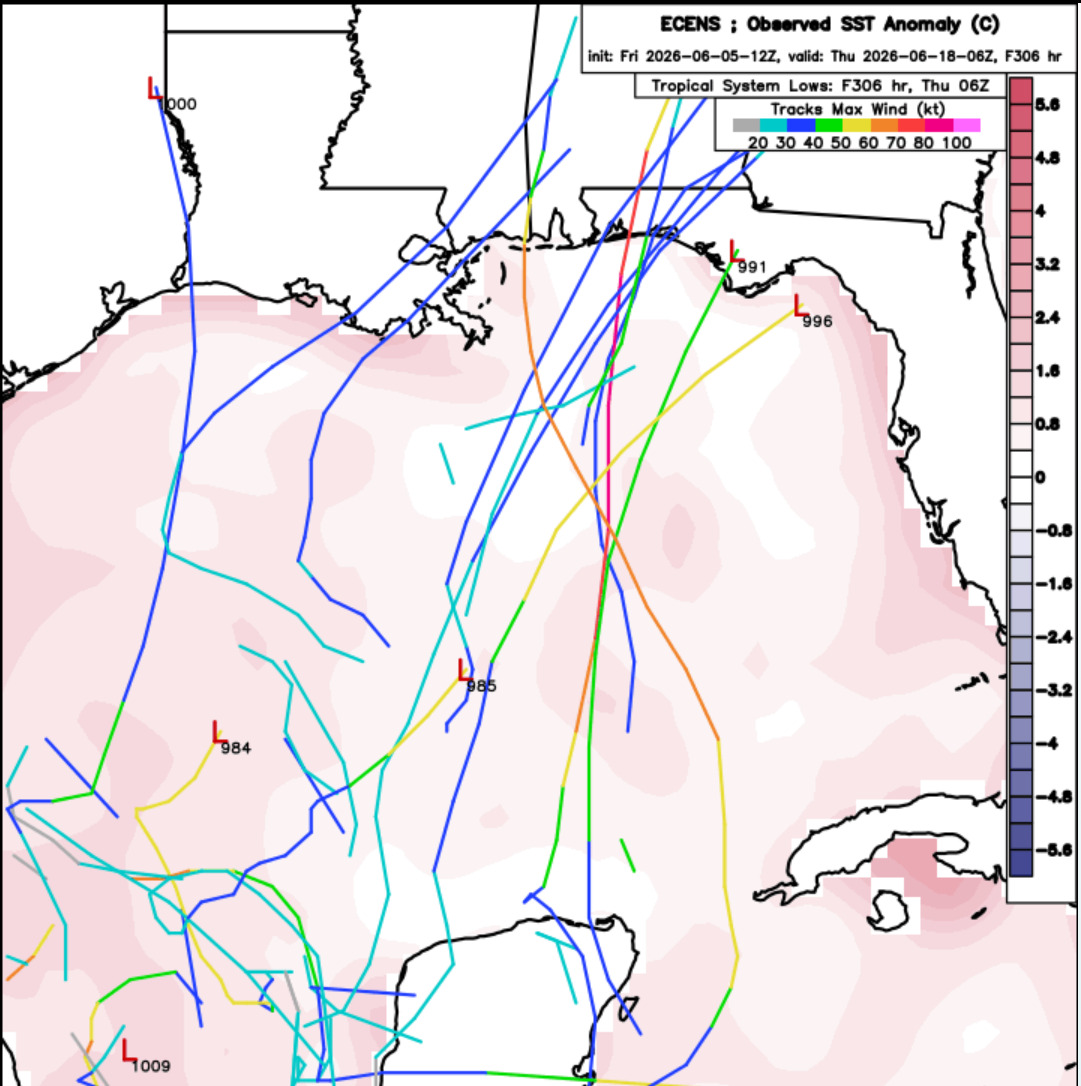
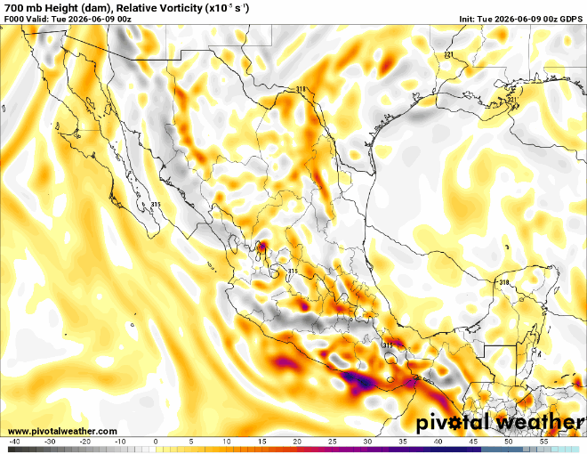
The 700mb relative vorticity loop from today's 0z GDPS ("Canadian") models a clear picture of this idea of taking a vort spinning out of a gyre w/remnants of Boris+Cristina into the extreme southwestern Gulf, then looping the conglomerated vort across eastern Mexico, to get drawn up by a passing trof, to then ultimately re-enter the Gulf along the Texas coast over mid-late next week. A somewhat plausible forecast, also supported off and on by a few runs of other global numerical weather prediction models, a few of their ensembles, plus a couple of the DeepMind ensemble members.
|


 Threaded