JMII
Weather Master

Reged:
Posts: 489
Loc: Margate, Florida
|
|
What was looking like an LA storm is now becoming more and more of a FL storm. Yesterday it was so disorganized I thought it might never gets its act together but this AM its looking more tropical. However it is being pushed hard by the tradewinds and limiting developement - the LLC is lagging way behind all the moisture to the west. A slow turn near Jamaica and clipping Cuba will be key points in its path to determine where in FL it ends up. Some of the models have it very far west to the point where it could be in the Big Bend area despite Port Charlotte being in the cross-hairs at this early stage. A tighter turn puts the Keys into the core. Going to monitor this closely.
Side note: our impact window install just finished last week so I no longer have to worry about putting multiple heavy panels onto a two story home. I'm getting too old for that nonsense.
--------------------
South FL Native... experienced many tropical systems, put up the panels for:
David 79 - Floyd 87 - Andrew 92 - Georges 98 - Frances 04 - Wilma 05 - Matthew 16 - Irma 17
Lost our St James City rental property to Ian 22
|
Lamar-Plant City
Storm Tracker

Reged:
Posts: 383
Loc: Plant City, Florida
|
|
This one has me worried...I suffered a serious spinal cord injury in June...did 6 weeks in hospital and rehab and am confined to a wheelchair for the time being while we wait and see what heals. I have no ability to get into either of my vehicles. This storm seems to have my area in its site, so please keep us informed. My mom is 85 and alone and I can't take care of her like I usually would in this situation. This one has shades of Charlie all over it and it is hard to describe what Charlie did to my mom's house and neighborhood. Praying this one away!
--------------------
If you don't like the weather, wait 5 minutes...
2023 Season Prediction: 17/6/2
|
cieldumort
Moderator

Reged:
Posts: 2305
Loc: Austin, Tx
|
|
TD9 is not winning the prettiest tropical depression award today. Persistently high northeasterly shear from Fiona's outflow continues to batter the barely-a-td today.
Unfortunately, this is not likely to last much beyond another day or two at most. By the time NINE reaches the western to northwestern Caribbean, shear could go from horribly hostile (present) to phenomenally favorable, just as the cyclone reaches some of the warmest and deeply warmest waters of the entire Atlantic basin for the entire stretch of this season.
There is yet a slim chance that NINE remains so impacted by the shear that it is not able to avail itself of the above mentioned stellar development environment as well and/or quickly as forecast. A slower ramp-up could make it less likely to recurve into the Florida peninsula. For now, modelling and indeed the official forecast do not expect that outcome, keeping the entire state of Florida in the cyclone's path.
|
dolfinatic
Weather Guru
Reged:
Posts: 129
Loc: St. Petersburg, Fl
|
|
 Not looking good. Time to get prepared. Not looking good. Time to get prepared.
|
IsoFlame
Weather Analyst

Reged:
Posts: 295
Loc: One block off the Atlantic Oce...
|
|
Quote:
TD9 is not winning the prettiest tropical depression award today. Persistently high northeasterly shear from Fiona's outflow continues to batter the barely-a-td today.
Unfortunately, this is not likely to last much beyond another day or two at most. By the time NINE reaches the western to northwestern Caribbean, shear could go from horribly hostile (present) to phenomenally favorable, just as the cyclone reaches some of the warmest and deeply warmest waters of the entire Atlantic basin for the entire stretch of this season.
There is yet a slim chance that NINE remains so impacted by the shear that it is not able to avail itself of the above mentioned stellar development environment as well and/or quickly as forecast. A slower ramp-up could make it less likely to recurve into the Florida peninsula. For now, modelling and indeed the official forecast do not expect that outcome, keeping the entire state of Florida in the cyclone's path.
A weaker (Cat 1/2) Ian, further west and a bit slower, based on last suggesting the frontal trough will influence but not eject a rapidly intensifying hurricane NE across the peninsula (ala ). A brief slowing, or even stall, over the east/central GOMEX off Tampa Bay allowing SE/S tropical surge to dumping 8-12" will be an issue for many saturated parts of central Florida but isn't an issue for my east central Florida location running a wet season deficit of nearly 7" I'll take a good soaking as long as the feeder spin ups are limited.
--------------------
CoCoRaHS Weather Observer (FL-VL-42) & Surf Forecaster: https://www.surf-station.com/north-florida-surf-forecast-3/
|
MichaelA
Weather Analyst

Reged:
Posts: 944
Loc: Pinellas Park, FL
|
|
The 12Z models seem to show a slight westward shift with landfall between Naples and Apalachicola. Several skirt the coast before reaching the Big Bend area with the showing a stall or small loop before landfall near St. Marks. The 5PM advisory nudges the track slightly westward with a landfall near Sarasota. Of course, this will change east or west with each advisory until it gets to within 72 hours of landfall.
--------------------
Michael
PWS
Edited by MichaelA (Fri Sep 23 2022 10:12 PM)
|
OrlandoDan
Weather Master

Reged:
Posts: 443
Loc: Longwood, FL
|
|
Orlando is on the dirty side. Let's all keep an eye on this one. The upper level synaptic conditions will drive the direction
--------------------
Keith (1988), Charley (2004), Frances (2004) , Jeanne (2004), Fay (2008), Mathew (2016), Irma (2017), Dorian (2019)
Personal Weather Station: https://www.wunderground.com/dashboard/pws/KFLLONGW67
|
MichaelA
Weather Analyst
Reged:
Posts: 944
Loc: Pinellas Park, FL
|
|
The 18Z nudges a little more westward and the 18Z HMON indicates a landfall near Cedar Key. Still waiting on the 18Z HWRF.
*Edit* The 18Z HWRF is in agreement with the 18Z .
--------------------
Michael
PWS
Edited by MichaelA (Sat Sep 24 2022 12:55 AM)
|
JMII
Weather Master
Reged:
Posts: 489
Loc: Margate, Florida
|
|
Two issues causing the confusion on TD9 / Ian future track:
1) Where will the true center form? East where the LLC is currently located or west where the moisture center is and the direction the shear wants it to go.
2) How strong will the front moving over the NE US will be in two days after the run across Cuba? A weak front draws Ian NE across FL, where as a strong front keeps Ian in the gulf.
This one is going to be dicey for awhile. Model guidance covers a wide range of possibilities from as far east as the western Bahamas to as far west as the FL/AL boarder. Of course the official forecast (for now) is right down the middle near Sarasota. The path is very -like  the upper level pattern ahead will allow for intensification once it consolidates, so this could spin up quickly once it gets into that more favorable environment. the upper level pattern ahead will allow for intensification once it consolidates, so this could spin up quickly once it gets into that more favorable environment.
|
MikeC
Admin
Reged:
Posts: 4544
Loc: Orlando, FL
|
|
18Z doesn't seem to have a great handle on the short term with TD9, but it's still worthwhile for general overview. A lot is going to depend on when the north turn begins and where the center forms now that shear will start to relax tomorrow.
The TVCN was at Bradenton earlier today and now has moved back to Englewood (then over Orlando and out over Volusia/Flagler)
I'm waiting on the storm to get out of its current shear situation because I think the short term errors are larger in the models.
|
cieldumort
Moderator
Reged:
Posts: 2305
Loc: Austin, Tx
|
|
NINE (Now Ian) has begun to avail itself of the much more favorable environment for development and potential Rapid Intensification, and the favorable conditions only look to improve from here, possibly off and on - or even mostly on - all the way to Florida, save land interaction.
This is not the scenario anyone wanted to see unfolding, but this is what looks to be the case with probably better than 90% certainty.
Here are my personal lifetime max intensity odds for Ian.
Low-Mid Tropical Storm < 1%
High-End Tropical Storm 2%
Cat 1 Hurricane 3%
Cat 2 Hurricane 15%
Cat 3 Hurricane 30%
Cat 4 Hurricane 35%
Cat 5 Hurricane 15%
Once the synoptic and meso scale features start to come into better focus, I might place an early best guess on landfall(s) intensity, but suffice it to say, this season will probably be the last time we ever see the name Ian used again.
|
IsoFlame
Weather Analyst
Reged:
Posts: 295
Loc: One block off the Atlantic Oce...
|
|
Organizing pre-dawn Saturday morning burst of convection , banding close to the LLC.
--------------------
CoCoRaHS Weather Observer (FL-VL-42) & Surf Forecaster: https://www.surf-station.com/north-florida-surf-forecast-3/
|
IsoFlame
Weather Analyst
Reged:
Posts: 295
Loc: One block off the Atlantic Oce...
|
|
5AM cone suggests possible Cat 2/3 very near the gut of Tampa Bay. Last major to hit was 1921 Tampa Bay/Tarpon Springs Hurricane
My uncle built his house in St. Pete on "high ground" (7' above Bay level) on Snell Island in the 1960's and lived there until his death in the late 2000's. Several tropical storms and a weak hurricane or two over the 40 year period submerged his dock, sea wall and yard, flooded many nearby homes and made roads impassible. But sea water never into the house.
If center of Ian tracks just to the left of the Bay entrance, striking or glancing off Pinellas peninsula, the storm surge could be historic.
--------------------
CoCoRaHS Weather Observer (FL-VL-42) & Surf Forecaster: https://www.surf-station.com/north-florida-surf-forecast-3/
|
MikeC
Admin
Reged:
Posts: 4544
Loc: Orlando, FL
|
|
morning models, note most initialized too far north based on recon reports.
6z :
Clips western Cuba Tuesday morning as a cat 3.
Landfalls east of Apalachicola as a cat 1/2 (weakens with shear before landfall)
0z euro
notably correctly picked up on the SW jog this morning
Cat 1 hurricane just west of Grand Cayman Monday night
Crosses Cuba as a cat 1 just west of Havana.
Cat 2/3 landfall near Englewood late Wednesday afternoon. Moves slowly over the state and over jacksonville early friday morning then zooms inland Northwest over Georgia.
And there you have the two camps, split the difference is closer to Crystal River or Cedar Key, but weighted closer to Tampa, which is where the official track is. I expect some changes, but the general range is Napes to Apalachicola still.
|
Marknole
Weather Watcher

Reged:
Posts: 46
Loc: Wacissa, FL
|
|
"Above-average uncertainty in the forecast track." So the Euro (and ensembles) have been consistent with SW (or more recently West Central) FL, with the (new and tweaked for the 2022 hurricane season!?) /ensembles staying offshore and eventually targeting Apalachee Bay. There is a history of "Steinhatchee Storms", and Ian looks like a prime candidate. This could be a best-case scenario with the center striking a swampy, lightly-populated area that is familiar with high storm surge. It would also likely be weakening due to expected wind shear that Mike mentioned.
Edited by Marknole (Sat Sep 24 2022 02:06 PM)
|
JMII
Weather Master
Reged:
Posts: 489
Loc: Margate, Florida
|
|
Quote:
morning models, note most initialized too far north based on recon reports.
6z :
Clips western Cuba Tuesday morning as a cat 3.
Landfalls east of Apalachicola as a cat 1/2 (weakens with shear before landfall)
That model run keeps it west enough that direct coastal effects wouldn't be too bad if it stays small. It is also further west then the previous run.
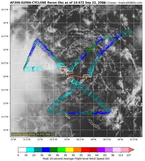
Ian is building, there is a lot of thunderstorms bubbling up and its even developing outflow channels. However recon didn't find much in the way of winds yet. Its a bit of a jumble but all the ingredients are there, its just needs time.
|
MichaelA
Weather Analyst
Reged:
Posts: 944
Loc: Pinellas Park, FL
|
|
The 11AM discussion bumps the intensity up a bit before landfall and nudges the forecast track a bit more westward with landfall near Crystal River. If Ian remains offshore from Tampa Bay, that will lessen the impact there. If Ian does follow that track, the Nature Coast could suffer a catastrophic storm surge. The models continue to shift a bit westward with landfalls from Crystal River to Apalachicola. The panhandle west of Apalachicola doesn’t need another major hurricane strike.
--------------------
Michael
PWS
|
Southern4sure
Weather Guru

Reged:
Posts: 121
Loc: Land O Lakes, FL
|
|
This 11 am discussion has Ian over my house at the 120H forecast position. I swear Ian is coming down my street…lol.
We are saturated from the daily rains and all our ponds are full. I’m not in a flood zone but I’m concerned with the amount of rain we will get and what it will do to the area.
|
GeorgeN
Weather Watcher

Reged:
Posts: 33
Loc: Wesley Chapel FL
|
|
Quote:
This 11 am discussion has Ian over my house at the 120H forecast position. I swear Ian is coming down my street…lol.
We are saturated from the daily rains and all our ponds are full. I’m not in a flood zone but I’m concerned with the amount of rain we will get and what it will do to the area.
The 2PM is more of the same despite a continued drift to the West. The Euro has drifted from its original landfall into the SouthWest portion of Florida to a more mid Florida entry. Meanwhile the mean keeps drifting West along the Florida panhandle. The wide spread between the two is probabaly why the is just recycling the previous track. This may be a good sign for those in the center of Florida, perhaps even for the whole state. Meanwhile, I've heard stories of people being extremely aggressive in my local grocery stores. The track is again causing widespread panic without providing much useful information. I'm curious as to why the ECMF long track model hasn't been run since early yesterday. At least I can't see it plotted beyond Cuba.
--------------------
Wesley Chapel FL - since 1990
Previous resident of North Miami and Merritt Island
|
MikeC
Admin
Reged:
Posts: 4544
Loc: Orlando, FL
|
|
There are two model camps
GFS/CMC is over toward Destin
Euro/UKMET/Icon is peninsula from Tampa (UK/Euro) to Icon, which is closer to the the big bend.
The TVCN consensus is around Apalachicola, which may be too much because of the high spread in the afternoon models in general
The position of the storm could change based on recon reports,but the 0z run tonight will be the first one with high altitude recon data which should help alleviate the spread. The center may be moving more north today based on the recon plane out their right now, but until past Jamaica its probably going to be in flux.
12z and 0z Euro go out the full distance, 6/18z do not, which would explain the plot only to Cuba.
Basically the entire cone is valid for the storm. Do not take any one model as gospel.
|


 Threaded


