alan
Weather Hobbyist

Reged:
Posts: 95
Loc: Apopka, FL
|
|
The national weather service has caps to the wind speeds based on how far the hurricane is out.
Believe the hurricane local statements.
|
Cocoa Beach
Unregistered
|
|
There is alot of confusing reports out there.
When did we go from this storm hitting with 120knts to 90?
I thought was supposed to strengthen?
I will stay for 90knts but 120 is a bit much.
Can someone explain?
Thanks
|
Hurricaned
Verified CFHC User
Reged:
Posts: 14
|
|
Quote:
The national weather service has caps to the wind speeds based on how far the hurricane is out.
Believe the hurricane local statements.
...but, is the "local" statement including Melbourne coastal information as well? Is that why the difference?
|
spook
Unregistered
|
|
Frances is going exactly the ways she is supposed to.It is us and our technology thats she is not going along with.It is good though because lives are saved because of our guesses,just hope the people who do not get hit understand this time they are lucky.The people in Punta Gorda would gladly trade a miss for what they got.
|
Bell
Unregistered
|
|
I am also confused!! I am trying to direct my friend, single mom w/5 kids newbie in w palm beach to a safe destination(kissimmee?) My only source of info is the internet (i live in Cal.) her info sources are very confusing. Is there an internet station for tracking this thing,with specific, accurate, up to date info?
|
Todd
Weather Watcher
Reged:
Posts: 30
Loc: Havelock, NC(34.89n76.92w)
|
|
I know what you mean .. We'll need to sit and see how it plays out. There are a lot of if's in these runs and they're based on fairly old data but they do give a general feel for the overall picture. These are not cast in stone! Yesterday's runs had it way on the east side.
|
alan
Weather Hobbyist

Reged:
Posts: 95
Loc: Apopka, FL
|
|
Does anything with the government make any sense?
|
spook
Unregistered
|
|
(Off topic post removed by moderator)
Edited by LI Phil (Thu Sep 02 2004 10:30 PM)
|
spoo
Unregistered
|
|
Looks like on the latest floatersat. a jog west?
|
LoisCane
Veteran Storm Chaser

Reged:
Posts: 1236
Loc: South Florida
|
|
Everyone has been calm here for the last few hours as they changed the storm direction to the NW. Mind you everyone knows it could turn back...but it was a welcome breathing spell.
Mayfield on TV with Norcross just now said the information they just got back from recon shows the ridge is building in strong in front of the storm and it possibly is slowing down because of that and they are still expecting it to bend back towards the west sometime down the line. When is the question.
Funny because....when it started pouring.. people everywhere on the streets were running like the storm was coming.
A wake up call I think.. saw people putting up shutters finally.
Shelters almost filled and the Home Depot is empty with only customers scrounging around for anything they can get their hands on.
Going out a bit.. relaxing a bit.. while I can.. Will stay up late watching the storm like last night.
Poor San Salvador
Bobbi
--------------------
http://hurricaneharbor.blogspot.com/
|
SkeetoBite
Master of Maps

Reged:
Posts: 298
Loc: Lakeland, FL
|
|
New wind map available here:
http://www.skeetobite.com
Local Mets in Tampa calling for 100 mph sustained winds in Lakeland as passes over. Seems like less based on latest forecast.
|
Rabbit
Weather Master

Reged:
Posts: 511
Loc: Central Florida
|
|
I have a feeling that this is going to continue to weaken (flight winds only 120 now) and hit land as a Cat III
|
Clark
Meteorologist
Reged:
Posts: 1710
Loc:
|
|
They're both right. That larger statement was for the overall area, and there are some locations that could receive those winds. Just not Orlando, a good 75 miles inland as the crow files to the southeast.
The storm, despite having excellent outflow all day, has been gradually weakening. I don't think that's bound to continue, however. A combination of an eyewall replacement cycle along with the disruptive forces of the islands has led to what we've seen today. The eyewall replacement is probably about done, though it remains open on the SW side. The islands are still going to inhibit the inflow as long as the storm moves along the spine of the Bahamas, but shouldn't be enough to lead to further weakening.
Current thinking - a NW jog should last for another 6 hours, then bend back to near WNW (or slightly south of that) towards the coast. The old upper low that has been in advance of the storm has reared it's head again today and has impacted the track just a bit to the north -- not totally unexpected, to tell the truth. It's almost a quasi-Fujiwhara effect, but not quite. However, shortly the storm should begin to round that low and get accelerated slightly to the WNW across Florida. Erin (95) isn't a bad analog for this storm's track, albeit probably slightly more northerly across the state.
Landfall near Ft. Pierce, a bit further north of my position of WPB, is looking pretty good. I'm almost certain there will be a second landfall on the Gulf coast, but the models disagree as to where and how strong. Personally, just off of experience, I would suggest somewhere in the Apalachicola area - between Panacea and Ft. Walton Beach, only so large because of the orientation of the coastline - as a high end tropical storm or minimal hurricane. In any case, most of Florida is going to receive a LOT of rain from this storm...5-15 inches in parts.
BTW, one last tidbit. The outflow from Howard in the EPac is getting shunted somewhat around the high currently steering . The heat released as a result of the outflow is serving to pump up the ridge a bit more, something that should keep going a bit further south. It is also worth noting that the 12Z models AGAIN did not initialize the height field correctly: the , previously the best performer, was the worst, whereas the and Eta (et al) were only slightly better. They were still 20-30m too low - and for the , almost 40m in spots.
That's where we sit now...more later if events warrant.
--------------------
Current Tropical Model Output Plots
(or view them on the main page for any active Atlantic storms!)
|
spook
Unregistered
|
|
are you saying this one is a name they retire
|
SirCane
Storm Tracker

Reged:
Posts: 249
Loc: Pensacola, FL
|
|
I'm afraid may go as far as Pensacola or Mobile now. Too much uncertainty! Seems like every night the track moves West.
|
52255225
Weather Guru

Reged:
Posts: 166
Loc: Parrish Fl
|
|
yes!
|
wxman007
Meteorologist
Reged:
Posts: 617
Loc: Tuscaloosa, AL
|
|
BULLETIN
HURRICANE UPDATE
NWS TPC/NATIONAL HURRICANE CENTER MIAMI FL 600 PM EDT THU SEP 2 2004
AT 512PM EDT...2112Z...A NOAA HURRICANE HUNTER AIRCRAFT REPORTED THE CENTER POSITION OF HAD WOBBLED BACK TO THE LEFT OR WEST OF THE FORWARD MOTION MENTIONED IN THE PREVIOUS ADVISORY. THIS SLIGHT WESTWARD JOG SHOULD NOT BE INTERPRETED AS A LONG TERM MOTION OR CHANGE FROM THE PREVIOUS FORECAST TRACK. GIVEN THE RELATIVELY SLOW FORWARD SPEED OF ...SOME ERRATIC MOTION WITH SEVERAL WOBBLES IN THE TRACK SHOULD BE EXPECTED.
FORECASTER STEWART
--------------------
Jason Kelley
|
HanKFranK
User

Reged:
Posts: 1841
Loc: Graniteville, SC
|
|
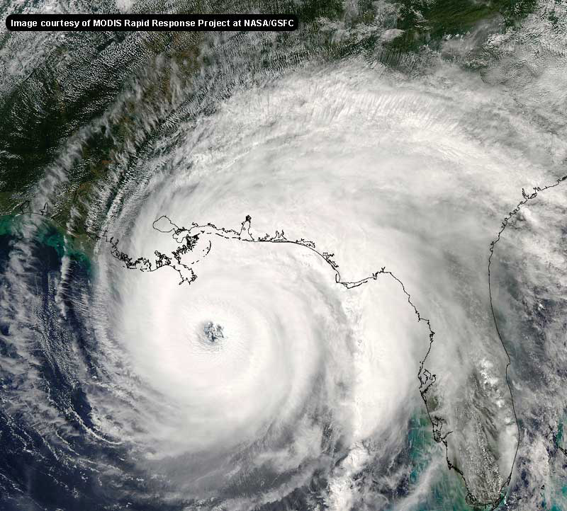
for about six hours ' eyewall convection has been lopsided, and i'm sure the storm has weakened. even without recon, the satelite presentation isn't category four anymore. it's 2/3 right now. rather large fluctuation in intensity, no? something i hadn't really seriously considered (perhaps because its occurence is often inexplicable).. that the storm may in fact 'magically' weaken as it closes on the coast.. could be in play. right now it looks like a stream of subsidence got into the eyewall and is killing the convection ring in places.. in others it is enhanced to compensate.. net result being an irregular, filled eye and a less intense storm.
this strange illogic, that strong hurricanes tend to weaken as they approach landfall, has blocked several storms from being catastrophic in recent years (floyd, lili, isabel to name a few). the official line on may take her down a notch later this evening.. but of course the storm has 36-48 hours to regain its composure.
so, if any of you people are out there stressing yourselves to death over the uncertainty with this system, enjoy the new stuff. assuming the worst is the safest path, but take solace in the fact that the worst has a way of evaporating when it comes to hurricanes.
t.d. 9 in the picture now, and the initial prog taking it due west at high speed looks a bit fishy to me. my thought is that more poleward movement will happen as it passes wrinkles in the upper ridge.. and that it moves more poleward anyway due to strength. that 70kt intensity shown has modesty written all over it, if the storm can deepen without accelerating to insane speeds.
don't forget 97L. it's slowed and a bit of ridging will build over it from the east, knock the shear back to where it can consolidate. i've argued that it already HAS developed, but now i'm going to go with it will develop as per classification.. and move north and northeast out into the north atlantic.
HF 2234z02september
Edited by HanKFranK (Thu Sep 02 2004 10:40 PM)
|
SoonerShawn
Unregistered
|
|
So maybe I wasn't so crazy after all.
ShawnS
|
BillD
User
Reged:
Posts: 398
Loc: Miami
|
|
You could try a website of one of the local radio stations. The NWS information is actually very good, but you have to understand the context. The info for MLB was for the coast, not inland.
As far as the 90 kt, vs 120 kt, nothing changed, that was a mis-interpretation of the forecast, the 90 kt was inland, not landfall.
I understand your frustration, but the reality is they don't know for sure where this storm is going to go. They have a good idea, and they are trying very hard to explain, but it isn't easy. No place in Florida is safe, that is why they have Hurricane Warnings up along most of the east coast. As I said a couple of times last night, if you want safe, go to Kansas. But it is probably too late for that. There are over a million people in mandatory evacuation zones along the east coast of Florida all looking for a "safe" place to go, it will not be easy to leave at this point.
Bill
|


 Threaded


