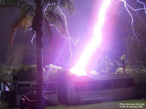
damejune2
Storm Tracker

Reged:
Posts: 237
Loc: Torrington, CT
|
|
I was watching a live feed from a link provided on this site by Mike C and one of the local news networks in Houston said 40% of the residents of Galveston and surrounding areas remained behind to ride out the storm. That is just ludicrous considering the interstates and other roads out of the area were clear/traffic and water free not even 12 hours ago...why would people risk their lives for material items? Parts of Galveston were already inundated by water at noontime...my goodness...god bless those who stayed behind!
--------------------
Gloria 1985 (Eye passed over my house in...get this...northwestern CT!)
|
stormchaserSteve
Registered User
Reged:
Posts: 3
Loc: Kansas
|
|
I`m gonna go out on a limb here and say we will see 115 winds in the next 2 hours. That will match the storm surge we are seeing.
This is only the 5th hurricane I`ve tracked and I love it. I only track the big or unusual ones. I`m waiting on the tornados to develop as I`m sure we`ll see a few before the night is over.
Tone it down a bit. This is not funny.
Edited by Storm Cooper (Sat Sep 13 2008 12:47 AM)
|
cieldumort
Moderator

Reged:
Posts: 2305
Loc: Austin, Tx
|
|
Quote:
I`m gonna go out on a limb here and say we will see 115 winds in the next 2 hours. That will match the storm surge we are seeing.
Ike may easily be classified as a Cat 3 prior to making landfall, but the exact Saffir-Simpson number does not have nearly as much to do with the storm surge this time. Ike is an exceptionally large hurricane, whose storm surge is likely to be on a level more typically seen in a Cat 4 or Cat 5.
|
prairiecomm
Registered User
Reged:
Posts: 3
|
|
foxnews.com has an live video feed that is still, as of 7:59 cdt, running.
it's right on the shore behind the seawall in galvaston, so you are looking across the roadway and seawall at the water beyond - there's a light that goes on and off, it seems to be out for good, now - but still interesting. this video must be indoors since it is still functional - the others on roofs were out some time ago
you can see the force of the wind on the palms
go to foxnews.com and click on live video stream - its the one for galveston coastline
|
SeaMule
Weather Hobbyist

Reged:
Posts: 64
Loc: Fairhope, Al...on the coast
|
|
A good friend of mine is about an hour and a half north of ground zero...so far...nothing heavy to report...they have power and all. However....their dad owns two beach homes on Bolivar Peninsula.....which should take the storm surge...I'm guessing -like....
There is no way...after what we all have read about the power of this storm...that i think any of us would have stayed...right?
Perhaps the report that it was a cat 2 was a bit misleading! They need another way of catergorizing these!!!!!!! then, more would have left galveston......
too late now
|
stormchaserSteve
Registered User
Reged:
Posts: 3
Loc: Kansas
|
|
Looks like the eye is opening back up. May not make a 3 after all?
|
MikeC
Admin
Reged:
Posts: 4544
Loc: Orlando, FL
|
|
Power has gone out to Galveston island in general, none of the webcams (except Mark Sudduth's... but it's pitch black) are recording now, I did add a Level 3 Radar Recording from HCW Here. Though.
The multi coverage link at http://flhurricane.com/ikecoverage.html is still up and working, however.
Folks in the upper texas coast, and Lousiana it's going to be a long night. God bless you all and we sincerely hope you and those you know and love have decided the right way in evacuations and preparations.
|
prairiecomm
Registered User
Reged:
Posts: 3
|
|
have been watching this feed on and off for several hours - the progression is intense - and obviously, it's going to get much worse. that emergency vehicle just drove up - could be a fox news car
in the video you are actually looking across a parking lot, past a row of hedge, low wall and palms, across the roadway/seawall and then the water beyond
J
|
prairiecomm
Registered User
Reged:
Posts: 3
|
|
well, a tree must have come down in front of the video because it's obscured now - and it's been changed to nothing in particular ...
|
cieldumort
Moderator
Reged:
Posts: 2305
Loc: Austin, Tx
|
|
Now in addition to reforming an eyewall and tightening up, pressures have resumed falling. At 110MPH, there is more than enough time left for Ike to go Cat 3 - perhaps even mid-range Cat 3, prior to, or going in to landfall. An argument could be made that high-end 3 is not entirely out of the question. Given the very healthy upper-level pattern in the northwest quadrant that has replaced the shear and dry air, strengthening up to and into landfall is a pretty good bet. But whatever Saffir-Simpson number Ike officially makes landfall at, a 15-25 foot water rise/surge, along and a bit east of the eye, is already baked in the cake.
Product: Air Force Vortex Message (URNT12 KNHC)
Transmitted: 13th day of the month at 01:00Z
Aircraft: Air Force Aircraft (Last 3 digits of the tail number are 304)
Storm Number & Year: 09L in 2008
Storm Name: Ike (in the North Atlantic basin)
Mission Number: 33
Observation Number: 22
A. Time of Center Fix: 13th day of the month at 0:46:00Z
B. Center Fix Coordinates: 28°21'N 94°14'W (28.35N 94.2333W) (View map)
B. Center Fix Location: 74 miles (119 km) to the SSE (151°) from Galveston, TX, USA.
C. Minimum Height at Standard Level: 2,703m (8,868ft) at 700mb
D. Estimated (by SFMR or visually) Maximum Surface Wind: 82kts (~ 94.4mph)
E. Location of the Estimated Maximum Surface Wind: 22 nautical miles (25 statute miles) to the NW (318°) of center fix
F. Maximum Flight Level Wind Inbound: From 35° at 89kts (From the NE at ~ 102.4mph)
G. Location of Maximum Flight Level Wind Inbound: 27 nautical miles (31 statute miles) to the NW (316°) of center fix
H. Minimum Sea Level Pressure: 952mb (28.11 inHg)
I. Maximum Flight Level Temp & Pressure Altitude Outside Eye: 9°C (48°F) at a pressure alt. of 3,041m (9,977ft)
J. Maximum Flight Level Temp & Pressure Altitude Inside Eye: 17°C (63°F) at a pressure alt. of 3,047m (9,997ft)
K. Dewpoint Temp (collected at same location as temp inside eye): 14°C (57°F)
K. Sea Surface Temp (collected at same location as temp inside eye): Not Available
L. Eye Character: Open in the east (center has 50% or more, but less than 100%, of eyewall coverage)
M. Eye Shape: Elliptical (oval shaped)
M. Orientation of Major Axis in Elliptical Eye: 40° to 220° (NE to SW)
M. Length of Major Axis in Elliptical Eye: 60 nautical miles (69 statute miles)
M. Length of Minor Axis in Elliptical Eye: 40 nautical miles (46 statute miles)
N. Fix Determined By: Penetration, Radar, Wind, Pressure and Temperature
N. Fix Level: 700mb
O. Navigation Fix Accuracy: 0.02 nautical miles
O. Meteorological Accuracy: 1 nautical mile
Remarks Section:
Maximum Flight Level Wind: 103kts (~ 118.5mph) in the northeast quadrant at 23:36:00Z
|
Thunderbird12
Meteorologist
Reged:
Posts: 644
Loc: Oklahoma
|
|
Ike is displaying some interesting features this evening. The innermost eye wall appears to be somewhat unstable, as there are several small-scale circulations rotating around in there. These circulations generally seem to be weak, but the stronger ones could locally enhance the winds in their vicinity. The main outer band has been expanding in both directions, leaving an increasing precip-free area outside of the inner eyewall.
The complex inner dynamics will lead to a wobbly approach to the coast. it is often said to not focus too much on the exact track, especially with a large storm like Ike, but when it comes to potential impacts on the Galveston/Houston area, now is the time to obsess over every single wobble or potential change in direction. A slight deviation either way will make a huge difference when it comes to storm surge impact near the center. Right now, Ike seems to be headed for a landfall a little south of Galveston, which would be bad news for that area.
|
Allison
Weather Guru

Reged:
Posts: 134
Loc: Laredo, Texas
|
|
Local news (KHOU) is reporting that the storm surge is up to the top of the Galveston Seawall -- about 15-17 feet high. Earlier today, Galveston-area residents were saying that it was already higher than Carla or Alicia.... One family interviewed was planning on staying, and had bought life jackets... 
Here in far west Houston, we're getting strong gusts, but still within TS strength... rain just started... we still have power and no apparent damage.
--------------------
Allison
|
flahurricane
Weather Hobbyist
Reged:
Posts: 55
Loc:
|
|
Quote:
Local news (KHOU) is reporting that the storm surge is up to the top of the Galveston Seawall -- about 15-17 feet high. Earlier today, Galveston-area residents were saying that it was already higher than Carla or Alicia.... One family interviewed was planning on staying, and had bought life jackets...
Here in far west Houston, we're getting strong gusts, but still within TS strength... rain just started... we still have power and no apparent damage.
You in west Houston are just now starting to get the outer bands of Ike. You've got a lot more coming. I'd expect widespread power outages in the next few hours.
Edited by flahurricane (Sat Sep 13 2008 05:31 AM)
|
cieldumort
Moderator
Reged:
Posts: 2305
Loc: Austin, Tx
|
|
Ike continues to organize into landfall, with the once 70 mile-wide center of circulation continuing to contract. Outflow is far superior in all quadrants than just about at any other time in Ike's entire lifespan, thus far; and while not especially warm to much depth, ocean temps along the upper Texas coast are quite a bit warmer than the ocean temps along the eastern half of Louisiana as Gustav came in.
Have uploaded a recent water vapor image highlighting Ike's excellent breathing.
An additional threat to those who are going to be experiencing the actual eyewall: The eye has been displaying embedded swirls all night, with several vortices noted within the innermost portions of the eyewall. This is indicative of an eyewall experiencing a lot of turbulence, and the kind of twisting and turning often very capable of quickly spinning up numerous EF-0 and EF-1 tornadoes without warning.
|
Allison
Weather Guru
Reged:
Posts: 134
Loc: Laredo, Texas
|
|
For those familiar with Houston -- KHOU reporting that Brennan's Restaurant in downtown has burned down, and now they're trying to keep the fire from spreading to other buildings.
--------------------
Allison
|
Thunderbird12
Meteorologist
Reged:
Posts: 644
Loc: Oklahoma
|
|
It is remarkable how Ike has reorganized in the last 12 hours or so. Thankfully, it has not had time to reconsolidate the wind field, which is still very large and broad. Surface winds (based on SFMR and dropsondes) remain lower than you might expect given the flight-level winds, which is keeping Ike below cat 3 status. Whether or not Ike makes cat 3 before landfall is strictly academic at this point.
Ike continues to wobble toward the coast. It wobbled a bit to the north a little earlier and the center now appears headed toward the city of Galveston proper, on the north side of Galveston island. Any further movement to the north would probably be a good thing, but much of the damage is already done at this point.
|
Raymond
Weather Guru
Reged:
Posts: 112
Loc: Germany
|
|
The surge near Galveston is currently 12 feet high and strongly raising, but the sligth northward jog of the storm center should take the worst of the surge away from there more to areas eastward.
|
cieldumort
Moderator
Reged:
Posts: 2305
Loc: Austin, Tx
|
|
Houston is now picking up winds over 100mph.
Sabine has just recorded 74mph sustained. Mike Bettes (TWC) just recorded a 101mph gust quickly after a 98mph gust - in Houston (Clear Lake) - at an arm's-length elevation of six or seven feet, which would reasonably equate to about 110mph at the standard measuring elevation of 10 meters.
|
Raymond
Weather Guru
Reged:
Posts: 112
Loc: Germany
|
|
This is good news for the storm surge in this area, which is currently a bit above 12 feet. Most likely it`ll stay below the high predictions and also below the sea wall hight at Galveston!
It´s of course also bad news for the areas more to the east of the landfall location, which will get the worst of surge and wind.

Edited by Raymond (Sat Sep 13 2008 07:25 AM)
|
Jane219ga
Registered User

Reged:
Posts: 8
Loc: Valrico, FL
|
|
Just wondering if this place is running okay today. Please put it graveyard if need be but no posts since 8:28AM is kind of unsettling.
|


 Threaded


