
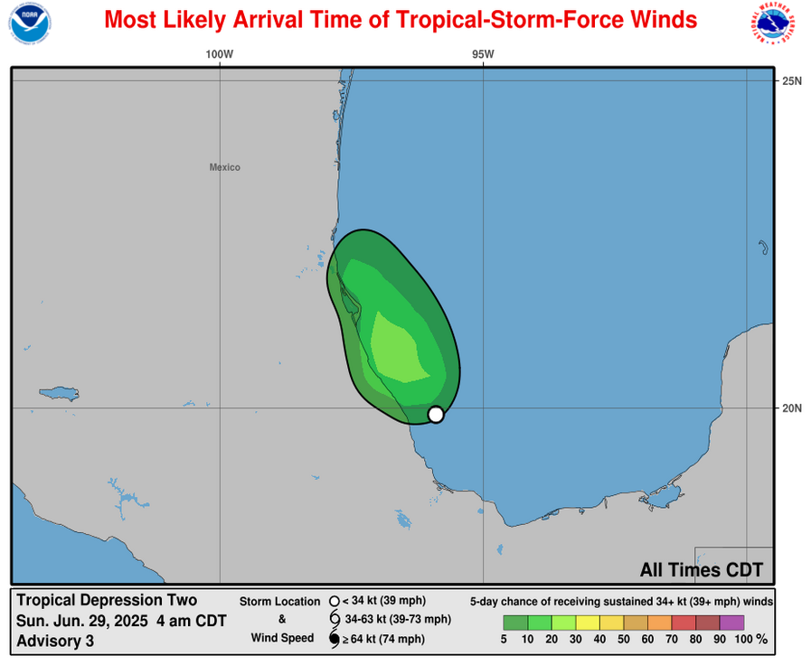
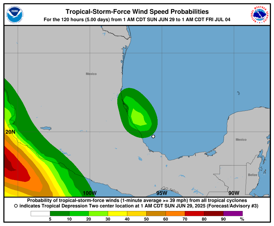
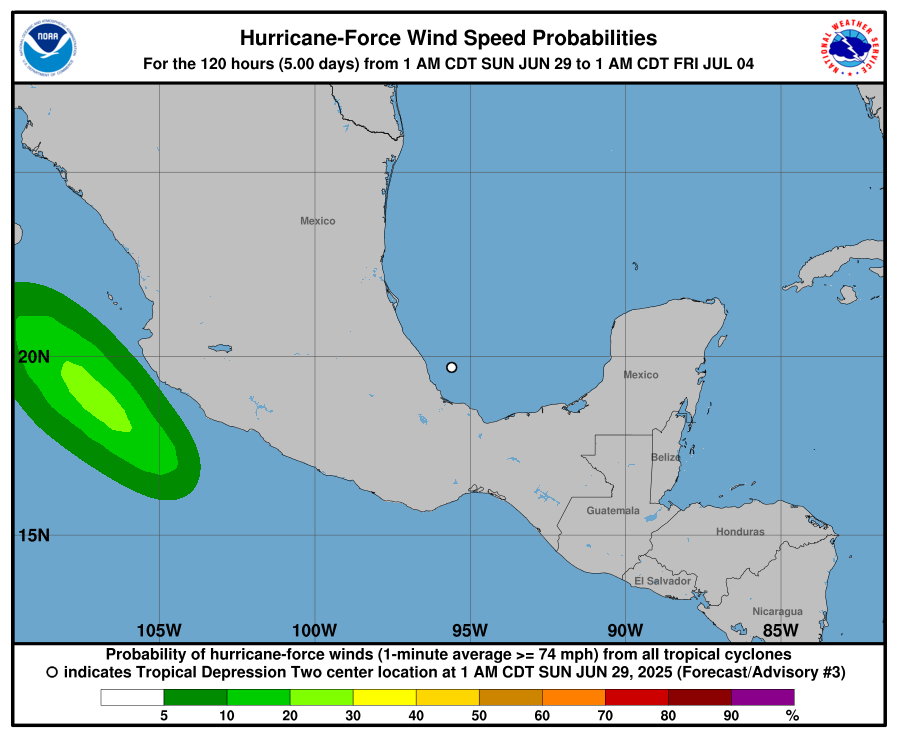
Tropical Depression TWO (2025)
06/28 8:00 PM EDT - Tropical Depression Moving West-northwestward Across The Bay
Of Campeche
19.5N 94.7W
Windspeed: 30 MPH - Pressure: 1011mb
Movement: Wnw at 7 MPH
| Public Storm Advisory | TD#2 B C | Dvorak T-Numbers | TAFB ssd UW-CIMSS |
| Governmental Storm Discussion | TD#2 B C | ||
| Forecast Advisory | TD#2 B | ||
The letters B C D and so on stand for alternate information sites, in case one is inoperative during
a internet swamping for storm info you can try another. These advisories come from the National Hurricane center: Usually they
are updated at 5AM, 11AM, 5PM and 11PM eastern.
When land areas are under a hurricane watch, it is updated every 3 hours.
See 1 animated recording related to TWO --
Tropical Tidbits Info Page for TWO
- Weather Underground Wundermap
- NHC Interactive Map PlotWhen land areas are under a hurricane watch, it is updated every 3 hours.
Buoy Reports Near TD#2 - CIMSS Data for TD#2 - RAMMB Info and Satellites for TD#2
Potential Storm Surge Flooding Map (Inundation) - NHC Track Map (See this animated)
 fa
fa
CIMSS Animated Satellite:

Weather Underground Animated Radar:


Coordinate History
| Adv# | Date | Lat | Long | Wind | Pres | Movement | Type | Name | Received | Forecaster |
| 1 | 06/28 5:00 PM | 19.3N | 94.2W | 30MPH | 1011mb | Wnw at 7 MPH | TD | TD#2 | 06/28 5:03 PM | Papin |
| 1A | 06/28 8:00 PM | 19.5N | 94.7W | 30MPH | 1011mb | Wnw at 7 MPH | TD | TD#2 | 06/28 7:51 PM | Beven |