
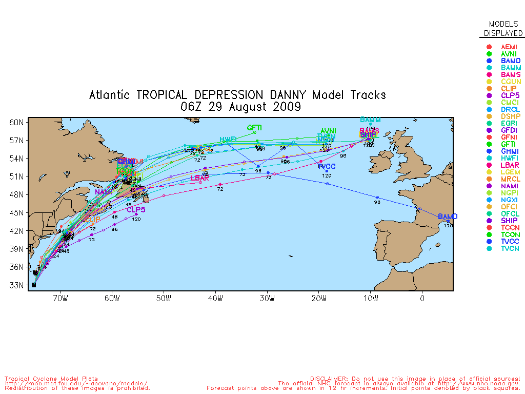
Tropical Depression DANNY (2009)
08/29 5:00 AM EDT - Danny Rapidly Becoming Absorbed By An Extratropical Low
34.3N 74.6W
Windspeed: 35 MPH - Pressure: 1007mb
Movement: North-northeast at 30 MPH
| Public Storm Advisory | DANNY B C | Dvorak T-Numbers | TAFB ssd UW-CIMSS |
| Governmental Storm Discussion | DANNY B C | ||
| Forecast Advisory | DANNY B | ||
The letters B C D and so on stand for alternate information sites, in case one is inoperative during
a internet swamping for storm info you can try another. These advisories come from the National Hurricane center: Usually they
are updated at 5AM, 11AM, 5PM and 11PM eastern.
When land areas are under a hurricane watch, it is updated every 3 hours.
Tropical Tidbits Info Page for DANNY
- Weather Underground Wundermap
- NHC Interactive Map PlotWhen land areas are under a hurricane watch, it is updated every 3 hours.
Buoy Reports Near DANNY - CIMSS Data for DANNY - RAMMB Info and Satellites for DANNY
Potential Storm Surge Flooding Map (Inundation) - NHC Track Map (See this animated)


 fa
fa
CIMSS Animated Satellite:

Weather Underground Animated Radar:


Coordinate History
| Adv# | Date | Lat | Long | Wind | Pres | Movement | Type | Name | Received | Forecaster |
| 1 | 08/26 11:00 AM | 24.9N | 70.3W | 45MPH | 1009mb | West-northwest at 18 MPH | TS | Danny | 08/26 10:46 AM | Beven |
| 2 | 08/26 5:00 PM | 25.2N | 71.2W | 45MPH | 1009mb | West-northwest at 12 MPH | TS | Danny | 08/26 4:37 PM | Beven |
| 3 | 08/26 11:00 PM | 26.0N | 71.6W | 50MPH | 1006mb | Northwest at 10 MPH | TS | Danny | 08/26 10:49 PM | Berg/pasch |
| 4 | 08/27 5:00 AM | 27.4N | 72.1W | 60MPH | 1006mb | Northwest at 10 MPH | TS | Danny | 08/27 4:46 AM | Blake |
| 5 | 08/27 11:00 AM | 27.5N | 73.1W | 60MPH | 1006mb | Northwest at 13 MPH | TS | Danny | 08/27 10:34 AM | Beven |
| 6 | 08/27 5:00 PM | 27.5N | 73.5W | 50MPH | 1008mb | West at 2 MPH | TS | Danny | 08/27 4:40 PM | Beven |
| 6A | 08/27 8:00 PM | 28.0N | 73.3W | 50MPH | 1008mb | North at 6 MPH | TS | Danny | 08/27 7:31 PM | Pasch |
| 7 | 08/27 11:00 PM | 28.4N | 73.5W | 45MPH | 1008mb | North-northwest at 8 MPH | TS | Danny | 08/27 10:34 PM | Pasch |
| 8 | 08/28 5:00 AM | 29.5N | 74.4W | 40MPH | 1008mb | North-northwest at 9 MPH | TS | Danny | 08/28 6:43 AM | Avila |
| 8A | 08/28 8:00 AM | 30.1N | 75.2W | 40MPH | 1008mb | North-northwest at 9 MPH | TS | Danny | 08/28 8:49 AM | Brennan |
| 9 | 08/28 11:00 AM | 30.1N | 75.5W | 40MPH | 1008mb | Northwest at 10 MPH | TS | Danny | 08/28 10:40 AM | Brennan |
| 10 | 08/28 5:00 PM | 30.4N | 75.4W | 40MPH | 1007mb | North at 6 MPH | TS | Danny | 08/28 4:34 PM | Brennan |
| 10A | 08/28 8:00 PM | 30.9N | 75.1W | 40MPH | 1006mb | North-northeast at 8 MPH | TS | Danny | 08/28 7:46 PM | Beven |
| 11 | 08/28 11:00 PM | 31.4N | 74.9W | 40MPH | 1006mb | North-northeast at 12 MPH | TS | Danny | 08/28 10:43 PM | Beven |
| 11A | 08/29 2:00 AM | 32.6N | 75.2W | 40MPH | 1006mb | North-northeast at 12 MPH | TS | Danny | 08/29 2:03 AM | Avila |
| 12 | 08/29 5:00 AM | 34.3N | 74.6W | 35MPH | 1007mb | North-northeast at 30 MPH | TD | DANNY | 08/29 4:49 AM | (Discussion) |