
First area of Interest in the Atlantic Invest 90L
Posted: 10:50 AM 10 June 2026 | 2 Comments | Add Comment | Newest: 11:51 AM 15-Jun EDT
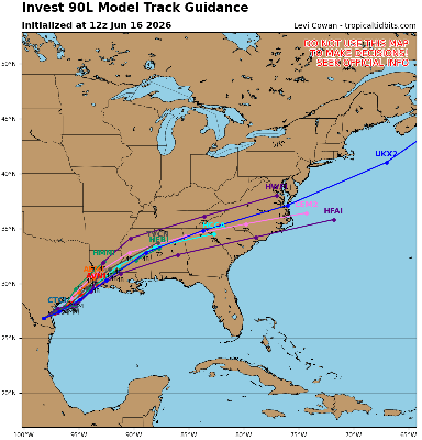
The Area of Interest has just been Invest-tagged, 90L. Specialized model runs will begin shortly and recon is being tentatively scheduled.
Ciel
1:00PM CDT 15 June, 2026 Update
Chances for development of this system are up to 50%, and Tropical Storm Watches and Warnings could be issued as early as tomorrow for portions of the NW Gulf.
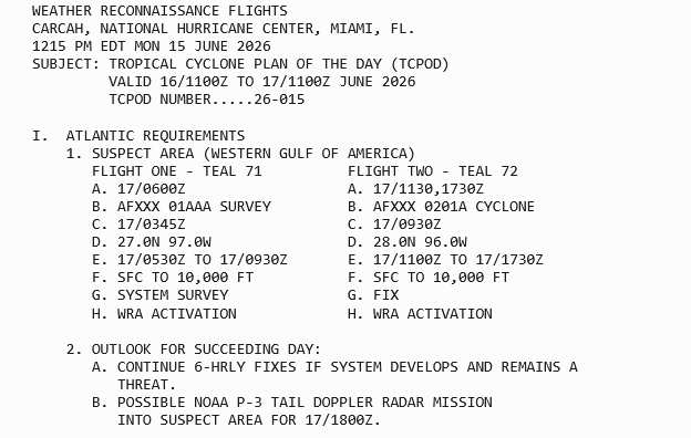
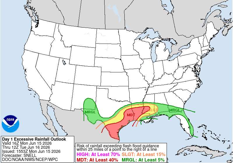
12:00PM CDT 15 June, 2026 Update
Widespread flash flooding, some of it catastrophic, continues. WPC has greatly expanded the MODERATE RISK outline
4:45PM CDT 14 June, 2026 Update
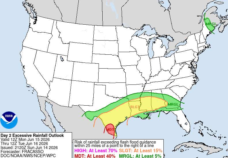
The risk of Flash Flooding across the south is going way up in response to the abundant influx of deep, tropical moisture courtesy of the area of low pressure we have been tracking and which is now inland over northeastern Mexico feeding into and interacting with an approaching wind shift front that is forecast to pull up mostly stationary for several days. Ground will likely become saturated if it isn't already across portions of south Texas, southeast Texas and Louisiana, and a multi-day, life-threatening flood event may be setting up.
Ciel
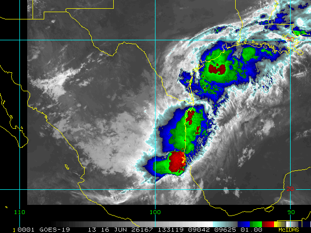
10:00AM CDT 13 June, 2026 Update
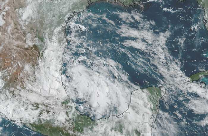
Above: This morning's visible image of the Gulf Low overlaid with GFS-analyzed 10-meter winds cr. TC-ATLAS
The Low in the western Gulf continues to gradually become better organized and is now likely centered just east of Tampico, MX, heading generally NW to NNW. Fluctuations in its path are likely over the next 3-7 days, but it is mostly modeled to head inland and then either track just inland from the coast of Texas, bumping into an approaching front, or reemerge off the coast roughly east of Brownsville, TX early next week.
The greatest risk with the area of low pressure in the western Gulf is going to be from the potential for several days of tropical rainfall and flooding, regardless of whether or not it becomes a Tropical Depression. The same will be true should it become a Tropical Depression, but never get a name. This is a system that is cranking up loads and loads of moisture into eastern Mexico, Texas and Louisiana, is likely to get stuck underneath a stalling front, and then get wrung out over the course of 3-7 days over many of the same areas. Flooding is always a serious risk with 'weak' systems that slow down or stall, but unfortunately, all-too-often these systems do not get the attention they deserve because they lack a name or title.
-Ciel
7:45AM CDT 12 June, 2026 Update
An area of low pressure has indeed formed in the Bay of Campeche. This is a very favorable region for Tropical Cyclogenesis and despite less-than-ideal conditions for development, development is possible and in fact the odds appear to be going up. An Invest tag is likely coming, specialized model runs would be added, and perhaps recon will also be tasked, depending.
-Ciel
Original Update
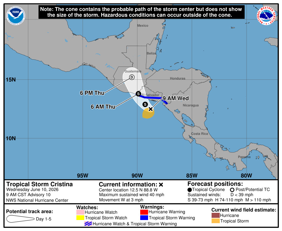
The 8am update for the tropical weather outlook now has the first area of interest for the 2026 Atlantic Hurricane season. This area would be the remnants of Cristina in the East Pacific after it crosses Guatemala and Mexico, which has a lot of high mountains. It's overall unlikely to develop, but worth watching in those areas and later on in the Gulf side of Mexico, and rainfall could reach its way into Texas after this. It'll be monitored for mid to late next week, but at this time development chances appear to be very low.

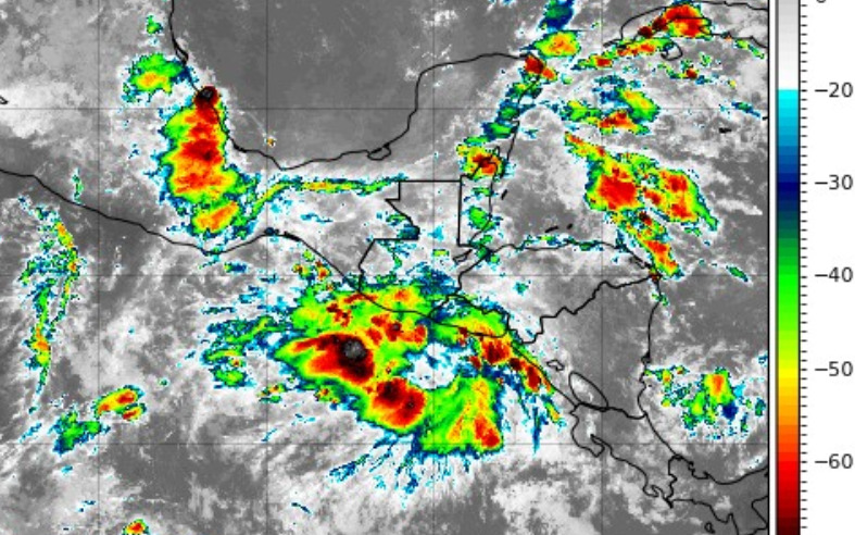
The remnants of east pacific Cristina with some tropical storm warnings up along Guatemala and El Salvador now:
Forecast Lounge discussion for this system in https://flhurricane.com/cyclone/showflat...gonew=1#UNREAD
Invest 90L Event Related Links
Tropical Tidbits Page on system
Flhurricane Satellite Floater Animation of 90L
GOES Floater
Tomer Berg Info page for 90L
CyclonicWx Page for 90L
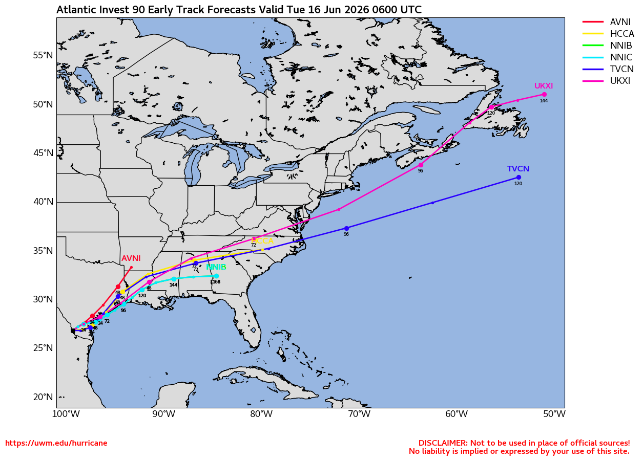
Clark Evans Track Model Plot of 90L
(Animated!) Model Plots in Google Earth - In Google Maps
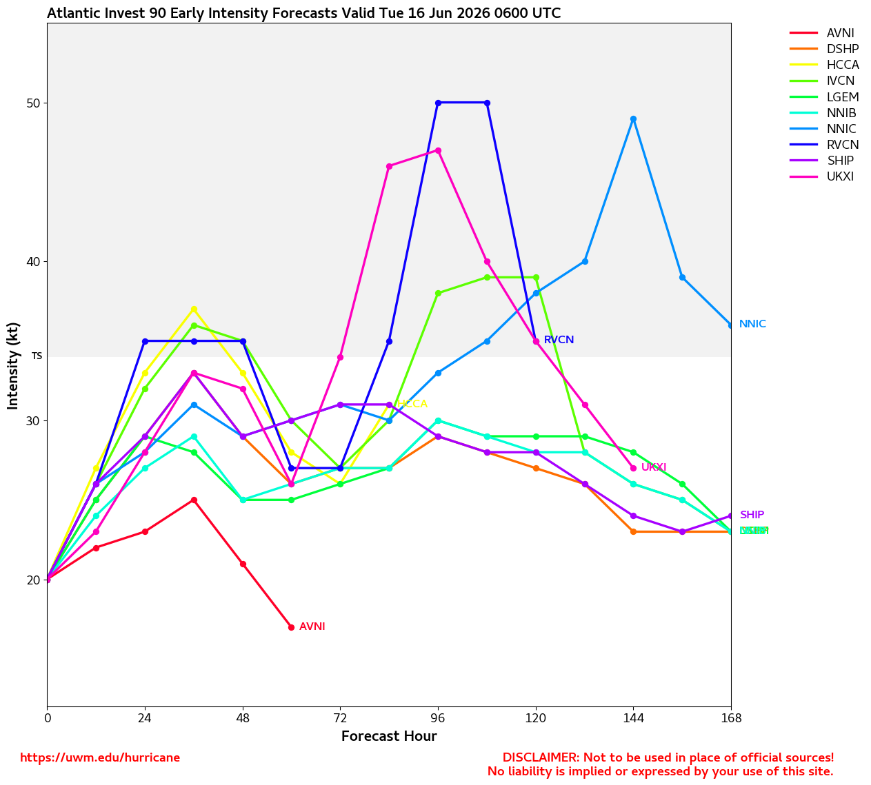
Clark Evans Intensity Model Plot of 90L (Animated!)
Clark Evans Top 10 Analog Storms for 90L
http://www.ral.ucar.edu/guidance/realtime/current/ More model runs on from RAL/Jonathan Vigh's page
NRL Info on 90L -- RAMMB Info
COD Atlantic Satellite View
Texas Gulf Coast Links [http://moe.met.fsu.edu/~mnissenbaum/radar.html Mark Nissenbaum's radar page}
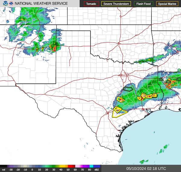
Texas Composite Radar Loop (Latest Static) East to West:
Houston/Galveston, TX Radar Radar Loop (Latest Static)
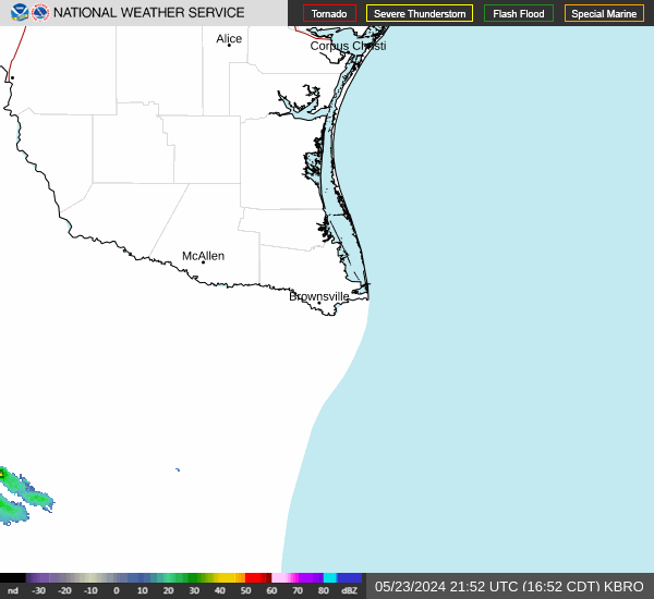
Corpus Christi, TX Radar Radar Loop (Latest Static)
Brownsville, TX Radar Radar Loop (Latest Static)
Gulf of Mexico Satellite Imagery
Area Forecast Discussions: Houston/Galveston, TX - Corpus Christi, TX - Browsnville/South Padre Island, TX


