
 Local Weather Outlooks/Discussions (18)


Dolly and Edouard
Posted: 04:08 PM 27 August 2026 | 14 Comments | Add Comment | Newest: 02:51 AM 03-Sep EDT
NHC has confirmed that Edouard has further intensified and is now making landfall as a 60 MPH 996 MB Tropical Storm. Additional strengthening is slightly possible, but not implicitly forecast. Once inland, given the small size of this cyclone, rapid weakening could commence within 12 hours.
Ciel
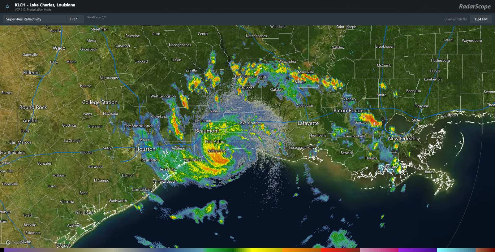
1:30PM CDT 1 September, 2026 Update
Edouard is making landfall in southwestern Louisiana as a mid-range 50+ MPH tropical storm. The cyclone does have radar returns that suggest winds could be at or near 60 heading into landfall, but awaiting NHC determination.
Compared to the other names we have had in the Atlantic basin this year, Edouard may be the best-looking. Certainly an A for effort.
CIel
7:30AM CDT 1 September, 2026 Update
A few changes.
For one, Edouard may be pushing inland a little bit north and a little earlier than was the forecast just last night. It may yet still slow down and/or bend a little west again however, so this is not certain. Nonetheless, locations closer to the TX/LA border may want to prep in case the core tracks much closer to this region than expected.
An earlier landfall could help cap its intensity. Most mets and weather geeks looking at this system take it right up to upper-end Tropical Storm, but Edouard becoming a hurricane is still very possible, and this is explicitly mentioned by NHC. In fact, Edouard has been building an eyewall since late last night. Hurricane Watches and Storm Surge Warnings are already in effect. Three to five feet of storm surge is forecast for locations between High Island, TX and the Vermilion/Iberia Parish line.
The cyclone is far wetter than it was yesterday, so having heavy rains cross a larger area is now more likely.
Ciel
2:00AM CDT 1 September, 2026 Update
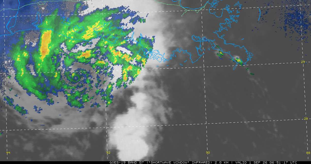
Banding and the incipient inner core continue improving overnight, and Edouard may be kicking off one of possibly two rounds of meaningful intensification prior to pushing inland.
Those along the upper Texas coast and southwestern Louisiana may want to pay closer attention and out of caution take some initial hurricane preps.
Ciel
10:30PM CDT 31 August, 2026 Update
A Hurricane Watch and Storm Surge Warning are up for portions of the NW Gulf coast.
SUMMARY OF WATCHES AND WARNINGS IN EFFECT:
A Storm Surge Warning is in effect for High Island to the Vermilion/Cameron Parish Line
A Hurricane Watch is in effect for High Island to the Cameron Louisiana
A Tropical Storm Warning is in effect for Port Bolivar to the Vermilion/Iberia Parish Line
Ciel
7:00PM CDT 31 August 2026, Update
FIVE has become Tropical Storm Edouard and conditions for further intensification heading towards landfall along the upper Texas coast and/or far southwestern Louisiana are in place.
Ciel
2:00PM ET 31 August, 2026 Update
FIVE has become a tropical cyclone and is now Tropical Depression FIVE (No longer 'Potential'). It was very close and many would argue that NHC could have just classified it a few hours ago, but there is no question now.
Winds to near tropical storm force have recently occurred in the more vigorous band on the south side of the center and FIVE is forecast to become Edouard later today or sometime tonight. As the center was pulled a little further east of its location yesterday in response to a blowup of convection on that side of the system, FIVE will probably now have even more time over the very warm gulf waters. Some model runs ramp it up quite a bit more than the official forecast and this is partly why.
Ciel
1:00PM ET 31 August, 2026 Update
Recon has found sufficient organization within Invest 97L for NHC to begin Advisories on PTC FIVE (Potential Tropical Cyclone). FIVE is expected to become Tropical Storm Edouard tonight and head towards the upper Texas coast.
Elsewhere, Invest Dolly has been decimated by shear while skirting the Greater Antilles. Regeneration odds now only NHC 10%.
Ciel
1:00PM ET 30 August, 2026 Update
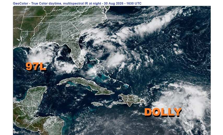
Some very real concerns during strong El Niño years is for waves to be held in check until they are coming much closer to land and also for fronts and/or trofs to linger over the Gulf and/or Gulf stream. We are now seeing these risks in action today as both Invest 97L and Invest Dolly are knocking on our door.
Interests in Louisiana and eastern Texas, perhaps especially the upper Texas coast, may want to begin paying close attention to Invest 97L. Conditions are becoming favorable for further development and a Tropical Depression or Storm could form within 48 hours.
Interests from the Bahamas to Cuba to South Florida may want to begin paying close attention to what we have been calling "Invest Dollly" (Former Tropical Storm Dolly). Conditions in the Gulf and Southwest Atlantic are becoming favorable for further development and a Tropical Depression or Storm could reform within 96 hours.
Ciel
9:30PM ET 29 August, 2026 Update
An area of low pressure that has formed south of Pensacola is presently in hostile conditions for development, but this may change as the system tracks west to west-northwest over the next few days, or at least until it runs into too much land. Considering how close to land Invest 97L already is, despite just 20% NHC odds, "Lemon Odds," we have also now opened up a Lounge for this Area of Interest: Invest FIVE Edouard Lounge
Ciel
11AM ET 28 August, 2026 Update
Dolly has opened back up into an open wave, even sooner than forecast, and the final NHC Advisory on short-lived Dolly has been written. This wave will continue to be monitored for potential regeneration later in the period, much like we monitor any Invest.
Ciel
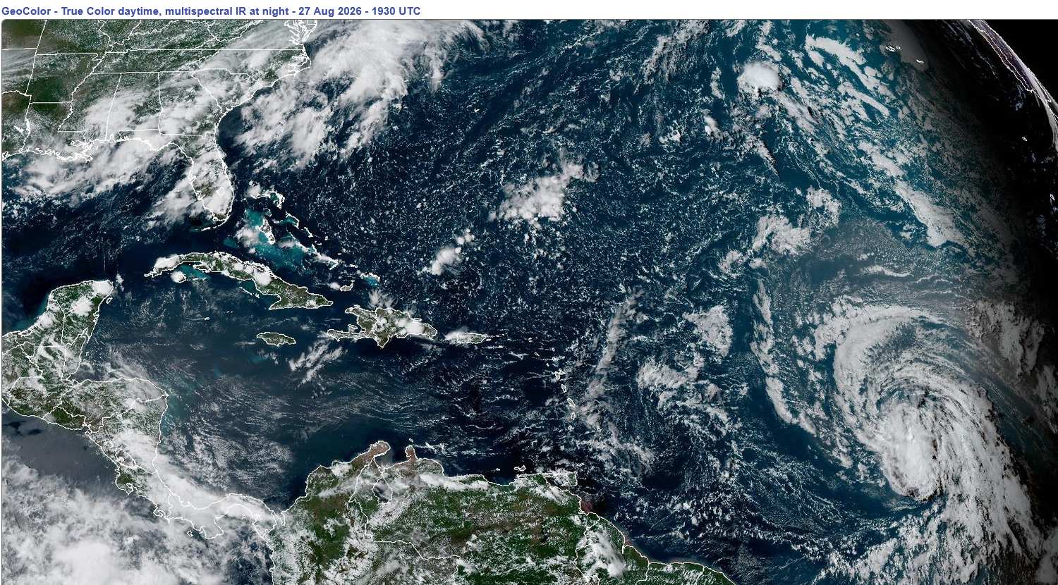
Lower Right: Tropical Storm Dolly in the Main Development Region of the Tropical Atlantic on August 27, 2026 1930z
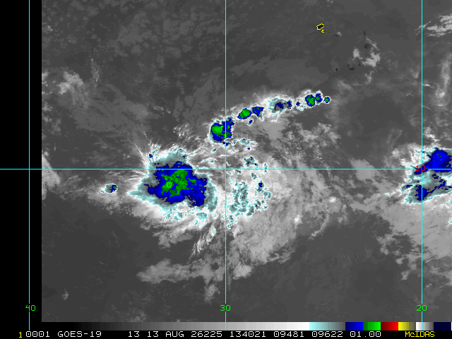
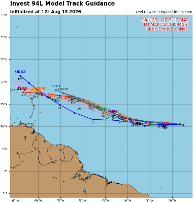
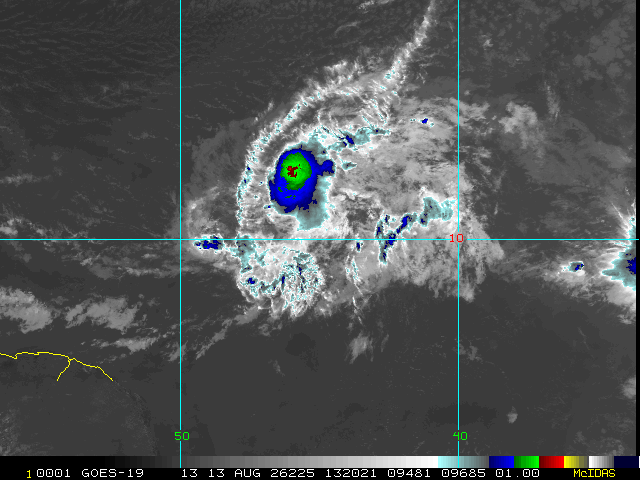
Earlier today, Invest 96L became our first Cape Verde tropical cyclone of the year. Cape Verde tropical cyclone, for a strong El Niño, at any rate. It barely made it, but now Tropical Storm Dolly has formed.
Conditions for Dolly's future aren't looking especially promising, and nearly all models and indeed the official NHC forecast has Dolly opening back up to a stout wave within about 2 days. Some strong blustery wind and heavy showers would still more likely than not affect much of the Antilles, regardless, starting the coming weekend and into at least early next week. After that, a few models and ensembles are warm to regeneration closer to the United States, but this portion of the extended forecast is still very speculative (See Lounge for more on this).
Edouard Event Related Links
Tropical Tidbits Page on system
Flhurricane Satellite Floater Animation of Edouard
GOES Floater
Tomer Berg Info page for Edouard
CyclonicWx Page for Edouard
Clark Evans Track Model Plot of Edouard
(Animated!) Model Plots in Google Earth - In Google Maps
Clark Evans Intensity Model Plot of Edouard (Animated!)
Clark Evans Track Plot of Edouard
Clark Evans Top 10 Analog Storms for Edouard
http://www.ral.ucar.edu/guidance/realtime/current/ More model runs on from RAL/Jonathan Vigh's page
NRL Info on Edouard -- RAMMB Info
COD Atlantic Satellite View
Dolly Event Related Links
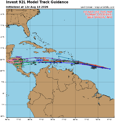
Tropical Tidbits Page on system
Flhurricane Satellite Floater Animation of Dolly
GOES Floater
Tomer Berg Info page for Dolly
CyclonicWx Page for Dolly
Clark Evans Track Model Plot of Dolly
(Animated!) Model Plots in Google Earth - In Google Maps
Clark Evans Intensity Model Plot of Dolly (Animated!)
Clark Evans Track Plot of Dolly
Clark Evans Top 10 Analog Storms for Dolly
http://www.ral.ucar.edu/guidance/realtime/current/ More model runs on from RAL/Jonathan Vigh's page
NRL Info on Dolly -- RAMMB Info
COD Atlantic Satellite View
StormCarib Reports from the Caribbean Islands
Caribbean Weather Observations
Full Caribbean Radar Composite
Caribbean Broadcast Corporation (TV/Radio from Antilles)
Central Pacific Hurricane Center
Radar:
South Shore Big Island, HI Radar Radar Loop
(Latest Static)
Kohala, HI (Big Island) Radar Radar Loop (Latest Static)
Molokai, HI (Maui/Oahu) Radar Radar Loop (Latest Static)
Kauai, HI Radar Radar Loop (Latest Static)
Hawaiian Media:
TV:
Hawaii News Now KGMB 9 (CBS)/KHNL 13 (NBC)
Newspaper:
Hawaii 24/7 (Big Island Newspaper)
Other:
 Re: Long Range 2026Western tropical Atlantic/Caribbean (10-20°N, 85-50°W) vertical wind shear continues to shatter previous records, with average shear in the western Atlantic for the past 30 days >3 kt stronger than any other year...
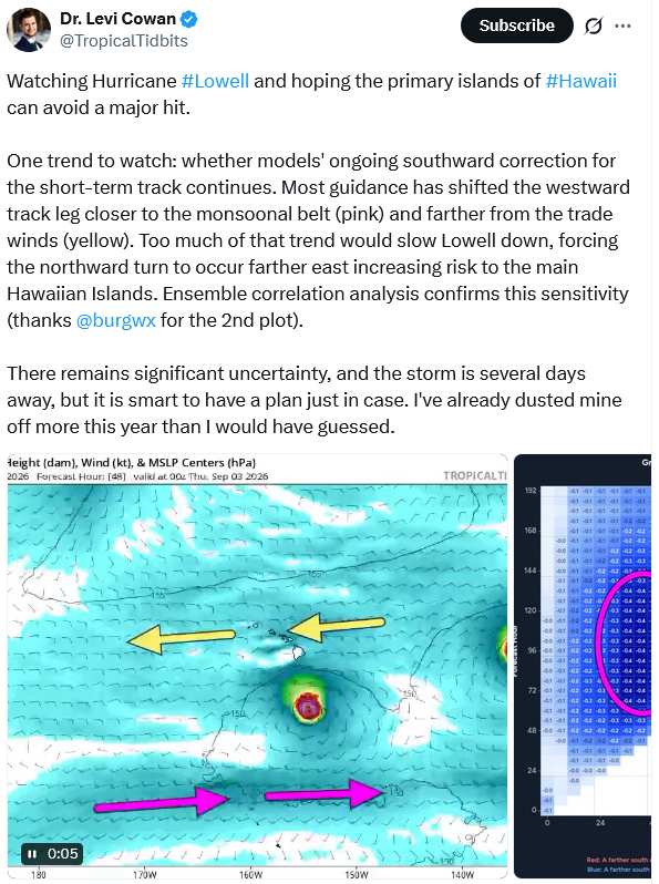 Re: Lowell Forecast Lounge: Hawaii ThreatTropical Tidbits on X
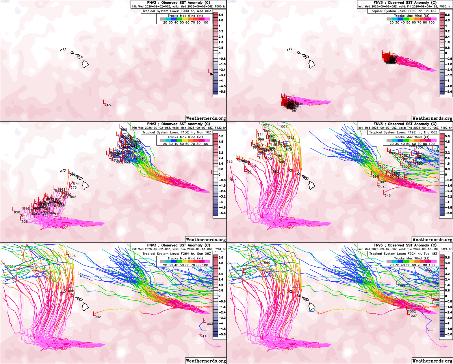 Re: Lowell and Karina - Potential Weather For HawaiiThe most recent FNV3 has backed off potential for significant interaction between Karina and Lowell, taking Karina on a more northerly course. Lowell, however, could pose a direct threat to the islands, based on this ...
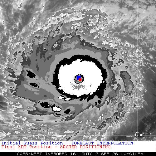 Re: Lowell: Another Hawa’i Threat?Hello Cat 5
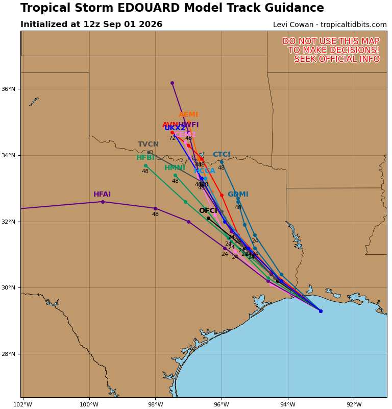 Re: Edouard LoungeOpen this post for details.
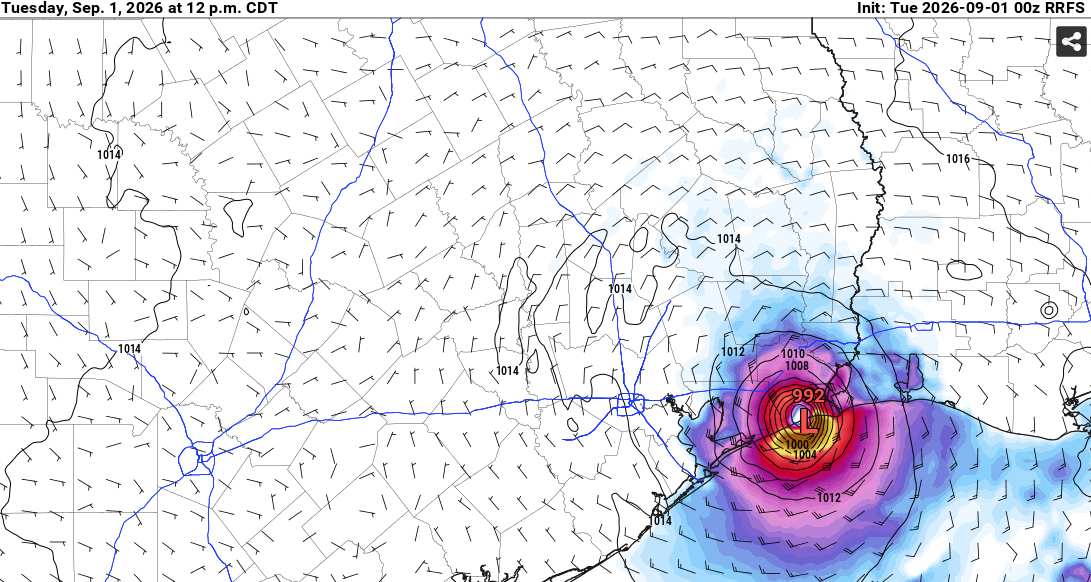 Re: Edouard LoungeModeled Pressure/Wind for time of landfall. Only including models that have done a reasonable job at initialization. Above: 992MB/69 KTSAbove: 988MB/63 KTS Above: 991MB/63 KNOTSHAFS-A. The most recent run did have an ...
General Hurricane Links
A curated collection of official sources, observations, models, and tropical weather commentary. For urgent weather information, always check official government sources first.
Official / Primary
- National Hurricane Center (NHC)
- Inside the Eye — Official NHC Blog
- Storm Forum (community discussion)
Satellite / Observations
- RAMMB Interactive Satellite Imagery
- Zoom Earth (storm tracks and satellite animation)
- CIMSS MIMIC-TC (microwave imagery)
- NRL Monterey (tracking maps and satellite)
- CIMSS Tropical Weather
- NDBC Buoy Data
- Caribbean Weather Observations
- Interactive Wundermap
- Animated Earth Wind View (Tropical Atlantic)
Data / Tracking / SST
- TC ATLAS (Tropical Cyclone Analysis Tool for Live and Archived Structure)
- Best Track FTP (official invest data)
- Full Active Invest / Storm List
- USNO Current Storm Information (includes Google Earth KMZ)
- Global SST Animation · SST Forecast
- NOAA Weather Radio
Forecast Models
Commentary / Tools
- Tropical Tidbits (Levi Cowan)
- Hurricanetrack.com (Mark Sudduth)
- Hurricane City (Jim Williams)
- TropicalAtlantic
- Storm2k
- Mike’s WX Page
- Greg Nordstrom
- Gulf Coast Weather
- American Weather
- Crown Weather (Robert Lightbown)
- The Eyewall
- Hurricane Hacker