F
Current Radar or Satellite Image

Flhurricane.com - Central Florida Hurricane Center - Tracking Storms since 1995Hurricanes Without the Hype! Since 1995


Chill falls over the Atlantic as the official season heads towards close
Days since last H. Landfall - US: Any 211 (Idalia) , Major: 211 (Idalia) Florida - Any: 211 (Idalia) Major: 211 (Idalia)
None
COMMUNICATION
STORM DATA
CONTENT
FOLLOW US
ADS
Login to remove ads


Archives 2010s >> 2012 Forecast Lounge

Jump to first unread post. Pages: 1 | 2 | (show all)
GuppieGrouper
Weather Master


Reged: Fri
Posts: 596
Loc: Polk County, Florida
Re: TS Leslie Forecast Lounge [Re: cieldumort]
      #93925 - Tue Sep 04 2012 08:56 PM

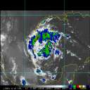
Leslie is looking well put together tonight. Has the storm finally stacked vertically? The outflow is not that obvious on the colored infrared satellite. With the forward speed at just 3mph it is showing a potential to increase in intensity. The shear does not seem as great tonight as in the recent past either.

--------------------
God commands. Laymen guess. Scientists record.


Post Extras: Print Post   Remind Me!   Notify Moderator  
MichaelA
Weather Analyst


Reged: Thu
Posts: 944
Loc: Pinellas Park, FL
Re: TS Leslie Forecast Lounge [Re: GuppieGrouper]
      #93926 - Tue Sep 04 2012 09:05 PM

The LLC is still on the southern side of the convection, so it is still tilted vertically. The shear is relaxing in the region and with the slow forward movement, Leslie could be getting its act together in the next few days.

--------------------
Michael

PWS


Post Extras: Print Post   Remind Me!   Notify Moderator  
GuppieGrouper
Weather Master


Reged: Fri
Posts: 596
Loc: Polk County, Florida
Re: TS Leslie Forecast Lounge [Re: MichaelA]
      #93934 - Wed Sep 05 2012 02:04 PM

It would seem that Leslie is now a 75mph hurricane according to the NHC. So will she get stronger?

--------------------
God commands. Laymen guess. Scientists record.


Post Extras: Print Post   Remind Me!   Notify Moderator  
MichaelA
Weather Analyst


Reged: Thu
Posts: 944
Loc: Pinellas Park, FL
Re: TS Leslie Forecast Lounge [Re: GuppieGrouper]
      #93935 - Wed Sep 05 2012 02:25 PM

The NHC forecast is for Leslie to strengthen to very near Cat 3 strength within 3 days as it moves generally northward affecting Bermuda. Looking at the satellite loops this afternoon, Leslie does appear to have strengthened and become vertical with convection now wrapped around the LLC. In the current low shear environment, yes, Leslie will become better organized and strengthen.

--------------------
Michael

PWS


Post Extras: Print Post   Remind Me!   Notify Moderator  
Pages: 1 | 2 | (show all)


Extra information
0 registered and 2 anonymous users are browsing this forum.

Moderator:  MikeC, Ed Dunham, danielw 

Print Topic

Forum Permissions
      You cannot start new topics
      You cannot reply to topics
      HTML is disabled
      UBBCode is enabled

Rating:
Topic views: 17836

Rate this topic

Jump to

Note: This is NOT an official page. It is run by weather hobbyists and should not be used as a replacement for official sources. 
CFHC's main servers are currently located at
Hostdime.com in Orlando, FL.
Image Server Network thanks to Mike Potts and Amazon Web Services. If you have static file hosting space that allows dns aliasing contact us to help out! Some Maps Provided by:
Great thanks to all who donated and everyone who uses the site as well. Site designed for 800x600+ resolution
When in doubt, take the word of the National Hurricane Center