Current Radar or Satellite Image

Flhurricane.com - Central Florida Hurricane Center - Tracking Storms since 199531 Years of Hurricanes Without the Hype - Since 1995


Invests 92L and 93L in the Atlantic. Invest 93C in the Central Pacific may pose a very serious threat to Hawaii later this week.
Days since last Hurricane Landfall — US Any: 671 (Milton), US Major: 671 (Milton), FL Any: 671 (Milton), FL Major: 671 (Milton)
FlHurricane Atlantic Tropical Cyclone Tracking 🌀 Since 1995
HypeScale:
1.85
0510
Communication
Storm Data
Content
Follow & Connect


General Discussion >> The Tropics Today

Jump to first unread post. Pages: 1
MichaelA
Weather Analyst


Reged:
Posts: 956
Loc: Pinellas Park, FL
Couple of areas
      #85788 - Mon Jul 27 2009 05:35 PM

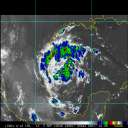
1st: Looks a bit interesting in the Bay of Campeche today with little vertical shear. There appears to be some circulation, but whether it is at the surface, I can't tell from the vis. sat. loop.

2nd: The wave that has moved off the coast of Africa still has fairly good convection associated with it. Whether that holds up for the next couple of days will be a determining factor for possible development.

3rd: The wave in the mid-Atlantic has a good signature, but there is some shear over that area.

--------------------
Michael

PWS


Post Extras: Print Post   Remind Me!   Notify Moderator  
Pages: 1


Extra information
0 registered and 0 anonymous users are browsing this forum.

Moderator:  CFHC, MikeC, Ed Dunham, Colleen A., danielw, Clark, RedingtonBeachGuy, SkeetoBite, Bloodstar, tpratch, typhoon_tip, cieldumort 

Print Topic

Forum Permissions
      You cannot start new topics
      You cannot reply to topics
      HTML is disabled
      UBBCode is enabled

Rating:
Topic views: 3904

Rate this topic

Jump to