Jeffmidtown
Weather Guru

Reged:
Posts: 132
Loc: Atlanta, Ga
|
|
Just got off the phone with a friend of mine whom I take back and forth from the airport here in Atlanta and he lives in Mobile, and he's debating on whether he's gonna ride it out or head up I-65(I believe).
I tell you what, with the latest recon reports coming in I'm really getting concerned for those in the Mobile/Pensacola area and anyone who is in the cone right now.
I think it would be a good idea if before we all went to bed this evening to say a prayer for those in the path of for their safety.
Also, saw on that hotel rooms as far north as Montgomery are full up and it may not be much better in Georgia from Macon south.
--------------------
You know it's a bad day.....when you wake up and see Jim Cantore and Geraldo Rivera broadcasting from your backyard....literally!
|
hurricane_run
Storm Tracker

Reged:
Posts: 366
Loc: USA
|
|
to the west of there looks to be a outflow boundary
|
hurricane_run
Storm Tracker

Reged:
Posts: 366
Loc: USA
|
|
There is a new thread up
|
damejune2
Storm Tracker

Reged:
Posts: 237
Loc: Torrington, CT
|
|
Quote:
Quote:
Does anyone have any links to sites where they have the models; UKMET, , Canadian Models, etc...??? If you do, can you post them? Thanks!
http://moe.met.fsu.edu/tcgengifs/
Thanks!!
--------------------
Gloria 1985 (Eye passed over my house in...get this...northwestern CT!)
|
Terra
Storm Tracker
Reged:
Posts: 286
Loc: Kingwood, Texas
|
|
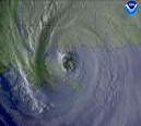
That last frame of the IR (or Vis, if you prefer) is darn impressive....
http://www.ssd.noaa.gov/PS/TROP/DATA/RT/FLOAT2/IR4/20.jpg
--------------------
Terra Dassau Cahill
|
Nate
Weather Watcher
Reged:
Posts: 40
|
|
Anyone have a nice Water VaporLoop for that region?
Thanks
|
damejune2
Storm Tracker

Reged:
Posts: 237
Loc: Torrington, CT
|
|
Quote:
to the west of there looks to be a outflow boundary
Boundry? Can you explain? Sorry, but i know nothing about this stuff.
--------------------
Gloria 1985 (Eye passed over my house in...get this...northwestern CT!)
|
WeatherNLU
Meteorologist

Reged:
Posts: 212
Loc: New Orleans, LA
|
|
I rarely call out the , and I am not really, it's just that they seem to be ignoring all of the models except for the A98E. All of the other models have shifted to between Pascagoula and Mobile. Will the come around, or take their chances with their forecast?
--------------------
I survived Hurricane Katrina, but nothing I owned did!
|
hurricane_run
Storm Tracker

Reged:
Posts: 366
Loc: USA
|
|
there is a new thread up but if you take a look at the pic you will see to the west some coulds that are rope like. This is an outflow boundary. this could be a inhibiting factor. air going away from the storm is trapped so it chokes itself
|
pcola
Storm Tracker

Reged:
Posts: 344
Loc: pensacola/gulf breeze
|
|
NLU, The models have changed back and forth every few hours, the has been consistent, and correct...I will go with them
--------------------
Erin 95 , Opal 95, Ivan 04, Dennis 05, and that's enough!!!!
|
jr928
Weather Guru
Reged:
Posts: 101
|
|
I would abandon the if I lived in pascagoula and bail now. It's not going back east and the models are showing it , let alone water vapor shows nothing in its way to make too large a push if it hits mid 3 levels soon
|
jr928
Weather Guru
Reged:
Posts: 101
|
|
there is actually a band pushing toward mid mississipi right now. It is plowing straight northwest with no resistance from any trough or low. trouble for biloxi- will come around
|
EMS
Weather Hobbyist
Reged:
Posts: 55
Loc: St. Petersburg, Florida
|
|
Here's a rough unscientific chart I put together showing the movement of during each 6 hour interval since July 5th. As you can see, historical movement over the last 2.5 days has been pretty much NW (a heading of 315 degrees). You will notice however that in 2 of last 3 intervals (i.e. today), movement was actually at a heading slightly greater than 315 degrees, perhaps signaling that gradual N/NW turn folks have been forecasting.
This might be hard to read, so I've attached it in a .txt format as well. Hope this is helpful.
TIME/DATE LAT LONG LAT CHG LNG CHG HEADING
11p 7/4 12.5 63.1 -- -- --
5a 7/5 12.6 64.4 0.1 1.3 274.4
11a 7/5 13.3 66.6 0.7 2.2 287.7
5p 7/5 14.2 68.3 0.9 1.7 297.9
11p 7/5 14.6 69.2 0.4 0.9 294.0
5a 7/5 15.1 70.3 0.5 1.1 294.4
11a 7/6 15.4 71.5 0.3 1.2 284.0
5p 7/6 16 72.5 0.6 1 301.0
11p 7/6 16.5 73.4 0.5 0.9 299.1
5a 7/7 17 74.6 0.5 1.2 292.6
11a 7/7 18 75.6 1 1 315.0
5p 7/7 19 76.6 1 1 315.0
11p 7/7 19.9 77.6 0.9 1 312.0
5a 7/8 20.7 79.1 0.8 1.5 298.1
11a 7/8 21.4 79.9 0.7 0.8 311.2
5p 7/8 22.6 81.1 1.2 1.2 315.0
11p 7/8 23 82.1 0.4 1 291.8
5a 7/9 23.9 82.9 0.9 0.8 318.4
11a 7/9 24.7 83.8 0.8 0.9 311.6
5p 7/9 25.7 84.6 1 0.8 321.3
|
lunkerhunter
Storm Tracker

Reged:
Posts: 248
Loc: Saint Augustine, FL
|
|
why? MS is in the cone just like Fort Myers was with Charlie. Don't follow the line, watch the cone. learn to read a chart correctly.
|


 Threaded


