nl
Storm Tracker

Reged:
Posts: 207
Loc: nsb,fl
|
|
as long as any hurricane doesnt hit on the vs miami game ill be fine i guess. go noles! 
|
MoparMitch
Weather Watcher
Reged:
Posts: 28
Loc: Atlanta, GA
|
|
Clark,
I am sure flying recon is not cheap, but do have some sort of idea how much money it costs to fly a mission? I also understand that a "single" mission is not just a fly-by rather a 12+ hour ordeal.
No specific numbers on the recon flights, but it can be a multiple day ordeal -- particularly for storms out beyond 70W, as they often base those flights (either going out there or coming back) in the Virgin Islands. There is a finite budget for the flights each season, and there are many other uses of the planes than for tropical activity -- research projects, field programs, the whole shebang. --Clark
Your thoughts...
Edited by Clark (Thu Aug 11 2005 08:22 PM)
|
Clark
Meteorologist
Reged:
Posts: 1710
Loc:
|
|
Irene is more or less holding her own this afternoon. The colder cloud tops are really obscuring things in trying to find where the low-level center is located. Add in that the circulation is not very large at all and it becomes even more difficult. Here's my best guess as to the structure and setup of the storm right now...
On visible imagery, cloud motions north of the main cloud pass are rapidly going from east-southeast to west-northwest, but not curving around into the storm's center. This gives further credence to the idea of a small circulation and is also likely one of the two regions where the strongest winds are associated with the storm. Cloud motions to the south of the storm at low levels are sprialing inwards, but not at a strong clip. With low clouds curving around to a N-S orientation near the current convective blowup at about 25.5N/62.5W, this suggests the center is further west of that mass. The speed of these low clouds, particularly further to the west, suggests that the circulation is not well define on the south side...but it is and has been closed per visible satellite imagery over the past week, just too small to accurately be captured as a closed low by the QuikSCAT passes at times.
The colder cloud tops on the western edge of the storm (looking at about 25.5-28N, 63.5-65W) are largely cirrus clouds; there is little convection associated with them at this point. An outflow boundary is racing to the NW out of this region, clearly evident on visible satellite imagery and an indicator of the collapse of the convection in this area several hours ago. I would expect cloud tops in this area to warm over the coming hours before convection redevelops there later tonight. In the meantime, some colder cloud tops are building to the east and southeast of the center of circulation; these will likely persist for some time as well.
Given the satellite appearance, the mid-level center would appear to be in the middle or on the eastern edge of the "colder" cloud tops to the NW of the deep convection, somewhere near 26-26.5N/63.5W. The actual low-level center is likely displaced from there, albeit not to a huge degree, and is located near 26N/64W, give or take. It is possible that there are multiple swirls rotating around the larger center, but we don't have accurate enough data to make that call at this time.
Given the current structure of the storm, winds are likely still around 50mph, given no improvement in the satellite signature of the storm and nothing else to suggest that winds are any higher at this point, cloud track and QuikSCAT winds included in that. Slow strengthening is still possible, but I don't see any rapid deepening likely in the near term. Think Emily, before it got to the islands, and that's probably a good marker for how this storm may try to get organized.
--------------------
Current Tropical Model Output Plots
(or view them on the main page for any active Atlantic storms!)
|
mightygringo85
Unregistered
|
|
I've been tracking Irene's movements for the last few days and in the last 12 hrs I've noticed a settle change in direction it's stil WNW but it's slowly angling towards the West. At least this is what my observations have been recording. 
|
ralphfl
Weather Master
Reged:
Posts: 435
|
|
Ok the 5pm is out now and its still going wnw and looks more to be turning out to sea then to the US mainland.
Still have to watch it but the models keep trending east.
Also contary to the above post it seems more nw now then before.
also winds still 50 and the pressure is the same so no stronger then last time around.
in the future, if you have another immediate thought to add, just tack it onto the post. like so. -HF
Edited by HanKFranK (Thu Aug 11 2005 11:21 PM)
|
ralphfl
Weather Master
Reged:
Posts: 435
|
|
This post was sent to the Hurricane Graveyard
|
doug
Weather Analyst
Reged:
Posts: 1006
Loc: parrish,fl
|
|
IR 2 suggests that a pretty strong W-E shear was still effecting the system which could account for the fact that the circulation remains in the NW quardrant of the envelope, although recent photos show some new convection east and north of where the center seems to be per Clark.
--------------------
doug
|
Ed in Va
Weather Master
Reged:
Posts: 489
Loc:
|
|
Not really much change in the track. Seems to be slowing quite a bit, though.
http://www.wunderground.com/tropical/tracking/at200509_5day.html
--------------------
Survived Carol and Edna '54 in Maine. Guess this kind of dates me!
|
NONAME
Weather Guru

Reged:
Posts: 136
|
|
http://www.nhc.noaa.gov/text/MIAREPRPD.shtml?
noname wants everybody to see the recon plan for tomorrow (which has been discussed several times earlier today. try posting links rather than huge text sections.. unless you have a few thoughts to go with your excerpt. -HF
Edited by HanKFranK (Thu Aug 11 2005 11:14 PM)
|
Storm Hunter
Veteran Storm Chaser

Reged:
Posts: 1370
Loc: Panama City Beach, Fl.
|
|
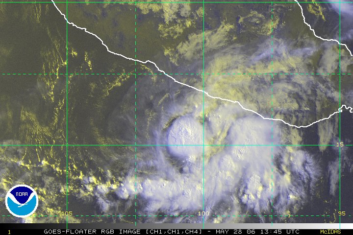
http://www.ssd.noaa.gov/PS/TROP/DATA/RT/float2-rgb-loop.html
irene rgb shot
--------------------
www.Stormhunter7.com ***see my flight into Hurricane Ike ***
Wx Data: KFLPANAM23 / CW8771
2012== 23/10/9/5 sys/strms/hurr/majh
|
rmbjoe1954
Weather Master

Reged:
Posts: 427
Loc: Port Saint Lucie, Florida, USA
|
|
That sat pic shows Irene dancing here way 'North' north-west.
--------------------
________2023 Forecast: 20/10/5________
There is little chance that meteorologists can solve the mysteries of weather until they gain an understanding of the mutual attraction of rain and weekends. ~Arnot Sheppard
|
mikeG
Unregistered
|
|
my earlier post #47471 .......well nice to know i was in the ball park....
from the TCDAT4
5m dics.
AN UPPER-LOW TO THE SOUTH OF IRENE HAS BEEN ADVECTING DRY MID-LEVEL
INTO THE SOUTHERN PORTION OF THE CYCLONE TODAY ...WHICH HAS CAUSED
THE CONVECTION TO ERODE AND WEAKEN AT TIMES. HOWEVER...WATER VAPOR
IMAGERY INDICATES THE LOW HAS BEEN WEAKENING AND THAT THE MID- TO
UPPER-LEVEL FLOW IS GRADUALLY BECOMING SOUTHEASTERLY.
the west side of irene is now looking better....great outflow...(stronger storm later on)
take a look at wv
|
meto
Weather Guru
Reged:
Posts: 140
|
|
strong wave just off africa, some monster ones will be coming off in the next week. hang on. ............................
|
firestar_1
Weather Hobbyist

Reged:
Posts: 64
Loc: Port Charlotte, FL, 26.98N 82....
|
|
After looking at the steering currents today, I am thinking there is a very good chance over the next 18 hours to see her head more nnw between the two highs...is this possible?
http://cimss.ssec.wisc.edu/tropic/real-time/atlantic/winds/winds-dlm.html
:?:
--------------------
Stay Aware...Stay Alert....Stay Alive.....
|
MapMaster
Weather Guru

Reged:
Posts: 138
|
|
OK, no one get excited...I have noticed the since last night it actually looks quite a bit like Andrew at about the same stage/location when it developed. This is NOT Andrew, and the set up isn't the same, but, just interesting to note.
Of greater interest is the sudden appearance of probabilities all over the east coast of Florida...and that we are a little deeper in the TS force wind cone.
The probabilities north to south, including Bermuda, show very little spread...jury is still out....
MM
|
MapMaster
Weather Guru

Reged:
Posts: 138
|
|
Deleted by author...already answered!
Edited by MapMaster (Thu Aug 11 2005 10:09 PM)
|
Lee-Delray
Weather Master

Reged:
Posts: 429
|
|
I don't see the Florida probabilities; where do I find them.
|
Ron Basso
Storm Tracker

Reged:
Posts: 267
Loc: hernando beach, FL
|
|
Sorry for the long copy but I need it to make a point here.
Per 's 5 PM Discussion:
THERE HAS NOT BEEN MUCH CHANGE IN THE MODEL FORECAST
TRACKS OR THE MODELS' HANDLING OF THE SUBTROPICAL RIDGE TO THE
NORTH OF IRENE AND THE ALLEGED WEAKENING OF THE WESTERN PORTION OF
THE RIDGE AFTER 72 HOURS. HOWEVER...IT SHOULD BE NOTED THAT NONE OF
THE MODELS CREATE A WEAKNESS IN THE RIDGE DUE TO A SHORTWAVE TROUGH MOVING INTO THE MEAN RIDGE POSITION. THE AND UKMET MODELS ERODE THE RIDGE AS A RESULT OF AMPLIFYING IRENE TO A SIZE NEARLY THE SAME AS THAT OF THE SYNOPTIC SCALE HIGH PRESSURE CENTER NEAR BERMUDA...WHICH RESULTS IN IRENE TURNING SHARPLY NORTHWARD ALONG 70W LONGITUDE BY 72 HOURS. THAT SCENARIO SEEMS LESS LIKELY...GIVEN THE CURRENT SIZE AND STRENGTH OF THE BERMUDA RIDGE AS NOTED IN WATER VAPOR IMAGERY AND UPPER-AIR DATA. THE HAS CONTINUED ITS TREND OF DISSIPATING IRENE WITHIN 48 HOURS AND MAINTAINING AN EAST- WEST ORIENTED MID-LEVEL RIDGE FROM BERMUDA WESTWARD TO THE CAROLINAS.
I dunno about most of you, but I read alot of doubt into the 5 PM discussion. When the MET says "Alleged" weakness in the ridge after 72 hrs this doesn't sound confident. In addition, what's bothering me about this storm is that the and have consistently dissipated this storm over the last 2-3 days of model runs along with the which one run its a tropical storm and then the next run is an open wave. Like the states, the and UKMET create a huge storm that dwarfs the ridge, thereby allowing it to slice thru it. So, overall, we don't have any model consensus. Usually with a stronger storm, we may have differing tracks but we don't have 2 models evaporating the storm and 2 models creating a mega-storm. I think the is scratching their heads, too, over its path in the long range (3-5 days) by really slowing the storm to a crawl. Right now, the storm can either dissipate in 48 hours, turn west or W-SW in the next 24-48 hours, get trapped within the ridge and meander at less than 5 kts, or rapidly develop into a strong hurricane and head north out to sea. Anyone got a wegee board?
good insight ron. it's ouija board.. but this isn't a spelling bee. -HF
Edited by HanKFranK (Thu Aug 11 2005 11:53 PM)
|
NewWatcher
Storm Tracker

Reged:
Posts: 388
Loc: Port Orange, FL
|
|
Very good points Ron, I was thinking the same thing about the models not being in agreement. Scratching my head also

--------------------
Pam in Volusia County
According to Colleen A ... "I AM A HURRICANE FREAK"
2007 Predictions 16/9/6
|
Rob1966
Registered User
Reged:
Posts: 9
Loc: Cooper City Florida
|
|
As always, is a wait and see. Next 24 hours "should be" a bit more enlighting. With so much uncertainy how will Jim Cantori know where to go?
|


 Threaded


