MikeC
Admin
Reged:
Posts: 4831
Loc: Orlando, FL
|
|
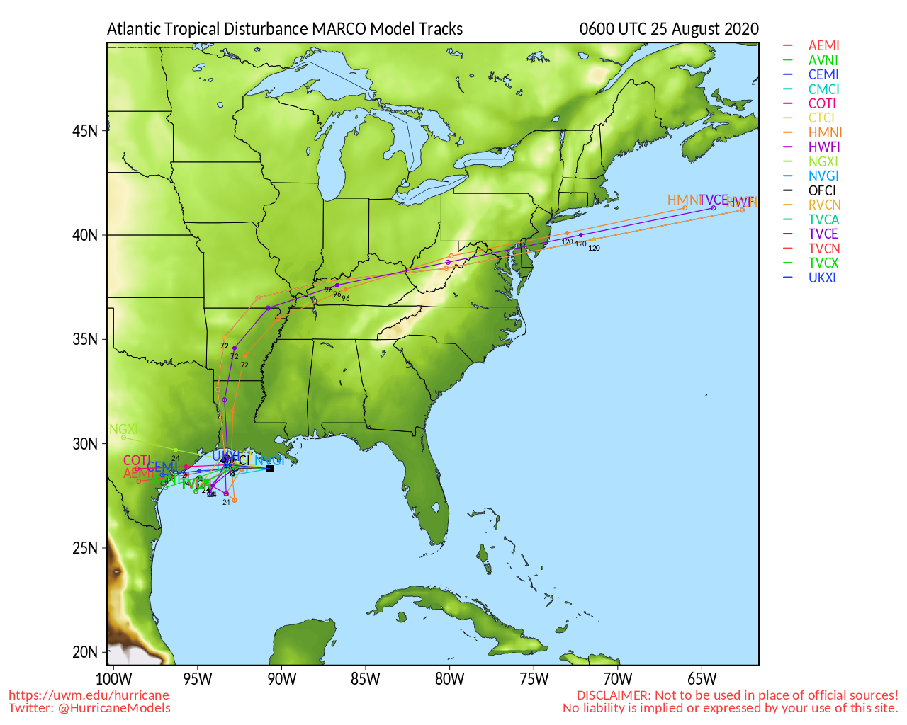
6PM EDT Update 24 August 2020
Hurricane Watches are up from Port Bolivar, TX to Morgan City, LA for Laura.
A Storm Surge Watch is in effect from San Luis Pass, Texas, to Ocean Springs, Mississippi, including Lake Pontchartrain, Lake Maurepas, and Lake Borgne for areas outside of the southeast Louisiana Hurricane and Storm Damage Risk Reduction System.
The forecast calls for a 105Mph hurricane at landfall, but with the caveat it could be stronger. Laura has not entered the Gulf yet, and will cross Cuba one more time before doing so.
Marco is rapidly weakening and all tropical storm warnings have been discontinued, we'll focus on Laura only for now.
8:30AM EDT Update 24 August 2020
After multiple attempts to recenter over water south of the islands, Laura has finally done so to the south of central Cuba. It now appears increasingly likely that a track that favors landfall in the northwestern rather than central GOM is afoot. This also would probably allow Laura more time over very warm waters and in an environment of generally favorable shear.
A high-end Major Hurricane landfall somewhere between northeastern Mexico and central Louisiana may be in the cards, and models are now starting to reflect this. Stay tuned.
Elsewhere, Tropical Storm Marco has been shredded and is now a shallow vortex of its former self, with most of the deep convection well displaced to the northeast. The vortex itself is heading north, then likely northwest to west, and may track along or either side of the coast for a few days, occasionally firing rounds of showers and storms and producing some blustery winds. Storm surge remains a threat, as does the risk for deadly rip currents and isolated severe thunderstorms, waterspouts and tornadoes.
Read more about Laura's & Marco's changing model runs in the Forecast Lounge
Ciel
5PM EDT Update 23 August 2020
Hurricane Marco is hitting stronger shear, but is fighting it for now, but shear is expected to increase as it nears the coast, and is expected to weaken some before landfall, and may skirt along the southern coast of Louisiana into Texas Late Monday night into Tuesday. Tropical Storm Warnings have been extended westward to Cameron, LA.
Tropical Storm Laura has strengthened some, today, and is now just south of the southern coast of Cuba. Tropical Storm Watches have been discontinued for Florida, except for Craig Key to Key West. Tropical storm Warnings are up for parts of the Caymans, and effectively all of Cuba. The forecast takes it into the Gulf and strengthens to a hurricane, and the National Hurricane Center calls out that based on how much land interaction with Cuba, it could possibly be a major hurricane at landfall somewhere in the Northwest Gulf on Wednesday. Those in the Cone in LA and Texas should take this one seriously and monitor for changes, especially when it enters the Gulf of Mexico.

6AM EDT Update 23 August 2020
Both Marco and Laura are forecast to be hurricanes in the Gulf of Mexico next week.
Marco, much smaller, may not be able to maintain hurricane intensity for long in the face of forecast shear, but could pack a strong punch just the same.
Laura, which started out as a large and sprawling system, continues consolidating, and doing so along the south sides of and/or south of the islands. The girth of this system alone is helping it to maintain while traveling at least partially over mountainous land. Now, in addition to her size, exceptional upper-level outflow has established itself aloft atop extremely deep and intense convection.
It is now clear that Laura has the potential to be a large and major hurricane in the Gulf of Mexico and possibly make landfall as such. Interests from Texas to western Florida would be wise to pay very close attention to her forecast track, and begin making preparations to protect life and property if within her cone and watch/warning zones.
Both tropical cyclones are dangerous storms and will likely threaten life and property along their track, and run the risk of delivering a wicked one-two punch.
Summary of Watches and Warnings
A Storm Surge Warning is in effect for: * Morgan City Louisiana to Ocean Springs Mississippi * Lake Borgne
A Hurricane Warning is in effect for: * Morgan City Louisiana to the Mouth of the Pearl River
A Storm Surge Watch is in effect for: * Sabine Pass to Morgan City Louisiana * Ocean Springs to the Alabama/Florida border * Lake Pontchartrain, Lake Maurepas, and Mobile Bay
A Hurricane Watch is in effect for: * Intracoastal City Louisiana to west of Morgan City * Lake Pontchartrain, Lake Maurepas, and Metropolitan New Orleans
A Tropical Storm Warning is in effect for: * Mouth of the Pearl River to the Mississippi/Alabama border * Lake Pontchartrain, Lake Maurepas, and Metropolitan New Orleans
A Tropical Storm Watch is in effect for: * Mississippi/Alabama border to the Alabama/Florida border
-Ciel
11PM EDT Update 22 August 2020
Tropical Storm Marco is a bit weaker than earlier, and it's small size is making it ramp up and down quite a bit. Right now it's on a down cycle, but any better conditions would push it back up. The hurricane center is forecasting it to become a hurricane, but weaken some as it approaches land. Those in the watch and warning area should listen to local media and officials for better information in your particular area.
Laura, tonight was the night we hoped to have some more information, and we do to a degree, it appears to be going over the land, as the center was estimated to be along the south shore of the Dominican Republic tonight. Center reformations are likely, and although most of the convection is south of Hispaniola, the pressures are lower on the north side. Thus the current forecast track seems fairly good, although later stages may change somewhat. Once Marco makes landfall, conditions in the Gulf become much more favorable for Laura, so a hurricane is forecast once in the Gulf. Unfortunately that means those in the northern Gulf will have to watch this for landfall Wednesday night. And likely to be a stronger system than Marco was, how much depends on how long Laura stays over land.
The threat to Florida is all but gone, but the Keys should still watch it, especially if the system reforms north of the islands overnight into tomorrow.
Original Update
Big changes for Marco, the forecast track now has landfall in Louisiana as an 85mph Hurricane, Hurricane Watches and Storm Surge Watches for Intracoastal City LA, to the Mississippi/Alabama border including Lake Pontchartrain and Metro New Orleans.
A Storm Surge Watch has been issued from Sabine Pass eastward to the Alabama/Florida border, including Lake Pontchartrain, Lake Maurepas, Lake Borgne, and Mobile Bay.
A Hurricane Watch has been issued from Intracoastal City Louisiana eastward to the Mississippi/Alabama border, including Lake Pontchartrain, Lake Maurepas, and Metropolitan New Orleans.
A Tropical Storm Watch has been issued from the Mississippi/Alabama border eastward to the Alabama/Florida border.
For Laura, Tropical Storm Watches up for Andros in the Bahamas, Florida Keys, and current forecast track takes it over the islands, and another hurricane threat for the North gulf coast on Wednesday.
4
|
MikeC
Admin
Reged:
Posts: 4831
Loc: Orlando, FL
|
|
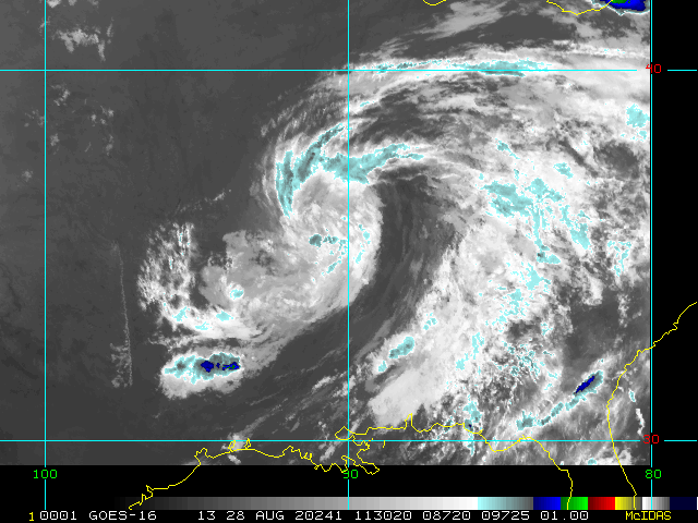
Laura's satellite appearance this morning is impressive despite being partially over land, once clear of the islands this looks like it may take off.
Marco seems to be strengthening again this morning, recon finding lower pressures now. (988mb) A stronger storm would imply more east on the Marco cone, but it still is likely to face shear as it approaches land to weaken it, exact timing will be important for how much, though. Vortex was 991mb, however.
|
MichaelA
Weather Analyst

Reged:
Posts: 956
Loc: Pinellas Park, FL
|
|
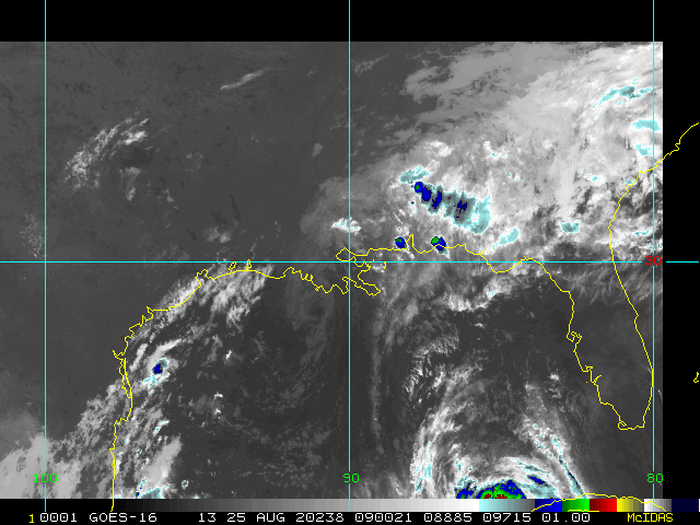
Latest imagery of Laura shows some degradation, but not a lot. Some organization could improve as it traverses the straights between Haiti and Cuba this afternoon. Whether the center traverses directly over Cuba or south or north of the island will play out for the continued definition of the overall system.
--------------------
Michael
PWS
|
MikeC
Admin
Reged:
Posts: 4831
Loc: Orlando, FL
|
|
Marco is being stubborn with a north northeast movement tonight, track may wind up quite a bit right, or the shear is really ripping it apart and the convection will head more north. Big band running through the Big Bend and Tallahassee tonight.
|
MikeC
Admin
Reged:
Posts: 4831
Loc: Orlando, FL
|
|
Center of Laura barely Visible on Key West Radar

|
danielw
Moderator

Reged:
Posts: 3527
Loc: Hattiesburg,MS (31.3N 89.3W)
|
|
1 AM CDT Cuban Weather Radar image.

Edited by danielw (Tue Aug 25 2020 02:24 AM)
|
|


 Threaded


