Current Radar or Satellite Image

Flhurricane.com - Central Florida Hurricane Center - Tracking Storms since 199531 Years of Hurricanes Without the Hype - Since 1995


EDOUARD MADE LANDFALL NEAR JOHNSON BAYOU, LOUISIANA
Days since last Hurricane Landfall — US Any: 692 (Milton), US Major: 692 (Milton), FL Any: 692 (Milton), FL Major: 692 (Milton)
FlHurricane Atlantic Tropical Cyclone Tracking 🌀 Since 1995
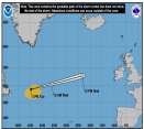
30.5N -94.6W
Wind: 35MPH
Pres: 1002mb
Moving:
Present movement...nw or 315 degrees at 8 mph...13 km/h
Click for Storm Spotlight
HypeScale:
2.50
0510
Communication
Storm Data
Content
Follow & Connect


Archives 2002-2009 >> 2002 Storm Forum

Steve
Senior Storm Chaser


Reged:
Posts: 1063
Loc: Metairie, LA
Question for the Meteorologists out there...
      Thu May 30 2002 09:59 PM

Is there a laymen FAQ out there about the different measurements one encounters and what they signify? It's pretty obvious when you look at a sea level pressure forecast, but the 200mb, 500mb, 800mb etc. are a little fuzzy to me. And what are the norms? Often you hear about the 500mb height line. Is this a point in the atmosphere where measurements are derived from or do they base interpretations off of seasonal norms or whatever?

Thanks for any tips or info.

Steve

--------------------
MF'n Super Bowl Champions

Post Extras Print Post   Remind Me!     Notify Moderator


Entire topic
Subject Posted by Posted on
* Question for the Meteorologists out there... Steve Thu May 30 2002 09:59 PM
. * * Re: Question for the Meteorologists out there... wxman007   Fri May 31 2002 12:24 PM
. * * Re: Question for the Meteorologists out there... Steve   Fri May 31 2002 04:52 PM

Extra information
0 registered and 0 anonymous users are browsing this forum.

Moderator:  MikeC, Ed Dunham, danielw 


Forum Permissions
      You cannot start new topics
      You cannot reply to topics
      HTML is enabled
      UBBCode is enabled

Rating:
Thread views: 3156

Rate this thread

Jump to