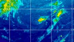
Current Radar or Satellite Image

Flhurricane.com - Central Florida Hurricane Center - Tracking Storms since 199531 Years of Hurricanes Without the Hype - Since 1995


Subropical to Tropical development becoming more likely over the weekend into next week off the southeast to east coast. Could head inland.
Days since last Hurricane Landfall — US Any: 40 (Isaias), US Major: 770 (Milton), FL Any: 40 (Isaias), FL Major: 770 (Milton)
FlHurricane Atlantic Tropical Cyclone Tracking 🌀 Since 1995
None
HypeScale:
0.66
0510
Communication
Storm Data
Content
Follow & Connect
 

Clark Evans/Flhurricane Animated Storm Intensity Model Plots for Tropical Depression Edouard (2026)
(source images from FSU and Flhurricane Met/Clark Evans) - Unofficial Image, do not use for planning.

30 images in loop - Last Checked: 11:01 am 05-Sep-2026 EDT. Last Updated: 10:12 pm 01-Sep-2026 EDT

Other animated plots: Clark Evans Track Models - SFWMD - Skeetobite

Updates checked for every hour, Actual changes depend on NHC/Models themselves.