Show Selection:
|
#1010238 (Received by flhurricane at: 11:02 PM 29.Jul.2020)
TCDAT4
Tropical Storm Isaias Discussion Number 7
NWS National Hurricane Center Miami FL AL092020
1100 PM AST Wed Jul 29 2020
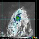
Observations from recent scatterometer passes over the system show
that it now has a sufficiently well-defined center to be
designated as a tropical cyclone. The current intensity is
estimated to be 45 kt, but these winds are currently occurring over
the Atlantic waters well to the north and northeast of the center.
Since the cyclone is expected to move over Hispaniola on Thursday
some weakening is likely within the next 24 hours. However since
Isaias has such a broad wind field, the weakening will probably not
be as significant as in a typical tropical cyclone with a small
radius of maximum winds. Also, a re-formation of the center to the
north of Hispaniola may occur. Later in the forecast period some
strengthening is likely, although this may be offset by
southwesterly wind shear on the order of 20 kt in 2-3 days. The
official forecast is close to the intensity model consensus but
well below the latest LGEM guidance.
The scatterometer data show that the center of the system is south
of the previously estimated track, so there is a lot of uncertainty
in the initial motion estimate of 285/17 kt. Isaias should move on
a west-northwestward to northwestward track on the southern and
southwestern side of a mid-tropospheric ridge. In 2-3 days,
the system is expected to turn north-northwestward due to a
weakness in the ridge and an approaching trough. Later in the
forecast period, the trough should cause Isaias to turn toward the
northeast. The official track forecast is a little to the east of
the previous one and a little west of the simple and corrected
dynamical model consensus tracks. It should be noted that further
adjustments to the forecast tracks are indeed possible, especially
after Isaias moves north of Hispaniola.
Key Messages:
1. Isaias will produce heavy rains and potentially life-threatening
flash flooding and mudslides across the Virgin Islands, Puerto Rico,
the Dominican Republic, northern Haiti, and over the southeastern
Bahamas.
2. Tropical storm conditions are likely across portions of the
the Virgin Islands, and Puerto Rico through tonight and will spread
westward to portions of the Dominican Republic, Haiti, and the
southeastern Bahamas and Turks and Caicos and the Central Bahamas
on Thursday and Friday. Tropical Storm Warnings are in effect for
these areas. Do not focus on the details of the track forecast, as
rainfall and wind hazards will extend far from the center of the
system.
3. While this system could bring some rainfall and wind impacts to
portions of Cuba, the northwestern Bahamas, and Florida later this
week and this weekend, it is too soon to determine the location or
magnitude of those impacts. Interests there should monitor the
progress of this system and updates to the forecast over the next
few days.
FORECAST POSITIONS AND MAX WINDS
INIT 30/0300Z 15.8N 67.0W 45 KT 50 MPH
12H 30/1200Z 17.6N 69.3W 45 KT 50 MPH
24H 31/0000Z 19.4N 72.2W 40 KT 45 MPH...INLAND
36H 31/1200Z 21.4N 74.8W 45 KT 50 MPH...OVER WATER
48H 01/0000Z 22.9N 77.3W 50 KT 60 MPH
60H 01/1200Z 24.8N 79.2W 55 KT 65 MPH
72H 02/0000Z 26.6N 80.2W 55 KT 65 MPH...INLAND
96H 03/0000Z 30.0N 80.5W 55 KT 65 MPH...INLAND
120H 04/0000Z 35.0N 77.0W 50 KT 60 MPH...INLAND
$$
Forecaster Pasch |


