Show Selection:
|
#1010272 (Received by flhurricane at: 4:53 AM 30.Jul.2020)
TCDAT4
Tropical Storm Isaias Discussion Number 8
NWS National Hurricane Center Miami FL AL092020
500 AM AST Thu Jul 30 2020
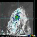
Isaias is sending some mixed signals tonight. The 1-min rapid
scan data from GOES-16 indicates that the low-level center is likely
displaced west of a very intense burst of deep convection on the
northeastern side of the circulation. However, the satellite data
also shows increased banding features overnight and a more
organized central cloud pattern, with recent hints that perhaps a
low-level center is trying to re-form closer to the convection.
Radar observations from San Juan show 60-65 kt Doppler wind
velocities during the past few hours near 5000 ft, so the initial
wind speed is raised to 50 kt.
Model forecasts are showing a complex evolution of the tropical
cyclone during the next day or two. There is good agreement that
Isaias will move across Hispaniola later today, and its low-level
center will likely become disorganized over the high terrain.
However, the strong burst of convection currently near Puerto Rico
is associated with a mid-level circulation, which should pass
along the north coast of Hispaniola later today. Most of the model
guidance suggest that this feature will cause the re-development of
a surface center over the northern part of the broader system while
the mid-level circulation moves close to the southeastern Bahamas.
Afterward, the cyclone would then move northwestward until the
weekend, and gradually turn northward and northeastward close to the
U.S. East Coast into early next week ahead of a mid-latitude trough.
The official track forecast is a little to the east of the previous
one and close to the NOAA corrected dynamical model consensus. It
should be noted that further adjustments to the forecast tracks are
indeed possible, especially after Isaias moves north of Hispaniola.
The intensity forecast is quite tricky. In the short term, Isaias
is expected to move across Hispaniola, as the storm's interaction
with the mountainous island should cause some weakening and
disruption to the circulation. However, as mentioned before, the
models suggest that a new center could form, and the
environmental conditions would support gradual intensification.
The intensity models have been trending higher, and the official
forecast is nudged upward accordingly, now showing a peak
intensity of 60 kt when the storm is near the coast of Florida and
the Southeast U.S. Coast. It should be noted that there are models
that show hurricane strength near the U.S. but, given the large
amount of uncertainty, it is preferred to stay on the
conservative side for now. We should have a better idea of how
strong Isaias will become near the U.S. after reconnaissance
aircraft sample the storm and after it passes Hispaniola later
today.
Key Messages:
1. Isaias will produce heavy rains and potentially life-threatening
flash flooding and mudslides across the Virgin Islands, Puerto Rico,
the Dominican Republic, northern Haiti, and over the Bahamas.
2. Tropical storm conditions are likely across portions of the
the Virgin Islands, and Puerto Rico through this morning and will
spread westward to portions of the Dominican Republic, Haiti, and
the Turks and Caicos and the Bahamas later today and Friday.
Tropical Storm Warnings are in effect for these areas. Do not focus
on the details of the track forecast, as rainfall and wind hazards
will extend far from the center of the system.
3. While this system could bring some rainfall and wind impacts to
portions of Cuba and Florida later this week and this weekend, it
is too soon to determine the location or magnitude of those impacts.
Interests there should monitor the progress of this system and
updates to the forecast over the next couple of days.
FORECAST POSITIONS AND MAX WINDS
INIT 30/0900Z 17.2N 67.9W 50 KT 60 MPH
12H 30/1800Z 18.8N 70.2W 45 KT 50 MPH...INLAND
24H 31/0600Z 20.6N 72.9W 45 KT 50 MPH...OVER WATER
36H 31/1800Z 22.3N 75.5W 50 KT 60 MPH
48H 01/0600Z 24.0N 77.9W 55 KT 65 MPH
60H 01/1800Z 25.5N 79.2W 60 KT 70 MPH
72H 02/0600Z 27.3N 80.0W 60 KT 70 MPH
96H 03/0600Z 31.0N 80.0W 60 KT 70 MPH
120H 04/0600Z 37.0N 74.5W 60 KT 70 MPH
$$
Forecaster Blake/Cangialosi |


