Show Selection:
|
#1010379 (Received by flhurricane at: 12:08 AM 31.Jul.2020)
TCDAT4
Hurricane Isaias Special Discussion Number 12
NWS National Hurricane Center Miami FL AL092020
1200 AM EDT Fri Jul 31 2020
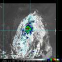
An Air Force Reserve Hurricane Hunter found that Isaias has become
a hurricane. Maximum flight-level winds so far were 87 kt at 850
mb, with believable SFMR values of at least 65 kt. A blend of
these values gives an initial wind speed of 70 kt. Some further
strengthening is likely over the next 24 hours before increasing
southwesterly shear could weaken the system. The intensity forecast
is modified upward from 5-10 kt through 48 hours and unchanged after
that time.
There are no changes to the previous track forecast.
Key Messages:
1. Isaias will produce heavy rains and potentially life-threatening
flash flooding and mudslides across the Dominican Republic, northern
Haiti, Turks and Caicos, and the Bahamas.
2. Hurricane conditions and dangerous storm surge are expected in
portions of the southeastern Bahamas overnight, central
and northwestern Bahamas late Friday and Saturday, and Hurricane
Warnings are in effect for these areas. Preparations
to protect life and property should be rushed to completion.
3. Tropical storm conditions are possible along portions of the
Florida east coast beginning Saturday, and a Tropical Storm Watch
is in effect. While storm surge watches are not currently needed
for this area, they may be required on Friday if the forecast track
shifts closer to the coast. Heavy rains associated with Isaias may
begin to affect South Florida and east-Central Florida beginning
late Friday night, potentially resulting in isolated flash and urban
flooding, especially in low-lying and poorly drained areas.
4. There is a risk of impacts from winds, heavy rainfall, and storm
surge late this weekend from the northeastern Florida coast and
spreading northward along the remainder of the U.S. east coast
through early next week. The details of the track and intensity
forecast remain uncertain, and it is too soon to determine the
magnitude and location of these potential impacts, but interests
along the entire U.S. east coast should monitor the progress of
Isaias and updates to the forecast.
FORECAST POSITIONS AND MAX WINDS
INIT 31/0400Z 20.4N 72.2W 70 KT 80 MPH
12H 31/1200Z 21.6N 73.9W 70 KT 80 MPH
24H 01/0000Z 23.5N 76.1W 75 KT 85 MPH
36H 01/1200Z 25.2N 77.8W 75 KT 85 MPH
48H 02/0000Z 26.7N 79.0W 70 KT 80 MPH
60H 02/1200Z 28.3N 79.6W 65 KT 75 MPH
72H 03/0000Z 30.0N 79.5W 65 KT 75 MPH
96H 04/0000Z 34.6N 76.8W 65 KT 75 MPH
120H 05/0000Z 42.0N 69.0W 60 KT 70 MPH
$$
Forecaster Blake |


