Show Selection:
|
#1013691 (Received by flhurricane at: 5:00 PM 24.Aug.2020)
TCDAT3
Tropical Storm Laura Discussion Number 20
NWS National Hurricane Center Miami FL AL132020
500 PM EDT Mon Aug 24 2020
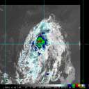
The satellite presentation of the tropical storm has improved
somewhat with deep convection remaining over the center, and an
increase in banding over the southeastern portion of the
circulation. Earlier aircraft and scatterometer data, however,
indicated that there has been little change in strength today, and
the initial intensity remains 50 kt. These observations have shown
the the stronger winds are located in the convective band well east
and southeast of the center, and that the system currently lacks
an inner core. This is likely the reason that Laura has not been
able to strengthen while it has moved over water today. The
aircraft also reported a fairly stable minimum pressure of 1001-1003
mb during its mission this morning and early afternoon.
The intensity forecast philosophy remains the same as the previous
advisory. Once Laura moves over the southeastern Gulf of Mexico
tonight, a combination of warm sea surface temperatures and low
vertical wind shear should allow for steady strengthening. The
latest iterations of the global and regional hurricane models
continue to show significant deepening while Laura traverses the
Gulf of Mexico, and a period or rapid strengthening is possible once
an inner core is able to organize. The statistical guidance is
again on the lower side of the intensity forecast envelope
while the HWRF and CTCI models bringing Laura to major hurricane
strength. The NHC intensity forecast is again between these
solutions and is close to the consensus aids.
The initial motion estimate is 290/16 kt. A deep-layer ridge over
the western Atlantic is expected to build westward during the next
day or so. By early Wednesday, a mid- to upper-level trough over
the south-central United States is forecast to erode the western
portion of the ridge, which should cause Laura to turn northwestward
and then northward toward the northwestern Gulf coast. After
landfall, Laura or its remnants are expected to become embedded
in the mid-latitude westerlies and recurve over the eastern U.S.
on days 4 and 5. The latest runs of the dynamical models are in a
little better agreement, but the 1200 UTC ECMWF ensemble mean is
located considerably left of its deterministic run, indicating that
uncertainty regarding the track forecast remains. Users are again
reminded to not to focus on the exact details of the track or
intensity forecasts as the average NHC track error at 60 h is
around 90 miles and the average intensity error is close to 15 mph.
In addition, wind, storm surge, and rainfall hazards will extend
far from the center.
The new NHC forecast necessitates the issuance of storm surge and
hurricane watches for portions of the U.S. Gulf Coast.
Key Messages:
1. Laura is forecast to reach the northwestern Gulf Coast as a
hurricane late Wednesday and early Thursday. Do not focus
on the details of the official forecast given the typical
uncertainty in NHC`s 2 to 3 day track and intensity predictions. In
addition, storm surge, wind, and rainfall hazards will extend well
away from Laura`s center along the Gulf Coast.
2. There is a risk of life-threatening storm surge from San Luis
Pass, Texas, to Ocean Springs, Mississippi, within the next 48
hours, and a storm surge watch has been issued for these areas
outside of the southeast Louisiana Hurricane and Storm Damage Risk
Reduction System. Residents in these areas should follow any advice
given by local officials.
3. Hurricane conditions are possible by late Wednesday from Port
Bolivar, Texas, to west of Morgan City, Louisiana, with tropical
storm conditions possible by Wednesday afternoon, and a hurricane
watch has been issued. Additional hurricane watches may be needed
farther south along the Texas coast if the track forecast shifts
toward the south and west tonight and Tuesday.
4. Tropical storm conditions and heavy rainfall are expected across
central and western Cuba through tonight. These rains could cause
mudslides and life-threatening flash and urban flooding.
FORECAST POSITIONS AND MAX WINDS
INIT 24/2100Z 21.7N 82.2W 50 KT 60 MPH
12H 25/0600Z 22.7N 84.5W 50 KT 60 MPH
24H 25/1800Z 24.2N 87.4W 60 KT 70 MPH
36H 26/0600Z 25.7N 90.0W 75 KT 85 MPH
48H 26/1800Z 27.5N 92.0W 85 KT 100 MPH
60H 27/0600Z 29.8N 93.1W 90 KT 105 MPH
72H 27/1800Z 32.5N 93.0W 45 KT 50 MPH...INLAND
96H 28/1800Z 36.1N 90.0W 25 KT 30 MPH...INLAND
120H 29/1800Z 36.5N 80.5W 25 KT 30 MPH...POST-TROP/REMNT LOW
$$
Forecaster Brown |


