Show Selection:
|
#1015705 (Received by flhurricane at: 10:45 AM 08.Sep.2020)
TCDAT2
Tropical Storm Paulette Discussion Number 7
NWS National Hurricane Center Miami FL AL172020
1100 AM AST Tue Sep 08 2020
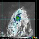
Paulette`s organization has noticeably improved since last night.
The tropical storm is still sheared, with its outflow restricted to
the southwest, however overnight AMSU imagery indicated that
convection was beginning to wrap around the western portion of its
circulation. The intensity estimate has been increased to 55 kt
based on Dvorak estimates from TAFB and SAB.
Paulette has manged to strengthen despite the shear, and some
additional short-term strengthening is certainly possible. It is not
out of the question that Paulette could become a hurricane, at least
briefly. The global models indicate that the shear will increase on
Wednesday, which should cause Paulette`s intensity to level off,
and more likely, decrease. The NHC intensity forecast is just above
the intensity consensus for the first 3 days, out of respect for
Paulette`s recent intensification above most of the guidance. By the
weekend, Paulette`s strength will heavily depend on its exact
orientation relative to an upper-level low that is expected to be
located west or southwest of the tropical storm. Some
restrengthening could occur then, but the NHC forecast just shows a
steady intensity, near the middle of the guidance suite.
Paulette is forecast to turn generally west-northwestward or
westward tonight and Wednesday as a mid-level ridge builds to its
north. The guidance then indicates that late this week Paulette
will turn northwestward when the ridge weakens. Differences in
Paulette`s forward speed on Wednesday and Thursday could result in
a very different track late in the period since it affects the
point at which the tropical storm will turn northwestward. The NHC
forecast is very close to the multi-model consensus throughout the
5-day period, but confidence in the forecast beyond 72 h is lower
than normal due to high spread in the track guidance.
FORECAST POSITIONS AND MAX WINDS
INIT 08/1500Z 18.4N 43.3W 55 KT 65 MPH
12H 09/0000Z 19.0N 44.2W 60 KT 70 MPH
24H 09/1200Z 19.8N 45.8W 60 KT 70 MPH
36H 10/0000Z 20.3N 47.8W 60 KT 70 MPH
48H 10/1200Z 20.6N 49.7W 55 KT 65 MPH
60H 11/0000Z 20.7N 51.2W 55 KT 65 MPH
72H 11/1200Z 21.2N 52.6W 50 KT 60 MPH
96H 12/1200Z 23.1N 55.4W 50 KT 60 MPH
120H 13/1200Z 26.0N 58.5W 50 KT 60 MPH
$$
Forecaster Zelinsky |


