Show Selection:
|
#1016016 (Received by flhurricane at: 4:36 PM 10.Sep.2020)
TCDAT2
Tropical Storm Paulette Discussion Number 16
NWS National Hurricane Center Miami FL AL172020
500 PM AST Thu Sep 10 2020
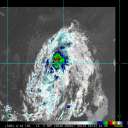
Continuous bursts of deep convection have been ongoing to the north
and northeast of Paulette`s center of circulation, with the cyclone
being affected by nearly 40 kt of deep-layer southwesterly shear.
The highest intensity estimates are Dvorak classifications of
T3.0/45 kt from TAFB and SAB, and that value remains the initial
intensity. The shear should reach its peak magnitude this evening,
which is likely to cause Paulette to weaken slightly during the
next 24 hours. However, gradual re-strengthening is forecast to
begin in about 36 hours, and the rate of intensification is expected
to increase in 2 to 3 days when the shear could fall to 10 kt or
less, along with a more unstable atmosphere and warmer sea surface
temperatures. Paulette is now forecast to become a hurricane by day
3 and continue to intensify through the end of the forecast period.
As was advertised in the previous forecast package, the new NHC
forecast intensities have been bumped up on days 3 through 5 and
now lie near or just below the IVCN intensity consensus and the
HCCA corrected consensus aid.
Paulette`s heading over the past 6-12 hours has been toward the
west-northwest, or 300/8 kt. The cyclone`s trajectory is expected
to oscillate between northwest and west-northwest for the next 4
days, being dictated by the strength of the subtropical ridge to
the north and the depth of the steering flow depending on
Paulette`s intensity. The updated NHC track forecast during this
period has been nudged a bit to the north, mostly to account for an
adjustment of the initial position. The model guidance all agree
that Paulette should turn northward around the western side of a
central Atlantic high pressure area by day 5, with the expected
hurricane likely to make a tight recurvature near Bermuda. There
remains some uncertainty on exactly where that turn will occur, but
for now the NHC forecast lies between the tighter-turning ECMWF and
HCCA models and the more gradually-turning GFS and HWRF models.
Key Messages:
1. Paulette is expected to approach Bermuda as a hurricane this
weekend and make its closest approach to the island on Monday and
Tuesday. While the exact details of Paulette`s track and intensity
near the island are not yet known, the risk of strong winds, storm
surge, and heavy rainfall on Bermuda continues to increase.
2. Swells produced by Paulette are expected to affect portions of
the Leeward Islands, the Greater Antilles, the Bahamas, Bermuda,
and the southeastern United States into the weekend. These swells
could cause life-threatening surf and rip current conditions.
FORECAST POSITIONS AND MAX WINDS
INIT 10/2100Z 22.1N 50.1W 45 KT 50 MPH
12H 11/0600Z 22.5N 51.5W 40 KT 45 MPH
24H 11/1800Z 23.6N 53.4W 40 KT 45 MPH
36H 12/0600Z 25.0N 55.1W 45 KT 50 MPH
48H 12/1800Z 26.6N 56.8W 45 KT 50 MPH
60H 13/0600Z 28.0N 58.9W 55 KT 65 MPH
72H 13/1800Z 29.2N 61.4W 65 KT 75 MPH
96H 14/1800Z 31.5N 65.5W 75 KT 85 MPH
120H 15/1800Z 34.5N 64.0W 80 KT 90 MPH
$$
Forecaster Berg |


