Show Selection:
|
#1016072 (Received by flhurricane at: 4:51 AM 11.Sep.2020)
TCPAT2
BULLETIN
Tropical Storm Paulette Advisory Number 18
NWS National Hurricane Center Miami FL AL172020
500 AM AST Fri Sep 11 2020
...PAULETTE EXPECTED TO BECOME A HURRICANE THIS WEEKEND...
...SWELLS FORECAST TO SPREAD ACROSS THE SOUTHWESTERN ATLANTIC
THROUGH THE WEEKEND INCREASING RIP CURRENT THREAT...
SUMMARY OF 500 AM AST...0900 UTC...INFORMATION
----------------------------------------------
LOCATION...23.1N 51.7W
ABOUT 810 MI...1305 KM ENE OF THE NORTHERN LEEWARD ISLANDS
ABOUT 1020 MI...1645 KM SE OF BERMUDA
MAXIMUM SUSTAINED WINDS...65 MPH...100 KM/H
PRESENT MOVEMENT...WNW OR 300 DEGREES AT 10 MPH...17 KM/H
MINIMUM CENTRAL PRESSURE...991 MB...29.27 INCHES
WATCHES AND WARNINGS
--------------------
There are no coastal watches or warnings in effect.
Interests in Bermuda should monitor the progress of Paulette.
Please consult products from your local weather office.
DISCUSSION AND OUTLOOK
----------------------
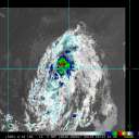
At 500 AM AST (0900 UTC), the center of Tropical Storm Paulette was
located near latitude 23.1 North, longitude 51.7 West. Paulette is
moving toward the west-northwest near 10 mph (17 km/h). A motion
toward the northwest is expected for the next few days. On the
forecast track, the center of Paulette should approach Bermuda
Sunday night and Monday.
Maximum sustained winds are near 65 mph (100 km/h) with higher
gusts. Little change in strength is expected today. Gradual
strengthening is expected to begin tonight or on Saturday, and
Paulette is forecast to become a hurricane this weekend.
Tropical-storm-force winds extend outward up to 205 miles (335 km)
from the center.
The estimated minimum central pressure is 991 mb (29.27 inches).
HAZARDS AFFECTING LAND
----------------------
Key messages for Paulette can be found in the Tropical Cyclone
Discussion under AWIPS header MIATCDAT2 and WMO header WTNT42 KNHC.
SURF: Swells generated by Paulette are expected to reach portions
of the Leeward Islands today and will continue to spread westward
to portions of the Greater Antilles, Bahamas, Bermuda, and the
southeastern United States into the weekend. These swells are
likely to cause life-threatening surf and rip current conditions.
Please consult products from your local weather office.
NEXT ADVISORY
-------------
Next complete advisory at 1100 AM AST.
$$
Forecaster Beven |


