Show Selection:
|
#1016941 (Received by flhurricane at: 4:54 PM 15.Sep.2020)
TCDAT5
Tropical Storm Teddy Discussion Number 13
NWS National Hurricane Center Miami FL AL202020
500 PM AST Tue Sep 15 2020
Overall, Teddy`s organization has continued to slowly improve
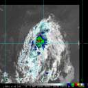
during the past several hours. AMSR microwave imagery near 1630 UTC
showed that a low- to mid-level eye feature is beginning to form.
The overall convective pattern has also improved, though not enough
to increase the intensity estimates at this time, which only range
from 45-55 kt. The intensity is therefore held at 55 kt, but it
does appear that some intensification is imminent.
The AMSR image showed indications of a microwave signature commonly
associated with rapid intensification in favorable environments. Low
shear and warm SSTs along the forecast track are certainly
conducive, though dry air continues to be a possible limiting
factor. The dry air is probably the reason that dry slots continue
to occasionally appear in IR imagery near the center of Teddy. Rapid
intensification probabilities are not particularly high; the SHIPS
RI gives a 22 percent chance of a 30-kt increase during the next 24
h while DTOPS shows a mere 1 percent chance. The rest of the
intensity models forecast only modest strengthening for the next
couple of days. The NHC intensity forecast is at the top of the
intensity guidance for the next 48 h and slightly above all of the
models after that, but I am hesitant to lower it any further at
this time given the recent microwave signature and overall
improvement in Teddy`s structure.
In contrast, Teddy`s track outlook remains straightforward, and no
changes of note were made to the official forecast. The tropical
storm is turning gradually toward the northwest and should begin
moving in that direction tonight. A ridge over the central Atlantic
should then steer Teddy in that general direction for the rest of
the week. The model spread is still much lower than normal, and
confidence in the track forecast is fairly high.
FORECAST POSITIONS AND MAX WINDS
INIT 15/2100Z 14.6N 47.9W 55 KT 65 MPH
12H 16/0600Z 15.5N 49.0W 65 KT 75 MPH
24H 16/1800Z 16.8N 50.2W 75 KT 85 MPH
36H 17/0600Z 18.2N 51.6W 85 KT 100 MPH
48H 17/1800Z 19.7N 53.1W 95 KT 110 MPH
60H 18/0600Z 21.0N 54.4W 100 KT 115 MPH
72H 18/1800Z 22.5N 55.8W 100 KT 115 MPH
96H 19/1800Z 25.4N 58.8W 105 KT 120 MPH
120H 20/1800Z 28.5N 61.5W 95 KT 110 MPH
$$
Forecaster Zelinsky |


