Show Selection:
|
#1017173 (Received by flhurricane at: 10:48 AM 16.Sep.2020)
TCDAT5
Hurricane Teddy Discussion Number 17
NWS National Hurricane Center Miami FL AL202020
1100 AM AST Wed Sep 16 2020
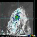
Teddy`s overall appearance has changed little over the past several
hours. Microwave and infrared satellite images depict a
well-defined inner core with an eye evident in the microwave
imagery. However, visible imagery reveals that the eye remains
cloud filled. Over the past few hours, the coldest cloud tops and
have become confined to the western portion of the circulation,
which could be the early signs of the cyclone experiencing some
westerly wind shear. The latest satellite intensity estimates
remain unchanged from 6 h ago, and therefore the initial intensity
will remain 85 kt.
Environmental conditions appear favorable for additional
strengthening over the next 18-24 h, and with the inner-core well
defined, rapid intensification could resume shortly. By 36 h,
increasing westerly wind shear and drier air should limit any
further intensification, and possibly induce some weakening. Later
on in the forecast period, Teddy could encounter some cooler waters
due to upwelling caused by Paulette. This could also attribute to
additional weakening. The latest NHC forecast is largely unchanged
from the previous one, and is on the high end of the guidance. It
should be noted that if the rapid intensification that has paused
recently doe not resume soon, adjustments to the intensity forecast
will be necessary.
Teddy continues to move northwestward at about 10 kt. This motion is
forecast to continue for the next few days, as the cyclone is
steered by a mid-level ridge to its north and northeast. Late in
the forecast period, the portion of the ridge north of Teddy is
expected to erode as a mid-latitude trough digs across the
northeastern United States. This evolution should cause the cyclone
to turn north-northwest and possibly north by day 5. The track
guidance is tightly clustered through day 3, then the spread
increases after that time, likely due to how the models are
handling the approaching trough. The NHC track forecast is close to
the previous one and is near the various multi-model track
consensus aids. On the forecast track, Teddy could make a close to
approach to Bermuda in about 5 days. However, based on average
5-day track and intensity errors, it is too soon to know what type
of impacts the cyclone could have on the island.
FORECAST POSITIONS AND MAX WINDS
INIT 16/1500Z 16.5N 49.7W 85 KT 100 MPH
12H 17/0000Z 17.5N 50.8W 95 KT 110 MPH
24H 17/1200Z 19.0N 52.3W 110 KT 125 MPH
36H 18/0000Z 20.4N 53.8W 115 KT 130 MPH
48H 18/1200Z 21.9N 55.3W 115 KT 130 MPH
60H 19/0000Z 23.5N 56.9W 110 KT 125 MPH
72H 19/1200Z 25.1N 58.7W 105 KT 120 MPH
96H 20/1200Z 28.3N 62.7W 95 KT 110 MPH
120H 21/1200Z 31.7N 64.1W 90 KT 105 MPH
$$
Forecaster Latto |


