Show Selection:
|
#1017931 (Received by flhurricane at: 4:39 AM 20.Sep.2020)
TCDAT3
Tropical Storm Wilfred Discussion Number 8
NWS National Hurricane Center Miami FL AL232020
500 AM AST Sun Sep 20 2020
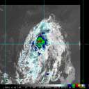
It is unclear if Wilfred still exists, and if so, exactly where it
is located. Although there is clear evidence of a broad elongated
circulation, the formerly small center of Wilfred is either
obscured by higher clouds or has dissipated. AMSR-2 microwave
imagery at 0431 UTC showed only evidence of a northwest-southeast
oriented trough with one or more embedded mesoscale lows. Visible
imagery and the next round of ASCAT passes will hopefully provide
more information about Wilfred`s status later this morning. The
intensity remains 35 kt based on ASCAT data from last night, but
more recent Dvorak estimates are lower.
Due to the uncertainty associated with Wilfred`s status and
location, the motion estimate is a very uncertain 295/15 kt. In
general, Wilfred or its eventual remnants should continue on a
west-northwestward heading today, and then could turn westward by
early Monday. The NHC forecast is very similar to the previous one
and lies near the middle of the guidance suite.
Virtually no change has been made to the official intensity
forecast. Wilfred will likely gradually weaken until it dissipates
due to a combination of increasing wind shear and a dry
environment. The exact point at which Wilfred will become a trough
varies from model to model, but confidence is fairly high that
Wilfred won`t last much longer than another day or two. The NHC
forecast carries Wilfred for 48 h based on persistence from the
previous advisory, but if recent trends hold, it could dissipate as
soon as later today.
FORECAST POSITIONS AND MAX WINDS
INIT 20/0900Z 15.0N 42.0W 35 KT 40 MPH
12H 20/1800Z 15.7N 44.1W 35 KT 40 MPH
24H 21/0600Z 16.2N 46.5W 30 KT 35 MPH
36H 21/1800Z 16.5N 48.5W 30 KT 35 MPH
48H 22/0600Z 16.7N 50.3W 25 KT 30 MPH
60H 22/1800Z...DISSIPATED
$$
Forecaster Zelinsky |


