Show Selection:
|
#1058761 (Received by flhurricane at: 4:53 PM 26.Aug.2021)
TCDAT4
Tropical Depression Nine Discussion Number 2
NWS National Hurricane Center Miami FL AL092021
500 PM EDT Thu Aug 26 2021
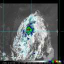
The overall satellite presentation of the tropical cyclone has
continued to gradually improve today. Visible imagery and very
recent observations from an Air Force Reserve reconnaissance
aircraft indicate that the circulation has continued to become
better defined. In addition, the convective activity has become a
little better organized in a band around the northeastern and
eastern portions of the circulation, and the system is likely near
tropical storm strength. However, the initial intensity remains 30
kt pending the aircraft fully sampling the eastern portion of the
circulation.
The initial motion estimate is northwestward or 325/12 kt. The 1200
UTC dynamical model guidance continues to take the system
northwestward around the southwestern side of well-established
deep-layer ridge over the western Atlantic. On the forecast track,
the system is expected to move over portions of western Cuba late
Friday, over the southeastern and central Gulf of Mexico on
Saturday, and approach the northern Gulf coast on Sunday. Although
the track guidance envelope has tightened this cycle, increasing
confidence in the overall forecast scenario, some shifts in the
track are still likely until the system consolidates and becomes
better defined. Users are reminded to not focus on the exact
forecast track as storm surge, wind, and rainfall hazards will
extend far from the center, and the average NHC track forecast error
at day 3 is around 120 miles. The lastest NHC track forecast is
close to the previous official forecast, and lies between the TCVA
and HCCA consensus aids.
There is some evidence of some light to moderate southerly shear
over the system, but with the cyclone moving over the high ocean
heat content waters of the northwestern Caribbean Sea the shear
should not hinder intensification, with steady strengthening
anticipated during the next 12 to 24 hours. Once the system moves
over the Gulf of Mexico, it will be traversing a warm eddy, and this
feature, combined with a favorable upper-level wind pattern and a
moist atmosphere, is likely to result in steady to rapid
strengthening on Saturday and Saturday night. The NHC intensity
forecast again brings the system to near major hurricane strength
when it approaches the northern Gulf coast on Sunday. This is
supported by the HWRF and CTCI models, and the global model guidance
that has consistently showed significant deepening of the system
over the Gulf of Mexico over the past several model cycles.
Therefore, as mentioned this morning, there is higher-than-normal
confidence that a strengthening tropical cyclone will be moving over
the Gulf of Mexico this weekend.
Key Messages:
1. Tropical storm conditions are expected in portions of the Cayman
Islands tonight and in portions of western Cuba and the Isle of
Youth Friday. Dangerous storm surge is possible Friday in portions
of western Cuba, including the Isle of Youth, in areas of onshore
flow.
2. Life-threatening heavy rains, flash flooding and mudslides are
expected across Jamaica, the Cayman Islands, and western Cuba,
including the Isle of Youth.
3. The system is forecast to approach the northern Gulf coast at or
near major hurricane intensity on Sunday, where there is an
increasing risk of life-threatening storm surge, damaging
hurricane-force winds, and heavy rainfall Sunday and Monday,
especially along the coast of Louisiana. Storm Surge and Hurricane
watches will likely be issued for a portion of this area later
tonight or Friday morning. Interests in these areas should closely
monitor the progress of this system and follow any advice given by
local officials.
FORECAST POSITIONS AND MAX WINDS
INIT 26/2100Z 18.0N 79.8W 30 KT 35 MPH
12H 27/0600Z 19.7N 81.0W 45 KT 50 MPH
24H 27/1800Z 21.7N 82.8W 55 KT 65 MPH...INLAND
36H 28/0600Z 23.7N 84.8W 60 KT 70 MPH...OVER WATER
48H 28/1800Z 25.6N 87.0W 70 KT 80 MPH
60H 29/0600Z 27.2N 88.8W 85 KT 100 MPH
72H 29/1800Z 28.9N 90.4W 95 KT 110 MPH
96H 30/1800Z 31.9N 91.4W 50 KT 60 MPH...INLAND
120H 31/1800Z 34.6N 90.0W 25 KT 30 MPH...INLAND
$$
Forecaster Brown |


