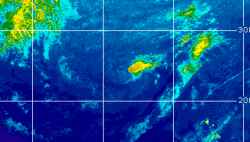
Current Radar or Satellite Image

Flhurricane.com - Central Florida Hurricane Center - Tracking Storms since 199531 Years of Hurricanes Without the Hype - Since 1995


Nor'easter along Florida east coast. HIGH RISK flood threat. Overal complex may develop even more surface lows off east coast for several more days.
Days since last Hurricane Landfall — US Any: 42 (Isaias), US Major: 772 (Milton), FL Any: 42 (Isaias), FL Major: 772 (Milton)
FlHurricane Atlantic Tropical Cyclone Tracking 🌀 Since 1995
None
HypeScale:
0.30
0510
Communication
Storm Data
Content
Follow & Connect
 
Show Selection:
Show plain - Location:
#1059696 (Received by flhurricane at: 4:47 PM 31.Aug.2021)
TCPAT5

BULLETIN
Tropical Depression Kate Advisory Number 15
NWS National Hurricane Center Miami FL AL102021
500 PM AST Tue Aug 31 2021

...KATE STILL A POORLY ORGANIZED DEPRESSION...


SUMMARY OF 500 PM AST...2100 UTC...INFORMATION
----------------------------------------------
LOCATION...24.6N 50.9W
ABOUT 875 MI...1405 KM NE OF THE LEEWARD ISLANDS
MAXIMUM SUSTAINED WINDS...35 MPH...55 KM/H
PRESENT MOVEMENT...N OR 360 DEGREES AT 7 MPH...11 KM/H
MINIMUM CENTRAL PRESSURE...1007 MB...29.74 INCHES


WATCHES AND WARNINGS
--------------------
There are no coastal watches or warnings in effect.


DISCUSSION AND OUTLOOK
----------------------
At 500 PM AST (2100 UTC), the center of Tropical Depression Kate was
located near latitude 24.6 North, longitude 50.9 West. The
depression is moving toward the north near 7 mph (11 km/h). A
north-northwestward motion is forecast to begin tonight and continue
through early Thursday, followed by a turn toward the north on
Thursday night and Friday.

Maximum sustained winds remain near 35 mph (55 km/h) with higher
gusts. Little change in strength is forecast during the next few
days.

The estimated minimum central pressure is 1007 mb (29.74 inches).


HAZARDS AFFECTING LAND
----------------------
None.


NEXT ADVISORY
-------------
Next complete advisory at 1100 PM AST.

$$
Forecaster Reinhart