Show Selection:
|
#1063189 (Received by flhurricane at: 4:35 AM 25.Sep.2021)
TCDAT4
Subtropical Storm Teresa Discussion Number 3
NWS National Hurricane Center Miami FL AL192021
500 AM AST Sat Sep 25 2021
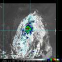
Teresa is poorly organized and it likely won't be a subtropical
cyclone for much longer. The cloud pattern consists of a swirl of
low-level clouds and a band of showers and thunderstorms that is
located more than 250 n mi northeast of the center. This patch of
convection has been detaching from the low-level circulation and it
appears to be more involved with an upper-level low to the east of
Teresa. ASCAT-B and ASCAT-C caught the circulation several hours
ago, and showed winds of 25-30 kt near it. However, that instrument
did not sample the area of convection well northeast of the center,
where the winds could be a little stronger. Given the degraded
structure of the system, the initial intensity is lowered to a
possibly generous 35 kt.
Now that the upper-level low has pulled away from the subtropical
storm, west-southwesterly shear is increasing across the circulation
and that should prevent convective organization and any opportunity
for strengthening. Due to the strong shear and dry air entrainment,
Teresa is likely to become a remnant low later today or tonight and
dissipate on Sunday.
Teresa is moving slowly west-northwestward at 5 kt. A turn to the
north is expected later today, followed by a northeast motion as the
cyclone moves in the flow ahead of a deep-layer trough.
FORECAST POSITIONS AND MAX WINDS
INIT 25/0900Z 34.5N 65.5W 35 KT 40 MPH
12H 25/1800Z 35.4N 65.3W 30 KT 35 MPH
24H 26/0600Z 37.2N 64.6W 30 KT 35 MPH...POST-TROP/REMNT LOW
36H 26/1800Z...DISSIPATED
$$
Forecaster Cangialosi |


