Show Selection:
|
#1272591 (Received by flhurricane at: 4:54 AM 20.Jul.2026)
TCDAT2
Tropical Depression Two Discussion Number 4
NWS National Hurricane Center Miami FL AL022026
400 AM CDT Mon Jul 20 2026
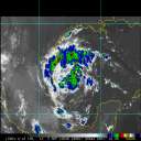
The tropical depression continues to have a fairly unimpressive
appearance on satellite imagery, with just a few fragments of deep
convection around the circulation center. An Air Force Reserve
reconnaissance aircraft has been sampling the system this morning,
finding that the pressure continues to gradually decrease with a
peak 925 mb flight level wind of 38 kt. This data is the primary
justification for increasing the winds slightly to 30 kt for this
advisory.
Recon fixes indicate that the depression is now moving slowly
northwestward at 320/3 kt. The tropical cyclone remains sandwiched
between two mid-level ridges, one to its northwest centered over the
Rockies and one to its southeast centered near the Bahamas. Over
time, the ridge over the Rockies is expected to become the dominant
steering feature as a longwave trough moves into the northeastern
United States. The byproduct of this change is that the system
should begin to gradually turn more west-northwestward and westward
by the middle of this week. This track should bring the cyclone near
or along the Gulf coast, approaching the mouth of the Mississippi
River by 72 h. The track guidance this cycle has shifted a
little northward over these first few days, and the NHC track
forecast was also shifted in that direction, blending the simple
consensus aid TVCN with the Google DeepMind (GDMI) track guidance.
As mentioned previously, the depression`s broad structure and
mid-level dry air are keeping the convection limited. Thus, its
intensification continues to be gradual. The depression is forecast
to become a tropical storm later today and continue to slowly
intensify while the shear remains low to moderate. After 36 h,
northeasterly shear is expected to increase markedly, and the
guidance is coming into better agreement that this should halt
additional intensification after that time. With the northward shift
in the track, the tropical cyclone is more likely to be disrupted by
land interaction beyond 60 h, and the latest NHC intensity forecast
now shows gradual weakening afterwards. This intensity forecast
still remains sensitive to the ultimate track, though it is notable
that the latest Google DeepMind ensemble mean only tracks the
cyclone out to 72 h, suggesting the majority of its members
dissipate the system beyond that period. The NHC intensity forecast
is a little lower than the previous cycle after 72 h, but it
wouldn`t be surprising if future adjustments are needed if more
guidance trends towards a further inland solution.
Key Messages:
1. The depression is expected to gradually strengthen and could
bring tropical storm conditions to portions of the Florida Panhandle
and Alabama coast beginning tonight into Tuesday, where a Tropical
Storm Watch is in effect.
2. Interests in Mississippi, Louisiana, and Texas should monitor the
progress of this system, as additional watches could be required for
portions of that area over the next day or two.
3. Areas of flash flooding will be possible through Friday along the
Gulf Coast and adjacent inland locations from western Florida to the
Middle Texas Coast, including southern portions of Alabama,
Mississippi, and Louisiana.
FORECAST POSITIONS AND MAX WINDS
INIT 20/0900Z 28.5N 85.4W 30 KT 35 MPH
12H 20/1800Z 28.7N 85.8W 35 KT 40 MPH
24H 21/0600Z 29.0N 86.3W 40 KT 45 MPH
36H 21/1800Z 29.3N 86.9W 45 KT 50 MPH
48H 22/0600Z 29.6N 87.8W 45 KT 50 MPH
60H 22/1800Z 29.8N 89.1W 45 KT 50 MPH
72H 23/0600Z 29.7N 90.9W 40 KT 45 MPH...INLAND
96H 24/0600Z 29.6N 93.0W 35 KT 40 MPH...INLAND
120H 25/0600Z 29.5N 95.6W 30 KT 35 MPH...INLAND
$$
Forecaster Papin |