Show Selection:
|
#1279302 (Received by flhurricane at: 11:03 AM 19.Sep.2026)
TCDAT1
Tropical Depression Six Discussion Number 1
NWS National Hurricane Center Miami FL AL062026
300 PM GMT Sat Sep 19 2026
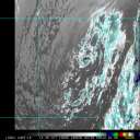
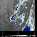
A recent ASCAT pass showed that the system NHC has been monitoring
southwest of the Azores (AL99) has a well-defined circulation and
peak wind vectors were around 26 kt. The stucture of the cyclone
still has the bulk of the convection on the northern side, and that
area of convection has persisted for more than 12 hours. However,
the cyclone appears to lie along the northern edge of a zone of
strong westerly shear. In addition the most recent TAFB
Dvorak fix was T2.0/30 kt, which has persisted since the last
forecast cycle. Based on the given data, this system has been
started as Tropical Depression Six with an initial intensity of 30
kt.
Tropical Depression Six is currently meandering, however it should
start to increase in speed and move generally to the northeast for
the next 36 h as a trough to the north weakens the ridge to the
northeast. Around 48 h, the ridge is expected to build back, which
will force the cyclone to move towards the southwest. The system is
expected to remain on this heading for the rest of the forecast
period. The current NHC track forecast is in good agreement with the
HCCA and GDMI.
The depression is expected to move into a slightly more favorable
environment, between two areas of intense shear. This could allow
for some slight intensification to occur for the next day or so.
After 36 h, the system is expected to move into an area of higher
shear as the previously mentioned trough starts to negatively impact
the cyclone, thus resulting in gradual weakening. The system is
expected to become a post-tropical remnant low around 72 h, and then
dissipate around 120 h. However, the guidance from the GFS and ECMWF
show significant differences in when dissipation occurs. The GFS has
the cyclone dissipating much sooner around 72 h, while the ECMWF has
dissipation occuring around 120 h. The current NHC intensity
forecast is in the middle of the guidance envelope and is slightly
under HCCA.
FORECAST POSITIONS AND MAX WINDS
INIT 19/1500Z 32.6N 33.6W 30 KT 35 MPH
12H 20/0000Z 33.0N 33.4W 35 KT 40 MPH
24H 20/1200Z 33.6N 33.1W 35 KT 40 MPH
36H 21/0000Z 33.8N 32.5W 40 KT 45 MPH
48H 21/1200Z 33.4N 32.3W 40 KT 45 MPH
60H 22/0000Z 32.4N 32.7W 35 KT 40 MPH
72H 22/1200Z 31.0N 33.9W 30 KT 35 MPH...POST-TROP/REMNT LOW
96H 23/1200Z 28.9N 37.4W 25 KT 30 MPH...POST-TROP/REMNT LOW
120H 24/1200Z...DISSIPATED
$$
Forecaster Katz/Berg |