Show Selection:
|
#1279825 (Received by flhurricane at: 10:42 PM 23.Sep.2026)
TCDAT1
Tropical Storm Fay Discussion Number 16
NWS National Hurricane Center Miami FL AL062026
300 AM GMT Thu Sep 24 2026
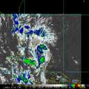
Deep convection has persisted since the previous advisory,
especially to the north and northeast of the surface center. Recent
microwave and geostationary satellite data indicate fairly good
confidence that the center is near the southern or southwestern edge
of the convection. The latest TAFB Dvorak intensity estimate is
2.5/35 kt and recent objective intensity estimates from UW-CIMSS
range from 33-42 kt. A pair of ASCAT passes from around 23/2300 UTC
showed several reliable 32 kt wind vectors. Given the low bias of
the ASCAT instrument due to its resolution, the initial intensity is
raised to 35 kt, in agreement with the TAFB estimate, making Fay a
tropical storm again.
The initial motion is estimated to be west-southwestward, or 250
degrees at 8 kt. Fay is expected to continue moving generally
westward for the next few days as it is steered by a narrow low- to
mid-level ridge to its north, although a deceleration is expected in
a couple of days as steering currents weaken. The NHC forecast is
very similar to the previous one, and is fairly close to, but
slightly faster toward the west than, the latest GDMI and HCCA.
Confidence in the NHC track forecast appears to be above average due
to good agreement among the track models.
Fay is forecast to remain over warm water and within a weak vertical
wind shear environment for another 36 hours, but the dry airmass
that Fay is embedded in, with mid-level relative humidity values
between 30 and 40 percent, should prevent significant strengthening.
The NHC forecast shows little change in strength while the shear
remains weak. By 48 hours, increasing northeasterly vertical wind
shear should work to induce gradual weakening. The NHC forecast is
a little higher than the previous one, in that it shows a more
gradual weakening in the 36 to 72 hour period. The NHC forecast is
near the middle of the guidance envelope, and forecast confidence is
medium to high. No changes have been made to the timing of
post-tropical transition or dissipation, but it should be noted that
the UKMET and Canadian models hold onto the low a bit longer than
indicated in the NHC forecast.
FORECAST POSITIONS AND MAX WINDS
INIT 24/0300Z 29.8N 40.0W 35 KT 40 MPH
12H 24/1200Z 29.8N 41.1W 35 KT 40 MPH
24H 25/0000Z 29.9N 42.2W 35 KT 40 MPH
36H 25/1200Z 29.9N 43.2W 35 KT 40 MPH
48H 26/0000Z 29.7N 44.1W 30 KT 35 MPH
60H 26/1200Z 29.6N 44.9W 30 KT 35 MPH...POST-TROP/REMNT LOW
72H 27/0000Z 29.8N 45.4W 25 KT 30 MPH...POST-TROP/REMNT LOW
96H 28/0000Z...DISSIPATED
$$
Forecaster Hagen |