Show Selection:
|
#1279886 (Received by flhurricane at: 10:54 AM 24.Sep.2026)
TCDAT1
Tropical Storm Fay Discussion Number 18
NWS National Hurricane Center Miami FL AL062026
300 PM GMT Thu Sep 24 2026
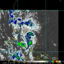
Resilient Fay has strengthened this morning. Deep convective
curved bands have developed both on the west and east sides of the
cyclone, and a small cold cloud top deep burst of convection is
persisting over the surface center. Based on the improved cloud
pattern and an increase in the Dvorak satellite intensity
estimated from TAFB, the initial intensity is raised to 45 kt.
Fay remains over warm ocean waters and a favorable upper-level wind
environment. Only a relatively stable, dry surrounding atmosphere
is preventing Fay from strengthening significantly. By the weekend,
deep-layer shear is expected to increase, which should induce a
weakening trend. Subsequently, Fay is forecast to degenerate into
a remnant low.
Fay`s initial motion is estimated to be due west, or 270/5 kt.
This general motion should continue with a slight reduction
in forward speed through dissipation on Sunday. The NHC track
forecast is similar to the previous advisory and lies close to the
skilled HFIP HCCA and GDMI TC ensemble mean.
FORECAST POSITIONS AND MAX WINDS
INIT 24/1500Z 29.8N 41.2W 45 KT 50 MPH
12H 25/0000Z 29.8N 42.0W 50 KT 60 MPH
24H 25/1200Z 29.7N 42.9W 45 KT 50 MPH
36H 26/0000Z 29.6N 43.9W 40 KT 45 MPH
48H 26/1200Z 29.5N 45.2W 30 KT 35 MPH...POST-TROP/REMNT LOW
60H 27/0000Z 29.5N 46.0W 30 KT 35 MPH...POST-TROP/REMNT LOW
72H 27/1200Z...DISSIPATED
$$
Forecaster Roberts |