Show Selection:
|
#874991 (Received by flhurricane at: 4:49 PM 15.Sep.2016)
TCDAT2
TROPICAL DEPRESSION TWELVE DISCUSSION NUMBER 6
NWS NATIONAL HURRICANE CENTER MIAMI FL AL122016
500 PM AST THU SEP 15 2016
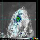
Deep convection has redeveloped in the northeastern quadrant of the
depression, although it is still a good distance away from the
center. Consequently, Dvorak classifications are just about the
same as earlier, and the initial wind speed estimate is kept at 30
kt. Southwesterly wind shear is expected to continue for a day or
two while the cyclone remains under the influence of an upper-level
trough. This trough is then expected to be replaced by a ridge in a
couple of days, with generally lighter shear by early next week.
While some weakening is still forecast, model guidance is in better
agreement on the depression eventually reaching a more conducive
environment for restrengthening, and the official intensity forecast
is raised a bit in the long term. This forecast could be
conservative for next week if the rather conducive environments
forecast by the ECMWF and UKMET models materialize.
The cyclone continues moving westward at 11 kt, and a west or
west-southwest motion is expected for the next few days while the
depression moves around a strengthening Atlantic subtropical ridge.
Thereafter, a turn to the west-northwest is forecast due to the
system reaching the southwestern periphery of the ridge. The model
guidance has spread out some on this cycle, with the UKMET having
shifted a fair distance north of its previous run. A stronger
system would probably turn a bit more to the west-northwest given
the forecast upper-level southeasterly winds. Since the intensity
prediction is higher than the last one, it makes sense to show the
cyclone gaining some latitude by the end of the forecast period. The
new NHC forecast is adjusted to the north of the previous one, but
still lies on the southern side of the guidance envelope.
FORECAST POSITIONS AND MAX WINDS
INIT 15/2100Z 17.8N 31.4W 30 KT 35 MPH
12H 16/0600Z 17.9N 33.3W 30 KT 35 MPH
24H 16/1800Z 18.0N 36.0W 30 KT 35 MPH
36H 17/0600Z 17.8N 38.6W 25 KT 30 MPH
48H 17/1800Z 17.5N 41.2W 30 KT 35 MPH
72H 18/1800Z 17.0N 46.5W 35 KT 40 MPH
96H 19/1800Z 17.5N 51.5W 40 KT 45 MPH
120H 20/1800Z 18.5N 56.0W 45 KT 50 MPH
$$
Forecaster Blake |


