Show Selection:
|
#893021 (Received by flhurricane at: 4:37 PM 21.Jun.2017)
TCDAT3
Tropical Storm Cindy Discussion Number 9
NWS National Hurricane Center Miami FL AL032017
400 PM CDT Wed Jun 21 2017
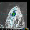
Cindy continues to have the overall appearance of a subtropical
cyclone this afternoon. However, the convective area just northwest
of the center has become somewhat better organized based on coastal
radar data, and the wind field has become smaller and more like a
tropical cyclone. Surface observations and reports from an Air
Force Reserve Hurricane Hunter aircraft show that the maximum winds
remain near 45 kt, mainly in the northwestern quadrant.
The initial motion is 315/8. There is again little change in either
the track forecast philosophy or the track forecast from the
previous advisory. Cindy is expected to turn northward and move
through a break in the mid-level subtropical ridge along the
northwest Gulf of Mexico coast, with landfall in southeastern Texas
or southwestern Louisiana in less than 24 hours. After 24-36 hours
Cindy, or its remnants, should accelerate northeastward in the
westerlies over the eastern United States.
Given the continued presence of dry air near the center, as shown by
experimental GOES-16 data, and its generally negative effects on the
central convection, little change in strength is expected before
landfall. Cindy should weaken after landfall and eventually become
absorbed by a frontal system over the eastern United States just
after 72 h.
While the aforementioned dry air is sufficient to keep Cindy from
intensifying, it will do little to reduce the overall rainfall
threat. Heavy rainfall is expected to continue over portions of the
central and eastern Gulf Coast, which could cause life-threatening
flash flooding in some locations. For more information on the
flooding hazard, see products from your local National Weather
Service office and the NOAA Weather Prediction Center.
FORECAST POSITIONS AND MAX WINDS
INIT 21/2100Z 28.2N 93.2W 45 KT 50 MPH
12H 22/0600Z 29.3N 93.7W 45 KT 50 MPH
24H 22/1800Z 31.3N 93.7W 35 KT 40 MPH...INLAND
36H 23/0600Z 33.4N 92.4W 25 KT 30 MPH...INLAND
48H 23/1800Z 35.3N 88.6W 20 KT 25 MPH...INLAND
72H 24/1800Z 38.5N 76.5W 20 KT 25 MPH...POST-TROP/EXTRATROP
96H 25/1800Z...DISSIPATED
$$
Forecaster Beven |


