Show Selection:
|
#894540 (Received by flhurricane at: 10:34 PM 05.Jul.2017)
TCDAT4
Tropical Depression Four Discussion Number 1
NWS National Hurricane Center Miami FL AL042017
1100 PM AST Wed Jul 05 2017
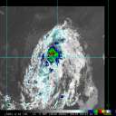
The low pressure area west of the Cabo Verde Islands has a
well-defined circulation based on a combination of surface
observations and scatterometer data. In addition, there has been a
persistent area of convection west of the center for the past 12 h
or so. Based on these, advisories are initiated on the system as a
tropical depression. The initial intensity is set to 25 kt based
on the scatterometer data and satellite intensity estimates from
TAFB and SAB.
Experimental multispectral imagery shows a large area of dry and
dusty air over the Atlantic near and east of the depression, and it
appears likely this will entrain into the circulation during the
next couple of days. The large-scale models forecast the system to
dissipate very quickly due to this entrainment, while in contrast
the statistical-dynamical guidance forecasts modest strengthening.
Another factor is that the current environment of light to moderate
easterly shear is expected to become moderate to strong
southwesterly shear at about 48 h. As a compromise between the
extremes in the guidance, the intensity forecast calls for little
change in strength for 48 h, followed by the system degenerating
to a remnant low by 72 h.
The initial motion is 290/12. The depression is on the south side
of a strong low- to mid-level ridge, and this feature should steer
the cyclone or its remnants west-northwestward for the next 5 days.
There should be an increase in forward speed during the next 24
h, with some decrease in forward speed after 72 h as the system
approaches a weakness in the ridge. The forecast track lies close
to the model consensus.
FORECAST POSITIONS AND MAX WINDS
INIT 06/0300Z 12.8N 38.4W 25 KT 30 MPH
12H 06/1200Z 13.4N 40.4W 30 KT 35 MPH
24H 07/0000Z 14.2N 43.8W 30 KT 35 MPH
36H 07/1200Z 15.2N 47.5W 30 KT 35 MPH
48H 08/0000Z 16.5N 51.1W 30 KT 35 MPH
72H 09/0000Z 19.5N 58.0W 25 KT 30 MPH...POST-TROP/REMNT LOW
96H 10/0000Z 22.0N 63.0W 20 KT 25 MPH...POST-TROP/REMNT LOW
120H 11/0000Z 24.5N 68.0W 20 KT 25 MPH...POST-TROP/REMNT LOW
$$
Forecaster Beven |


