Show Selection:
|
#898307 (Received by flhurricane at: 4:35 PM 13.Aug.2017)
TCDAT3
Tropical Storm Gert Discussion Number 4
NWS National Hurricane Center Miami FL AL082017
500 PM EDT Sun Aug 13 2017
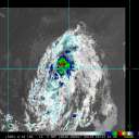
Satellite images indicate that the tropical cyclone is gradually
strengthening. The banding features have become better established
during the last several hours, and the system has become less
vertically tilted. The Dvorak classification from TAFB and ADT
values from CIMSS at the University of Wisconsin support increasing
the initial wind speed to 35 kt, making the system Tropical Storm
Gert.
Gert is moving north-northwestward at 9 kt on the southwestern
periphery of a subtropical ridge. A northward motion is expected
tonight and Monday while the system rounds the western side of the
ridge, and Gert is expected to be about midway between Bermuda and
North Carolina on Monday and Tuesday. After that time, a
progressively faster motion to the northeast and east-northeast is
forecast as the system moves on the north side of the ridge and
becomes embedded in the mid-latitude westerlies until it dissipates
in about 5 days. The track guidance remains in very good agreement,
and only small changes were made to the previous NHC prediction.
This forecast lies near the middle of the tightly clustered guidance
envelope.
The system is over warm 29 deg C SSTs, and it will remain over
these warm waters during the next few days. In addition, the global
models indicate that the upper-level pattern should become conducive
for strengthening during the next 36 hours or so. The combination
of these conditions should allow Gert to strengthen during the next
couple of days. Thereafter, a sharp increase in west-southwesterly
shear, drier air, and decreasing sea surface temperatures should end
the strengthening trend and lead to extratropical transition in
a little more than 3 days. The NHC intensity forecast is slightly
above the previous one, but remains on the lower side of the
guidance.
The center of Gert recently passed very near NOAA buoy 41047, and
that data has been helpful in estimating the minimum pressure of the
system.
FORECAST POSITIONS AND MAX WINDS
INIT 13/2100Z 28.1N 71.7W 35 KT 40 MPH
12H 14/0600Z 29.3N 72.1W 40 KT 45 MPH
24H 14/1800Z 31.1N 72.1W 50 KT 60 MPH
36H 15/0600Z 32.9N 71.3W 55 KT 65 MPH
48H 15/1800Z 35.1N 68.8W 55 KT 65 MPH
72H 16/1800Z 39.8N 59.1W 50 KT 60 MPH
96H 17/1800Z 45.0N 44.5W 45 KT 50 MPH...POST-TROP/EXTRATROP
120H 18/1800Z...DISSIPATED
$$
Forecaster Cangialosi |


